Whitehall Bay
Campground · Kansas · 30 bookable sites ·
Managed by the US Army Corps of Engineers
- 30
- Bookable sites
- 93 ft
- Max rig length
- up to 150
- People per site
- 1
- Accessible site
- 996 ft
- Elevation
Overview
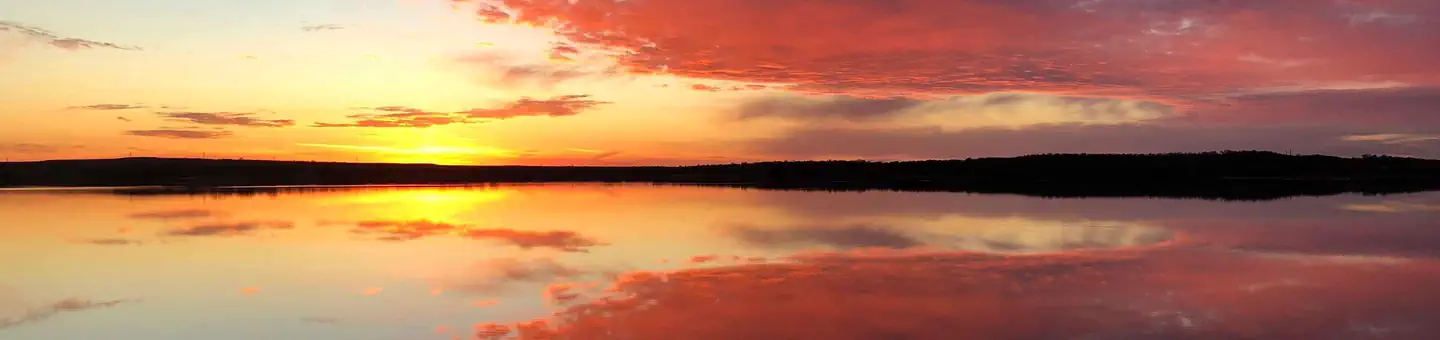
Whitehall Bay Campground is located on the shores of Fall River Lake in Greenwood County, Kansas. Opportunities for outdoor family fun and recreation include swimming, boating, water skiing, camping, picnicking and sightseeing.Recreation
For birdwatchers and nature lovers, there is an 8,000 acre Fall River wildlife area, where prairie chickens, waterfowl, rabbits, wild turkeys, white tail deer, doves and quail are commonly seen. Over 400 species of birds are protected in this area.Hiking and biking opportunities near Fredonia Bay include the 1.5-mile Casner Creek Trail, which meanders through the forest, opening onto a breathtaking display of wildflowers during spring and summer months, or the 1-mile Turkey Run Trail, which leads visitors through a wooded ravine, over a stream and into a tall grass prairie with an impressive view of the lake.
Facilities
This campground contains four group sites with electric hookups, and 20 family sites with electric. Additional amenities include flush toilets, drinking water, showers, a playground, beach, boat ramp and a dump station.Natural Features
Rolling prairies and tree-dotted valleys sheltered by limestone-capped ridges surround Fall Lake, which stretches up the picturesque Fall River for 15 miles. This scenic area has a wealth of native wildlife and vegetation.Nearby Attractions
Fall River State Park is nearby, offering great hiking, fishing and birding along the river. Canoeing is also a popular activity in the park.The facts
- 30 bookable sites
- 1 accessible site
- Vehicles up to 93 ft
- Up to 150 people per site
- Loops: WHITEHALL BAY
Site types
- 25 Standard Electric
- 4 Group Standard Electric
- 1 Standard Nonelectric
Amenities
- Electric hookups
- Water hookups
- Sewer hookups
- Campfires allowed
- Fire pits
- Picnic tables
- Shade
- Pets allowed
Not recorded upstream: grills.
30 campsites at Whitehall Bay
Check-in 04:00 PM · Check-out 03:00 PM
| Site | Loop | Type | Entry | Surface | Max rig | People | |
|---|---|---|---|---|---|---|---|
| 001 | WHITEHALL BAY | Standard Electric | Back In | Gravel | 40 ft | 8 | 🐾 |
| 002 | WHITEHALL BAY | Standard Electric | Back In | Gravel | 40 ft | 8 | 🐾 |
| 003 | WHITEHALL BAY | Standard Electric | Back In | Gravel | 60 ft | 8 | 🐾 |
| 004 | WHITEHALL BAY | Standard Electric | Back In | Gravel | 63 ft | 8 | 🐾 |
| 005 | WHITEHALL BAY | Standard Electric | Back In | Gravel | 40 ft | 8 | 🐾 |
| 006 | WHITEHALL BAY | Standard Electric | Back In | Gravel | 40 ft | 8 | 🐾 |
| 007 | WHITEHALL BAY | Standard Electric | Back In | Gravel | 77 ft | 8 | 🐾 |
| 008 | WHITEHALL BAY | Standard Electric | Back In | Gravel | 45 ft | 8 | 🐾 |
| 009 | WHITEHALL BAY | Standard Electric | Back In | Gravel | 55 ft | 8 | 🐾 |
| 010 | WHITEHALL BAY | Standard Electric | Back In | Gravel | 40 ft | 8 | 🐾 |
| 011 | WHITEHALL BAY | Standard Electric | Back In | Gravel | 92 ft | 8 | 🐾 |
| 012 | WHITEHALL BAY | Standard Electric | Back In | Gravel | 62 ft | 8 | 🐾 |
| 013 | WHITEHALL BAY | Standard Electric | Back In | Gravel | 68 ft | 8 | 🐾 |
| 014 | WHITEHALL BAY | Standard Electric | Back In | Gravel | 62 ft | 8 | 🐾 |
| 015 | WHITEHALL BAY | Standard Electric | Back In | Gravel | 58 ft | 8 | 🐾 |
| 016 | WHITEHALL BAY | Standard Electric | Back In | Gravel | 30 ft | 8 | 🐾 |
| 017 | WHITEHALL BAY | Standard Electric | Back In | Gravel | 73 ft | 8 | 🐾 |
| 018 | WHITEHALL BAY | Standard Electric | Back In | Gravel | 58 ft | 8 | 🐾 |
| 019 | WHITEHALL BAY | Standard Electric | Back In | Gravel | 60 ft | 8 | 🐾 |
| 020 | WHITEHALL BAY | Standard Electric | Back In | Gravel | 38 ft | 8 | 🐾 |
| 021 | WHITEHALL BAY | Standard Nonelectric | Back In | Gravel | 72 ft | 8 | 🐾 |
| 022 | WHITEHALL BAY | Standard Electric | Back In | Gravel | — | 8 | ♿ 🐾 |
| 023 | WHITEHALL BAY | Standard Electric | Back In | Gravel | 75 ft | 8 | 🐾 |
| 026 | WHITEHALL BAY | Standard Electric | Back In | Gravel | 60 ft | 8 | 🐾 |
| 027 | WHITEHALL BAY | Standard Electric | Back In | Gravel | 93 ft | 8 | 🐾 |
| 028 | WHITEHALL BAY | Standard Electric | Back In | Gravel | 70 ft | 8 | 🐾 |
| GS1 | WHITEHALL BAY | Group Standard Electric | — | Gravel | — | 40 | 🐾 |
| GS2 | WHITEHALL BAY | Group Standard Electric | — | Gravel | — | 40 | 🐾 |
| GS3 | WHITEHALL BAY | Group Standard Electric | — | Gravel | — | 60 | 🐾 |
| GS4 | WHITEHALL BAY | Group Standard Electric | — | Gravel | — | 150 | 🐾 |
Getting there
From US HWY 400, turn left (north) at mile marker 344 (Z 50 Rd.) 0.09, turn right (east) 2.8 miles across dam, turn left (north) 0.8 miles, turn left (west), 0.7 miles, turn right (north) 1.7 miles to low water crossing, straight (north) 0.1 miles, west 0.4 miles, turn left (south) 1.1 miles to entrance to park.
37.66717, -96.07268 · 37°40'1.8"N 96°4'21.7"W
Typical weather
| Jan | Feb | Mar | Apr | May | Jun | Jul | Aug | Sep | Oct | Nov | Dec | |
|---|---|---|---|---|---|---|---|---|---|---|---|---|
| High °F | — | — | — | — | — | — | — | — | — | — | — | — |
| Low °F | — | — | — | — | — | — | — | — | — | — | — | — |
| Precip in | 1.0 | 1.5 | 2.6 | 4.0 | 5.4 | 6.0 | 4.1 | 4.1 | 3.4 | 3.5 | 2.2 | 1.6 |
1991–2020 averages from the nearest NOAA station, 1.4 mi away — not measured at the facility itself, and elevation can make a real difference over that distance.
Map
Member photos
Common questions about Whitehall Bay
- Can you reserve a site at Whitehall Bay?
- Yes, Whitehall Bay is reservable through Recreation.gov.
- How many campsites does Whitehall Bay have?
- 30 sites.
- What is the maximum RV length at Whitehall Bay?
- 93 ft. That is the longest vehicle the sites here are recorded as taking; individual sites may be shorter.
- Are pets allowed at Whitehall Bay?
- Yes, pets are allowed at Whitehall Bay.
- Does Whitehall Bay have hookups?
- Electric, Water, Sewer.
- Are campfires allowed at Whitehall Bay?
- Campfires are allowed at Whitehall Bay. Check for a current fire restriction before you go.
Camping near Whitehall Bay
- Damsite - Fall River Lake 1.5 mi · Campground · we watch it
- Riverside West 42.3 mi · Campground · we watch it
- Timber Hill Park 42.8 mi · Campground · we watch it
- Riverside East 42.9 mi · Campground · we watch it
- Downstream Point 43.5 mi · Campground · we watch it
- Mound Valley 43.5 mi · Campground · we watch it
- Overlook (KS) 43.5 mi · Campground · we watch it
- Cherryvale Park 43.5 mi · Campground · we watch it
- Dam Site 43.9 mi · Campground · we watch it
- Washington Cove 53 mi · Campground · we watch it
- Post Oak Park 53.5 mi · Campground · we watch it
- Copan Point 53.9 mi · Campground · we watch it
Contact
- Phone 620-658-4445
- Book Recreation.gov
Recreation.gov last updated this record on 2026-02-25.
Facility information and photographs from Recreation.gov (RIDB). SpotOpened is not affiliated with Recreation.gov or any federal agency.
Comments