Table Rock
Campground · Idaho · 1 bookable site ·
Managed by the USDA Forest Service
Targhee National Forest (NF) · Open Access
- 1
- Bookable site
- 20 ft
- Max rig length
- up to 200
- People per site
- 5,738 ft
- Elevation
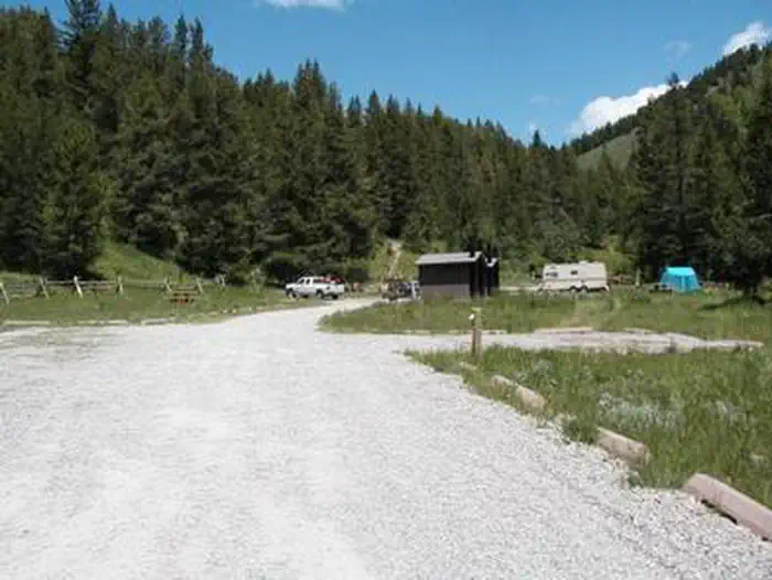
Overview
Table Rock Campground is located in a small but scenic canyon near Kelly Canyon Ski Resort, approximately 30 miles from Idaho Falls, Idaho. Hiking, mountain biking and ATV riding are popular activities.Recreation
Hawley Gulch Trail begins at the campground, offering great opportunities for ATV enthusiasts, hikers and mountain bikers. Numerous forest roads and trails in the area allow ATV travel, hiking, horseback riding and mountain biking.Facilities
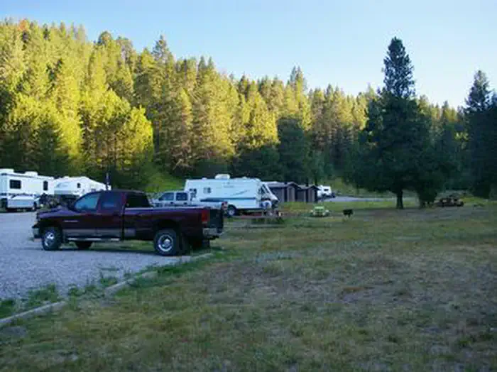
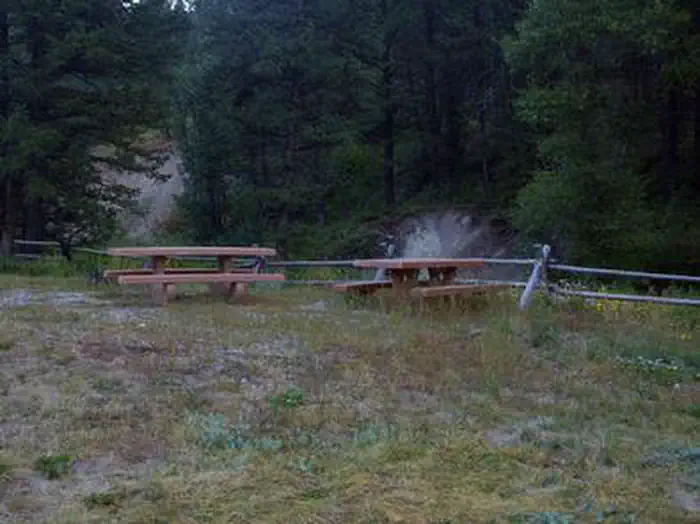
Table Rock is a large group campground that can accommodate up to 200 people. Accessible vault toilets are provided, but there is no electricity. Picnic tables, campfire circles and grills are scattered throughout the site. The road and oversized parking spur are gravel.Natural Features
The campground is situated in a quiet draw covered by an open grassy meadow dotted with summer wildflowers. Aspens and towering pines border the site, offering partial shade.Contact Info
For facility specific information, please call (541) 351-1182.The facts
- Season: May — USDA Forest Service, Aug 24, 2026
- 1 bookable site
- Vehicles up to 20 ft
- Up to 200 people per site
- Loops: TABL
Site types
- 1 Group Standard Nonelectric
Amenities
- Campfires allowed
- Fire pits
- Picnic tables
- Shade
Not recorded upstream: electric hookups, water hookups, sewer hookups, grills, pets allowed.
1 campsite at Table Rock
Check-in 2:00 PM · Check-out 12:00 PM
| Site | Loop | Type | Entry | Surface | Max rig | People | |
|---|---|---|---|---|---|---|---|
| GS-1 | TABL | Group Standard Nonelectric | Back In | Gravel | 20 ft | 200 |
Getting there
43.63083, -111.58972 · 43°37'51.0"N 111°35'23.0"W
Typical weather
| Jan | Feb | Mar | Apr | May | Jun | Jul | Aug | Sep | Oct | Nov | Dec | |
|---|---|---|---|---|---|---|---|---|---|---|---|---|
| High °F | — | — | — | — | — | — | — | — | — | — | — | — |
| Low °F | — | — | — | — | — | — | — | — | — | — | — | — |
| Precip in | 1.5 | 0.9 | 1.1 | 1.5 | 2.0 | 1.4 | 0.5 | 0.9 | 1.1 | 1.3 | 1.0 | 1.1 |
1991–2020 averages from the nearest NOAA station, 14.7 mi away — not measured at the facility itself, and elevation can make a real difference over that distance.
Map
More photos
Member photos
Common questions about Table Rock
- Can you reserve a site at Table Rock?
- Yes, Table Rock is reservable through Recreation.gov.
- How many campsites does Table Rock have?
- 1 site.
- What is the maximum RV length at Table Rock?
- 20 ft. That is the longest vehicle the sites here are recorded as taking; individual sites may be shorter.
- Are campfires allowed at Table Rock?
- Campfires are allowed at Table Rock. Check for a current fire restriction before you go.
Also listed by
Table Rock also appears in other federal recreation data. Facts below are matched by name and location, not confirmed by Table Rock's operator.
USDA Forest Service — data as of Aug 24, 2026
- For current fees, please go to Recreation.gov
Accessibility:
- Accessible vault toilets
Camping near Table Rock
- Falls Campground 17.8 mi · Campground · we watch it
- Egin Lakes Campground/Day Use Area 26 mi · Campground · we watch it
- Stinking Springs ATV and Mountain Biking Trail 2.2 mi · Facility
- Wolf Flats Recreation Area 2.3 mi · Facility
- Kelly Island Campground 3.5 mi · Campground
- South Fork of the Snake River: Byington Boat Access 3.8 mi · Facility
- South Fork of the Snake River - Conant 14.1 mi · Activity pass
- South Fork of the Snake River: Conant Boat Access 15.8 mi · Facility
- South Fork of the Snake River: Lorenzo Boat Access 16.3 mi · Facility
- Pine Creek Campground 19.6 mi · Campground
- South Fork of the Snake River: Menan Boat Access 21.2 mi · Facility
- Palisades Creek Campground 24.8 mi · Campground
Contact
- Phone 208-270-0150 OR 541-351-1182
- Book Recreation.gov
Recreation.gov last updated this record on 2026-05-01.
Facility information and photographs from Recreation.gov (RIDB). SpotOpened is not affiliated with Recreation.gov or any federal agency.
Comments