South Fork of the Snake River - Conant
Activity pass ·
Managed by the Bureau of Land Management
Upper Snake Field Office (Bureau of Land Management ID) · Open Access
- 5,249 ft
- Elevation
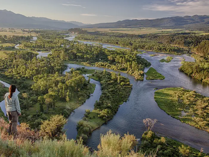
The South Fork of the Snake River supports the largest native cutthroat fishery outside of Yellowstone National Park. Among recreationists throughout the country, the South Fork is known as a premier blue-ribbon trout fishery and was selected as the host site for the 1997 World Fly-Fishing Championship. More than 300,000 anglers, campers, hikers, boaters and other recreationists use the South Fork each year. A facility use fee is required at the interagency boat access sites (Palisades Dam, Palisades Creek, Spring Creek, Conant, Fullmer, Byington, Twin Bridges, Lorenzo, Menan, Mike Walker) located along the South Fork and Main Snake from May 24 - September 30. All vehicles at the sites must display either a day or season pass.
Getting there
43.46354, -111.42805 · 43°27'48.7"N 111°25'41.0"W
Typical weather
Typically 85°F in Jul, down to 30°F in Jan.
| Jan | Feb | Mar | Apr | May | Jun | Jul | Aug | Sep | Oct | Nov | Dec | |
|---|---|---|---|---|---|---|---|---|---|---|---|---|
| High °F | 30 | 35 | 45 | 56 | 66 | 75 | 85 | 84 | 75 | 59 | 43 | 32 |
| Low °F | 11 | 14 | 22 | 27 | 35 | 41 | 46 | 44 | 37 | 29 | 20 | 12 |
| Precip in | 1.9 | 1.3 | 1.5 | 1.9 | 2.5 | 2.1 | 1.3 | 1.3 | 1.6 | 1.8 | 1.6 | 1.4 |
1991–2020 averages from the nearest NOAA station, 7.7 mi away — not measured at the facility itself, and elevation can make a real difference over that distance.
Map
Member photos
Common questions about South Fork of the Snake River - Conant
- Can you reserve a site at South Fork of the Snake River - Conant?
- Yes, South Fork of the Snake River - Conant is reservable through Recreation.gov.
Camping near South Fork of the Snake River - Conant
- Falls Campground 3.9 mi · Campground · we watch it
- Table Rock 14.1 mi · Campground · we watch it
- Calamity 14.2 mi · Campground · we watch it
- Big Elk 18.4 mi · Campground · we watch it
- South Fork of the Snake River: Conant Boat Access 1.8 mi · Facility
- Palisades Creek Campground 11.7 mi · Campground
- Wolf Flats Recreation Area 13 mi · Facility
- Pine Creek Campground 13.5 mi · Campground
- Riverside Park Campground 14.1 mi · Campground
- Stinking Springs ATV and Mountain Biking Trail 14.2 mi · Facility
- Kelly Island Campground 16.1 mi · Campground
- South Fork of the Snake River: Byington Boat Access 16.2 mi · Facility
Facility information and photographs from Recreation.gov (RIDB). SpotOpened is not affiliated with Recreation.gov or any federal agency.
Comments