Swinging Bridge
Campground · Idaho · 7 bookable sites ·
Managed by the USDA Forest Service
Boise National Forest (NF) · Open Access
- 7
- Bookable sites
- 40 ft
- Max rig length
- up to 8
- People per site
- 1
- Accessible site
- 3,653 ft
- Elevation

Overview
Swinging Bridge Campground is located 10 miles north of Banks, Idaho just off Highway 55 at an elevation of 4,000 feet.The North Fork Payette River flows next to the highway, where extreme kayaking is a popular activity.
Recreation
The North Fork of the Payette River is a very popular location for expert kayaking. Whitewater rafting is nearby on the Main and South Fork sections of the Payette River.Anglers will find good to excellent fishing for whitefish and rainbow trout.
Facilities
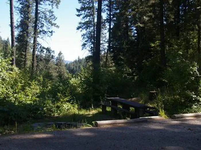
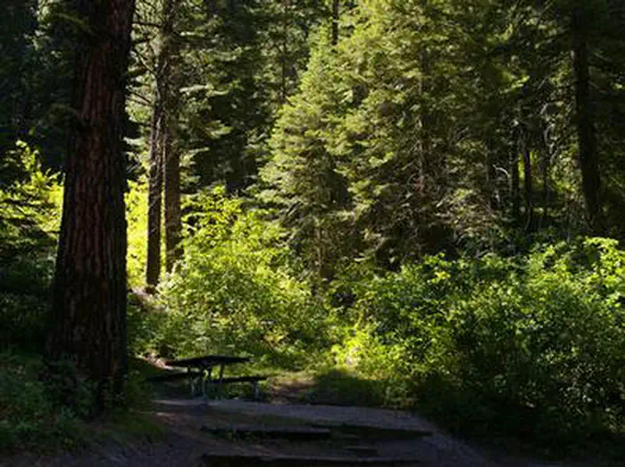
The campground contains single-family sites, each with a picnic table and campfire ring. Vault toilets are provided. Roads and parking spurs are paved. Because of its proximity to the highway, some noise from passing traffic is to be expected.Natural Features
The campground is situated is a scenic canyon just above Highway 55. The mountains are forested with a mix of Ponderosa and lodgepole pines and shade is plentiful within most of the campground. Summer days are warm, reaching 80-90 degrees; nights are cooler.The facts
- Season: Mid-May – End of September — USDA Forest Service, Aug 24, 2026
- 7 bookable sites
- 1 accessible site
- Vehicles up to 40 ft
- Up to 8 people per site
- Loops: SWIN
Site types
- 7 RV Nonelectric
Amenities
- Shade
Not recorded upstream: electric hookups, water hookups, sewer hookups, campfires allowed, fire pits, picnic tables, grills, pets allowed.
7 campsites at Swinging Bridge
Check-in 2:00 PM · Check-out 12:00 PM
| Site | Loop | Type | Entry | Surface | Max rig | People | |
|---|---|---|---|---|---|---|---|
| 001 | SWIN | Rv Nonelectric | Back In | Paved | 30 ft | 8 | |
| 004 | SWIN | Rv Nonelectric | Back In | Paved | 16 ft | 8 | ♿ |
| 005 | SWIN | Rv Nonelectric | Back In | Paved | 35 ft | 8 | |
| 006 | SWIN | Rv Nonelectric | Back In | Paved | 30 ft | 8 | |
| 007 | SWIN | Rv Nonelectric | Back In | Paved | 25 ft | 8 | |
| 008 | SWIN | Rv Nonelectric | Back In | Paved | 30 ft | 8 | |
| 009 | SWIN | Rv Nonelectric | Back In | Paved | 40 ft | 8 |
Getting there
From Horseshoe Bend, ID, take State Rt. 55 north for 21.5 miles to the campground sign. Turn left after the sign into the campground(on west side of highway).
44.17156, -116.12096 · 44°10'17.6"N 116°7'15.5"W
Typical weather
Typically 93°F in Jul, down to 38°F in Jan.
| Jan | Feb | Mar | Apr | May | Jun | Jul | Aug | Sep | Oct | Nov | Dec | |
|---|---|---|---|---|---|---|---|---|---|---|---|---|
| High °F | 38 | 45 | 54 | 62 | 72 | 81 | 93 | 91 | 81 | 65 | 48 | 38 |
| Low °F | 15 | 19 | 26 | 31 | 39 | 44 | 51 | 48 | 40 | 30 | 22 | 17 |
| Precip in | 3.4 | 2.3 | 2.3 | 2.0 | 2.2 | 1.2 | 0.4 | 0.3 | 0.5 | 1.6 | 2.3 | 3.9 |
1991–2020 averages from the nearest NOAA station, 8 mi away — not measured at the facility itself, and elevation can make a real difference over that distance.
Map
More photos
Member photos
Common questions about Swinging Bridge
- Can you reserve a site at Swinging Bridge?
- Yes, Swinging Bridge is reservable through Recreation.gov.
- How many campsites does Swinging Bridge have?
- 7 sites.
- What is the maximum RV length at Swinging Bridge?
- 40 ft. That is the longest vehicle the sites here are recorded as taking; individual sites may be shorter.
Camping near Swinging Bridge
- Cold Springs Campground - Boise NF (ID) 1.6 mi · Campground · we watch it
- Eastside 11.4 mi · Campground · we watch it
- Canyon Creek Campground 1.2 mi · Campground
- Cold Springs Campground (Group ONLY ) 1.6 mi · Campground
- Big Eddy Campground 3.5 mi · Campground
- Payette River: Deer Creek 7 mi · Facility
- Payette River: Confluence 7.5 mi · Facility
- Smith's Ferry Snowmobiling Adventures 8.9 mi · Facility
- Tie Creek Campground 10 mi · Campground
- Payette River: Chief Parrish 10.1 mi · Facility
- Hollywood Campground 11.1 mi · Campground
- Sage Hen Nature Trail Trailhead 11.6 mi · Facility
Contact
- Phone 541-351-1182
- Book Recreation.gov
Recreation.gov last updated this record on 2026-02-25.
Facility information and photographs from Recreation.gov (RIDB). SpotOpened is not affiliated with Recreation.gov or any federal agency.
Comments