Payette River: Deer Creek
Facility · Idaho ·
Managed by the Bureau of Land Management
South Fork Payette Suitable - Recreational River (Suitable - Recreational) · Open Access
- 2,952 ft
- Elevation
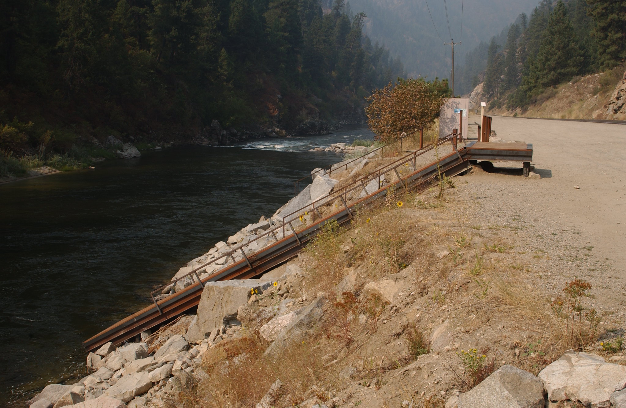
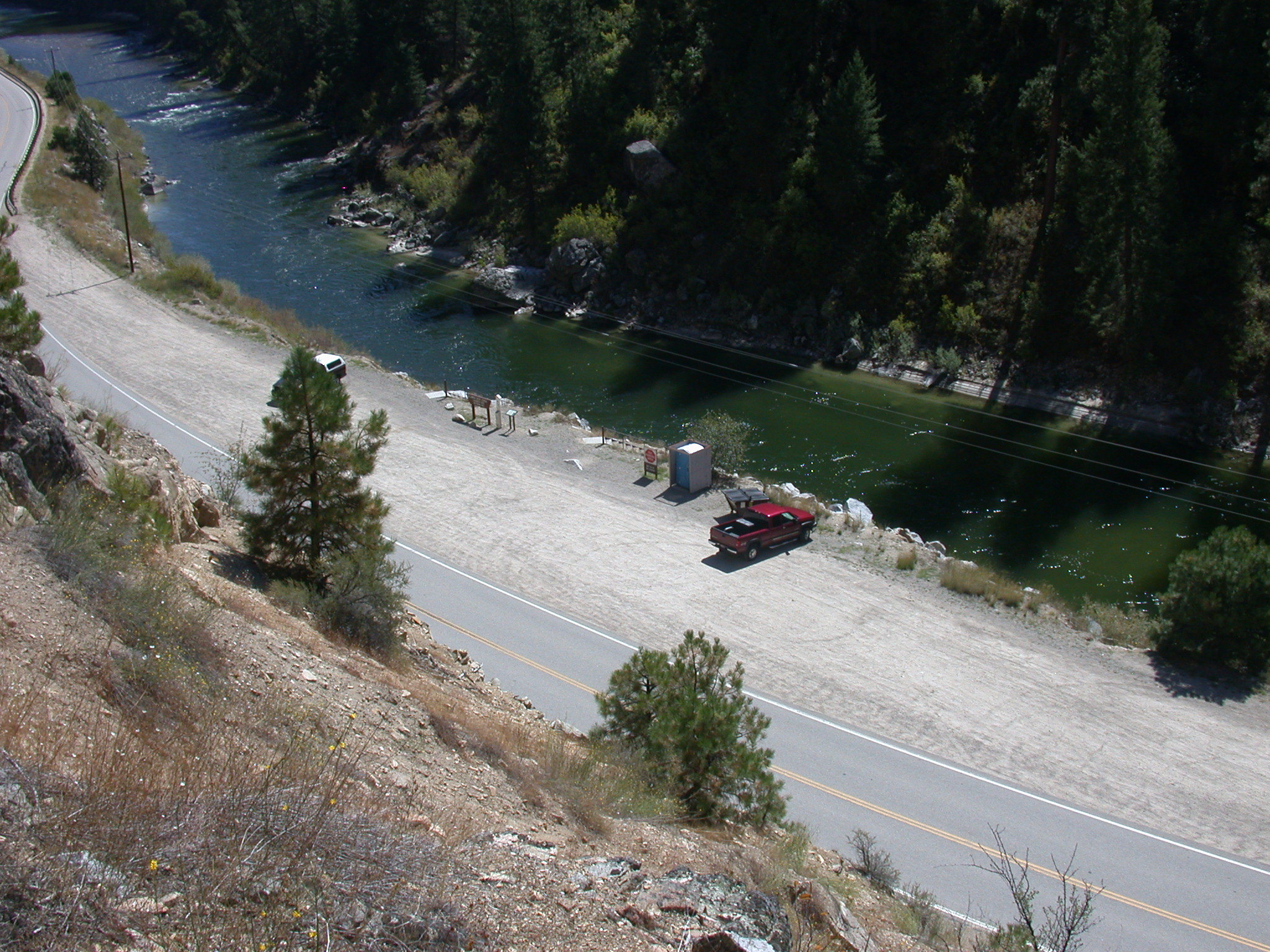
The South Fork Payette River is a classic pool-drop river cooperatively managed by the BLM and Boise National Forest. Deer Creek launch is a main put-in spot for the Class III-IV, "Staircase" section of the South Fork Payette River. many boaters will launch here to avoid the three miles of calm water from the Confluence Site. The site is essentially a very broad gravel area adjacent to the Banks-Lowman Highway. The facilities include a steep, steel and wood boat ramp, portable toilet, and information kiosk. This is a fee parking area - $5.00/day or $30.00 season pass for the Boise National Forest Annual Day Use Pass. Day passes are available on-site.
Purchase online Boise National Forest Annual Day Use Pass
Getting there
Deer Creek Launch Site is located along the Banks-Lowman Highway four miles east of Banks, Idaho and six miles west of Garden Valley, Idaho.
44.09222, -116.03250 · 44°5'32.0"N 116°1'57.0"W
Typical weather
Typically 89°F in Jul, down to 33°F in Dec.
| Jan | Feb | Mar | Apr | May | Jun | Jul | Aug | Sep | Oct | Nov | Dec | |
|---|---|---|---|---|---|---|---|---|---|---|---|---|
| High °F | 34 | 41 | 52 | 60 | 69 | 78 | 89 | 89 | 79 | 64 | 44 | 33 |
| Low °F | 19 | 22 | 27 | 32 | 38 | 44 | 48 | 46 | 39 | 31 | 26 | 20 |
| Precip in | 4.2 | 2.5 | 2.9 | 2.1 | 1.8 | 1.4 | 0.4 | 0.5 | 0.8 | 1.7 | 3.2 | 5.0 |
1991–2020 averages from the nearest NOAA station, 3.2 mi away — not measured at the facility itself, and elevation can make a real difference over that distance.
Map
Fees and stay limits
Parking: $5/day; or $30/Boise National Forest Annual Day Use Pass.
Stay limit: Day use only.
From Recreation.gov, which is not always current. The operator's own page is the authority on what you will be charged.
More photos
Member photos
Common questions about Payette River: Deer Creek
- Can you reserve a site at Payette River: Deer Creek?
- No. Payette River: Deer Creek is not reservable through Recreation.gov, so sites are first-come, first-served or booked elsewhere.
- How long can you stay at Payette River: Deer Creek?
- Day use only.
Camping near Payette River: Deer Creek
- Hot Springs 6.1 mi · Campground · we watch it
- Swinging Bridge 7 mi · Campground · we watch it
- Cold Springs Campground - Boise NF (ID) 8 mi · Campground · we watch it
- Payette River: Confluence 1.5 mi · Facility
- Hot Springs Campground and Group sites 6.7 mi · Campground
- Payette River: Chief Parrish 7 mi · Facility
- Canyon Creek Campground 7.8 mi · Campground
- Cold Springs Campground (Group ONLY ) 8 mi · Campground
- Payette River: Beehive Bend 9.5 mi · Facility
- Big Eddy Campground 9.6 mi · Campground
- Tie Creek Campground 9.6 mi · Campground
- Hardscrabble Campground 12.1 mi · Campground
Contact
- Phone 208-384-3300
- Email BLM_ID_FourRiversOffice@blm.gov
- Info Recreation.gov
Recreation.gov last updated this record on 2026-05-01.
Facility information and photographs from Recreation.gov (RIDB). SpotOpened is not affiliated with Recreation.gov or any federal agency.
Comments