Island Bar Recreation Site
Facility · Idaho ·
Managed by the Bureau of Land Management
Cottonwood Field Office (Bureau of Land Management ID) · Open Access
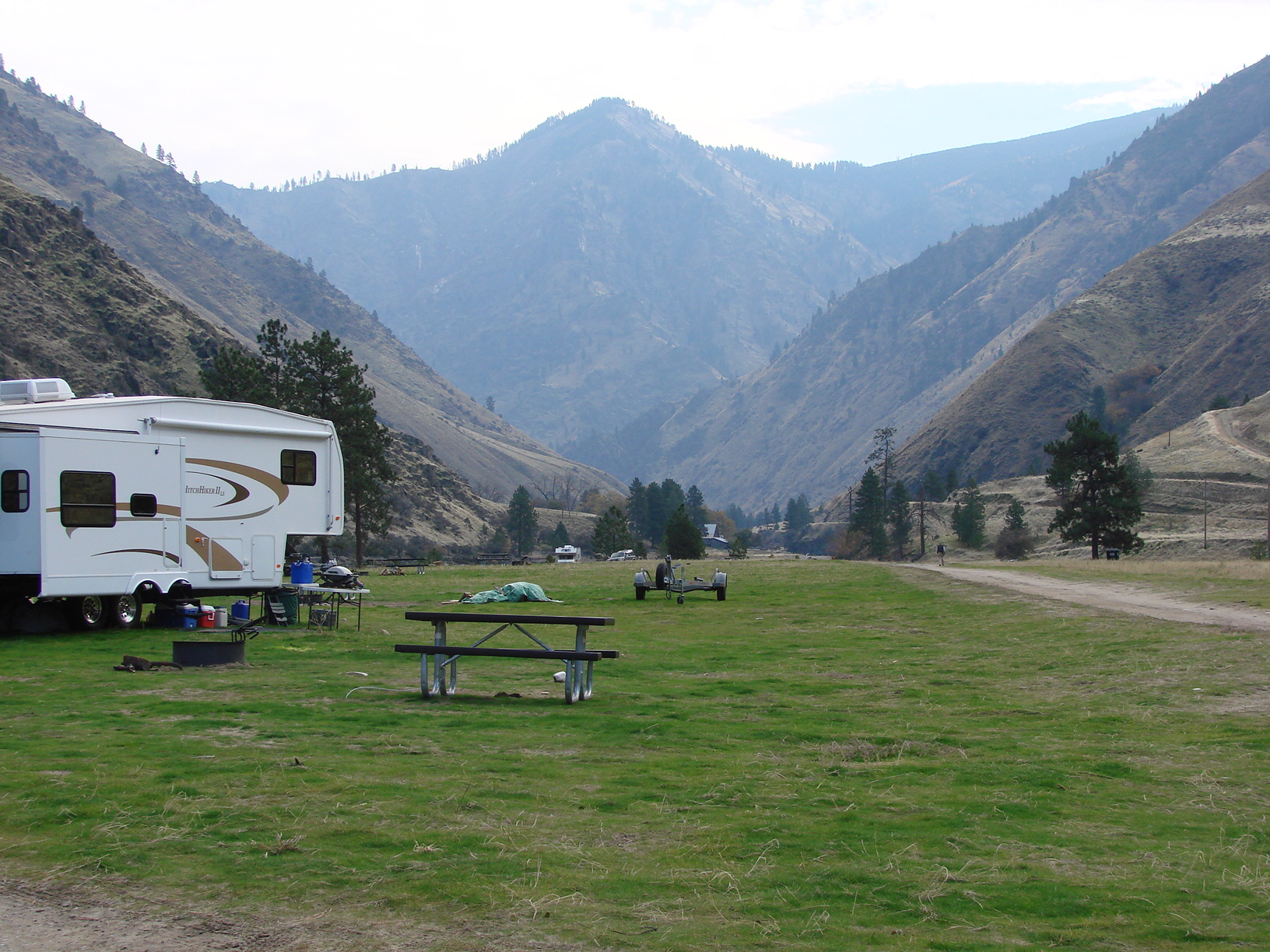
The site is located on the Lower Salmon River. It is a frequent put-in spot for floating the Lower Salmon River via raft, kayak, or jet boat. The site is largely undeveloped and is near large, sandy beaches and has easy access to the Salmon River. BLM recreation sites also on this stretch of river are Lucile, Old Lucile, Shorts Bar, Slate Creek, Skookumchuck, White Bird, Hammer Creek and Pine Bar. Be sure to check those sites for more information and amenities for boat ramps or camping. For river maps, authorized outfitters and shuttle services, see the links below.
Getting there
4.8 miles east of Riggins, Idaho on Big Salmon Road
45.41583, -116.25944 · 45°24'57.0"N 116°15'34.0"W
Typical weather
Typically 90°F in Aug, down to 40°F in Dec.
| Jan | Feb | Mar | Apr | May | Jun | Jul | Aug | Sep | Oct | Nov | Dec | |
|---|---|---|---|---|---|---|---|---|---|---|---|---|
| High °F | 41 | 46 | 55 | 62 | 71 | 78 | 90 | 90 | 80 | 64 | 48 | 40 |
| Low °F | 25 | 26 | 30 | 35 | 41 | 47 | 52 | 52 | 45 | 36 | 29 | 25 |
| Precip in | 1.3 | 1.4 | 1.8 | 2.0 | 2.2 | 1.7 | 0.8 | 0.7 | 1.2 | 1.5 | 1.4 | 1.4 |
1991–2020 averages from the nearest NOAA station, 7.8 mi away — not measured at the facility itself, and elevation can make a real difference over that distance.
Map
Fees and stay limits
/
From Recreation.gov, which is not always current. The operator's own page is the authority on what you will be charged.
Member photos
Common questions about Island Bar Recreation Site
- Can you reserve a site at Island Bar Recreation Site?
- No. Island Bar Recreation Site is not reservable through Recreation.gov, so sites are first-come, first-served or booked elsewhere.
Camping near Island Bar Recreation Site
- Main Salmon River (Powerboat) 15.4 mi · Permit · we watch it
- Hazard Lake 15.9 mi · Campground · we watch it
- Shorts Bar Recreation Site 2.1 mi · Facility
- Spring Bar Campground 5.8 mi · Campground
- Old Lucile Recreation Site 7.8 mi · Facility
- Blackerby Picnic Area 8 mi · Facility
- Lucile Recreation Site 8.7 mi · Facility
- Iron Phone Junction Campground 11.3 mi · Campground
- Heavens Gate Overlook 11.9 mi · Facility
- Seven Devils Campground 13.4 mi · Campground
- Kirkwood Ranch 15.6 mi · Facility
- Slate Creek Recreation Site 16 mi · Facility
Contact
- Phone 208-962-3245
- Email BLM_ID_CottonwoodOffice@blm.gov
- Info Recreation.gov
Recreation.gov last updated this record on 2026-03-25.
Facility information and photographs from Recreation.gov (RIDB). SpotOpened is not affiliated with Recreation.gov or any federal agency.
Comments