Zapata Falls Campground
Campground · Colorado · 40 bookable sites ·
Managed by the Bureau of Land Management
San Luis Valley Field Office (Bureau of Land Management CO) · Open Access
- 40
- Bookable sites
- up to 15
- People per site
- 4
- Accessible sites
- 7,765 ft
- Elevation
Overview
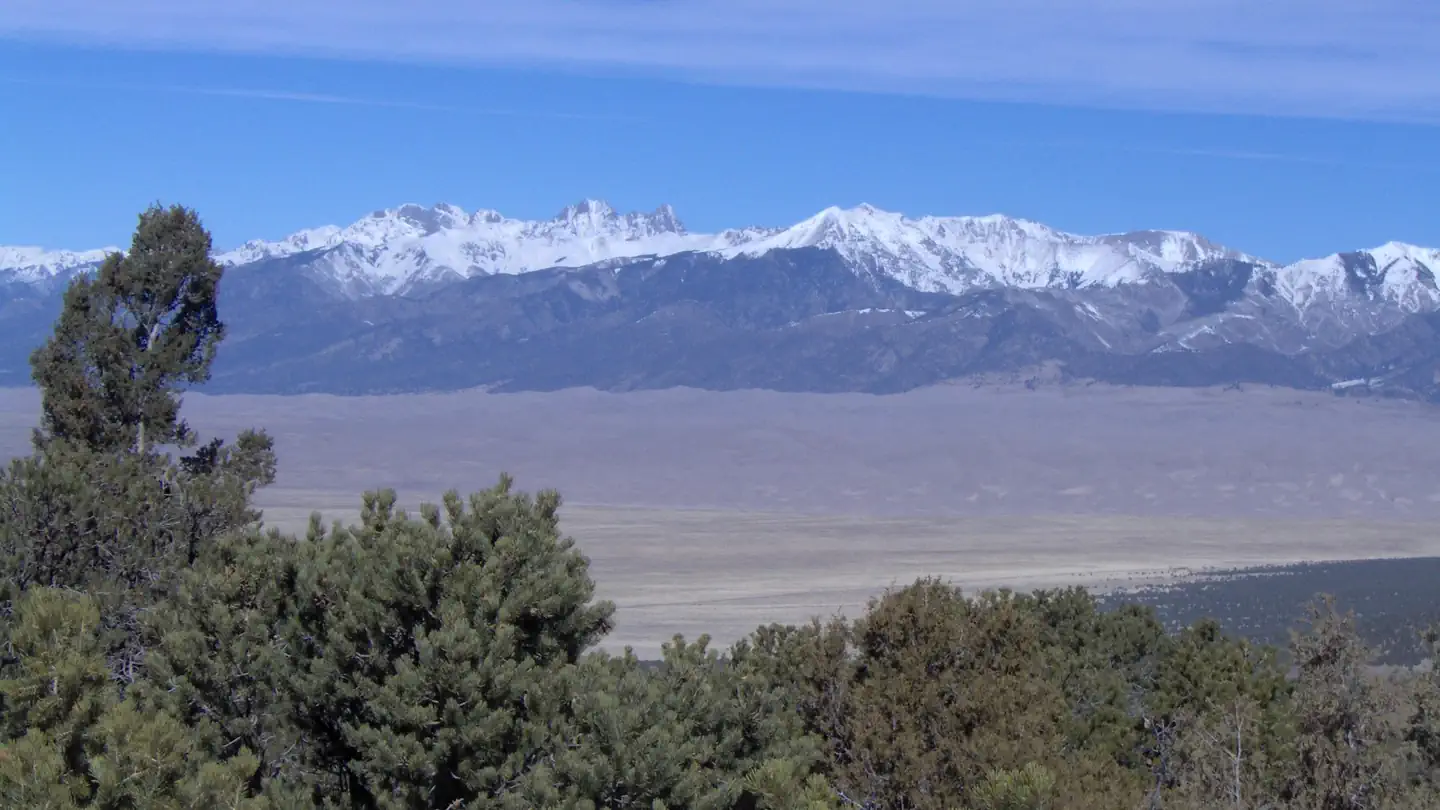
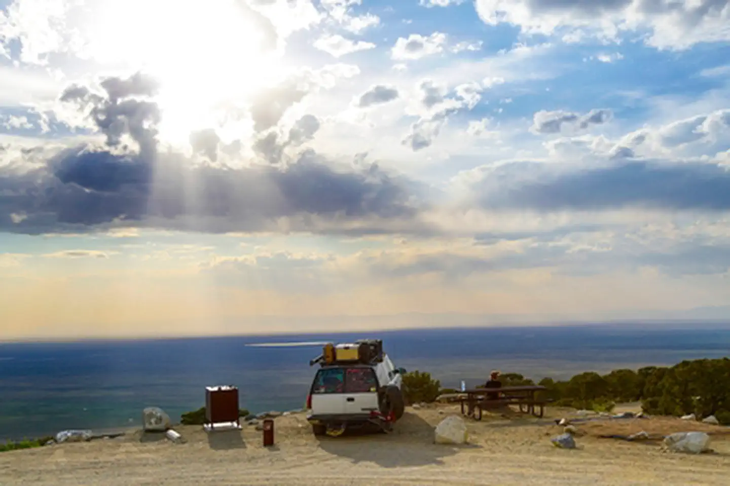
A short drive up the gravel road that leads to the Bureau of Land Management’s Zapata Falls Campground (CG) will let visitors to the area see the San Luis Valley and Great Sand Dunes National Park & Preserve from a whole new perspective. The campground offers bird’s-eye views of the valley floor below, the San Juan Mountains to the west, the adjacent Great Sand Dunes National Park and Preserve, and several 14er’s and many other towering peaks of the Sangre de Cristo Mountain range that Zapata Falls CG sits on — not to mention spectacular sunrises, sunsets and night skies!
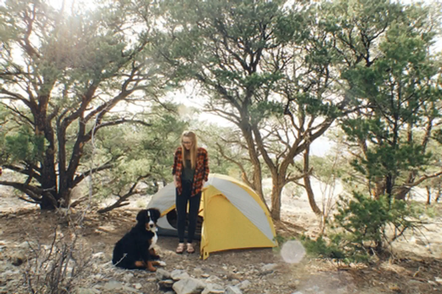
Zapata Falls CG has 23 single campsites, 1 group site and 1 camp host site nestled among piñon pines along two one-mile long loops. The sites on one loop are designed for tent campers. Parking spurs on the second loop vary a little in length but in general can handle RVs, towed campers, or other configurations of vehicles up to about 50 feet long.
A new trailhead in the campground supplies a link to the South Zapata Creek Trail and the Sangre de Cristo Wilderness. A second trail, next door to the campground in the day-use area, leads visitors on a mildly steep half-mile hike to Zapata Falls, which gives the campground its name.
Recreation
Zapata Falls Recreation Area is a destination known for its waterfall viewing and sweeping vistas of the San Luis Valley, its soaring mountain ranges, and the adjacent Great Sand Dunes National Park. From the waterfall, the trail continues onto the Rio Grande National Forest, for those seeking a backcountry experience in the high country above and the Sangre de Cristo Wilderness.
Recreation Sites
• Standard Nonelectric
• Rv Nonelectric
• Group Tent Only Area Nonelectric
• Overnight
Facilities
• Road signs from highway to Recreation Area.
• Improved gravel roads in Recreation Area (no pavement).
• No public drinking water system.
• 6 vault (or pit-type) toilets.
• Trash bins throughout campground and day-use areas.
• 23 Individual sites (11 Tent, 12 RV, 1 Group Tent, 1 CG Host Site, 7 Picnic sites.
• Standard campground amenities-table, tent pads, fire ring, food storage locker, parking.
• Interpretive, informational, and directional signs.
• Trailhead and overflow parking areas.
• Foot and horse trails.
• All facilities open year-round.
• Cell phone service is good.
Natural Features
Zapata Falls Special Recreation Management Area
The Zapata Falls Special Recreation Management Area (SRMA) is rich in history and geology and offers opportunities to hike, camp, mountain bike and view spectacular scenery. Zapata Falls and the 628 acres surrounding them are State Trust Lands owned by the Colorado State Land Board and are also a designated Colorado Natural Area. They are cooperatively managed with the Bureau of Land Management.
History
The name “Zapata” is the Spanish word for shoe and is tied to the history of settlement in the San Luis Valley. In 1864, Mexican families established the community of Zapata at the western base of the Sangre de Cristo Mountains and raised sheep and other livestock. In the 1870s, cattleman consolidated land holdings and established one of the San Luis Valley’s first and largest cattle ranches know as Zapata Ranch, which remains an active ranch today.
Geology
Zapata Falls SRMA perches on the edge of an active rift valley. The San Luis Valley was formed when geologic activity along the Rio Grande Rift, a giant crack in the earth’s top layers, caused the rugged Sangre de Cristo Mountains to rise and the flat plain of the San Luis Valley to sink. Bedrock lies 5,000 to 13,000 feet below the valley floor, beneath layers of gravel, soil, and water.
Approximately two million years ago, alpine glaciers inched down the steep slopes of the Sangre de Cristo Mountains. Water flowing from the glacier and snowfields in the valley above found a weak spot near the end of a moraine – a huge rock pile deposited thousands of years ago by a glacier. For thousands of years, water has carved its path, forming Zapata Falls.
Don’t Take the Plunge at Zapata Falls
The cold waters of South Zapata Creek drop more than 25 feet through a narrow, rocky canyon. Please use extreme caution when hiking or wading around the base of Zapata Falls. In spring and summer, the water is cold, the current may be strong, and the rocks are slippery. In winter, climbing to the base of the falls is a slick proposition. Zapata Creek freezes into a sheet of ice blanketed by snow. Beware, the ice may not be thick enough to support your weight. There is no view of the falls from above; trying to climb the rocky walls is dangerous to you and to people below you. The falls are home to the black swift, a rare and elusive bird that nests only in the misty reaches of waterfalls. Stay on the trails to keep from disturbing the birds nesting in the cliffs.
Contact Info
For local information, please call (719) 852-7074 or call (877) 444-6777 for general information.Nearby Attractions
Zapata Falls Trail
To reach Zapata Falls, you will need to take a short but arduous hike to Zapata Creek. The falls are upstream from where the trail meets the creek. The only way to view the falls is to get your feet wet by wading carefully upstream to the base of the falls.
Length: 1/2 mile each way
Elevation: 9,000 to 9,400 feet
Connections: South Zapata Lake Trail (U.S. Forest Service Trail #852)
Other Nearby Attractions:
• NPS-Great Sand Dunes National Park and Preserve.
• USFS-Rio Grande National Forest and Sangre de Cristo Wilderness.
• BLM-Blanca Wetlands Recreation Area.
• USFWS-Baca and Alamosa National Wildlife Refuges.
• Great Sand Dunes Oasis-Restaurant, gift shop, and lodge (near GRSA Park entrance).
• Ft. Garland Museum and Cultural Center.
• Colorado Gators Reptile Park.
• UFO Watchtower.
• Sand Dunes Hot Springs Pool.
Other Nearby Campgrounds: Pinyon Flats CG, Great Sand Dunes NPP
The facts
- 40 bookable sites
- 45 sites in total, including non-bookable
- 3 sites for day use only
- 4 accessible sites
- Up to 15 people per site
- Loops: Day Use Area, Picnic Loop, RV, Tent
Site types
- 25 RV Nonelectric
- 11 Standard Nonelectric
- 5 Management
- 3 Picnic
- 1 Group Tent Only Area Nonelectric
Amenities
- Campfires allowed
- Pets allowed
Not recorded upstream: electric hookups, water hookups, sewer hookups, fire pits, picnic tables, grills, shade.
45 campsites at Zapata Falls Campground
| Site | Loop | Type | Entry | Surface | Max rig | People | |
|---|---|---|---|---|---|---|---|
| Picnic Site 1 | Day Use Area | Picnic | — | — | — | 15 | 🐾 |
| Picnic Site 2 | Day Use Area | Picnic | — | — | — | 6 | 🐾 |
| Picnic Site 3 | Day Use Area | Picnic | — | — | — | 8 | 🐾 |
| Picnic Site 4 | Picnic Loop | Management | — | — | — | 6 | 🐾 |
| Picnic Site 5 | Picnic Loop | Management | — | — | — | 6 | 🐾 |
| Picnic Site 6 | Picnic Loop | Management | — | — | — | 6 | 🐾 |
| Picnic Site 7 | Picnic Loop | Management | — | — | — | 6 | 🐾 |
| 14 | RV | Rv Nonelectric | — | — | — | 6 | 🐾 |
| 15 | RV | Rv Nonelectric | Pull Through | Gravel | — | 6 | 🐾 |
| 16 | RV | Rv Nonelectric | Back In | Gravel | — | 6 | 🐾 |
| 17 | RV | Rv Nonelectric | Pull Through | Gravel | — | 6 | ♿ 🐾 |
| 18 | RV | Rv Nonelectric | Pull Through | Gravel | — | 6 | 🐾 |
| 19 | RV | Rv Nonelectric | Back In | Gravel | — | 6 | 🐾 |
| 20 | RV | Rv Nonelectric | Pull Through | Gravel | — | 6 | 🐾 |
| 21 | RV | Rv Nonelectric | Back In | Gravel | — | 6 | 🐾 |
| 22 | RV | Rv Nonelectric | Back In | Gravel | — | 6 | 🐾 |
| 23 | RV | Rv Nonelectric | Back In | Gravel | — | 6 | 🐾 |
| 24 | RV | Rv Nonelectric | Pull Through | Gravel | — | 6 | 🐾 |
| 25 | RV | Rv Nonelectric | Back In | Gravel | — | 6 | 🐾 |
| 26 | RV | Rv Nonelectric | Back In | Gravel | — | 6 | ♿ 🐾 |
| 27 | RV | Rv Nonelectric | Back In | Gravel | — | 6 | 🐾 |
| 28 | RV | Rv Nonelectric | Pull Through | Gravel | — | 6 | 🐾 |
| 29 | RV | Rv Nonelectric | Back In | Gravel | — | 6 | 🐾 |
| 30 | RV | Rv Nonelectric | Back In | Gravel | — | 6 | 🐾 |
| 31 | RV | Rv Nonelectric | Back In | Gravel | — | 6 | 🐾 |
| 32 | RV | Rv Nonelectric | Back In | Gravel | — | 6 | 🐾 |
| 33 | RV | Rv Nonelectric | Back In | Gravel | — | 6 | 🐾 |
| 34 | RV | Rv Nonelectric | Back In | Gravel | — | 6 | 🐾 |
| 35 | RV | Rv Nonelectric | Back In | Gravel | — | 6 | 🐾 |
| 36 | RV | Rv Nonelectric | Back In | Gravel | — | 6 | 🐾 |
| 37 | RV | Rv Nonelectric | Back In | Gravel | — | 6 | 🐾 |
| 38 | RV | Rv Nonelectric | Pull Through | Gravel | — | 6 | 🐾 |
| 1-Host | Tent | Management | — | — | — | 6 | 🐾 |
| 10 | Tent | Standard Nonelectric | — | — | — | 6 | 🐾 |
| 11 | Tent | Standard Nonelectric | — | — | — | 6 | 🐾 |
| 12 | Tent | Standard Nonelectric | — | — | — | 6 | 🐾 |
| 13 | Tent | Standard Nonelectric | — | — | — | 6 | 🐾 |
| 2 | Tent | Group Tent Only Area Nonelectric | — | — | — | 15 | ♿ 🐾 |
| 3 | Tent | Standard Nonelectric | — | — | — | 6 | ♿ 🐾 |
| 4 | Tent | Standard Nonelectric | — | — | — | 6 | 🐾 |
| 5 | Tent | Standard Nonelectric | — | — | — | 6 | 🐾 |
| 6 | Tent | Standard Nonelectric | — | — | — | 6 | 🐾 |
| 7 | Tent | Standard Nonelectric | — | — | — | 6 | 🐾 |
| 8 | Tent | Standard Nonelectric | — | — | — | 6 | 🐾 |
| 9 | Tent | Standard Nonelectric | — | — | — | 6 | 🐾 |
Getting there
Zapata Falls is accessed by Colorado State Highway 150 between mile markers 10 and 11, located approximately 5 miles south of Great Sand Dunes National Park and Preserve and 10.5 miles north of U.S. Highway 160. The turn-off is to the east, and the campground is located 3.5 miles (5.8km) up an unpaved road. Elevation 9,088ft.
37.62857, -105.59513 · 37°37'42.9"N 105°35'42.5"W
Typical weather
| Jan | Feb | Mar | Apr | May | Jun | Jul | Aug | Sep | Oct | Nov | Dec | |
|---|---|---|---|---|---|---|---|---|---|---|---|---|
| High °F | — | — | — | — | — | — | — | — | — | — | — | — |
| Low °F | — | — | — | — | — | — | — | — | — | — | — | — |
| Precip in | 0.5 | 0.4 | 0.7 | 1.0 | 1.0 | 0.9 | 2.3 | 2.0 | 1.4 | 0.8 | 0.4 | 0.5 |
1991–2020 averages from the nearest NOAA station, 1.8 mi away — not measured at the facility itself, and elevation can make a real difference over that distance.
Map
Fees and stay limits
Individual Sites = $11/night Group Tent Site = $20/night 14 day Max Stay
From Recreation.gov, which is not always current. The operator's own page is the authority on what you will be charged.
More photos
Member photos
Common questions about Zapata Falls Campground
- Can you reserve a site at Zapata Falls Campground?
- Yes, Zapata Falls Campground is reservable through Recreation.gov.
- How many campsites does Zapata Falls Campground have?
- 45 sites in total, of which 40 can be booked.
- Are pets allowed at Zapata Falls Campground?
- Yes, pets are allowed at Zapata Falls Campground.
- Are campfires allowed at Zapata Falls Campground?
- Campfires are allowed at Zapata Falls Campground. Check for a current fire restriction before you go.
Camping near Zapata Falls Campground
- Pinon Flats Campground 9.4 mi · Campground · we watch it
- Duncan Cabin 17 mi · Campground · we watch it
- Alvarado Campground 31.2 mi · Campground · we watch it
- Bear Lake Campground (Co) 32.6 mi · Campground · we watch it
- Blue Lake Campground - San Isabel NF (CO) 33.2 mi · Campground · we watch it
- Zapata Falls Day Use Area 2.4 mi · Facility
- Entrance Station 7.9 mi · Visitor Center
- Medano Pass Primitive Road Campsites 13.3 mi · Campground
- Stone Cellar Guard Station Cabin 17 mi · Campground
- South Colony Basin 24.6 mi · Facility
- North Crestone Creek Campground 27.8 mi · Campground
- Blue Lake Campground 33.2 mi · Campground
Contact
- Phone 719-852-7074
- Book Recreation.gov
Recreation.gov last updated this record on 2026-04-16.
Facility information and photographs from Recreation.gov (RIDB). SpotOpened is not affiliated with Recreation.gov or any federal agency.
Comments