Buckhorn Ranger Station
Campground · Colorado · 3 bookable sites ·
Managed by the USDA Forest Service
Roosevelt National Forest (NF) · Open Access
- 3
- Bookable sites
- up to 6
- People per site
- 1
- Accessible site
- 8,277 ft
- Elevation
Overview
The Buckhorn Ranger Station has three cabins, an office and large garage. In August 2022, the Buckhorn Ranger Station was listed in the National Register of Historic Places. The Buckhorn Ranger Cabin was built in 1933 by the Civilian Conservation Corps.
Guests need to bring bedding, including pillows, blankets and/or sleeping bags, as well as towels, toiletry items, and food and beverages. Cooking pots, table and chairs, dishes, and utensils are provided.
The Ranger Cabin is a fully-furnished two-bedroom cabin with indoor plumbing and electricity. It can accommodate up to six people and has two single beds in one bedroom, a queen bed in the second bedroom and a futon in the living room. The cabin is also equipped with a woodstove. The kitchen has running water, a stove and oven, refrigerator, microwave, and toaster.
The Assistant Ranger Cabin is a one-bedroom cabin with two twin beds and a futon in the living room. The cabin has a propane heater, a full kitchen with gas stove and refrigerator, and a bathroom with shower.
The Bunkhouse is an efficiency cabin that is planned to be wheelchair accessible. It has a kitchen with eating area and a small living room/bedroom area.
Recreation
Danner Hill Trail (AKA Donner Pass Trail) is located just north of the site and heads to the south towards Lookout Mountain. Forest Road 100 (West White Pine Road) heads north of the site to the original location of the West White Pine Fire Lookout that was relocated by helicopter to Fort Collins, Colorado.
The area is popular for biking, hiking, OHV and motorized riding, hunting, and scenic drives.
Facilities
Beyond the specific cabin details above, the overall facility has a two fire pits, a horseshoe court and charcoal grills.
Natural Features
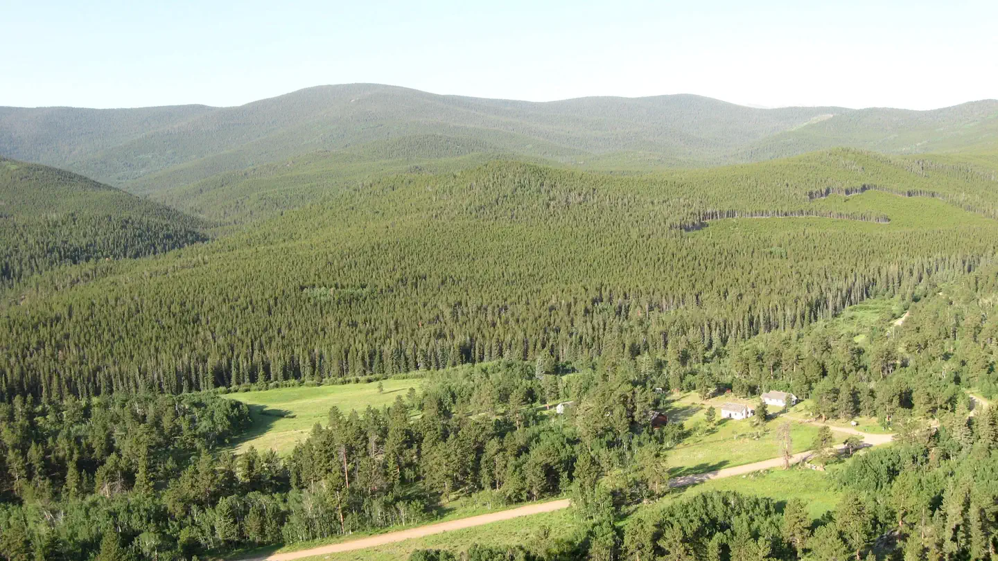
The Buckhorn Ranger Station is located on a large broad open terrace in the narrow Buckhorn Canyon just off Box Elder Creek, a tributary of Buckhorn Creek. West and East White Pine Mountains are located to the north, Lookout Mountain and Crystal Mountain are located to the south and Pingree Pass and the Mummy Range are located to the west.
Nearby Attractions
The Golden Eagle Disc Golf Course is locate just across Larimer County Road 44H.
The facts
- 3 bookable sites
- 1 accessible site
- Up to 6 people per site
- Loops: Buckhorn
Site types
- 3 Cabin Electric
Amenities
- Campfires allowed
- Fire pits
- Picnic tables
- Grills
- Shade
- Pets allowed — not available
Not recorded upstream: electric hookups, water hookups, sewer hookups.
3 campsites at Buckhorn Ranger Station
Check-in 3:00 PM · Check-out 10:00 AM
| Site | Loop | Type | Entry | Surface | Max rig | People | |
|---|---|---|---|---|---|---|---|
| Buckhorn Assistant Ranger Cabin (0502) | Buckhorn | Cabin Electric | — | — | — | 4 | |
| Buckhorn Bunkhouse (0503) | Buckhorn | Cabin Electric | — | — | — | 4 | ♿ |
| Buckhorn Ranger Cabin (Fullen Kamp) | Buckhorn | Cabin Electric | — | — | — | 6 |
Getting there
The site is located on the south and north sides of Larimer County Road 44H (Buckhorn Road) 22 miles west of Masonville, Colorado, in the Roosevelt National Forest. The site is 165’ east of the intersection of Forest Service Road 100, 11.6 miles west of the intersection of Buckhorn Road and Stove Prairie Road (just past mile marker 32 if driving from the east), and 1 mile east of the junction of Buckhorn Road and Monument Gulch Road.
40.58080, -105.46862 · 40°34'50.9"N 105°28'7.0"W
Typical weather
| Jan | Feb | Mar | Apr | May | Jun | Jul | Aug | Sep | Oct | Nov | Dec | |
|---|---|---|---|---|---|---|---|---|---|---|---|---|
| High °F | — | — | — | — | — | — | — | — | — | — | — | — |
| Low °F | — | — | — | — | — | — | — | — | — | — | — | — |
| Precip in | 1.7 | 1.8 | 2.3 | 3.8 | 2.7 | 1.3 | 1.8 | 2.2 | 1.4 | 2.0 | 1.8 | 1.9 |
1991–2020 averages from the nearest NOAA station, 8.5 mi away — not measured at the facility itself, and elevation can make a real difference over that distance.
Map
More photos
Member photos
Common questions about Buckhorn Ranger Station
- Can you reserve a site at Buckhorn Ranger Station?
- Yes, Buckhorn Ranger Station is reservable through Recreation.gov.
- How many campsites does Buckhorn Ranger Station have?
- 3 sites.
- Are pets allowed at Buckhorn Ranger Station?
- No, pets are not allowed at Buckhorn Ranger Station.
- Are campfires allowed at Buckhorn Ranger Station?
- Campfires are allowed at Buckhorn Ranger Station. Check for a current fire restriction before you go.
Camping near Buckhorn Ranger Station
- Jacks Gulch 4.9 mi · Campground · we watch it
- Mountain Park 7 mi · Campground · we watch it
- Narrows (Co) 7.9 mi · Campground · we watch it
- West White Pine Road (#100) 0.1 mi · Facility
- Cache la Poudre Wilderness 3.7 mi · Facility
- Bennett Creek Picnic Site 5.9 mi · Facility
- Tom Bennett Campground 6 mi · Facility
- Moody Hill Road (#513) 6.4 mi · Facility
- Kelly Flats Campground 6.9 mi · Campground
- Mountain Park Picnic Site Day Use 7.1 mi · Activity pass
- Mt. McConnel Trailhead Day Pass 7.1 mi · Activity pass
- Narrows Campground: Upper and Lower 7.9 mi · Campground
Contact
- Phone 970-295-6600
- Email VisitARP@usda.gov
- Book Recreation.gov
Recreation.gov last updated this record on 2026-06-06.
Facility information and photographs from Recreation.gov (RIDB). SpotOpened is not affiliated with Recreation.gov or any federal agency.
Comments