Hole-in-the-Wall Campground
Campground · California · 37 bookable sites ·
Managed by the National Park Service
Mojave National Preserve (National Preserve) · Open Access
- 37
- Bookable sites
- 30 ft
- Max rig length
- up to 8
- People per site
- 4,278 ft
- Elevation
Overview
Mojave preserves a diverse mosaic of ecological habitats and a 10,000 year history of human connection with the desert. Offering extensive opportunities to experience desert landscapes, the preserve promotes understanding and appreciation for the increasingly threatened resources of the Mojave Desert. This remote preserve encourages a sense of discovery and a connection to wild places.
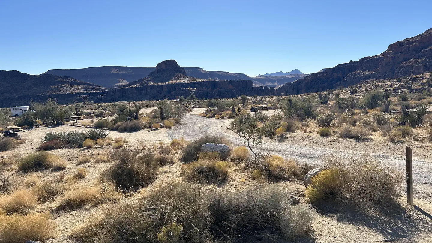
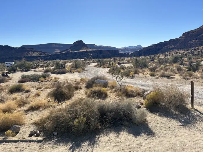
At 4,400 feet in elevation, Hole-in-the-Wall Campground is surrounded by sculptured volcanic rock walls and makes a great base camp for hikers.
Recreation
There are over 1.6 million acres to explore. The popular main attractions are accessible by paved and unpaved roads and more remote areas of the park will require a high clearance, 4WD vehicle.
Check out the must see highlights: Mojave National Preserve Must See Highlights
Explore the preserve off the beaten path! Take your street legal vehicle along the historic Mojave Road or visit the multitude of canyons and mining roads. Be sure to have high clearance and 4WD. Do not enter mines. 4WD Routes
Mojave offers many hikes to choose! Hiking
Visit Zzyzx and learn about its history. It is also a great birding location due to its pond.
Facilities
Hole-in-the-Wall has 38 campsites. Each campsite contains 1-2 vehicle parking spots, picnic table, fire ring, and tent area. Water spigots and vault toilets are available around the campground. Camp hosts are typically present in the peak season months. A dump station is available for campers. Free WiFi is available 24/7 at the Hole-in-the-Wall Information Center.
Natural Features
Three of the four major North American deserts are found at Mojave National Preserve: the Mojave, Great Basin, and Sonoran. Dozens of seeps and springs coupled with varied elevations and soil types create microhabitats that support a diversity of plant and animal life. Cactus gardens, relict plant communities of white fir and chaparral and the densest, largest Joshua tree forest are all found here.
Geologically, the region is just as diverse as it is ecologically. Mountain ranges, dry riverbeds, great mesas, towering sand dunes, striking cinders cones, domes and lava flows define Mojave. Ancient rocks that date back to 2.5 billion years old have been discovered in the Clark Mountains.
Set out to search for the blooms across the preserve: Wildflowers
Visit the world’s largest Joshua Tree forest around the Cima Dome area.
Nearby Attractions
Popular Hikes:
Kelso Dunes - Hike to the top of our most popular sand dune!
Rings Loop – 1.5 miles, Discover how Hole-in-the-Wall got its name as you ascend narrow Banshee Canyon with the help of metal rings mounted in the rock.
Barber Peak - This loop trail encircles Barber Peak just west of Hole-in-the-Wall Campground.
Lava Tube - Explore an underground wonder! High clearance vehicle recommended.
Teutonia Peak - A mixed Joshua tree forest and Joshua tree graveyard beckon en route to a rocky peak with expansive views of Cima Dome and beyond! This area burned in August 2020.
The facts
- 37 bookable sites
- 38 sites in total, including non-bookable
- Vehicles up to 30 ft
- Up to 8 people per site
- Loops: A
Site types
- 35 Standard Nonelectric
- 2 Hike To
- 1 Management
Amenities
- Campfires allowed
- Pets allowed
- Water hookups — not available
- Shade — not available
Not recorded upstream: electric hookups, sewer hookups, fire pits, picnic tables, grills.
38 campsites at Hole-in-the-Wall Campground
Check-in 01:00 PM · Check-out 12:00 PM
| Site | Loop | Type | Entry | Surface | Access | Max rig | People | |
|---|---|---|---|---|---|---|---|---|
| 1 | A | Management | Back In | Gravel | Drive In | 25 ft | 8 | 🐾 |
| 10 | A | Standard Nonelectric | Back In | Gravel | Drive In | 25 ft | 8 | 🐾 |
| 11 | A | Standard Nonelectric | Back In | Gravel | Drive In | 25 ft | 8 | 🐾 |
| 12 | A | Standard Nonelectric | Back In | Gravel | Drive In | 25 ft | 8 | 🐾 |
| 13 | A | Standard Nonelectric | Pull Through | Gravel | Drive In | 30 ft | 8 | 🐾 |
| 14 | A | Standard Nonelectric | Pull Through | Gravel | Drive In | 30 ft | 8 | 🐾 |
| 15 | A | Standard Nonelectric | Back In | Gravel | Drive In | 25 ft | 8 | 🐾 |
| 16 | A | Standard Nonelectric | Back In | Gravel | Drive In | 25 ft | 8 | 🐾 |
| 17 | A | Standard Nonelectric | Back In | Gravel | Drive In | 25 ft | 8 | 🐾 |
| 18 | A | Standard Nonelectric | Back In | Gravel | Drive In | 25 ft | 8 | 🐾 |
| 19 | A | Standard Nonelectric | Back In | Gravel | Drive In | 25 ft | 8 | 🐾 |
| 2 | A | Standard Nonelectric | Back In | Gravel | Drive In | 25 ft | 8 | 🐾 |
| 20 | A | Standard Nonelectric | Back In | Gravel | Drive In | 25 ft | 8 | 🐾 |
| 21 | A | Hike To | Back In | Gravel | Hike In | 25 ft | 8 | 🐾 |
| 22 | A | Hike To | Back In | Gravel | Hike In | 25 ft | 8 | 🐾 |
| 23 | A | Standard Nonelectric | Pull Through | Gravel | Drive In | 30 ft | 8 | 🐾 |
| 24 | A | Standard Nonelectric | Back In | Gravel | Drive In | 25 ft | 8 | 🐾 |
| 25 | A | Standard Nonelectric | Pull Through | Gravel | Drive In | 30 ft | 8 | 🐾 |
| 26 | A | Standard Nonelectric | Pull Through | Gravel | Drive In | 30 ft | 8 | 🐾 |
| 27 | A | Standard Nonelectric | Back In | Gravel | Drive In | 25 ft | 8 | 🐾 |
| 28 | A | Standard Nonelectric | Pull Through | Gravel | Drive In | 30 ft | 8 | 🐾 |
| 29 | A | Standard Nonelectric | Back In | Gravel | Drive In | 25 ft | 8 | 🐾 |
| 3 | A | Standard Nonelectric | Back In | Gravel | Drive In | 25 ft | 8 | 🐾 |
| 30 | A | Standard Nonelectric | Back In | Gravel | Drive In | 25 ft | 8 | 🐾 |
| 31 | A | Standard Nonelectric | Back In | Gravel | Drive In | 25 ft | 8 | 🐾 |
| 32 | A | Standard Nonelectric | Back In | Gravel | Drive In | 25 ft | 8 | 🐾 |
| 33 | A | Standard Nonelectric | Back In | Gravel | Drive In | 25 ft | 8 | 🐾 |
| 34 | A | Standard Nonelectric | Back In | Gravel | Drive In | 25 ft | 8 | 🐾 |
| 35 | A | Standard Nonelectric | Back In | Gravel | Drive In | 30 ft | 8 | 🐾 |
| 36 | A | Standard Nonelectric | Back In | Gravel | Drive In | 25 ft | 8 | 🐾 |
| 37 | A | Standard Nonelectric | Back In | Gravel | Drive In | 25 ft | 8 | 🐾 |
| 38 | A | Standard Nonelectric | Pull Through | Gravel | Drive In | 30 ft | 8 | 🐾 |
| 4 | A | Standard Nonelectric | Back In | Gravel | Drive In | 25 ft | 8 | 🐾 |
| 5 | A | Standard Nonelectric | Back In | Gravel | Drive In | 25 ft | 8 | 🐾 |
| 6 | A | Standard Nonelectric | Back In | Gravel | Drive In | 25 ft | 8 | 🐾 |
| 7 | A | Standard Nonelectric | Pull Through | Gravel | Drive In | 30 ft | 8 | 🐾 |
| 8 | A | Standard Nonelectric | Back In | Gravel | Drive In | 25 ft | 8 | 🐾 |
| 9 | A | Standard Nonelectric | Back In | Gravel | Drive In | 25 ft | 8 | 🐾 |
Getting there
From Los Angeles, Barstow, and Joshua Tree via Interstate 40: Exit Essex Road and drive north for 10 miles and turn right at the junction to Black Canyon Road. Continue for 10 miles to Hole-in-the-Wall. The roads are paved until the turn-off into the campground. Cell phone service is unreliable.
From Death Valley and Las Vegas via Interstate 15: From the Kelbaker Road, Cima Road, or Nipton Road entrances, make your way to Kelso-Cima Road and turn east onto Cedar Canyon Road. Continue onto Cedar Canyon Road for 6 miles and turn right onto Black Canyon Road for 9 miles.
35.04548, -115.39140 · 35°2'43.7"N 115°23'29.0"W
Typical weather
Typically 92°F in Jul, down to 53°F in Dec.
| Jan | Feb | Mar | Apr | May | Jun | Jul | Aug | Sep | Oct | Nov | Dec | |
|---|---|---|---|---|---|---|---|---|---|---|---|---|
| High °F | 54 | 55 | 62 | 68 | 77 | 87 | 92 | 91 | 85 | 74 | 62 | 53 |
| Low °F | 40 | 41 | 45 | 50 | 58 | 69 | 73 | 72 | 68 | 57 | 47 | 40 |
| Precip in | 1.3 | 1.8 | 1.6 | 0.6 | 0.2 | 0.1 | 1.1 | 0.6 | 0.7 | 0.6 | 0.5 | 1.6 |
1991–2020 averages from the nearest NOAA station, 11.3 mi away — not measured at the facility itself, and elevation can make a real difference over that distance.
Map
More photos
Member photos
Common questions about Hole-in-the-Wall Campground
- Can you reserve a site at Hole-in-the-Wall Campground?
- Yes, Hole-in-the-Wall Campground is reservable through Recreation.gov.
- How many campsites does Hole-in-the-Wall Campground have?
- 38 sites in total, of which 37 can be booked.
- What is the maximum RV length at Hole-in-the-Wall Campground?
- 30 ft. That is the longest vehicle the sites here are recorded as taking; individual sites may be shorter.
- Are pets allowed at Hole-in-the-Wall Campground?
- Yes, pets are allowed at Hole-in-the-Wall Campground.
- Does Hole-in-the-Wall Campground have hookups?
- No hookups are recorded here.
- Are campfires allowed at Hole-in-the-Wall Campground?
- Campfires are allowed at Hole-in-the-Wall Campground. Check for a current fire restriction before you go.
Camping near Hole-in-the-Wall Campground
- Black Canyon Group and Equestrian Campground 0.5 mi · Campground · we watch it
- Mid Hills Campground 5.9 mi · Campground · we watch it
- Hole-in-the-Wall Visitor Center 0.3 mi · Facility
- Kelso Depot Visitor Center 15 mi · Facility
- Route 66 (Piute Crossing) 22.4 mi · Facility
- Walking Box Ranch 36.5 mi · Facility
- Havasu Wilderness 46 mi · Facility
- Katherine Landing RV Park 48.4 mi · Campground
- Katherine Landing Campground 48.7 mi · Campground
- Soda Mountains WSA 49.1 mi · Facility
- Cottonwood Cove RV Park 50.2 mi · Campground
- Mohave Milltown West Trailhead 50.2 mi · Facility
Contact
- Phone 760-252-6100
- Email moja_campgrounds@nps.gov
- Book Recreation.gov
Recreation.gov last updated this record on 2026-02-25.
Facility information and photographs from Recreation.gov (RIDB). SpotOpened is not affiliated with Recreation.gov or any federal agency.
Comments