Tyler Bend Campground
Campground · Arkansas · 43 bookable sites ·
Managed by the National Park Service
Buffalo National River (National River) · Open Access
- 43
- Bookable sites
- up to 150
- People per site
- 1
- Accessible site
- 622 ft
- Elevation

Overview
Campers will delight in the picturesque river views at Tyler Bend. Located 11 miles (18 km) northwest of Marshall, Arkansas, Tyler Bend is set on a quiet, peaceful section of the great Buffalo National River. Known as the middle river region, the campground offers tranquil views of the river beside pastures.
Recreation
Small-mouth bass, catfish and sunfish are the most popular fish to catch on the Buffalo River, but visitors should be aware that an Arkansas fishing license is required to fish anywhere on the river. The middle river location also allows for extended seasons for kayaking and tubing. If there's enough rain, the sports can go through mid- to late summer. Get a dose of history by hiking to the Collier Homestead, a restored Ozark dwelling from the 1930's. The homestead remembers one of the homes built by settlers in response to the Homestead Act of 1862.
For current paddling conditions, please check with an outfitter (visit our Guided Services web page ), call the Tyler Bend Visitor Center at 870-439-2502, or check the Buffalo National River Float Guide Dashboard
Facilities
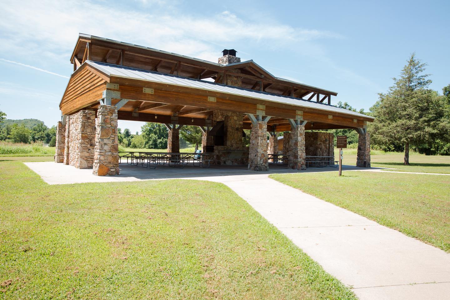
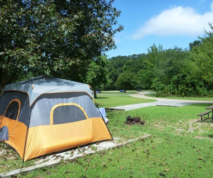
The Tyler Bend Visitor Center is open year-round and has interesting exhibits on the history of flora and fauna in the Buffalo National River area. It's the primary visitor center for the region and provides several educational programs in the auditorium. The campground has 10 walk-in and 28 drive-in sites available, plus a day-use pavilion and five group sites.Natural Features
The Buffalo National River flows free over swift running rapids and quiet pools for its 135-mile (217 km) length. One of the few remaining rivers in the lower 48 states without dams, the Buffalo cuts its way through massive limestone bluffs traveling eastward through the Arkansas Ozarks and into the White River.
Nearby Attractions
The Buffalo River Trail is accessible from the Collier trailhead parking area. This trail joins the Ozark Highlands Trail at Woolum, 14 miles (22.5 km) upstream from Tyler Bend.
Charges & Cancellations
The facts
- 43 bookable sites
- 44 sites in total, including non-bookable
- 1 site for day use only
- 1 accessible site
- Up to 150 people per site
- Loops: Group Sites, Main Loop, Pavilion, Tent only
Site types
- 26 Standard Nonelectric
- 10 Tent Only Nonelectric
- 5 Group Tent Only Area Nonelectric
- 1 Group Shelter Electric
- 1 Management
- 1 RV Nonelectric
Amenities
- Campfires allowed
- Fire pits
- Picnic tables
- Shade
- Pets allowed
Not recorded upstream: electric hookups, water hookups, sewer hookups, grills.
44 campsites at Tyler Bend Campground
| Site | Loop | Type | Entry | Surface | Access | Max rig | People | |
|---|---|---|---|---|---|---|---|---|
| G1 | Group Sites | Group Tent Only Area Nonelectric | — | Paved | — | — | 25 | 🐾 |
| G2 | Group Sites | Group Tent Only Area Nonelectric | — | Paved | — | — | 25 | 🐾 |
| G3 | Group Sites | Group Tent Only Area Nonelectric | — | Paved | — | — | 25 | 🐾 |
| G4 | Group Sites | Group Tent Only Area Nonelectric | — | Paved | — | — | 25 | 🐾 |
| G5 | Group Sites | Group Tent Only Area Nonelectric | — | Paved | — | — | 25 | 🐾 |
| Site# 01 | Main Loop | Management | — | — | Drive In | — | 6 | 🐾 |
| Site# 02 | Main Loop | Standard Nonelectric | — | — | Drive In | — | 6 | 🐾 |
| Site# 03 | Main Loop | Standard Nonelectric | — | — | Drive In | — | 6 | 🐾 |
| Site# 04 | Main Loop | Standard Nonelectric | — | — | Drive In | — | 6 | 🐾 |
| Site# 05 | Main Loop | Standard Nonelectric | — | — | Drive In | — | 6 | 🐾 |
| Site# 06 | Main Loop | Standard Nonelectric | — | — | Drive In | — | 6 | 🐾 |
| Site# 07 | Main Loop | Standard Nonelectric | — | — | Drive In | — | 6 | 🐾 |
| Site# 08 | Main Loop | Standard Nonelectric | — | — | Drive In | — | 6 | 🐾 |
| Site# 09 | Main Loop | Standard Nonelectric | — | — | Drive In | — | 6 | 🐾 |
| Site# 10 | Main Loop | Standard Nonelectric | — | — | Drive In | — | 6 | 🐾 |
| Site# 11 | Main Loop | Standard Nonelectric | — | — | Drive In | — | 6 | 🐾 |
| Site# 12 | Main Loop | Rv Nonelectric | Pull Through | — | Drive In | — | 6 | 🐾 |
| Site# 13 | Main Loop | Standard Nonelectric | Pull Through | — | Drive In | — | 6 | 🐾 |
| Site# 14 | Main Loop | Standard Nonelectric | — | — | Drive In | — | 6 | 🐾 |
| Site# 15 | Main Loop | Standard Nonelectric | — | — | Drive In | — | 6 | 🐾 |
| Site# 16 | Main Loop | Standard Nonelectric | — | — | Drive In | — | 6 | 🐾 |
| Site# 17 | Main Loop | Standard Nonelectric | — | — | Drive In | — | 6 | 🐾 |
| Site# 18 | Main Loop | Standard Nonelectric | — | — | Drive In | — | 6 | 🐾 |
| Site# 19 | Main Loop | Standard Nonelectric | — | — | Drive In | — | 6 | 🐾 |
| Site# 20 | Main Loop | Standard Nonelectric | — | — | Drive In | — | 6 | 🐾 |
| Site# 21 | Main Loop | Standard Nonelectric | — | — | Drive In | — | 6 | 🐾 |
| Site# 22 | Main Loop | Standard Nonelectric | — | — | Drive In | — | 6 | 🐾 |
| Site# 23 | Main Loop | Standard Nonelectric | — | — | Drive In | — | 6 | 🐾 |
| Site# 24 | Main Loop | Standard Nonelectric | — | — | Drive In | — | 6 | 🐾 |
| Site# 25 | Main Loop | Standard Nonelectric | — | — | Drive In | — | 6 | 🐾 |
| Site# 26 | Main Loop | Standard Nonelectric | — | — | Drive In | — | 6 | 🐾 |
| Site# 27 | Main Loop | Standard Nonelectric | — | — | Drive In | — | 6 | 🐾 |
| Site# 28 | Main Loop | Standard Nonelectric | — | — | Drive In | — | 6 | 🐾 |
| Pavilion | Pavilion | Group Shelter Electric | — | — | — | — | 150 | 🐾 |
| Walk-in: A | Tent only | Tent Only Nonelectric | — | Paved | Hike In | — | 6 | 🐾 |
| Walk-in: B | Tent only | Tent Only Nonelectric | — | Paved | Hike In | — | 6 | 🐾 |
| Walk-in: C | Tent only | Tent Only Nonelectric | — | Paved | Hike In | — | 6 | 🐾 |
| Walk-in: D | Tent only | Tent Only Nonelectric | — | Paved | Hike In | — | 6 | 🐾 |
| Walk-in: E | Tent only | Tent Only Nonelectric | — | Paved | Hike In | — | 6 | 🐾 |
| Walk-in: F | Tent only | Tent Only Nonelectric | — | Paved | Hike In | — | 6 | ♿ 🐾 |
| Walk-in: G | Tent only | Tent Only Nonelectric | — | Paved | Hike In | — | 6 | 🐾 |
| Walk-in: H | Tent only | Tent Only Nonelectric | — | Paved | Hike In | — | 6 | 🐾 |
| Walk-in: I | Tent only | Tent Only Nonelectric | — | Paved | Hike In | — | 6 | 🐾 |
| Walk-in: J | Tent only | Tent Only Nonelectric | — | Paved | Hike In | — | 6 | 🐾 |
Getting there
From Springfield, Missouri take U.S. Highway 65 south for 109 miles (175 km); then turn right at Ranger Road (follow signs) and drive another 2 miles (3.2 km) to visitor center and campground.
From Little Rock, Arkansas take Interstate 40 West for 34 miles (55 km), then exit "U.S. 65/Skyline Drive." From here continue on U.S. Highway 65 north for 74 miles (119 km) and turn left at Ranger Road (follow signs) to the visitor center and campground.
35.98667, -92.76389 · 35°59'12.0"N 92°45'50.0"W
Typical weather
Typically 90°F in Jul, down to 48°F in Jan.
| Jan | Feb | Mar | Apr | May | Jun | Jul | Aug | Sep | Oct | Nov | Dec | |
|---|---|---|---|---|---|---|---|---|---|---|---|---|
| High °F | 48 | 53 | 61 | 70 | 77 | 85 | 90 | 90 | 83 | 73 | 60 | 51 |
| Low °F | 24 | 28 | 36 | 45 | 55 | 64 | 67 | 65 | 57 | 45 | 35 | 27 |
| Precip in | 3.2 | 3.3 | 4.7 | 5.1 | 5.3 | 4.2 | 3.4 | 3.0 | 3.9 | 3.8 | 4.5 | 3.6 |
1991–2020 averages from the nearest NOAA station, 2.7 mi away — not measured at the facility itself, and elevation can make a real difference over that distance.
Map
Fees and stay limits
Fees for the walk-in sites and drive-in sites (non-electric) are $20 a night for up to 6 people per site. Fees for the Group Tent Only Area (non-electric) are $50 a night for 10 to 25 people per group site.
From Recreation.gov, which is not always current. The operator's own page is the authority on what you will be charged.
More photos
Member photos
Common questions about Tyler Bend Campground
- Can you reserve a site at Tyler Bend Campground?
- Yes, Tyler Bend Campground is reservable through Recreation.gov.
- How many campsites does Tyler Bend Campground have?
- 44 sites in total, of which 43 can be booked.
- Are pets allowed at Tyler Bend Campground?
- Yes, pets are allowed at Tyler Bend Campground.
- Are campfires allowed at Tyler Bend Campground?
- Campfires are allowed at Tyler Bend Campground. Check for a current fire restriction before you go.
Camping near Tyler Bend Campground
- Buffalo Point 13 mi · Campground · we watch it
- Richland Creek Campground 16.2 mi · Campground · we watch it
- Ozark Campground 22.7 mi · Campground · we watch it
- Barkshed Campground 28.9 mi · Campground · we watch it
- Tyler Bend Visitor Center less than 0.1 mi · Facility
- Woolum 6.6 mi · Facility
- South Maumee 8 mi · Facility
- Rush Campground 15.2 mi · Campground
- Carver Campground 15.4 mi · Facility
- Richland Creek Wilderness 15.7 mi · Facility
- Sams Throne Recreation Area 17.6 mi · Facility
- Kyles Landing 29.3 mi · Facility
Contact
- Phone 870-439-2502
- Email buff_information@nps.gov
- Book Recreation.gov
Recreation.gov last updated this record on 2026-07-23.
Facility information and photographs from Recreation.gov (RIDB). SpotOpened is not affiliated with Recreation.gov or any federal agency.
Comments