Tompkins Bend Day-Use
Campground · Arkansas · 1 bookable site ·
Managed by the US Army Corps of Engineers
- 1
- Bookable site
- up to 125
- People per site
- 1
- Accessible site
- 634 ft
- Elevation
Overview
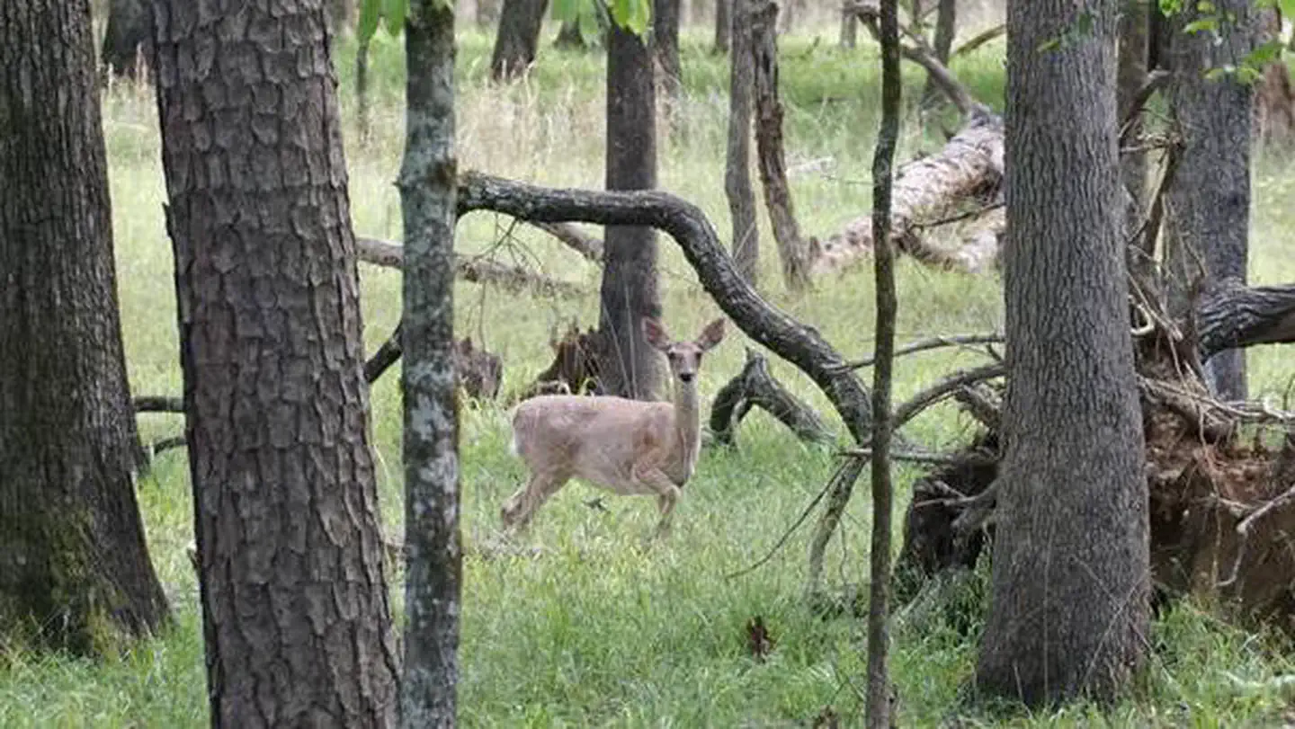
Tompkins Bend Day-Use Area on Lake Ouachita, is a great spot to getaway for the day. The combination of lush mountain scenery and wildlife, make this quiet location an ideal place for a family gathering, reunion, or group retreat.
Click here for the Lake Ouachita Virtual Tour.
Recreation
Water skiers, jet skiers and anglers can all enjoy the crystal clear waters of the lake, while hikers enjoy the campground's location on the Lake Ouachita Vista Trail (LOViT), which meanders across the south end of the lake.
Wildlife enthusiasts can find everything from bobcats to black bears and deer in the forested mountains surrounding the lake, and Bald eagles are often spotted in winter.
Facilities
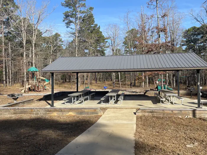
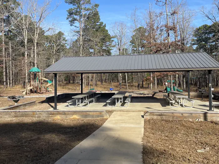
The Day-Use Pavilion has electrical hook-ups, picnic tables, and lighting. Other amenities include a bathroom facility, a playground, and a grassy wooded scenic view.
Natural Features
Lake Ouachita is fed from the cool waters of the Ouachita River in central Arkansas. Surrounded by the Ouachita Mountains and National Forest, it's crystal waters span over 40,000 acres and extend for 30 miles, making it the largest lake completely in the state of Arkansas.
Nearby Attractions
Head to Hot Springs National Park and discover how it earned the nickname, "The American Spa." Or take a scenic drive through the 1.8 million-acres of Ouachita National Forest. Here, off-roading enthusiasts can take on the Wolf Pen Gap Off-Highway Vehicle Trail System.
Contact Info
This location is unstaffed. To speak with our main office for general information, please call: (501) 767-2101.The facts
- 1 bookable site
- 1 site for day use only
- 1 accessible site
- Up to 125 people per site
- Loops: Tompkins Bend Day-Use
Site types
- 1 Group Shelter Electric
Amenities
- Electric hookups
- Water hookups
- Campfires allowed
- Picnic tables
- Grills
- Shade
- Pets allowed
Not recorded upstream: sewer hookups, fire pits.
1 campsite at Tompkins Bend Day-Use
Check-in 7:00 AM · Check-out 10:00 PM
| Site | Loop | Type | Entry | Surface | Max rig | People | |
|---|---|---|---|---|---|---|---|
| PAVILION 1 | Tompkins Bend Day-Use | Group Shelter Electric | — | Paved | — | 125 | ♿ 🐾 |
Getting there
From Hot Springs, Arkansas, take US 270 west approximately 24.5 miles to Tompkin
Bend Road. Turn right and follow access road 2.4 miles north to park.
From
Mount Ida, Arkansas, take US 270 east about 10.7 miles to Tompkins Bend
Road. Turn left and follow access road 2.4 miles north to the park.
34.56805, -93.47058 · 34°34'5.0"N 93°28'14.1"W
Typical weather
| Jan | Feb | Mar | Apr | May | Jun | Jul | Aug | Sep | Oct | Nov | Dec | |
|---|---|---|---|---|---|---|---|---|---|---|---|---|
| High °F | — | — | — | — | — | — | — | — | — | — | — | — |
| Low °F | — | — | — | — | — | — | — | — | — | — | — | — |
| Precip in | 3.8 | 3.8 | 4.6 | 5.1 | 5.8 | 3.9 | 3.6 | 3.9 | 3.6 | 4.2 | 4.8 | 4.9 |
1991–2020 averages from the nearest NOAA station, 5.7 mi away — not measured at the facility itself, and elevation can make a real difference over that distance.
Map
More photos
Member photos
Common questions about Tompkins Bend Day-Use
- Can you reserve a site at Tompkins Bend Day-Use?
- Yes, Tompkins Bend Day-Use is reservable through Recreation.gov.
- How many campsites does Tompkins Bend Day-Use have?
- 1 site.
- Are pets allowed at Tompkins Bend Day-Use?
- Yes, pets are allowed at Tompkins Bend Day-Use.
- Does Tompkins Bend Day-Use have hookups?
- Electric, Water.
- Are campfires allowed at Tompkins Bend Day-Use?
- Campfires are allowed at Tompkins Bend Day-Use. Check for a current fire restriction before you go.
Camping near Tompkins Bend Day-Use
- Tompkins Bend 0.1 mi · Campground · we watch it
- Joplin 1.7 mi · Campground · we watch it
- Denby Point 1.9 mi · Campground · we watch it
- Little Fir 4.4 mi · Campground · we watch it
- Charlton Recreation Area 6.2 mi · Campground · we watch it
- Crystal Springs (AR) 6.8 mi · Campground · we watch it
- Crystal Springs (AR) Day-Use 7.3 mi · Campground · we watch it
- Brady Mountain Day-Use 11.7 mi · Campground · we watch it
- Brady Mountain 11.7 mi · Campground · we watch it
- Spillway (Lake Ouachita) 14.5 mi · Campground · we watch it
- Avery 15.8 mi · Campground · we watch it
- Camp Clearfork 6 mi · Campground
Contact
- Phone 501-767-2101
- Book Recreation.gov
Recreation.gov last updated this record on 2026-03-11.
Facility information and photographs from Recreation.gov (RIDB). SpotOpened is not affiliated with Recreation.gov or any federal agency.
Comments