Cottonwood Group Picnic Site
Campground · Wyoming · 1 bookable site ·
Managed by the USDA Forest Service
Wyoming Range Withdrawal Area Special Designated Area (Special Designated Area) · Restricted Access
- 1
- Bookable site
- up to 50
- People per site
- 7,503 ft
- Elevation
Overview
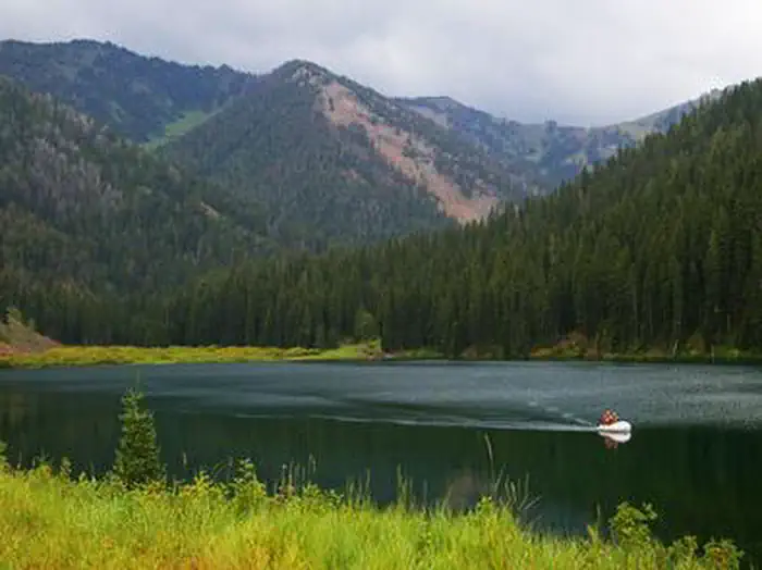
Cottonwood Group Picnic Site is located next to scenic Cottonwood Lake on the Salt River Mountains, surrounded by the forests of western Wyoming.Recreation
The lake offers great canoeing and boating for smaller craft, as well as fishing for brook and cutthroat trout.Hiking, mountain biking, off-road vehicle and horseback riding trails are in the area.
Facilities
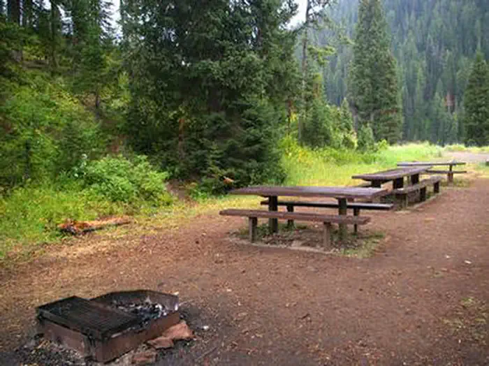
This day-use picnic site can accommodate up to 25 guests and 8-10 vehicles. Vault toilets and drinking water are provided.
A group overnight campsite is available for reservations here.
Natural Features
The picnic site is located above Cottonwood Lake, near the peaceful North Fork Creek. A forest of pines and aspens offers shade, and vibrant summer wildflowers are abundant.The Bridger-Teton National Forest offers more than 3.4 million acres of public land for outdoor recreation. With its pristine watersheds, abundant wildlife and immense wildlands, the forest comprises a large part of the Greater Yellowstone Ecosystem, the largest intact ecosystem in the lower 48 United States.
The facts
- 1 bookable site
- 2 sites in total, including non-bookable
- 2 sites for day use only
- Up to 50 people per site
- Loops: COGPS, Scan & Pay
Site types
- 1 Group Picnic Area
- 1 Management
Amenities
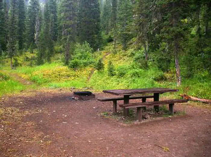
- Picnic tables
- Pets allowed
Not recorded upstream: electric hookups, water hookups, sewer hookups, campfires allowed, fire pits, grills, shade.
2 campsites at Cottonwood Group Picnic Site
Check-in 8:00 AM · Check-out 10:00 PM
| Site | Loop | Type | Entry | Surface | Max rig | People | |
|---|---|---|---|---|---|---|---|
| 001 | COGPS | Group Picnic Area | Pull Through | Gravel | — | 50 | 🐾 |
| S&P Site Type 0 | Scan & Pay | Management | Pull Through | Gravel | — | 50 | 🐾 |
Getting there
The forest boundary is about a mile up the access road, and the campground is 6 miles beyond that. Continue past the west first loop of the campground, then go right at the 'Y' intersection toward lake. The group picnic area is on the left side of the road.
42.63833, -110.81639 · 42°38'18.0"N 110°48'59.0"W
Typical weather
| Jan | Feb | Mar | Apr | May | Jun | Jul | Aug | Sep | Oct | Nov | Dec | |
|---|---|---|---|---|---|---|---|---|---|---|---|---|
| High °F | — | — | — | — | — | — | — | — | — | — | — | — |
| Low °F | — | — | — | — | — | — | — | — | — | — | — | — |
| Precip in | 5.2 | 4.5 | 4.2 | 4.2 | 3.9 | 2.6 | 1.4 | 1.4 | 2.2 | 3.1 | 4.0 | 4.5 |
1991–2020 averages from the nearest NOAA station, 0.9 mi away — not measured at the facility itself, and elevation can make a real difference over that distance.
Map
Fees and stay limits
$25 up to 25 ppl; $50 for 26-50 people (25 ppl max due to covid restrictions at this time)
From Recreation.gov, which is not always current. The operator's own page is the authority on what you will be charged.
More photos
Member photos
Common questions about Cottonwood Group Picnic Site
- Can you reserve a site at Cottonwood Group Picnic Site?
- Yes, Cottonwood Group Picnic Site is reservable through Recreation.gov.
- How many campsites does Cottonwood Group Picnic Site have?
- 2 sites in total, of which 1 can be booked.
- Are pets allowed at Cottonwood Group Picnic Site?
- Yes, pets are allowed at Cottonwood Group Picnic Site.
Camping near Cottonwood Group Picnic Site
- Cottonwood Group Campsite 0.2 mi · Campground · we watch it
- Cazier Cabin 8 mi · Campground · we watch it
- La Barge Guard Station 10.1 mi · Campground · we watch it
- Allred Flats Group Picnic Site 12.7 mi · Campground · we watch it
- Cottonwood/Fish Creek Areas 0.1 mi · Facility
- Swift Creek Campground 7.5 mi · Campground
- Cazier Guard Station 8.1 mi · Campground
- Greys River Ranger District 8.4 mi · Facility
- Smith Fork Area 9.1 mi · Facility
- LaBarge Guard Station 10 mi · Campground
- Wyoming Centennial Scenic Byway 12.2 mi · Facility
- Middle Piney Lake Campground 13 mi · Campground
Contact
- Phone 307-886-5300
- Book Recreation.gov
Recreation.gov last updated this record on 2026-02-25.
Facility information and photographs from Recreation.gov (RIDB). SpotOpened is not affiliated with Recreation.gov or any federal agency.
Comments