Spearhead Point Shelter
Campground · Wisconsin · 1 bookable site ·
Managed by the USDA Forest Service
Chequamegon National Forest (NF) · Open Access
- 1
- Bookable site
- up to 30
- People per site
- 1
- Accessible site
- 1,411 ft
- Elevation
Overview
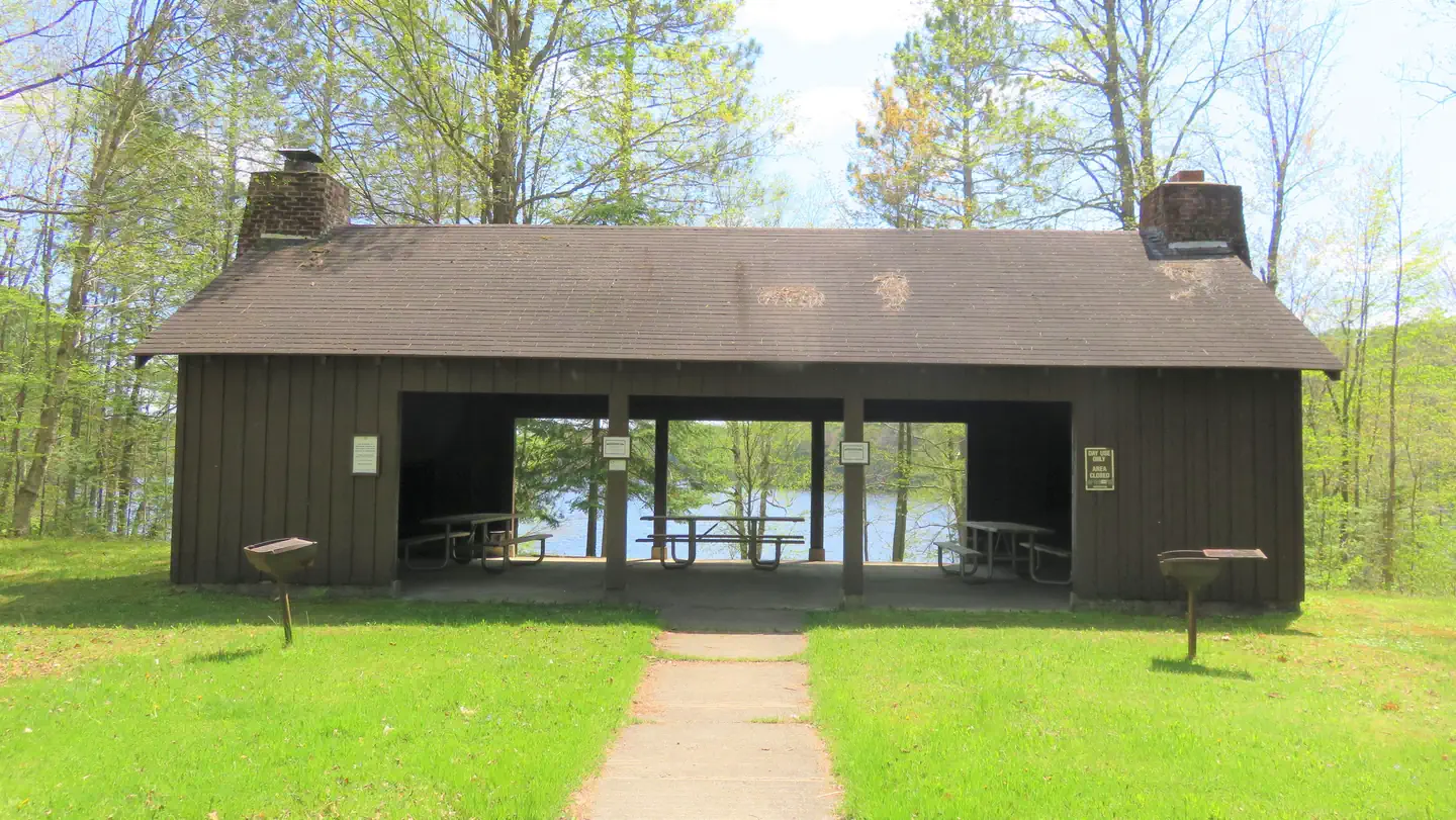
Spearhead Point Shelter is a day-use picnic site for large groups. It is located in one of the most popular areas surrounding Mondeaux Flowage in northern Wisconsin. Nearby, visitors can access the lake and numerous trails.Recreation
Boating, swimming and fishing are popular activities. Anglers can expect to find a variety of species, including pike, largemouth bass and bluegill. Boats with and without motors are allowed on the lake, however the lake is quite shallow in some areas. A portion of the Ice Age National Scenic Trail is easily accessed from the campground. The trail is open to hiking and wanders 1,200 miles along the edge of a historic glacier that once covered the state of Wisconsin and much of North America.Facilities
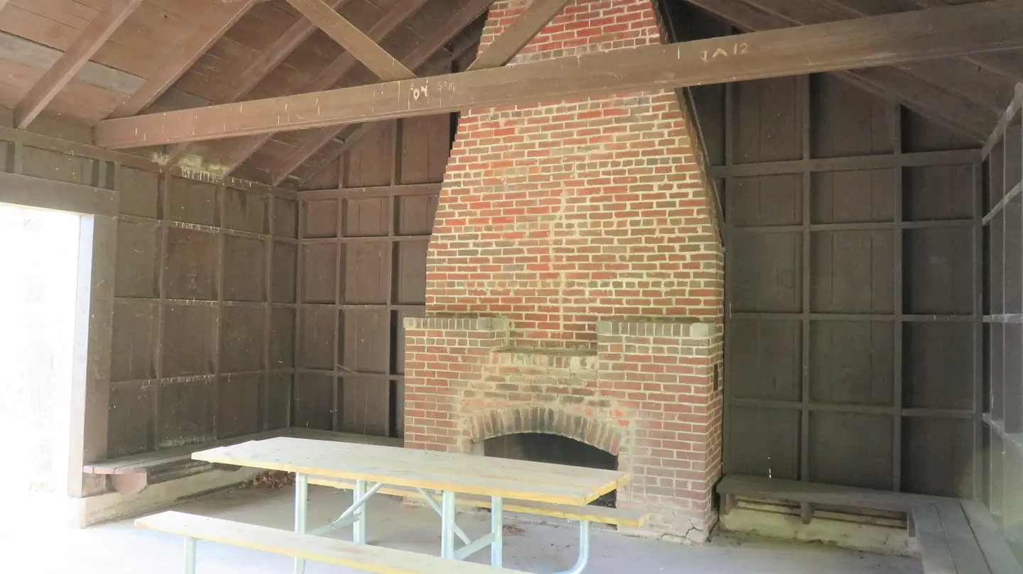
The accessible picnic shelter can accommodate up to 30 people. It is equipped with picnic tables and grills. Two stone fireplaces are available inside the shelter. Accessible vault toilets and drinking water are also provided.Overnight camping is not allowed at the shelter but is available at adjacent Spearhead Point Campground.
Natural Features
The shelter is located within the Spearhead Point Campground at an elevation of 1,140 feet. Tall trees surround the shelter, which is nestled along the western shore of 411-acre Mondeaux Flowage.Nearby Attractions
The city of Westboro is about 10 miles away.The facts
- 1 bookable site
- 1 site for day use only
- 1 accessible site
- Up to 30 people per site
- Loops: SPEARHEAD POINT
Site types
- 1 Group Shelter Nonelectric
Amenities
- Grills
- Shade
Not recorded upstream: electric hookups, water hookups, sewer hookups, campfires allowed, fire pits, picnic tables, pets allowed.
1 campsite at Spearhead Point Shelter
Check-in 6:00 AM · Check-out 10:00 PM
| Site | Loop | Type | Entry | Surface | Water | Max rig | People | |
|---|---|---|---|---|---|---|---|---|
| 001 | SPEARHEAD POINT | Group Shelter Nonelectric | — | Gravel | Lakefront | — | 30 | ♿ |
Getting there
From Medford, travel north on State Highway 13 for 4 miles, then turn left (west) onto County Road M and continue for 7 miles. Turn right (north) onto County Highway E and continue about 8 miles, then turn right (east) onto Forest Service Road 1563 and continue for about 1 mile. Turn right (east) onto Forest Service Road 106 and look for the campground entrance sign at the top of the hill.
45.32778, -90.44694 · 45°19'40.0"N 90°26'49.0"W
Typical weather
Typically 79°F in Jul, down to 21°F in Jan.
| Jan | Feb | Mar | Apr | May | Jun | Jul | Aug | Sep | Oct | Nov | Dec | |
|---|---|---|---|---|---|---|---|---|---|---|---|---|
| High °F | 21 | 26 | 38 | 52 | 66 | 75 | 79 | 77 | 69 | 55 | 39 | 26 |
| Low °F | 2 | 6 | 18 | 31 | 43 | 53 | 57 | 55 | 47 | 35 | 23 | 10 |
| Precip in | 1.1 | 1.1 | 1.7 | 3.0 | 3.7 | 4.8 | 4.0 | 4.3 | 3.9 | 3.3 | 1.9 | 1.4 |
1991–2020 averages from the nearest NOAA station, 14.5 mi away — not measured at the facility itself, and elevation can make a real difference over that distance.
Map
More photos

Member photos
Common questions about Spearhead Point Shelter
- Can you reserve a site at Spearhead Point Shelter?
- Yes, Spearhead Point Shelter is reservable through Recreation.gov.
- How many campsites does Spearhead Point Shelter have?
- 1 site.
Camping near Spearhead Point Shelter
- Spearhead Point less than 0.1 mi · Campground · we watch it
- Eastwood 0.3 mi · Campground · we watch it
- West Point Recreation Area 0.8 mi · Campground · we watch it
- Picnic Point (Wi) 1.6 mi · Campground · we watch it
- Chippewa 14.5 mi · Campground · we watch it
- Sailor Lake 36.5 mi · Campground · we watch it
- Sailor Lake Pavilion 36.9 mi · Campground · we watch it
- Smith Rapids Pavilion 42.4 mi · Campground · we watch it
- Smith Rapids 42.4 mi · Campground · we watch it
- Twin Lakes (Wi) 46.9 mi · Campground · we watch it
- North Twin Lake Recreation Area 3.2 mi · Campground
- Kathryn Lake Recreation Area 12.2 mi · Campground
Contact
- Phone 715-784-4875
- Book Recreation.gov
Recreation.gov last updated this record on 2026-02-25.
Facility information and photographs from Recreation.gov (RIDB). SpotOpened is not affiliated with Recreation.gov or any federal agency.
Comments