Troublesome Creek Campground
Campground · Washington · 25 bookable sites ·
Managed by the USDA Forest Service
Snoqualmie National Forest (NF) · Open Access
- 25
- Bookable sites
- 30 ft
- Max rig length
- up to 12
- People per site
- 5
- Accessible sites
- 1,269 ft
- Elevation
Overview
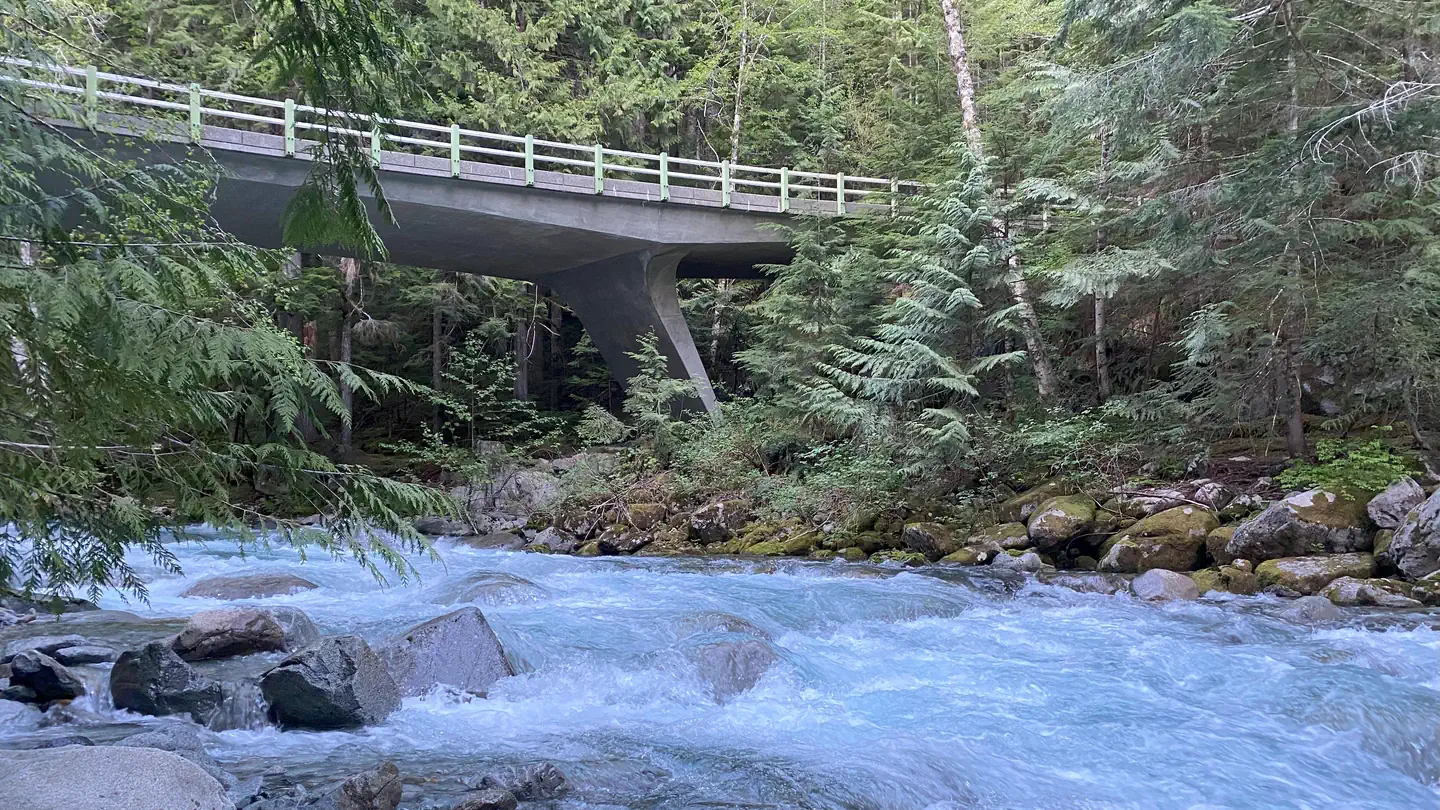
This campground is located approximately 20 miles east of Index, Washington in the Mt. Baker-Snoqualmie National Forest. It offers guests a wonderful spot to take in the scenery and enjoy a multitude of recreational activities in the Northern Cascade Range.Sites are nestled in a mixed conifer forest on the banks of the scenic North Fork Skykomish River and its tributary, Troublesome Creek. Water is abundant in this area, offering visitors easy access to fishing, kayaking, and swimming. Guests will be lulled to sleep by its subtle, but ever-present gurgle.
This campground is ideal for escaping the hustle of everyday life to enjoy time with friends and family.
Recreation
At the campground, Troublesome Creek is a delight for exploring. A footbridge crosses the bubbling creek beneath towering pine and fir trees. For guests wanting to relax at the water's edge, or children searching for newness in nature, this is an ideal spot without even leaving the campground.The adjacent North Fork Skykomish River offers fishing for steelhead and salmon.
For those wanting to venture further, the Beckler Peak Trail may be included on the agenda. Located 10 miles from the town of Skykomish, this trail is challenging, but worth the effort, offering hikers the opportunity to view the diverse landscapes of the area from a variety of perspectives.
At the Jennifer Dunn Trailhead, the trail starts out on a decommissioned logging road, and climbs through young alder and vine maple to an expansive vista of the Skykomish Valley. The trail continues to switchback through huge trees and by the remains of a trapper's cabin. Climbing higher, and upon reaching the final ridge top through steep alpine forest, hikers will be in awe of the panoramic view of near and distant peaks.
Facilities
Troublesome Creek Campground offers standard sites, accommodating both tent and RV camping. Tent-only sites are available as well.
The campground is equipped with picnic tables and vault toilets. No electrical hook-ups are available.
Access to the Skykomish River is available from the campground, and several sites are near the river's edge.
Natural Features
The Mt. Baker-Snoqualmie National Forest showcases rugged peaks, sparkling alpine lakes, and old-growth forests, providing visitors with unique and surprising landscapes.Mt. Baker, the most prominent feature of the Mt. Baker Wilderness Area, dominates the landscape on a clear day. Rising to an elevation of 10,781 feet, the active volcano from which the forest takes its name is perpetually snow-capped and mantled with an extensive network of creeping glaciers. Mt. Baker's summit, Grant Peak, is actually a mound of ice 1,300 feet deep, which hides a massive volcanic crater.
Wildlife in the area includes mountain goats traversing the higher elevations, to coyotes and pine marten in the forests. Migratory birds and native fish find ample habitat in the varied ecosystems as well. These species, along with many others, depend on surrounding undeveloped wilderness, clean streams, and diverse forests to live.
Contact Info
For facility specific information, please call (530) 932-0242.Charges & Cancellations
Once your reservation start date has begun, neither the Recreation.gov Contact Center nor the campground manager will be able to modify your reservation.
The facts
- 25 bookable sites
- 5 accessible sites
- Vehicles up to 30 ft
- Up to 12 people per site
- Loops: TROUBLESOME
Site types
- 18 Standard Nonelectric
- 7 Tent Only Nonelectric
Amenities
- Campfires allowed
- Fire pits
- Picnic tables
- Shade
- Pets allowed
Not recorded upstream: electric hookups, water hookups, sewer hookups, grills.
25 campsites at Troublesome Creek Campground
Check-in 2:00 PM · Check-out 12:00 PM
| Site | Loop | Type | Entry | Surface | Water | Max rig | People | |
|---|---|---|---|---|---|---|---|---|
| 001 | TROUBLESOME | Standard Nonelectric | Back In | Gravel | Riverfront | 25 ft | 6 | ♿ 🐾 |
| 002 | TROUBLESOME | Standard Nonelectric | Back In | Gravel | Riverfront | — | 6 | 🐾 |
| 003 | TROUBLESOME | Standard Nonelectric | Back In | Gravel | Riverfront | 25 ft | 6 | ♿ 🐾 |
| 004 | TROUBLESOME | Standard Nonelectric | Back In | Gravel | Riverfront | 25 ft | 12 | ♿ 🐾 |
| 005 | TROUBLESOME | Standard Nonelectric | Back In | Gravel | Riverfront | 25 ft | 6 | 🐾 |
| 006 | TROUBLESOME | Standard Nonelectric | Back In | Gravel | Riverfront | 25 ft | 6 | 🐾 |
| 007 | TROUBLESOME | Tent Only Nonelectric | — | Gravel | Riverfront | — | 6 | ♿ 🐾 |
| 008 | TROUBLESOME | Tent Only Nonelectric | — | Gravel | Riverfront | — | 6 | 🐾 |
| 009 | TROUBLESOME | Tent Only Nonelectric | — | Gravel | Riverfront | — | 6 | 🐾 |
| 010 | TROUBLESOME | Tent Only Nonelectric | — | Gravel | Riverfront | — | 12 | 🐾 |
| 011 | TROUBLESOME | Standard Nonelectric | Back In | Gravel | Riverfront | — | 6 | 🐾 |
| 012 | TROUBLESOME | Standard Nonelectric | Back In | Gravel | Riverfront | — | 6 | 🐾 |
| 013 | TROUBLESOME | Standard Nonelectric | Back In | Gravel | Riverfront | — | 6 | 🐾 |
| 014 | TROUBLESOME | Standard Nonelectric | Back In | Gravel | Riverfront | — | 6 | 🐾 |
| 015 | TROUBLESOME | Standard Nonelectric | Back In | Gravel | Riverfront | 20 ft | 6 | 🐾 |
| 016 | TROUBLESOME | Standard Nonelectric | Back In | Gravel | Riverfront | 30 ft | 6 | 🐾 |
| 017 | TROUBLESOME | Tent Only Nonelectric | — | Gravel | Riverfront | — | 6 | 🐾 |
| 018 | TROUBLESOME | Standard Nonelectric | Back In | Gravel | Riverfront | 25 ft | 6 | 🐾 |
| 019 | TROUBLESOME | Tent Only Nonelectric | — | Gravel | Riverfront | — | 6 | 🐾 |
| 020 | TROUBLESOME | Tent Only Nonelectric | — | Gravel | Riverfront | — | 6 | 🐾 |
| 021 | TROUBLESOME | Standard Nonelectric | Back In | Gravel | Riverfront | 25 ft | 6 | 🐾 |
| 022 | TROUBLESOME | Standard Nonelectric | Back In | Gravel | Riverfront | 25 ft | 6 | 🐾 |
| 023 | TROUBLESOME | Standard Nonelectric | Back In | Gravel | Riverfront | — | 6 | 🐾 |
| 024 | TROUBLESOME | Standard Nonelectric | Back In | Gravel | Riverfront | 20 ft | 6 | ♿ 🐾 |
| 025 | TROUBLESOME | Standard Nonelectric | Back In | Gravel | Riverfront | 25 ft | 6 | 🐾 |
Getting there
From Everett travel east on US-2. Pass through Monroe and continue another 21 miles then turn north (left) on Index – Galena Road. Continue for 11 Miles, arriving at Troublesome Creek Campground on the right.
47.89819, -121.40269 · 47°53'53.5"N 121°24'9.7"W
Typical weather
Typically 77°F in Aug, down to 41°F in Dec.
| Jan | Feb | Mar | Apr | May | Jun | Jul | Aug | Sep | Oct | Nov | Dec | |
|---|---|---|---|---|---|---|---|---|---|---|---|---|
| High °F | 42 | 47 | 52 | 59 | 66 | 69 | 77 | 77 | 71 | 58 | 47 | 41 |
| Low °F | 32 | 32 | 34 | 38 | 44 | 48 | 52 | 52 | 48 | 42 | 36 | 32 |
| Precip in | 16.7 | 10.6 | 11.9 | 8.3 | 5.0 | 4.0 | 1.7 | 1.9 | 4.8 | 12.3 | 18.1 | 14.6 |
1991–2020 averages from the nearest NOAA station, 9.4 mi away — not measured at the facility itself, and elevation can make a real difference over that distance.
Map
Member photos
Common questions about Troublesome Creek Campground
- Can you reserve a site at Troublesome Creek Campground?
- Yes, Troublesome Creek Campground is reservable through Recreation.gov.
- How many campsites does Troublesome Creek Campground have?
- 25 sites.
- What is the maximum RV length at Troublesome Creek Campground?
- 30 ft. That is the longest vehicle the sites here are recorded as taking; individual sites may be shorter.
- Are pets allowed at Troublesome Creek Campground?
- Yes, pets are allowed at Troublesome Creek Campground.
- Are campfires allowed at Troublesome Creek Campground?
- Campfires are allowed at Troublesome Creek Campground. Check for a current fire restriction before you go.
Camping near Troublesome Creek Campground
- Evergreen Mountain Lookout 7.7 mi · Campground · we watch it
- Heybrook Lookout 8.7 mi · Campground · we watch it
- Money Creek Campground 11.7 mi · Campground · we watch it
- Beckler River Campground 11.9 mi · Campground · we watch it
- Bedal Campground 13.7 mi · Campground · we watch it
- Miller River Group Camp 14.4 mi · Campground · we watch it
- San Juan Campground 1.8 mi · Campground
- Troublesome Creek Campground 1.8 mi · Campground
- Mountain Loop Scenic Byway 9 mi · Facility
- US Highway 2 - Skykomish Area east to Stevens Pass 10.3 mi · Facility
- Beaver Creek Group Campground 13.8 mi · Campground
- Coal Creek Group Campground 14.4 mi · Campground
Contact
- Phone 360-804-1103
- Book Recreation.gov
Recreation.gov last updated this record on 2026-03-11.
Facility information and photographs from Recreation.gov (RIDB). SpotOpened is not affiliated with Recreation.gov or any federal agency.
Comments