Noisy Creek
Campground · Washington · 20 bookable sites ·
Managed by the USDA Forest Service
Colville National Forest (NF) · Open Access
- 20
- Bookable sites
- 45 ft
- Max rig length
- up to 40
- People per site
- 11
- Accessible sites
- 3,150 ft
- Elevation
Overview
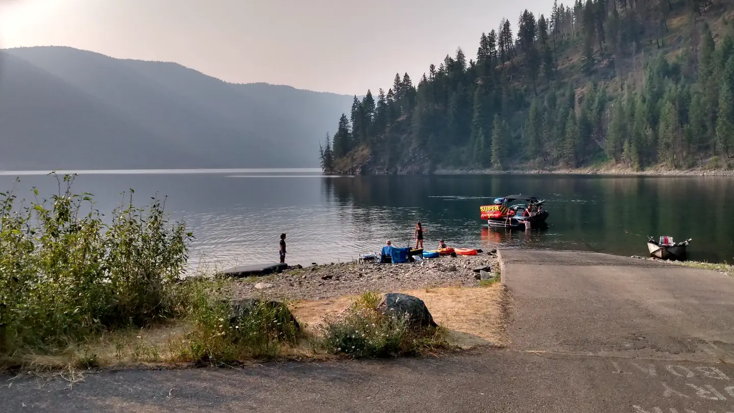
Noisy Creek Campground is located at the south end of Sullivan Lake. The campground is a perfect getaway just 20 miles from the US-Canada border. Campsites are set back from the lake. Beyond the campground are scenic mountains where hiking is popular. Fishing, swimming and boating are favorite activities.
Recreation
The Sullivan Lake Basin provides campers with opportunities for swimming, fishing, boating and hiking. Common fish species in the lake include burbot (ling cod) and Kokanee salmon. Fishing in this lake is most successful from a boat. Canoeing, kayaking and paddle boarding are among the water sports popular on the lake.
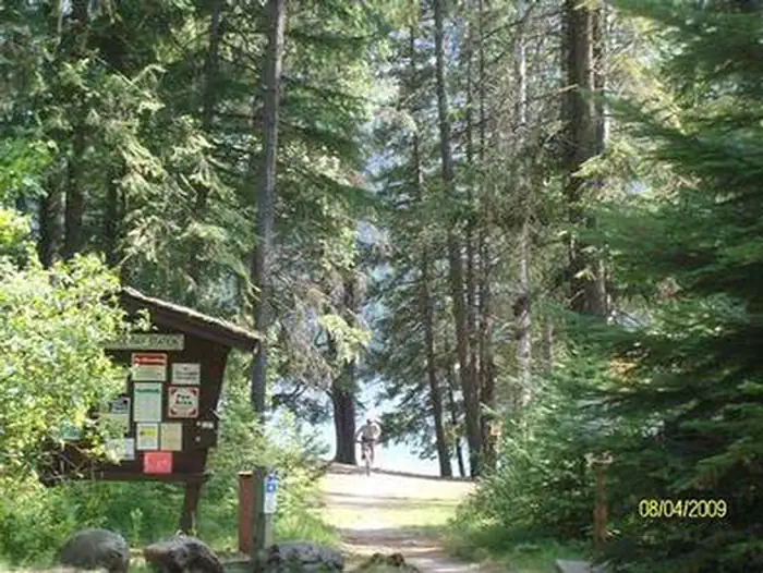
Two major hiking trails can be accessed directly from the campground. The Lakeshore Trail is a designated National Scenic Trail that runs along the eastern shore of the lake. This 4.2 mile trail offers viewpoints of the lake and is a popular day-hike for all ages. The Noisy Creek Trail follows along the creek for two miles, and then veers sharply upslope to the top of Hall Mountain.
There are rich opportunities for bird watching and wildlife viewing in general in the area. Individual animals from the Hall Mountain bighorn sheep herd sometimes pass through the campground. Cougars, bobcats and black bears can all be seen in the local area.
Facilities
Campsites are pleasant and within walking distance of the lake and swimming area. Amenities include a picnic area, boat ramp, picnic tables, fire rings, vault toilets, drinking water and garbage service.
Natural Features
Sullivan Lake covers 1,291 acres and has a depth of 320 feet. Hall Mountain rises abruptly from the eastern shore of the lake to a height of over 6000 feet. Abundant western larch, aspen and cottonwood trees create vibrant colors in the area during the fall.
Nearby Attractions
Sullivan Lake is about four miles southeast of Metaline Falls, a quaint town with historic buildings. Crawford State Park is located on the west side of the Pend Oreille River near the U.S.- Canada border. In the summer, a park ranger conducts under-ground tours of Gardiner Cave, the main attraction at this park. Seattle City Light offers tours of their Boundary Hydroelectric Project, on the main-stem Pend Oreille River one mile from the international border.
The facts
- Season: May 24 – Labor Day Weekend — USDA Forest Service, Aug 24, 2026
- 20 bookable sites
- 11 accessible sites
- Vehicles up to 45 ft
- Up to 40 people per site
- Loops: BIGH, EAGL, Loop GS
Site types
- 19 Standard Nonelectric
- 1 Group Standard Nonelectric
Amenities
- Campfires allowed
- Shade
- Pets allowed
Not recorded upstream: electric hookups, water hookups, sewer hookups, fire pits, picnic tables, grills.
20 campsites at Noisy Creek
Check-in 2:00 PM · Check-out 12:00 PM
| Site | Loop | Type | Entry | Surface | Max rig | People | |
|---|---|---|---|---|---|---|---|
| 015 | BIGH | Standard Nonelectric | Pull Through | Gravel | 45 ft | 8 | 🐾 |
| 016 | BIGH | Standard Nonelectric | Pull Through | Gravel | 45 ft | 8 | ♿ 🐾 |
| 017 | BIGH | Standard Nonelectric | Back In | Gravel | 45 ft | 8 | 🐾 |
| 018 | BIGH | Standard Nonelectric | Back In | Gravel | 45 ft | 8 | 🐾 |
| 019 | BIGH | Standard Nonelectric | Back In | Gravel | 35 ft | 8 | 🐾 |
| 001 | EAGL | Standard Nonelectric | Back In | Gravel | 45 ft | 8 | 🐾 |
| 002 | EAGL | Standard Nonelectric | Back In | Gravel | 45 ft | 8 | 🐾 |
| 003 | EAGL | Standard Nonelectric | Back In | Gravel | 25 ft | 8 | ♿ 🐾 |
| 004 | EAGL | Standard Nonelectric | Back In | Gravel | 45 ft | 8 | ♿ 🐾 |
| 005 | EAGL | Standard Nonelectric | Back In | Gravel | 35 ft | 8 | 🐾 |
| 006 | EAGL | Standard Nonelectric | Back In | Gravel | 35 ft | 8 | ♿ 🐾 |
| 007 | EAGL | Standard Nonelectric | Back In | Gravel | 45 ft | 8 | 🐾 |
| 008 | EAGL | Standard Nonelectric | Back In | Gravel | 45 ft | 8 | ♿ 🐾 |
| 009 | EAGL | Standard Nonelectric | Back In | Gravel | 45 ft | 8 | 🐾 |
| 010 | EAGL | Standard Nonelectric | Back In | Gravel | 45 ft | 8 | ♿ 🐾 |
| 011 | EAGL | Standard Nonelectric | Back In | Gravel | 45 ft | 8 | ♿ 🐾 |
| 012 | EAGL | Standard Nonelectric | Back In | Gravel | 45 ft | 8 | ♿ 🐾 |
| 013 | EAGL | Standard Nonelectric | Back In | Gravel | 45 ft | 8 | ♿ 🐾 |
| 014 | EAGL | Standard Nonelectric | Back In | Gravel | 25 ft | 8 | ♿ 🐾 |
| GS1 | Loop GS | Group Standard Nonelectric | Back In | Gravel | 35 ft | 40 | ♿ 🐾 |
Getting there
Campground is located ninety miles north of Spokane, Washington. From the junction of State Highway 20, take Highway 31 north for three miles to the junction of the Sullivan Lake Road (County Road 9345Follow the Sullivan Lake Road for 8 miles to the campground entrance. The campground is located at the south end of Sullivan Lake.
48.78389, -117.27861 · 48°47'2.0"N 117°16'43.0"W
Typical weather
| Jan | Feb | Mar | Apr | May | Jun | Jul | Aug | Sep | Oct | Nov | Dec | |
|---|---|---|---|---|---|---|---|---|---|---|---|---|
| High °F | — | — | — | — | — | — | — | — | — | — | — | — |
| Low °F | — | — | — | — | — | — | — | — | — | — | — | — |
| Precip in | 3.9 | 2.2 | 2.8 | 2.4 | 2.5 | 3.0 | 1.5 | 1.1 | 1.4 | 2.6 | 4.8 | 3.7 |
1991–2020 averages from the nearest NOAA station, 6.7 mi away — not measured at the facility itself, and elevation can make a real difference over that distance.
Map
More photos
Member photos
Common questions about Noisy Creek
- Can you reserve a site at Noisy Creek?
- Yes, Noisy Creek is reservable through Recreation.gov.
- How many campsites does Noisy Creek have?
- 20 sites.
- What is the maximum RV length at Noisy Creek?
- 45 ft. That is the longest vehicle the sites here are recorded as taking; individual sites may be shorter.
- Are pets allowed at Noisy Creek?
- Yes, pets are allowed at Noisy Creek.
- Are campfires allowed at Noisy Creek?
- Campfires are allowed at Noisy Creek. Check for a current fire restriction before you go.
Also listed by
Noisy Creek also appears in other federal recreation data. Facts below are matched by name and location, not confirmed by Noisy Creek's operator.
USDA Forest Service — data as of Aug 24, 2026
- Camping: $29/single site
- Group Camping: $110
- Extra vehicle: none
- Day use: $10
- Season Day Pass for Colville Only: $52
- Season Pass for Colville and Idaho Panhandle: $52
Restrictions:
- Quiet hours between 10 p.m. and 6 a.m.
- Campfire in developed fire ring only
- Fireworks are prohibited
- Pets must be on leash
- OHV use prohibited in the campground
- Maximum length of stay: 14 days
- Food and wildlife attractants must be properly stored at all times
Camping near Noisy Creek
- East Sullivan 5.4 mi · Campground · we watch it
- West Sullivan 5.4 mi · Campground · we watch it
- Edgewater Campground 6.1 mi · Campground · we watch it
- Gillette Campground 16.6 mi · Campground · we watch it
- Lake Gillette Campground 16.8 mi · Campground · we watch it
- East Sullivan Campground 3.8 mi · Campground
- West Sullivan Campground 3.8 mi · Campground
- Mill Pond Campground 4.9 mi · Campground
- Big Meadow Lake Campground 13.5 mi · Campground
- Lake Leo Campground 13.6 mi · Campground
- Silver Creek Campground 13.8 mi · Campground
- Lake Thomas Campground 16.1 mi · Campground
Contact
- Phone 435-245-6521
- Book Recreation.gov
Recreation.gov last updated this record on 2026-02-25.
Facility information and photographs from Recreation.gov (RIDB). SpotOpened is not affiliated with Recreation.gov or any federal agency.
Comments