Port Ramp Marina
Campground · Utah · 50 bookable sites ·
Managed by the USDA Forest Service
- 50
- Bookable sites
- 39 ft
- Max rig length
- 4,944 ft
- Elevation
Overview
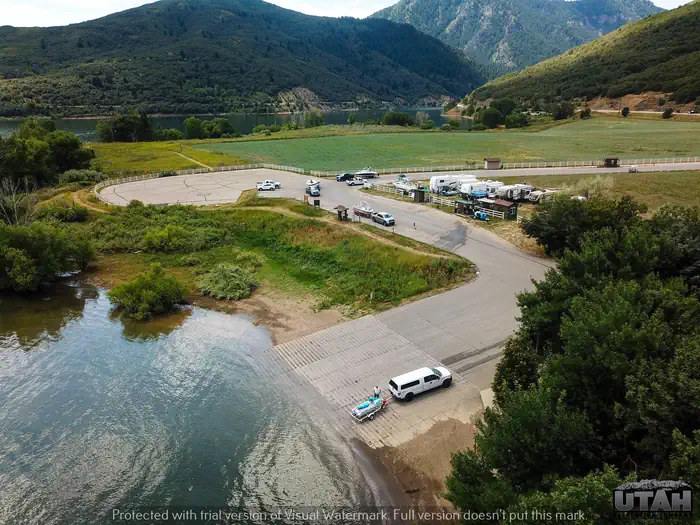
Port Ramp Marina is a boat slip rental facility located just 10 miles from Ogden, Utah, on the west side of Pineview Reservoir in scenic Ogden Valley. The marina is the most used launching facility at Pineview, which is the busiest reservoir in the state.Recreation
Pineview Reservoir offers spectacular boating, windsurfing, swimming, fishing, and playing in the water and sand.
There are three swim areas with sandy beaches- Cemetery Point west of Huntsville, Anderson Cove Campground and day-use area, and Middle Inlet Beach north of Huntsville.
Facilities
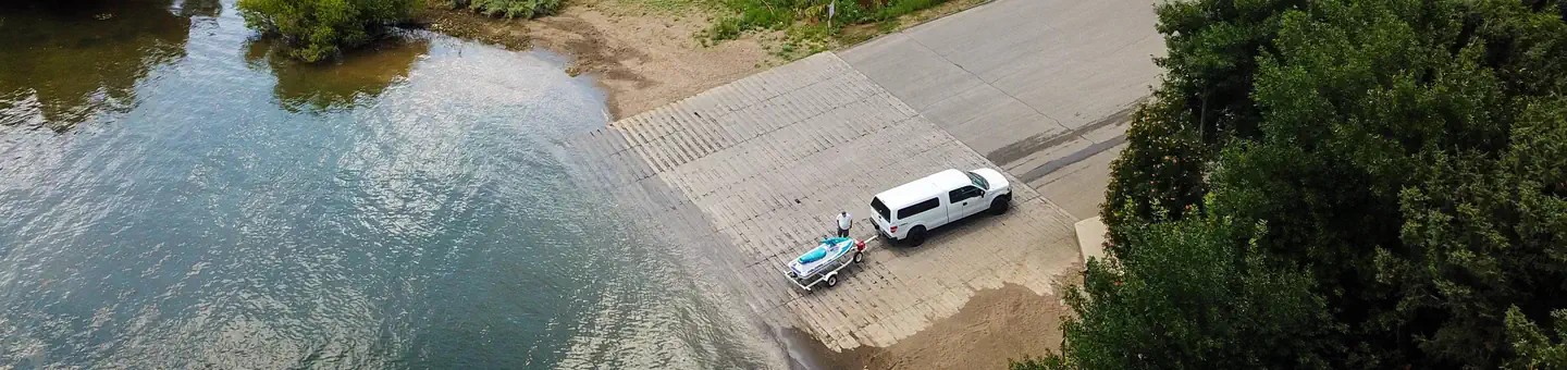
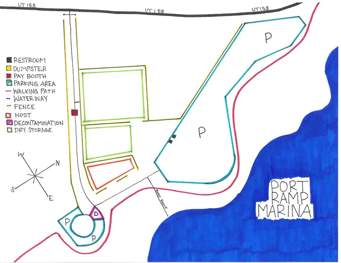
The marina rents boat slips for the entire season, from mid-May through September. The facility has a concrete boat ramp and a large paved parking lot with a designated area for slip holders. An adjacent gravel lot is used for overflow parking and dry storage.
Dry storage can be purchased for the season. A public dock is on-site. A dump station and vault toilets are located in the paved parking lot.
Natural Features
Pineview Reservoir lies on the backside of the Wasatch Front. Ogden Valley is comprised of patchwork farmland surrounded by beautiful peaks.Contact Info
For facility specific information, please call (385) 273-1100.Nearby Attractions
Anderson Cove Campground is located 5 miles away on the south shore of Pineview Reservoir. It offers both family and group campsites and a swimming beach.The facts
- 50 bookable sites
- 50 sites for day use only
- Vehicles up to 39 ft
- Loops: A, B, W
Site types
- 50 Mooring
50 campsites at Port Ramp Marina
| Site | Loop | Type | Entry | Surface | Access | Max rig | People | |
|---|---|---|---|---|---|---|---|---|
| 001 | A | Mooring | — | — | Boat In | 28 ft | — | |
| 002 | A | Mooring | — | — | Boat In | 28 ft | — | |
| 003 | A | Mooring | — | — | Boat In | 28 ft | — | |
| 004 | A | Mooring | — | — | Boat In | 28 ft | — | |
| 005 | A | Mooring | — | — | Boat In | 28 ft | — | |
| 006 | A | Mooring | — | — | Boat In | 28 ft | — | |
| 007 | A | Mooring | — | — | Boat In | 28 ft | — | |
| 008 | A | Mooring | — | — | Boat In | 28 ft | — | |
| 009 | A | Mooring | — | — | Boat In | 28 ft | — | |
| 010 | A | Mooring | — | — | Boat In | 28 ft | — | |
| 011 | A | Mooring | — | — | Boat In | 28 ft | — | |
| 012 | A | Mooring | — | — | Boat In | 28 ft | — | |
| 013 | A | Mooring | — | — | Boat In | 28 ft | — | |
| 014 | A | Mooring | — | — | Boat In | 28 ft | — | |
| 015 | A | Mooring | — | — | Boat In | 28 ft | — | |
| 016 | A | Mooring | — | — | Boat In | 28 ft | — | |
| 017 | A | Mooring | — | — | Boat In | 28 ft | — | |
| 018 | A | Mooring | — | — | Boat In | 28 ft | — | |
| 019 | A | Mooring | — | — | Boat In | 28 ft | — | |
| 020 | A | Mooring | — | — | Boat In | 28 ft | — | |
| 021 | A | Mooring | — | — | Boat In | 28 ft | — | |
| 022 | A | Mooring | — | — | Boat In | 28 ft | — | |
| 023 | A | Mooring | — | — | Boat In | 28 ft | — | |
| 024 | A | Mooring | — | — | Boat In | 28 ft | — | |
| 001 | B | Mooring | — | — | Boat In | 28 ft | — | |
| 002 | B | Mooring | — | — | Boat In | 28 ft | — | |
| 003 | B | Mooring | — | — | Boat In | 28 ft | — | |
| 004 | B | Mooring | — | — | Boat In | 28 ft | — | |
| 005 | B | Mooring | — | — | Boat In | 28 ft | — | |
| 006 | B | Mooring | — | — | Boat In | 28 ft | — | |
| 007 | B | Mooring | — | — | Boat In | 28 ft | — | |
| 008 | B | Mooring | — | — | Boat In | 28 ft | — | |
| 009 | B | Mooring | — | — | Boat In | 28 ft | — | |
| 010 | B | Mooring | — | — | Boat In | 28 ft | — | |
| 011 | B | Mooring | — | — | Boat In | 32 ft | — | |
| 012 | B | Mooring | — | — | Boat In | 31 ft | — | |
| 013 | B | Mooring | — | — | Boat In | 31 ft | — | |
| 014 | B | Mooring | — | — | Boat In | 32 ft | — | |
| 015 | B | Mooring | — | — | Boat In | 28 ft | — | |
| 016 | B | Mooring | — | — | Boat In | 28 ft | — | |
| 017 | B | Mooring | — | — | Boat In | 28 ft | — | |
| 018 | B | Mooring | — | — | Boat In | 28 ft | — | |
| 019 | B | Mooring | — | — | Boat In | 28 ft | — | |
| 020 | B | Mooring | — | — | Boat In | 28 ft | — | |
| 021 | B | Mooring | — | — | Boat In | 28 ft | — | |
| 022 | B | Mooring | — | — | Boat In | 28 ft | — | |
| 023 | B | Mooring | — | — | Boat In | 28 ft | — | |
| 024 | B | Mooring | — | — | Boat In | 28 ft | — | |
| W001 | W | Mooring | — | — | Boat In | 39 ft | — | |
| W002 | W | Mooring | — | — | Boat In | 30 ft | — |
Getting there
41.26861, -111.82222 · 41°16'7.0"N 111°49'20.0"W
Typical weather
Typically 87°F in Jul, down to 32°F in Jan.
| Jan | Feb | Mar | Apr | May | Jun | Jul | Aug | Sep | Oct | Nov | Dec | |
|---|---|---|---|---|---|---|---|---|---|---|---|---|
| High °F | 32 | 37 | 48 | 56 | 66 | 77 | 87 | 85 | 75 | 61 | 45 | 33 |
| Low °F | 10 | 13 | 23 | 30 | 37 | 44 | 50 | 49 | 40 | 31 | 22 | 13 |
| Precip in | 4.1 | 3.2 | 3.3 | 3.2 | 3.1 | 1.8 | 0.7 | 1.0 | 1.7 | 2.7 | 2.6 | 3.2 |
1991–2020 averages from the nearest NOAA station, 1.1 mi away — not measured at the facility itself, and elevation can make a real difference over that distance.
Map
Fees and stay limits
Cash, Check, or Scan & Pay (with recreation.gov app) Boat Launch - $22.00 + $3.00 per vessel (additional recreational fee collected on behalf of Weber county and Huntsville Town for the express use of County. Fees will be used for improvements to recreational areas) Day Use - $20.00 + $3.00 (additional recreational fee collected on behalf of Weber county and Huntsville Town for the express use of County. Fees will be used for improvements to recreational areas) Dry Storage - $695/season, $134/month, or $59/week Season day use pass - $197.00, includes day use and boat launch at Pineview Reservoir and Strawberry Reservoir Senior and Access Interagency passes do not cover boat launching or day-use.
From Recreation.gov, which is not always current. The operator's own page is the authority on what you will be charged.
More photos
Member photos
Common questions about Port Ramp Marina
- Can you reserve a site at Port Ramp Marina?
- Yes, Port Ramp Marina is reservable through Recreation.gov.
- How many campsites does Port Ramp Marina have?
- 50 sites.
- What is the maximum RV length at Port Ramp Marina?
- 39 ft. That is the longest vehicle the sites here are recorded as taking; individual sites may be shorter.
Camping near Port Ramp Marina
- Cemetery Point Picnic Area 1.2 mi · Campground · we watch it
- Anderson Cove (Uinta-Wasatch-Cache National Forest, UT) 2.1 mi · Campground · we watch it
- Middle Inlet Group Day Use 2.4 mi · Campground · we watch it
- Magpie Campground (UT) 8.1 mi · Campground · we watch it
- Botts Campground 8.5 mi · Campground · we watch it
- South Fork (Ut) 8.8 mi · Campground · we watch it
- Lower Meadows Campground 9.4 mi · Campground · we watch it
- Perception Park 9.5 mi · Campground · we watch it
- Upper Meadows Campground 9.8 mi · Campground · we watch it
- Willows Campground (UT) 9.9 mi · Campground · we watch it
- Anderson Cove Campground 2.3 mi · Campground
- Maples Campground 3.6 mi · Campground
Contact
- Phone OGDEN RANGER DISTRICT 801-625-5112 OR UTAH RECREATION COMPANY 385-273-1100 OR PORT RAMP MARINA 801-745-6390
- Book Recreation.gov
Recreation.gov last updated this record on 2026-06-16.
Facility information and photographs from Recreation.gov (RIDB). SpotOpened is not affiliated with Recreation.gov or any federal agency.
Comments