Navajo Cliffs
Campground · Utah · 1 bookable site ·
Managed by the USDA Forest Service
Ashley National Forest (NF) · Open Access
- 1
- Bookable site
- up to 80
- People per site
- 6,219 ft
- Elevation
Overview
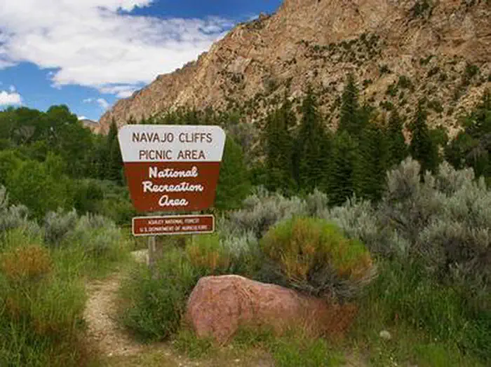
Navajo Cliffs is an ideal group day-use site for weddings, reunions and large gatherings. It's just 7 miles south of Manila, Utah, along the scenic Sheep Creek Geological Loop at an elevation of 6,200 feet.Recreation
Sheep Creek offers rainbow trout and kokanee salmon fishing. Boating, fishing, canoeing, water skiing and swimming are popular activities on nearby Flaming Gorge.Facilities
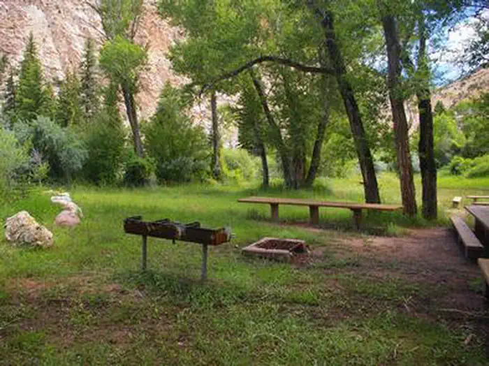
This group day-use site can accommodate up to 80 people. Large picnic tables, a serving table, grills and a campfire ring with benches are provided. A vault toilet and garbage service is provided but there is no water. Picnickers must bring their own supply.Natural Features
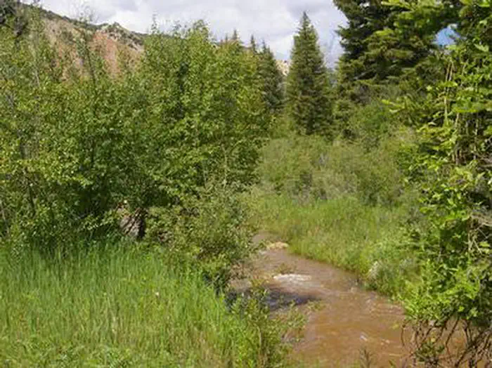
The site offers beautiful views of unique Navajo Cliffs. Shady trees line the banks of Sheep Creek, which runs through the site. Wildlife is plentiful in the area. Typical weather ranges from warm days to cool nights.Nearby Attractions
Flaming Gorge National Recreation Area is known not only for its beautiful red cliffs, but also for its world-class fishing for lake, brown and rainbow trout. Boating, waterskiing, jet skiing, canoeing, kayaking, swimming and scuba diving are popular activities on the reservoir.Flaming Gorge Dam offers guided tours of the working hydroelectric plant and the dam itself; The adjacent visitor center contains area history exhibits.
The Green River below the dam provides spectacular rafting opportunities. A trip down the river offers unique geology, outlaw history and Native American rock art.
The facts
- 1 bookable site
- 1 site for day use only
- Up to 80 people per site
- Loops: NAVAJO CLIFFS
Site types
- 1 Group Picnic Area
Amenities
- Shade
Not recorded upstream: electric hookups, water hookups, sewer hookups, campfires allowed, fire pits, picnic tables, grills, pets allowed.
1 campsite at Navajo Cliffs
Check-in 10:00 AM · Check-out 10:00 PM
| Site | Loop | Type | Entry | Surface | Max rig | People | |
|---|---|---|---|---|---|---|---|
| 1 | NAVAJO CLIFFS | Group Picnic Area | — | Paved | — | 80 |
Getting there
From Manila, Utah: Travel 7 miles south on Highway 44 to Sheep Creek Geological Loop. Site is a short distance from Carmel Campground on Sheep Creek.
40.92861, -109.72417 · 40°55'43.0"N 109°43'27.0"W
Typical weather
Typically 83°F in Jul, down to 34°F in Dec.
| Jan | Feb | Mar | Apr | May | Jun | Jul | Aug | Sep | Oct | Nov | Dec | |
|---|---|---|---|---|---|---|---|---|---|---|---|---|
| High °F | 36 | 39 | 49 | 56 | 65 | 76 | 83 | 81 | 72 | 60 | 45 | 34 |
| Low °F | 12 | 15 | 24 | 30 | 39 | 46 | 54 | 51 | 43 | 32 | 21 | 14 |
| Precip in | 0.5 | 0.6 | 0.6 | 1.0 | 1.6 | 1.2 | 1.1 | 1.3 | 1.0 | 1.5 | 0.5 | 0.6 |
1991–2020 averages from the nearest NOAA station, 4.2 mi away — not measured at the facility itself, and elevation can make a real difference over that distance.
Map
More photos
Member photos
Common questions about Navajo Cliffs
- Can you reserve a site at Navajo Cliffs?
- Yes, Navajo Cliffs is reservable through Recreation.gov.
- How many campsites does Navajo Cliffs have?
- 1 site.
Camping near Navajo Cliffs
- Summit Springs Guard Station 3.6 mi · Campground · we watch it
- Hideout Canyon Boat-in Campground 4.2 mi · Campground · we watch it
- Browne Lake Group Sites 6.3 mi · Campground · we watch it
- Carmel Campground 0.5 mi · Campground
- Manns Campground 0.6 mi · Campground
- Willows Campground 0.7 mi · Campground
- Sheep Creek Bay Campground 2.6 mi · Campground
- Flaming Gorge District Office 4.1 mi · Facility
- Kingfisher Island Boat-in Campground 4.5 mi · Campground
- Deep Creek Campground 5.1 mi · Campground
- Dowd Mountain Overlook 5.6 mi · Facility
- Browne Lake Campground 6.8 mi · Campground
Contact
- Phone 435-784-3483
- Book Recreation.gov
Recreation.gov last updated this record on 2026-02-25.
Facility information and photographs from Recreation.gov (RIDB). SpotOpened is not affiliated with Recreation.gov or any federal agency.
Comments