Ledgefork Guard Station
Campground · Utah · 1 bookable site ·
Managed by the USDA Forest Service
Wasatch National Forest (NF) · Open Access
- 1
- Bookable site
- up to 8
- People per site
- 7,738 ft
- Elevation
Overview
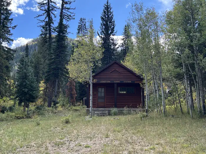
Ledgefork Guard Station is located just above Smith and Morehouse Reservoir on the western edge of the Uinta Mountains in northeastern Utah. Visitors enjoy fishing, canoeing and exploring the Smith and Morehouse Trail. This is a unique recreational experience of staying in a historic Forest Service cabin while providing funds for the ongoing maintenance and renovation of these historic buildings.
Recreation
The Smith and Morehouse reservoir is open to motorized boats, though a wake-less speed is enforced, making it an excellent place for canoeing and kayaking. A boat ramp is located on the northwest shore. Anglers enjoy fishing for stocked rainbow trout and other native fish species.
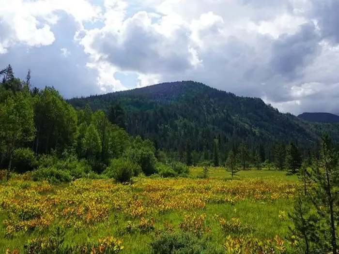
The 12-mile round-trip Smith and Morehouse Trail is popular with hikers and backpackers. The trail begins in the campground and leads through forests, meadows and a marsh before spurring off to Erickson Basin and Island Lake.
Facilities
The maximum capacity of the complex is 8 people. There is one bedroom with queen beds. The bathroom is located on the main floor. The gathering area is located on the main floor, equipped with sofas and chairs Bring your linens, dishes, silverware, cups, and glasses, pots and pans are provided- fully equipped kitchen. There is electricity to appliances provided by a generator, running water, flush toilets, shower, electric lights/appliances, and propane heat. Utilities are included.
The basement is not accessible to the public. No pets are allowed.
Natural Features
The cabin is surrounded by a scenic conifer and aspen forest. A variety of wildlife makes its home around the reservoir, including moose and deer.
Nearby Attractions
Mirror Lake Scenic Byway, Length 65 miles/104 km, Time to allow: 2 hours. Heading east from Kamas through the national forest, Mirror Lake Highway is one of the most popular mountain routes in the state. The road winds through farm and ranch lands and rises to heavily forested mountain terrain accented by the meadows and rugged peaks. There are numerous access points into the High Uinta Wilderness along this byway.
Charges & Cancellations
The facts
- 1 bookable site
- Up to 8 people per site
- Loops: Ledgefork Guard Station
Site types
- 1 Cabin Electric
Amenities
- Campfires allowed
Not recorded upstream: electric hookups, water hookups, sewer hookups, fire pits, picnic tables, grills, shade, pets allowed.
1 campsite at Ledgefork Guard Station
Check-in 03:00 PM · Check-out 12:00 PM
| Site | Loop | Type | Entry | Surface | Max rig | People | |
|---|---|---|---|---|---|---|---|
| Guard Station | Ledgefork Guard Station | Cabin Electric | — | — | — | 8 |
Getting there
From Salt Lake City:
From I 15, take I 80E past Park City to either Hwy 189 or Wanship. On 189, travel SE to Kearns Blvd/SR 248. Continue east on SR 248 to Browns Canyon Rd. Travel E/NE on Browns Canyon until it connects with SR 32 just north of Peoa. Turn south onto SR32 and travel until it becomes North Bench and then Weber Canyon Rd. From Wanship, take SR 32 past Rockport State Park to Peoa. At Peoa, SR32 becomes North Bench Rd and then Weber Canyon Rd. Stay on Weber Canyon Rd to FR 33. Turn right (south) onto FR 33 and travel past Smith Morehouse Reservoir to Ledgefork. (FR33 distance ~16 miles)
From Utah County (Provo):
Follow US 189 (University Ave.) through Provo Canyon to Heber City. At the junction in Heber, turn left and stay on 189 going north until you reach SR32. Turn right (east) on SR32 and travel past Jordanelle State Park to Francis. At Francis, turn left (north) onto Main St. Stay on Main st. until it becomes New Lane Rd in Oakley. Stay on New Lane Rd to Weber Canyon Rs. Turn right (east) onto Weber Canyon Rd. Stay on Weber Canyon Rd to FR 33. Turn right (south) onto FR 33 and travel past Smith Morehouse Reservoir to Ledgefork. (FR33 distance ~16 miles)
40.74208, -111.09989 · 40°44'31.5"N 111°5'59.6"W
Typical weather
| Jan | Feb | Mar | Apr | May | Jun | Jul | Aug | Sep | Oct | Nov | Dec | |
|---|---|---|---|---|---|---|---|---|---|---|---|---|
| High °F | — | — | — | — | — | — | — | — | — | — | — | — |
| Low °F | — | — | — | — | — | — | — | — | — | — | — | — |
| Precip in | 3.1 | 2.6 | 2.7 | 3.1 | 2.7 | 1.4 | 1.2 | 1.5 | 1.9 | 2.1 | 2.5 | 2.7 |
1991–2020 averages from the nearest NOAA station, 3.5 mi away — not measured at the facility itself, and elevation can make a real difference over that distance.
Map
Fees and stay limits
$157.00 - 8 people, 2 vehicles $10.00 Extra Vehicle
From Recreation.gov, which is not always current. The operator's own page is the authority on what you will be charged.
More photos
Member photos
Common questions about Ledgefork Guard Station
- Can you reserve a site at Ledgefork Guard Station?
- Yes, Ledgefork Guard Station is reservable through Recreation.gov.
- How many campsites does Ledgefork Guard Station have?
- 1 site.
- Are campfires allowed at Ledgefork Guard Station?
- Campfires are allowed at Ledgefork Guard Station. Check for a current fire restriction before you go.
Camping near Ledgefork Guard Station
- Ledgefork less than 0.1 mi · Campground · we watch it
- Smith and Morehouse 1.9 mi · Campground · we watch it
- Washington Lake 8.3 mi · Campground · we watch it
- Yellow Pine Campground (UT) 8.7 mi · Campground · we watch it
- Shingle Creek ATV Campground 8.9 mi · Campground · we watch it
- Trial Lake Campground 9 mi · Campground · we watch it
- Lilly Lake Campground 9.5 mi · Campground · we watch it
- Lost Creek Campground 9.7 mi · Campground · we watch it
- Pine Valley North Wasatch Cach 10 mi · Campground · we watch it
- Lower Provo Campground 10.3 mi · Campground · we watch it
- Washington Lake Campground 8.6 mi · Campground
- Ponderosa Group Campground 9.1 mi · Campground
Contact
- Phone 385-273-1100
- Book Recreation.gov
Recreation.gov last updated this record on 2026-08-11.
Facility information and photographs from Recreation.gov (RIDB). SpotOpened is not affiliated with Recreation.gov or any federal agency.
Comments