Iron Mine
Campground · Utah · 16 bookable sites ·
Managed by the USDA Forest Service
Ashley National Forest (NF) · Open Access
- 16
- Bookable sites
- 60 ft
- Max rig length
- up to 50
- People per site
- 7,514 ft
- Elevation
Overview
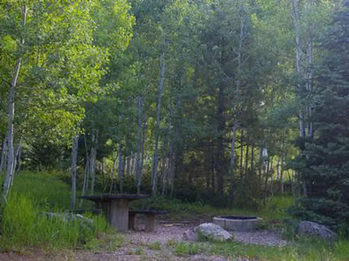
Iron Mine Campground in nestled in the scenic North Fork Drainage off Highway 35, about 18 miles from Tabiona, Utah.The North Fork Drainage lies on the southern slope of the beautiful Uinta Mountains in northeastern Utah. Visitors enjoy fly-fishing and exploring many local trails.
Recreation
Fishing for brook, brown and rainbow trout is a popular activity on the North Fork Duchesne. Hiking, mountain biking, OHV and horseback riding trails are in the area.Facilities
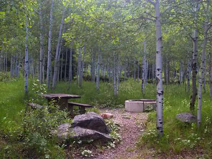
The campground contains single and double sites, and one group site that can accommodate up to 50 people.Sites are equipped with picnic tables and campfire rings. Vault toilets, drinking water and trash collection are provided. Roads and parking spurs are dirt.
Natural Features
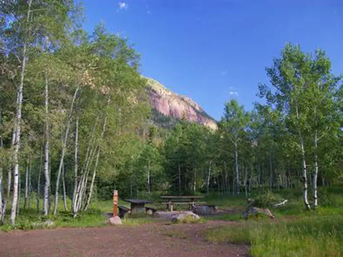
The campground is situated in an aspen forest dotted with subalpine fir, lodgepole pine and spruce near the North Fork Duchesne River at an elevation of 7,400 feet. The campground affords beautiful scenic views of the surrounding canyon and summer wildflowers are plentiful.Nearby Attractions
The North Fork Drainage provides access to the Granddaddy Lake region of the High Uintas via Grandview Trail. Numerous sparkling lakes provide great backcountry fishing. Backpacking, hiking and horseback riding are very popular in this breathtaking area.Charges & Cancellations
A $10.00 service fee will apply if you change or cancel your reservation. Late cancellations are subject to additional fees. For full details see NRRS Reservation Policy.The facts
- Season: May — USDA Forest Service, Aug 24, 2026
- 16 bookable sites
- 26 sites in total, including non-bookable
- Vehicles up to 60 ft
- Up to 50 people per site
- Loops: IRON MINE
Site types
- 15 Standard Nonelectric
- 10 Management
- 1 Group Standard Nonelectric
Amenities
- Campfires allowed
- Fire pits
- Picnic tables
- Shade
Not recorded upstream: electric hookups, water hookups, sewer hookups, grills, pets allowed.
26 campsites at Iron Mine
Check-in 2:00 PM · Check-out 2:00 PM
| Site | Loop | Type | Entry | Surface | Max rig | People | |
|---|---|---|---|---|---|---|---|
| 001 | IRON MINE | Standard Nonelectric | Pull Through | Gravel | 60 ft | 8 | |
| 002 | IRON MINE | Standard Nonelectric | Pull Through | Gravel | 30 ft | 8 | |
| 003 | IRON MINE | Standard Nonelectric | Pull Through | Gravel | 60 ft | 8 | |
| 004 | IRON MINE | Standard Nonelectric | Pull Through | Gravel | 60 ft | 8 | |
| 005 | IRON MINE | Standard Nonelectric | Pull Through | Gravel | 60 ft | 8 | |
| 006 | IRON MINE | Standard Nonelectric | Back In | Gravel | 60 ft | 8 | |
| 007 | IRON MINE | Standard Nonelectric | Pull Through | Gravel | 60 ft | 8 | |
| 008 | IRON MINE | Standard Nonelectric | Pull Through | Gravel | 40 ft | 8 | |
| 009 | IRON MINE | Standard Nonelectric | Back In | Gravel | 40 ft | 8 | |
| 010 | IRON MINE | Standard Nonelectric | Back In | Gravel | 60 ft | 8 | |
| 011 | IRON MINE | Standard Nonelectric | Back In | Gravel | 40 ft | 8 | |
| 012 | IRON MINE | Standard Nonelectric | Pull Through | Gravel | 40 ft | 8 | |
| 013 | IRON MINE | Standard Nonelectric | Back In | Gravel | 60 ft | 8 | |
| 014 | IRON MINE | Standard Nonelectric | Back In | Gravel | 60 ft | 16 | |
| 015 | IRON MINE | Standard Nonelectric | Back In | Gravel | 40 ft | 8 | |
| 016 | IRON MINE | Management | Back In | Gravel | 40 ft | 8 | |
| 017 | IRON MINE | Management | Back In | Gravel | 40 ft | 8 | |
| 018 | IRON MINE | Management | Back In | Gravel | 30 ft | 8 | |
| 019 | IRON MINE | Management | Back In | Gravel | 20 ft | 8 | |
| 020 | IRON MINE | Management | Back In | Gravel | 20 ft | 8 | |
| 021 | IRON MINE | Management | Back In | Gravel | 20 ft | 8 | |
| 022 | IRON MINE | Management | Back In | Gravel | 18 ft | 8 | |
| 023 | IRON MINE | Management | Back In | Gravel | 30 ft | 8 | |
| 024 | IRON MINE | Management | Back In | Gravel | 20 ft | 8 | |
| 025 | IRON MINE | Management | Back In | Gravel | 20 ft | 16 | |
| 026 | IRON MINE | Group Standard Nonelectric | Pull Through | Gravel | — | 50 |
Getting there
From Highway 40, turn north on Highway 208 to Tabiona, then proceed northwest through Hanna to the North Fork Drainage.
40.55417, -110.88667 · 40°33'15.0"N 110°53'12.0"W
Typical weather
| Jan | Feb | Mar | Apr | May | Jun | Jul | Aug | Sep | Oct | Nov | Dec | |
|---|---|---|---|---|---|---|---|---|---|---|---|---|
| High °F | — | — | — | — | — | — | — | — | — | — | — | — |
| Low °F | — | — | — | — | — | — | — | — | — | — | — | — |
| Precip in | 4.5 | 3.9 | 3.6 | 3.9 | 3.1 | 1.7 | 1.6 | 2.2 | 2.5 | 2.8 | 3.3 | 4.3 |
1991–2020 averages from the nearest NOAA station, 9.3 mi away — not measured at the facility itself, and elevation can make a real difference over that distance.
Map
More photos
Member photos
Common questions about Iron Mine
- Can you reserve a site at Iron Mine?
- Yes, Iron Mine is reservable through Recreation.gov.
- How many campsites does Iron Mine have?
- 26 sites in total, of which 16 can be booked.
- What is the maximum RV length at Iron Mine?
- 60 ft. That is the longest vehicle the sites here are recorded as taking; individual sites may be shorter.
- Are campfires allowed at Iron Mine?
- Campfires are allowed at Iron Mine. Check for a current fire restriction before you go.
Also listed by
Iron Mine also appears in other federal recreation data. Facts below are matched by name and location, not confirmed by Iron Mine's operator.
USDA Forest Service — data as of Aug 24, 2026
- $10-$16/night for single/double unit 10 people in each single site and 20 people in each double site. $25/night for group unit with a capacity of 50 people.
Camping near Iron Mine
- Hades 1.6 mi · Campground · we watch it
- Aspen (Ut) 4.5 mi · Campground · we watch it
- Cobblerest Campground 5.5 mi · Campground · we watch it
- Shady Dell Campground 7.2 mi · Campground · we watch it
- Soapstone 7.5 mi · Campground · we watch it
- Lost Creek Campground 9 mi · Campground · we watch it
- Wolf Creek (Ut) 9.1 mi · Campground · we watch it
- Lilly Lake Campground 9.1 mi · Campground · we watch it
- Washington Lake 9.3 mi · Campground · we watch it
- Trial Lake Campground 9.4 mi · Campground · we watch it
- Upper Stillwater 9.8 mi · Campground · we watch it
- Washington Lake Campground 9.2 mi · Campground
Contact
- Book Recreation.gov
Recreation.gov last updated this record on 2026-02-25.
Facility information and photographs from Recreation.gov (RIDB). SpotOpened is not affiliated with Recreation.gov or any federal agency.
Comments