Deer Run Campground
Campground · Utah · 18 bookable sites ·
Managed by the USDA Forest Service
Ashley National Forest (NF) · Open Access
- 18
- Bookable sites
- 45 ft
- Max rig length
- up to 20
- People per site
- 2
- Accessible sites
- 6,178 ft
- Elevation
Overview
Deer Run Campground is located in the beautiful Flaming Gorge National Recreation Area on the Ashley National Forest at an elevation of 6,200 feet. Flaming Gorge Reservoir is less than a mile below the campground. Exciting recreational activities abound, including boating, water skiing and fishing.Recreation
Flaming Gorge National Recreation Area is known not only for its beautiful red cliffs, but also for its world-class fishing for lake, brown and rainbow trout. Boating, water skiing, jet skiing, canoeing, kayaking, swimming and scuba diving are popular activities on the reservoir. Cedar Springs Marina is adjacent.Bear Canyon Trail, an easy 3-mile round-trip trail for hiking and mountain biking, begins nearby and leads to views of Red Canyon and Flaming Gorge.
Facilities
This small campground contains family campsites equipped with picnic tables and campfire rings. Flush toilets, showers and drinking water are provided. A dump station and marina are located in the immediate area at Cedar Springs.For larger groups, the nearby Arch Dam, Greendale, Dripping Springs, Antelope Flat and Dutch John Draw Campgrounds have several group sites available.
Natural Features
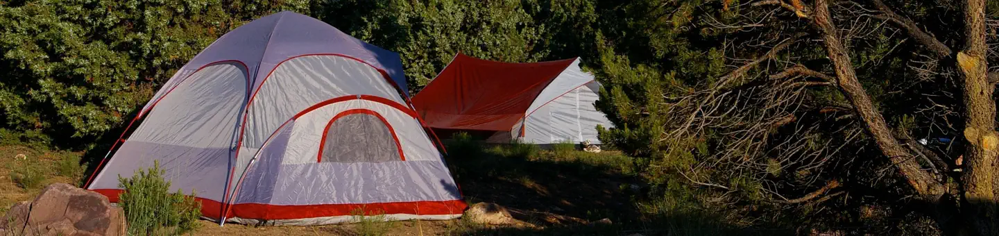
Deer Run is situated among juniper, pinyon pine and sagebrush above Flaming Gorge Reservoir. Shade is limited and the reservoir is not visible from the campground. A resident deer herd gives this site its name.Contact Info
For facility specific information, please call (801) 226-3564.Nearby Attractions
Flaming Gorge Dam offers guided tours of the working hydroelectric plant and the dam, and the adjacent visitor center contains area history exhibits.The Green River below the dam provides spectacular rafting opportunities. A trip down the river offers unique geology, outlaw history and Native American rock art.
The facts
- Season: April – October — USDA Forest Service, Aug 24, 2026
- 18 bookable sites
- 2 accessible sites
- Vehicles up to 45 ft
- Up to 20 people per site
- Loops: DEER
Site types
- 17 Standard Nonelectric
- 1 RV Nonelectric
Amenities
- Shade
- Pets allowed
Not recorded upstream: electric hookups, water hookups, sewer hookups, campfires allowed, fire pits, picnic tables, grills.
18 campsites at Deer Run Campground
Check-in 02:00 PM · Check-out 11:00 AM
| Site | Loop | Type | Entry | Surface | Max rig | People | |
|---|---|---|---|---|---|---|---|
| 001 | DEER | Standard Nonelectric | Back In | Paved | 45 ft | 10 | 🐾 |
| 002 | DEER | Standard Nonelectric | Pull Through | Gravel | 45 ft | 10 | 🐾 |
| 003 | DEER | Standard Nonelectric | Back In | Paved | 45 ft | 20 | 🐾 |
| 004 | DEER | Standard Nonelectric | Back In | Paved | 45 ft | 10 | 🐾 |
| 005 | DEER | Standard Nonelectric | Back In | Paved | 45 ft | 20 | 🐾 |
| 006 | DEER | Standard Nonelectric | Back In | Paved | 45 ft | 10 | 🐾 |
| 007 | DEER | Standard Nonelectric | Pull Through | Paved | 45 ft | 10 | 🐾 |
| 008 | DEER | Standard Nonelectric | Back In | Paved | 34 ft | 10 | ♿ 🐾 |
| 009 | DEER | Standard Nonelectric | Back In | Paved | 35 ft | 10 | ♿ 🐾 |
| 010 | DEER | Standard Nonelectric | Back In | Paved | 45 ft | 20 | 🐾 |
| 011 | DEER | Standard Nonelectric | Pull Through | Paved | 45 ft | 10 | 🐾 |
| 012 | DEER | Standard Nonelectric | Back In | Paved | 44 ft | 10 | 🐾 |
| 013 | DEER | Rv Nonelectric | Back In | Paved | 35 ft | 20 | 🐾 |
| 014 | DEER | Standard Nonelectric | Back In | Paved | 45 ft | 10 | 🐾 |
| 015 | DEER | Standard Nonelectric | Back In | Paved | 42 ft | 10 | 🐾 |
| 016 | DEER | Standard Nonelectric | Back In | Paved | 37 ft | 10 | 🐾 |
| 017 | DEER | Standard Nonelectric | Back In | Paved | 45 ft | 10 | 🐾 |
| 018 | DEER | Standard Nonelectric | Back In | Paved | 42 ft | 10 | 🐾 |
Getting there
From Manila, Utah, take Highway 44 for 28 miles. Turn left on U.S. 191 and go north for about 4 miles. Turn north onto Forest Road 183 and travel approximately 2 miles to the campground, adjacent to Cedar Springs Marina.
From Rock Springs, Wyoming, take I-80 west toward Green River about 6 miles to the junction with U.S. 191/Flaming Gorge Road. Take U.S. 191 south for 67 miles, passing through Dutch John. Turn north onto Forest Road 183 and travel approximately 2 miles to the campground, adjacent to Cedar Springs Marina.
40.90722, -109.44333 · 40°54'26.0"N 109°26'36.0"W
Typical weather
Typically 87°F in Jul, down to 36°F in Dec.
| Jan | Feb | Mar | Apr | May | Jun | Jul | Aug | Sep | Oct | Nov | Dec | |
|---|---|---|---|---|---|---|---|---|---|---|---|---|
| High °F | 37 | 40 | 50 | 57 | 67 | 79 | 87 | 84 | 75 | 62 | 46 | 36 |
| Low °F | 13 | 15 | 24 | 30 | 38 | 46 | 52 | 52 | 43 | 32 | 22 | 13 |
| Precip in | 0.5 | 0.7 | 0.9 | 1.1 | 1.4 | 0.9 | 1.0 | 1.2 | 1.7 | 1.4 | 0.5 | 0.5 |
1991–2020 averages from the nearest NOAA station, 2.4 mi away — not measured at the facility itself, and elevation can make a real difference over that distance.
Map
More photos


Member photos
Common questions about Deer Run Campground
- Can you reserve a site at Deer Run Campground?
- Yes, Deer Run Campground is reservable through Recreation.gov.
- How many campsites does Deer Run Campground have?
- 18 sites.
- What is the maximum RV length at Deer Run Campground?
- 45 ft. That is the longest vehicle the sites here are recorded as taking; individual sites may be shorter.
- Are pets allowed at Deer Run Campground?
- Yes, pets are allowed at Deer Run Campground.
Also listed by
Deer Run Campground also appears in other federal recreation data. Facts below are matched by name and location, not confirmed by Deer Run Campground's operator.
USDA Forest Service — data as of Aug 24, 2026
- Showers are open to non-campers for a fee of $4.
- Sanitation station is open for a fee
- Potable water is available.
Camping near Deer Run Campground
- Cedar Springs Campground 0.4 mi · Campground · we watch it
- Firefighters Campground 1.1 mi · Campground · we watch it
- Mustang Ridge Campground 1.3 mi · Campground · we watch it
- Arch Dam Campground 1.7 mi · Campground · we watch it
- Greendale 1.9 mi · Campground · we watch it
- Dutch John Draw Campground 2.1 mi · Campground · we watch it
- Jarvies Family Boat In 2.4 mi · Campground · we watch it
- Jarvies Boat in Group 2.6 mi · Campground · we watch it
- Dripping Springs Campground (Ut) 4.6 mi · Campground · we watch it
- Skull Creek 5.3 mi · Campground · we watch it
- Flaming Gorge Dam Visitor Center 1.1 mi · Facility
- Dutch John Draw Group Campground 2.4 mi · Campground
Contact
- Phone 435-889-3000
- Email Help.Ashley.DutchJohn@AmericanLL.com
- Book Recreation.gov
Recreation.gov last updated this record on 2026-02-28.
Facility information and photographs from Recreation.gov (RIDB). SpotOpened is not affiliated with Recreation.gov or any federal agency.
Comments