Satsop Campground
Campground · 19 bookable sites ·
Managed by the USDA Forest Service
Olympic National Forest (NF) · Open Access
- 19
- Bookable sites
- 30 ft
- Max rig length
- up to 16
- People per site
- 10
- Accessible sites
- 1,015 ft
- Elevation
Overview
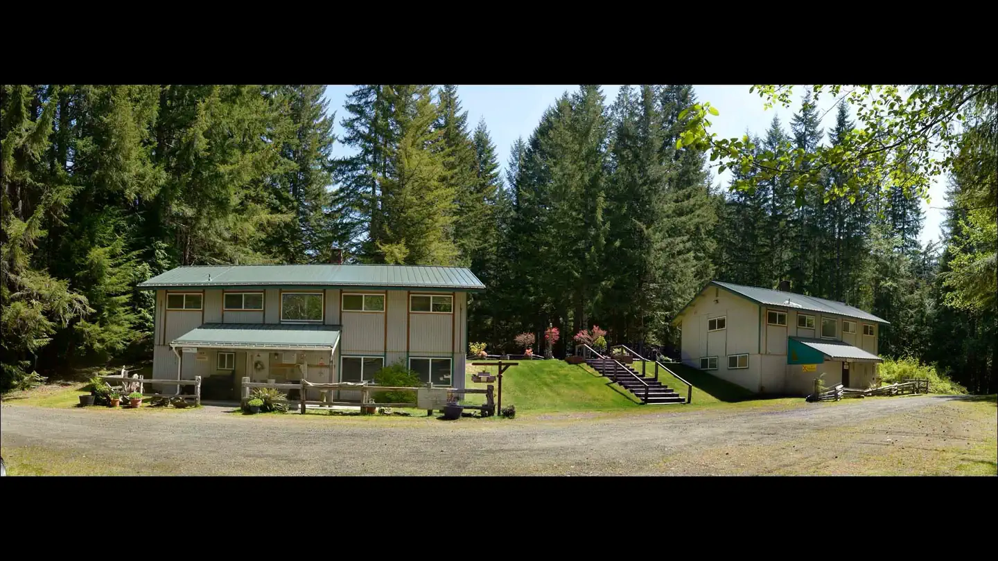
Satsop Campground is located 2.5 miles east of Wynoochee Lake and near the West Fork of the Satsop River. The Satsop Campground is rich in heritage and part of the emerald paradise that is Olympic National Forest. Evergreen conifers and hardwoods provide a beautiful wooded setting.
Recreation
Recreational opportunities abound, including picnicking, swimming, hiking, biking, boating at nearby Wynoochee Lake, hunting and fishing, all possible within the area. The nearby Olympic National Park is full of hiking trails, marked and primitive. 2.5 Miles to the west is Wynoochee Lake open for boating, skiing, canoeing, fishing and swimming. If you love the outdoors, you will find something to do here!
Facilities
The campground offers 19 sites overall of which 7 standard campsites with full hookups that will accommodate trailers and RVs up to 30' in length. Three walk-in group tent sites will accommodate up to 16 people each. There are seven regular walk-in tent camping sites. Two RV/Tent sites have no hookups are also available. This year, Satsop will not have flush toilets as outhouses will be used as the primary bathrooms. Satsop has drinking water and trash collection, as well as picnic tables, campfire rings and a series of gravel roads. An RV dump station is located 2.5 miles away on Forest Road 2294.
Natural Features
Olympic National Forest is located on the Olympic Peninsula in the northwest corner of Washington State, known as the Evergreen State. The Olympic Peninsula is an unique geographic province consisting of five major landscapes: temperate rain forest, rugged mountain terrain, large lowland lakes, cascading rivers and saltwater beaches. Here the flora and fauna provide interest beyond the imagination.
Nearby Attractions
Scenic Spoon Creek Falls and Wynoochee Falls are both accessed by short trails nearby. The 16-mile Wynoochee Lake Shore Trail circles the entire nearby Wynoochee Lake and is open to mountain bikes. At the nearby Wynoochee Dam, visitors can enjoy exhibits at the vista overlook and a dramatic view of the river gorge just below the dam. Swimming and picnicking facilities are available at the dam.
The facts
- 19 bookable sites
- 10 accessible sites
- Vehicles up to 30 ft
- Up to 16 people per site
- Loops: Hike In, Satsop
Site types
- 7 RV Electric
- 7 Tent Only Nonelectric
- 2 Group Standard Nonelectric
- 2 RV Nonelectric
- 1 Group Tent Only Area Nonelectric
Amenities
- Electric hookups
- Water hookups
- Sewer hookups
- Campfires allowed
- Shade
- Pets allowed
Not recorded upstream: fire pits, picnic tables, grills.
19 campsites at Satsop Campground
| Site | Loop | Type | Entry | Surface | Access | Max rig | People | |
|---|---|---|---|---|---|---|---|---|
| 10 | Hike In | Group Standard Nonelectric | — | — | Hike In | — | 16 | ♿ 🐾 |
| 11 | Hike In | Tent Only Nonelectric | — | — | Hike In | — | 8 | 🐾 |
| 12 | Hike In | Tent Only Nonelectric | — | — | Hike In | — | 8 | 🐾 |
| 13 | Hike In | Tent Only Nonelectric | — | — | Hike In | — | 8 | 🐾 |
| 14 | Hike In | Tent Only Nonelectric | — | — | Hike In | — | 8 | 🐾 |
| 15 | Hike In | Group Tent Only Area Nonelectric | — | — | Hike In | — | 16 | 🐾 |
| 01 | Satsop | Rv Electric | — | — | Drive In | 30 ft | 8 | 🐾 |
| 02 | Satsop | Rv Electric | — | Gravel | — | 30 ft | 8 | ♿ 🐾 |
| 03 | Satsop | Rv Electric | — | — | Drive In | 30 ft | 8 | ♿ 🐾 |
| 04 | Satsop | Rv Electric | — | — | — | 30 ft | 8 | ♿ 🐾 |
| 05 | Satsop | Rv Electric | Back In | — | — | 30 ft | 8 | ♿ 🐾 |
| 06 | Satsop | Rv Electric | — | — | — | 30 ft | 8 | ♿ 🐾 |
| 07 | Satsop | Rv Electric | — | — | — | 30 ft | 8 | ♿ 🐾 |
| 08 | Satsop | Group Standard Nonelectric | — | — | — | — | 8 | 🐾 |
| 09 | Satsop | Rv Nonelectric | — | — | — | 30 ft | 8 | ♿ 🐾 |
| 16 | Satsop | Rv Nonelectric | — | — | Drive In | 26 ft | 8 | ♿ 🐾 |
| 17 | Satsop | Tent Only Nonelectric | — | — | Hike In | — | 8 | ♿ 🐾 |
| 18 | Satsop | Tent Only Nonelectric | — | — | Hike In | — | 8 | 🐾 |
| 19 | Satsop | Tent Only Nonelectric | — | — | Hike In | — | 8 | 🐾 |
Getting there
From Route 12 via Montesano: Turn north on Wynoochee Valley Road, 1 mile west of Montesano. Drive 35 miles on Wynoochee Valley Road and Forest Road 22 to a major intersection. Turn right (east). Drive about 1 mile and stay left at the Y. Drive another mile or so and the campground will be on your right.
47.36790, -123.56591 · 47°22'4.4"N 123°33'57.3"W
Typical weather
Typically 74°F in Jul, down to 42°F in Dec.
| Jan | Feb | Mar | Apr | May | Jun | Jul | Aug | Sep | Oct | Nov | Dec | |
|---|---|---|---|---|---|---|---|---|---|---|---|---|
| High °F | 44 | 46 | 51 | 56 | 63 | 67 | 74 | 73 | 68 | 57 | 48 | 42 |
| Low °F | 35 | 34 | 36 | 39 | 43 | 48 | 51 | 52 | 49 | 43 | 38 | 35 |
| Precip in | 21.2 | 13.4 | 15.1 | 9.4 | 5.0 | 4.1 | 2.1 | 2.6 | 5.7 | 13.0 | 20.8 | 21.4 |
1991–2020 averages from the nearest NOAA station, 10.1 mi away — not measured at the facility itself, and elevation can make a real difference over that distance.
Map
Member photos
Common questions about Satsop Campground
- Can you reserve a site at Satsop Campground?
- Yes, Satsop Campground is reservable through Recreation.gov.
- How many campsites does Satsop Campground have?
- 19 sites.
- What is the maximum RV length at Satsop Campground?
- 30 ft. That is the longest vehicle the sites here are recorded as taking; individual sites may be shorter.
- Are pets allowed at Satsop Campground?
- Yes, pets are allowed at Satsop Campground.
- Does Satsop Campground have hookups?
- Electric, Water, Sewer.
- Are campfires allowed at Satsop Campground?
- Campfires are allowed at Satsop Campground. Check for a current fire restriction before you go.
Camping near Satsop Campground
- Coho Campground 2.4 mi · Campground · we watch it
- Falls Creek Campground 14.8 mi · Campground · we watch it
- Staircase Campground 15 mi · Campground · we watch it
- Wynoochee Lake Shore Trailhead - Coho Campground 2.3 mi · Campground
- Spider Lake Trailhead 7.1 mi · Facility
- Campbell Tree Grove Campground 9.7 mi · Campground
- Brown Creek Interpretive Trailhead 11.8 mi · Facility
- Lebar Horse Camp 12 mi · Facility
- Brown Creek Campground 12 mi · Campground
- Gatton Creek Trailhead 14.6 mi · Facility
- Gatton Creek Campground/Day Use Area 14.7 mi · Campground
- Lake Quinault Lodge 14.9 mi · Facility
Contact
- Email D5Recreation@gmail.com
- Book Recreation.gov
Recreation.gov last updated this record on 2026-08-10.
Facility information and photographs from Recreation.gov (RIDB). SpotOpened is not affiliated with Recreation.gov or any federal agency.
Comments