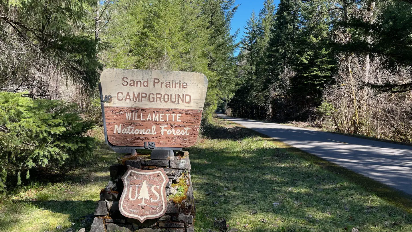
Sand Prairie Campground
Campground · 22 bookable sites ·
Managed by the USDA Forest Service
Willamette National Forest (NF) · Open Access
- 22
- Bookable sites
- up to 6
- People per site
- 1,588 ft
- Elevation
Overview
This 21-site campground is located in a mixed stand of Douglas-fir, Western hemlock, cedar, dogwood and hazelnut. The nearby Middle Fork River provides for scenic views and excellent recreation opportunities.
Hikers, equestrians, and mountain bikers can access the 27-mile Middle Fork Willamette Trail at the south end of the site.
Recreation
With Hills Creek Reservoir and the Middle Fork River so nearby, Sand Prairie is a wonderful place to stay for kayakers, paddle boarders, and fishers alike. It also serves as a gateway to the Middle Fork National Recreation Trail, making it a great place for mountain bikers, hikers, and equestrians. Other nearby trails help continue the adventure, with trails to Young's Rock, Larrison Rock, and Chuckle Springs all only a short drive away.
Facilities
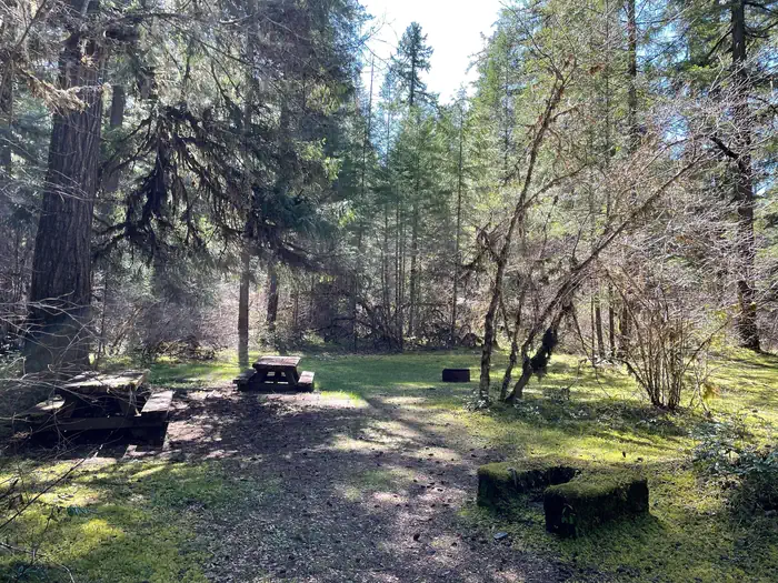
The campground has a restroom and trash service. All sites have a picnic table and fire ring. There is no potable water and no gas or electric hookups available. Pull-through sites are limited in number and can fill up quickly.
Natural Features
Nestled in a grove of Douglas-fir, Western hemlock, cedar, dogwood and hazelnut trees, this campground has easy access to Hills Creek Reservoir, Middle Fork River, and several wonderful hiking trails. The foothills for the Cascades and the rushing water of the Middle Fork provide an excellent backdrop for your stay.
Nearby Attractions
Hills Creek Reservoir, Middle Fork River, Young's Rock, Larrison Rock, Chuckle Springs, Indigo Springs
The facts
- Season: May – September — USDA Forest Service, Aug 24, 2026
- 22 bookable sites
- 25 sites in total, including non-bookable
- Up to 6 people per site
- Loops: Sand Prairie, Scan and Pay
Site types
- 22 Standard Nonelectric
- 3 Management
Amenities
- Campfires allowed
- Shade
- Pets allowed
- Water hookups — not available
Not recorded upstream: electric hookups, sewer hookups, fire pits, picnic tables, grills.
25 campsites at Sand Prairie Campground
Check-in 2:00 PM · Check-out 1:00 PM
| Site | Loop | Type | Entry | Surface | Max rig | People | |
|---|---|---|---|---|---|---|---|
| 001 | Sand Prairie | Standard Nonelectric | Back In | — | — | 6 | 🐾 |
| 002 | Sand Prairie | Standard Nonelectric | Back In | Paved | — | 6 | 🐾 |
| 003 | Sand Prairie | Standard Nonelectric | Back In | Paved | — | 6 | |
| 004 | Sand Prairie | Standard Nonelectric | Back In | — | — | 6 | |
| 005 | Sand Prairie | Standard Nonelectric | Back In | — | — | 6 | |
| 006 | Sand Prairie | Standard Nonelectric | Back In | Paved | — | 6 | 🐾 |
| 007 | Sand Prairie | Standard Nonelectric | Back In | — | — | 6 | |
| 008 | Sand Prairie | Standard Nonelectric | Back In | — | — | 6 | |
| 009 | Sand Prairie | Standard Nonelectric | Back In | — | — | 6 | 🐾 |
| 010 | Sand Prairie | Standard Nonelectric | Back In | — | — | 6 | 🐾 |
| 011 | Sand Prairie | Standard Nonelectric | Back In | — | — | 6 | |
| 012 | Sand Prairie | Standard Nonelectric | Back In | — | — | 6 | |
| 013 | Sand Prairie | Standard Nonelectric | Back In | — | — | 6 | 🐾 |
| 014 | Sand Prairie | Standard Nonelectric | Back In | — | — | 6 | 🐾 |
| 015 | Sand Prairie | Standard Nonelectric | Back In | — | — | 6 | |
| 016 | Sand Prairie | Standard Nonelectric | Back In | — | — | 6 | |
| 017 | Sand Prairie | Standard Nonelectric | Pull Through | — | — | 6 | 🐾 |
| 018 | Sand Prairie | Standard Nonelectric | Back In | — | — | 6 | |
| 019 | Sand Prairie | Standard Nonelectric | Back In | — | — | 6 | |
| 020 | Sand Prairie | Standard Nonelectric | Back In | Paved | — | 6 | 🐾 |
| 021 | Sand Prairie | Standard Nonelectric | Pull Through | Paved | — | 6 | 🐾 |
| ScanPay 2 | Scan and Pay | Management | — | — | — | — | |
| ScanPay 3 | Scan and Pay | Management | — | — | — | — | |
| ScanPay 4 | Scan and Pay | Management | — | — | — | — | |
| Standard | Scan and Pay | Standard Nonelectric | — | — | — | — |
Getting there
Exit I-5 heading east on Highway 58 towards Oakridge, OR. On the east side of Oakridge, just past mile marker 37, take a right onto Kitson Springs Road. In approximately half a mile take a right onto Forest Service Road 21. Just past mile marker 11 the entrance to the campground will be on the right.
43.60139, -122.45139 · 43°36'5.0"N 122°27'5.0"W
Typical weather
| Jan | Feb | Mar | Apr | May | Jun | Jul | Aug | Sep | Oct | Nov | Dec | |
|---|---|---|---|---|---|---|---|---|---|---|---|---|
| High °F | — | — | — | — | — | — | — | — | — | — | — | — |
| Low °F | — | — | — | — | — | — | — | — | — | — | — | — |
| Precip in | 10.0 | 7.8 | 9.0 | 7.7 | 5.5 | 3.3 | 0.9 | 0.9 | 2.7 | 6.2 | 10.9 | 12.3 |
1991–2020 averages from the nearest NOAA station, 7.6 mi away — not measured at the facility itself, and elevation can make a real difference over that distance.
Map
More photos

Member photos
Common questions about Sand Prairie Campground
- Can you reserve a site at Sand Prairie Campground?
- Yes, Sand Prairie Campground is reservable through Recreation.gov.
- How many campsites does Sand Prairie Campground have?
- 25 sites in total, of which 22 can be booked.
- Are pets allowed at Sand Prairie Campground?
- Yes, pets are allowed at Sand Prairie Campground.
- Does Sand Prairie Campground have hookups?
- No hookups are recorded here.
- Are campfires allowed at Sand Prairie Campground?
- Campfires are allowed at Sand Prairie Campground. Check for a current fire restriction before you go.
Also listed by
Sand Prairie Campground also appears in other federal recreation data. Facts below are matched by name and location, not confirmed by Sand Prairie Campground's operator.
USDA Forest Service — data as of Aug 24, 2026
- Single Campsites - $14 per night
- Extra Vehicles - $6 per vehicle, per night
- Campsite must be occupied every night paid, and fees must be paid within 30 minutes of arrival.
Restrictions:
- Single campsite capacity: 6 persons, 2 vehicles, 2 tents
- Multiple campsite capacity: 8 persons, 3 vehicles, 3 tents
- Quiet hours: 10 pm to 6 am
- Camping is not allowed more than 14 days in a 60 day period.
- Check-in time: 2:00 pm or later. Check-out time: 1:00 pm
- Use of chainsaws in the campground is prohibited
- Dogs MUST be on leash at all times within the campground
Camping near Sand Prairie Campground
- Warner Mountain Lookout 5.8 mi · Campground · we watch it
- Secret 6 mi · Campground · we watch it
- Packard Creek 6.9 mi · Campground · we watch it
- Campers Flat 7.2 mi · Campground · we watch it
- Sacandaga 9.5 mi · Campground · we watch it
- Musick Guard Station 9.6 mi · Campground · we watch it
- Blue Pool 10.7 mi · Campground · we watch it
- Packard Creek Campground 4.9 mi · Campground
- C.T. Beach Picnic Area and Boat Launch 7.7 mi · Facility
- Eugene to Crest Trailhead #2 9.6 mi · Facility
- Fairview Peak Lookout 10.1 mi · Campground
- Blue Pool Campground (Middle Fork Ranger District) 10.7 mi · Campground
Contact
- Phone N/A
- Book Recreation.gov
Recreation.gov last updated this record on 2026-02-25.
Facility information and photographs from Recreation.gov (RIDB). SpotOpened is not affiliated with Recreation.gov or any federal agency.
Comments