Lake McClellan UTV/ATV Area
Activity pass ·
Managed by the USDA Forest Service
McClellan Creek National Grassland (NF) · Open Access
- 2,939 ft
- Elevation
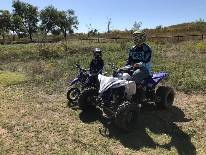
The Lake McClellan UTV/ATV Area Trailhead is located outside of the Lake McClellan Campground. This multiple-use trail system is approximately 10 miles in length with a difficulty rating of light to moderate.
Passes are per (1) Off Highway Vehicle (OHV). You may print the pass and keep it with the vehicle, print a copy for each operator to carry, or send and download the pass to your device(s).
UTV's and ATV's may be used on designated trails only. Jeeps, pickups, and dune buggies (sand rails) may not be used on the UTV/ATV Trail.
Trails are closed the second Friday through Sunday in December for a youth hunt in the area.
The facts
- Season: Year round — USDA Forest Service, Aug 24, 2026
Getting there
35.20453, -100.87433 · 35°12'16.3"N 100°52'27.6"W
Typical weather
| Jan | Feb | Mar | Apr | May | Jun | Jul | Aug | Sep | Oct | Nov | Dec | |
|---|---|---|---|---|---|---|---|---|---|---|---|---|
| High °F | — | — | — | — | — | — | — | — | — | — | — | — |
| Low °F | — | — | — | — | — | — | — | — | — | — | — | — |
| Precip in | 0.7 | 0.7 | 1.5 | 1.7 | 3.0 | 3.3 | 2.4 | 2.7 | 2.3 | 1.9 | 0.8 | 0.9 |
1991–2020 averages from the nearest NOAA station, 3.3 mi away — not measured at the facility itself, and elevation can make a real difference over that distance.
Map
Member photos
Common questions about Lake McClellan UTV/ATV Area
- Can you reserve a site at Lake McClellan UTV/ATV Area?
- Yes, Lake McClellan UTV/ATV Area is reservable through Recreation.gov.
Also listed by
Lake McClellan UTV/ATV Area also appears in other federal recreation data. Facts below are matched by name and location, not confirmed by Lake McClellan UTV/ATV Area's operator.
USDA Forest Service — data as of Aug 24, 2026
- $3 per day use. $10 per night for single unit camping, $15 per night for water and electric hookups. $5 per ATV to use designated trail. If you do not have a pass, you may purchase one online , or look for the Pay Station on site. Envelopes for payment are in the box next to the fee tube. CASH OR CH
Restrictions:
- ATVs may not be ridden in the campground.
Camping near Lake McClellan UTV/ATV Area
- East Bluff #1 Campground - Lake McClellan 0.8 mi · Campground
- McDowell Campground 0.8 mi · Campground
- Rosita Flats 23.3 mi · Facility
- Sanford Yake Campground 29.6 mi · Campground
- Sanford Yake 29.6 mi · Campground
- Cedar Canyon Campground 45.9 mi · Campground
- Park Headquarters 50.3 mi · Facility
- Fort Ebey State Park 52.4 mi · Facility
- Harbor Bay Campground 52.4 mi · Campground
- Fritch Fortress 52.4 mi · Facility
- Alibates Visitor Center 53.4 mi · Facility
- Blue West Campground 53.8 mi · Campground
Facility information and photographs from Recreation.gov (RIDB). SpotOpened is not affiliated with Recreation.gov or any federal agency.
Comments