Hatteras Island Weather Bureau Station
Visitor Center ·
Managed by the National Park Service
- 1 ft
- Elevation
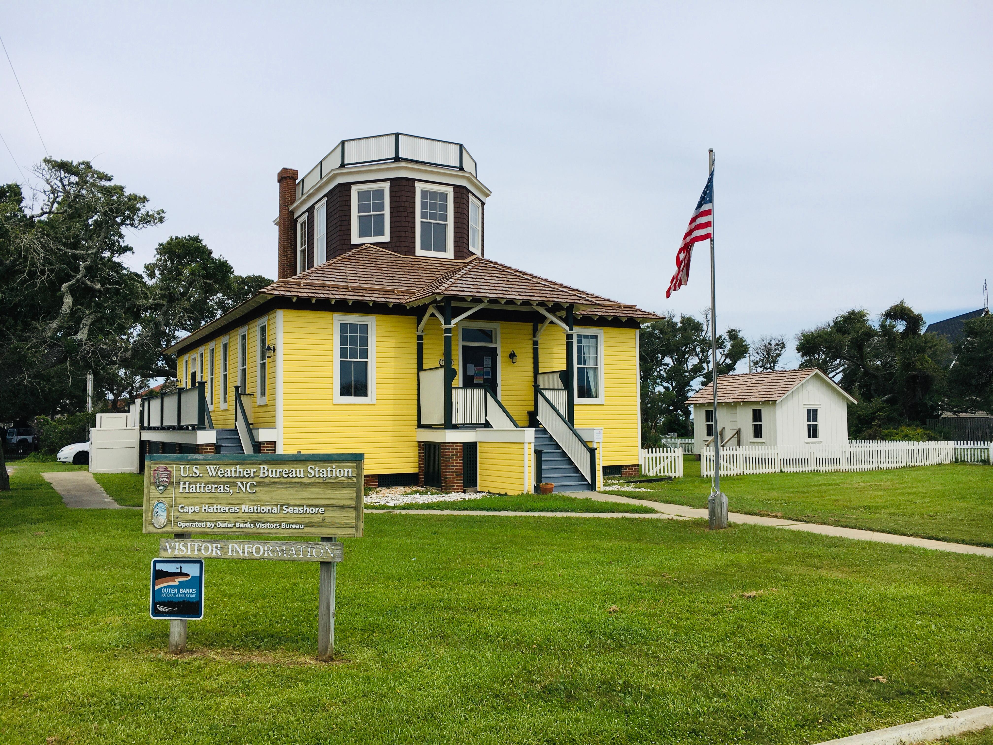
The Hatteras Weather Bureau Station was built in 1901 as one of the many stations along the east coast that would forecast weather for boats and the surrounding communities. Today the building is used as a information center.
Getting there
Located just north of NC 12 in Hatteras Village.
35.22000, -75.69028 · 35°13'12.0"N 75°41'25.0"W
Typical weather
Typically 87°F in Jul, down to 55°F in Jan.
| Jan | Feb | Mar | Apr | May | Jun | Jul | Aug | Sep | Oct | Nov | Dec | |
|---|---|---|---|---|---|---|---|---|---|---|---|---|
| High °F | 55 | 57 | 61 | 69 | 77 | 84 | 87 | 87 | 83 | 75 | 66 | 59 |
| Low °F | 41 | 42 | 46 | 54 | 63 | 71 | 75 | 74 | 71 | 61 | 52 | 45 |
| Precip in | 4.9 | 4.3 | 4.4 | 3.9 | 4.4 | 4.4 | 5.4 | 6.7 | 7.6 | 5.6 | 4.8 | 4.7 |
1991–2020 averages from the nearest NOAA station, 4 mi away — not measured at the facility itself, and elevation can make a real difference over that distance.
Map
Member photos
Common questions about Hatteras Island Weather Bureau Station
- Can you reserve a site at Hatteras Island Weather Bureau Station?
- No. Hatteras Island Weather Bureau Station is not reservable through Recreation.gov, so sites are first-come, first-served or booked elsewhere.
Camping near Hatteras Island Weather Bureau Station
- Frisco Campground 4.7 mi · Campground · we watch it
- Bodie Island Lighthouse 9.4 mi · Tickets · we watch it
- Cape Point Campground 13.2 mi · Campground · we watch it
- Ocracoke Campground 14.9 mi · Campground · we watch it
- Long Point Cabin Camp 39 mi · Campground · we watch it
- Oregon Inlet Campground 40.9 mi · Campground · we watch it
- Museum of the Sea 9.3 mi · Facility
- Portsmouth Visitor Center 23.5 mi · Facility
- Swanquarter Wilderness 31.7 mi · Facility
- Mattamuskeet National Wildlife Refuge Deer Hunts 33.9 mi · Activity pass
- Mattamuskeet NWR September Canada Goose Hunt 33.9 mi · Activity pass
- North Core Banks - Beach Camping 39 mi · Campground
Contact
- Phone (252) 473-2111
- Email caha_public_affairs@nps.gov
- Info Recreation.gov
Recreation.gov last updated this record on 2026-02-25.
Facility information and photographs from Recreation.gov (RIDB). SpotOpened is not affiliated with Recreation.gov or any federal agency.
Comments