Bodie Island Lighthouse
Tickets · North Carolina ·
Managed by the National Park Service
Cape Hatteras National Seashore (National Seashore) · Open Access
- 8 ft
- Elevation
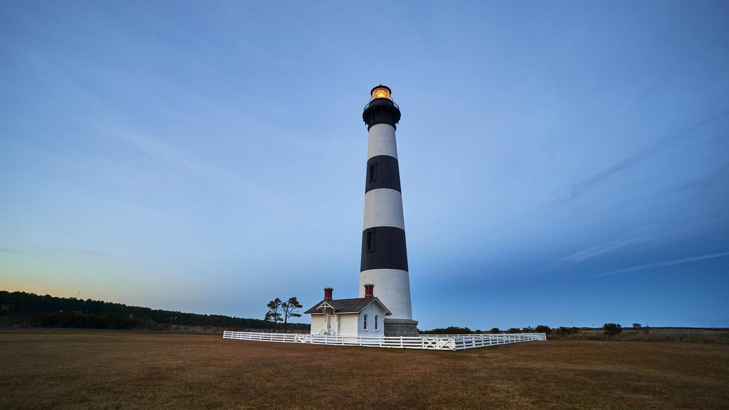
- The National Park Service provides visitors the unique opportunity to climb the Bodie Island Lighthouse and the Cape Hatteras Lighthouse. Tours are a great way to experience these historic structures!
- Bodie Island Lighthouse is open seasonally for self-guided tours..
- Climbing tickets can only be purchased on the day of your intended climb. Tickets go on sale daily at 7 a.m. Tickets may not be purchased for future dates.
- Please be at the base of the lighthouse 5 minutes before your ticket time. No refunds for no shows or late arrivals..
- Cape Hatteras Lighthouse may not be open for climbing due to ongoing restoration efforts.
- Please call (252) 475-9018, hours are 7:00 am - 6:00 pm est. if you have questions.
This tour may be cancelled if weather conditions are unsafe (i.e., high winds, storms, and/or lightning in the area).
Getting there
- North (From Richmond, VA)
Follow I-95 South to Richmond, VA. Take I-64 East toward Norfolk/Virginia Beach, VA. Take I-64 or I-664 to Chesapeake, VA. From I-64, take Exit 291B to Route 168, the Chesapeake Expressway (a toll-road costing $3.00 - $6.00 each way). Once in North Carolina, Route 168 turns into US-158 East. Follow US-158 East through Nags Head, NC to the junction of NC-12 South. Continue on NC-12 South until you reach the village of Buxton. Signs for Cape Hatteras Lighthouse will be on your left. Follow signs to lighthouse parking.
- West (From Rocky Mount, NC)
Follow US-64 East through Tarboro, Williamston, Plymouth, Columbia, and Manteo, crossing the Alligator River Bridge and the Virginia Dare Bridge. Keep going on US-64 East to Nags Head, NC, going over the Washington Baum Bridge, to the junction of NC-12 South. Turn right onto NC-12 South and you will be at the north entrance. Continue on NC-12 South until you reach the village of Buxton. Signs for Cape Hatteras Lighthouse will be on your left. Follow signs to lighthouse parking.
- South (From Florence, SC)
Take I-95 North to Wilson, NC. Take US-264 East through Greenville, NC and Washington, NC. From Washington, NC, take US-17 to Williamston and follow US-64 East to Nags Head, NC and the junction of NC-12 South. Continue on NC-12 South until you reach the village of Buxton. Signs for Cape Hatteras Lighthouse will be on your left. Follow signs to lighthouse parking.
35.25121, -75.52818 · 35°15'4.3"N 75°31'41.4"W
Typical weather
Typically 87°F in Jul, down to 54°F in Jan.
| Jan | Feb | Mar | Apr | May | Jun | Jul | Aug | Sep | Oct | Nov | Dec | |
|---|---|---|---|---|---|---|---|---|---|---|---|---|
| High °F | 54 | 57 | 62 | 69 | 77 | 84 | 87 | 87 | 82 | 74 | 65 | 58 |
| Low °F | 40 | 41 | 46 | 55 | 63 | 71 | 75 | 74 | 71 | 61 | 52 | 45 |
| Precip in | 4.7 | 4.3 | 4.2 | 4.0 | 4.5 | 4.8 | 5.6 | 7.0 | 8.1 | 5.2 | 4.7 | 4.6 |
1991–2020 averages from the nearest NOAA station, 4.3 mi away — not measured at the facility itself, and elevation can make a real difference over that distance.
Map
More photos
Member photos
Common questions about Bodie Island Lighthouse
- Can you reserve a site at Bodie Island Lighthouse?
- Yes, Bodie Island Lighthouse is reservable through Recreation.gov.
Camping near Bodie Island Lighthouse
- Frisco Campground 4.7 mi · Campground · we watch it
- Cape Point Campground 22.3 mi · Campground · we watch it
- Ocracoke Campground 24.2 mi · Campground · we watch it
- Oregon Inlet Campground 37.9 mi · Campground · we watch it
- Museum of the Sea 0.1 mi · Facility
- Hatteras Island Weather Bureau Station 9.4 mi · Visitor Center
- Portsmouth Visitor Center 32.8 mi · Facility
- Swanquarter Wilderness 39 mi · Facility
- Bodie Island Visitor Center 39.2 mi · Facility
- Mattamuskeet National Wildlife Refuge Deer Hunts 40.7 mi · Activity pass
- Mattamuskeet NWR September Canada Goose Hunt 40.7 mi · Activity pass
- Whalebone Junction Information Center 45.3 mi · Visitor Center
Contact
- Phone CAPE HATTERAS LIGHT HOUSE: 252-475-9602. BODIE ISLAND LIGHTHOUSE: 252-475-9018.
- Book Recreation.gov
Recreation.gov last updated this record on 2026-02-25.
Facility information and photographs from Recreation.gov (RIDB). SpotOpened is not affiliated with Recreation.gov or any federal agency.
Comments