Campo Alto Campground
Campground · 19 bookable sites ·
Managed by the USDA Forest Service
Los Padres National Forest (NF) · Open Access
- 19
- Bookable sites
- 40 ft
- Max rig length
- up to 70
- People per site
- 8,263 ft
- Elevation

Overview
Tucked away high atop the Cerro Noroeste, you'll find solitude, serenity and unsurpassed scenery as you lose yourself in a pleasant grove of Jeffrey pines at Campo Alto Campground. Campsites are spacious, the air is filled with a pine-sweet scent, and you will enjoy end-of-the-road privacy. Invigorated by the fresh air, your inner hiker will hunger to head out on the Vincent Tumameit Trailhead to enjoy the scenic mountain vistas. Do your best to leave this natural setting just as you found it. The campsites have no barriers to block your view, so most modest sized RVs, and all tent campers fit well here.Recreation
Campo Alto Campground is best appreciated by pristine camping enthusiasts who prefer to leave the hurried life behind. Hiking into the Chumash Wilderness by day, and star gazing by night are the chosen methods of decompressing.Facilities
This seasonal campground is open daily, May - November. There are 15 single campsites that include picnic tables and fire rings, and two group campsites. Two toilets are located near the campsites. You should plan to be completely self-sustainable for the duration of your trip. There is no potable water or electricity onsite. There is no dump station. Please bring garbage bags as this facility is "Pack it in. Pack it out."Natural Features
Located at 8,250 f.t, the campground is shaded by a thick blanket of Jeffrey pine. Great views of the the Carrizo Plain to the north, Cuyama Valley, Quatal and Apache Canyons to the west, as well as views of the San Joaquin valley to the east and Lockwood Valley and Sespe ranges to the south, are also some prevalent attributes of this little piece of heaven.Nearby Attractions
Hiking trails, biking, fishing and swimming are accessed within 30 minutes. Restaurants, gas and shopping within 15 miles at Pine Mountain Club or 25 miles in Frazier Park.The facts
- 19 bookable sites
- Vehicles up to 40 ft
- Up to 70 people per site
- Loops: Loop 1, Loop 2
Site types
- 17 Standard Nonelectric
- 2 Group Standard Nonelectric
Amenities
- Campfires allowed
- Fire pits
- Picnic tables
- Grills
- Shade
- Pets allowed
Not recorded upstream: electric hookups, water hookups, sewer hookups.
19 campsites at Campo Alto Campground
Check-in 03:00 PM · Check-out 12:00 PM
| Site | Loop | Type | Entry | Surface | Grade | Max rig | People | |
|---|---|---|---|---|---|---|---|---|
| 01 | Loop 1 | Standard Nonelectric | Back In | Gravel | Slight | 40 ft | 6 | 🐾 |
| 02 | Loop 1 | Standard Nonelectric | Back In | Gravel | Slight | 40 ft | 6 | 🐾 |
| 03 | Loop 1 | Standard Nonelectric | Back In | Gravel | Moderate | 40 ft | 6 | 🐾 |
| 04 | Loop 1 | Standard Nonelectric | Back In | Gravel | Slight | 40 ft | 6 | 🐾 |
| 05 | Loop 1 | Standard Nonelectric | Back In | Gravel | Moderate | 40 ft | 6 | 🐾 |
| 06 | Loop 1 | Standard Nonelectric | Back In | Gravel | Moderate | 40 ft | 6 | 🐾 |
| 07 | Loop 1 | Standard Nonelectric | Back In | Gravel | Moderate | 40 ft | 6 | 🐾 |
| 08 | Loop 1 | Standard Nonelectric | Back In | Gravel | Moderate | 40 ft | 6 | 🐾 |
| 09 | Loop 1 | Standard Nonelectric | Back In | Gravel | Moderate | 40 ft | 6 | 🐾 |
| 10 | Loop 1 | Standard Nonelectric | Back In | Gravel | Moderate | 40 ft | 6 | 🐾 |
| 11 | Loop 1 | Standard Nonelectric | Back In | Gravel | Moderate | 40 ft | 6 | 🐾 |
| 12 | Loop 1 | Standard Nonelectric | Back In | Gravel | Moderate | 40 ft | 6 | 🐾 |
| 13 | Loop 2 | Standard Nonelectric | Back In | Gravel | Moderate | 40 ft | 6 | 🐾 |
| 14 | Loop 2 | Standard Nonelectric | Back In | Gravel | Moderate | 40 ft | 6 | 🐾 |
| 15 | Loop 2 | Standard Nonelectric | Back In | Gravel | Moderate | 40 ft | 6 | 🐾 |
| 16 | Loop 2 | Standard Nonelectric | Back In | Gravel | Moderate | 40 ft | 6 | 🐾 |
| 17 | Loop 2 | Standard Nonelectric | Back In | Gravel | Moderate | 40 ft | 6 | 🐾 |
| GS1 | Loop 2 | Group Standard Nonelectric | Back In | Gravel | — | 25 ft | 70 | 🐾 |
| GS2 | Loop 2 | Group Standard Nonelectric | Back In | Gravel | — | 25 ft | 70 | 🐾 |
Getting there
Located off Mil Potrero Highway, approximately 3 miles west of Pine Mountain Club. On Forest Road 9N27. From I-5 take Frazier Park Mountain Park Rd in Lebec. Go west 10 miles to Mil Potrero Rd and make a right. Turn left at the Mil Potrero Ranger station (Cerro Noroeste Rd-Forest Road 9N27) and proceed 6 miles to the end. The campground is at the top of My Abel. GPS: 34.8314, -119.2095
34.83140, -119.20480 · 34°49'53.0"N 119°12'17.3"W
Typical weather
| Jan | Feb | Mar | Apr | May | Jun | Jul | Aug | Sep | Oct | Nov | Dec | |
|---|---|---|---|---|---|---|---|---|---|---|---|---|
| High °F | — | — | — | — | — | — | — | — | — | — | — | — |
| Low °F | — | — | — | — | — | — | — | — | — | — | — | — |
| Precip in | 3.2 | 4.0 | 2.3 | 0.9 | 0.4 | 0.1 | 0.1 | 0.0 | 0.2 | 0.7 | 0.9 | 2.3 |
1991–2020 averages from the nearest NOAA station, 8 mi away — not measured at the facility itself, and elevation can make a real difference over that distance.
Map
More photos

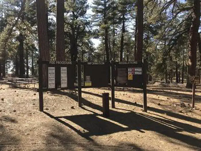
Member photos
Common questions about Campo Alto Campground
- Can you reserve a site at Campo Alto Campground?
- Yes, Campo Alto Campground is reservable through Recreation.gov.
- How many campsites does Campo Alto Campground have?
- 19 sites.
- What is the maximum RV length at Campo Alto Campground?
- 40 ft. That is the longest vehicle the sites here are recorded as taking; individual sites may be shorter.
- Are pets allowed at Campo Alto Campground?
- Yes, pets are allowed at Campo Alto Campground.
- Are campfires allowed at Campo Alto Campground?
- Campfires are allowed at Campo Alto Campground. Check for a current fire restriction before you go.
Camping near Campo Alto Campground
- MT. Pinos Campground 5.9 mi · Campground · we watch it
- McGill Campground and Group Campground 6.1 mi · Campground · we watch it
- Campo Alto Group Campground 0.1 mi · Facility
- West Tumamait Trailhead - 21W03 0.3 mi · Facility
- Toad Springs Campground 2.4 mi · Campground
- East Tumamait Trailhead - 21W03 3.4 mi · Facility
- Marian Campground 3.4 mi · Campground
- Chula Vista Trailhead 4.6 mi · Facility
- Chumash Wilderness 4.8 mi · Facility
- Dome Springs Campground 5 mi · Campground
- Nettle Springs Campground 5.3 mi · Campground
- McGill Group Campground 6.1 mi · Facility
Contact
- Phone 805-434-1996
- Book Recreation.gov
Recreation.gov last updated this record on 2026-02-25.
Facility information and photographs from Recreation.gov (RIDB). SpotOpened is not affiliated with Recreation.gov or any federal agency.
Comments