Buckhorn Campground Loop A
Campground ·
Managed by the National Park Service
Chickasaw Oklahoma Tribal Statistical Area (D6)
- 885 ft
- Elevation
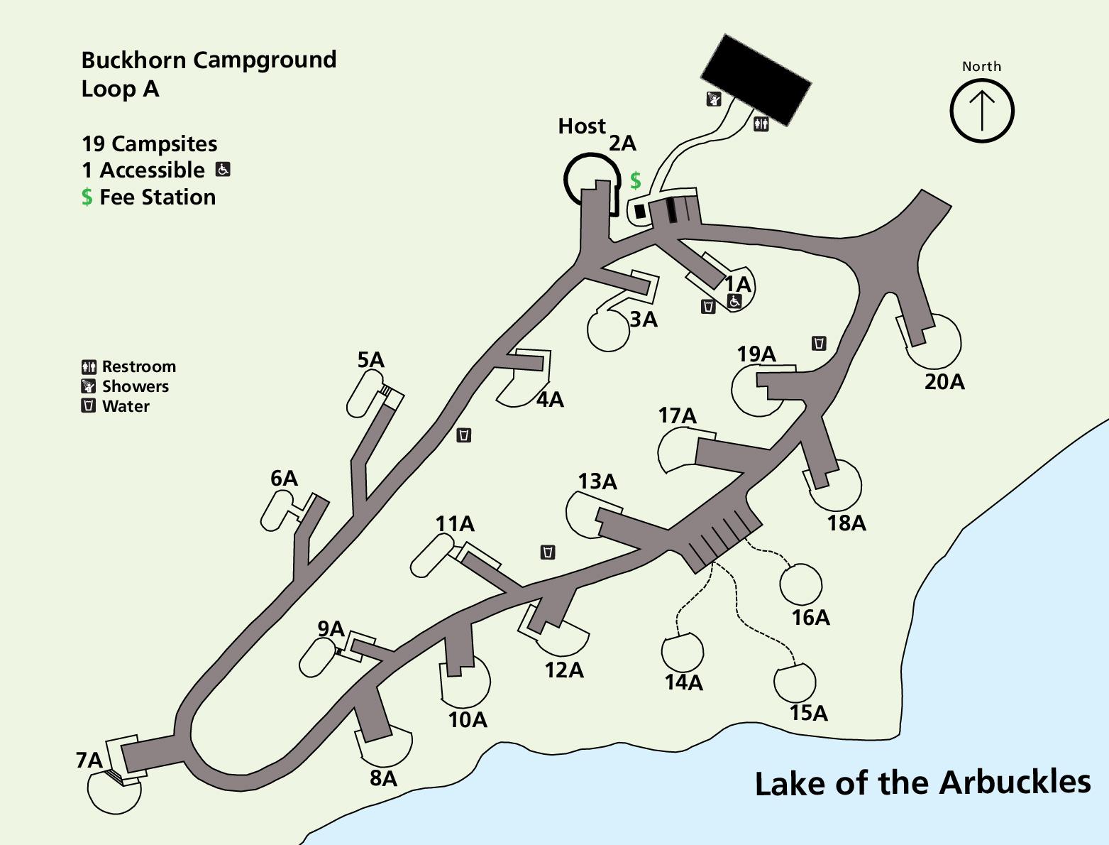
Buckhorn Campground has four loops. Loop A is open seasonally on a first come, first served basis. There are no hookups for RVs on Loop A. Located next to Lake of the Arbuckles, Buckhorn Campground is also located near the Buckhorn Boat Launch and near the southern trailhead for the Rock Creek Multi-Use Trail.
Getting there
Buckhorn Campground Loop A directions and information are available at https://www.nps.gov/chic/planyourvisit/campgrounds.htm.
34.42967, -96.98811 · 34°25'46.8"N 96°59'17.2"W
Typical weather
Typically 94°F in Aug, down to 52°F in Jan.
| Jan | Feb | Mar | Apr | May | Jun | Jul | Aug | Sep | Oct | Nov | Dec | |
|---|---|---|---|---|---|---|---|---|---|---|---|---|
| High °F | 52 | 56 | 65 | 73 | 79 | 88 | 93 | 94 | 86 | 75 | 63 | 54 |
| Low °F | 28 | 32 | 41 | 49 | 59 | 68 | 71 | 70 | 62 | 50 | 39 | 31 |
| Precip in | 2.0 | 1.9 | 3.6 | 3.7 | 5.5 | 4.4 | 3.7 | 3.0 | 4.4 | 4.0 | 2.8 | 2.7 |
1991–2020 averages from the nearest NOAA station, 4.7 mi away — not measured at the facility itself, and elevation can make a real difference over that distance.
Map
Member photos
Common questions about Buckhorn Campground Loop A
- Can you reserve a site at Buckhorn Campground Loop A?
- No. Buckhorn Campground Loop A is not reservable through Recreation.gov, so sites are first-come, first-served or booked elsewhere.
Camping near Buckhorn Campground Loop A
- Buckhorn Campground (Chickasaw) 0.1 mi · Campground · we watch it
- Buckhorn Pavilion 1.3 mi · Campground · we watch it
- The Point Campground (Chickasaw) 2.8 mi · Campground · we watch it
- Veterans Lake Pavilion 4.2 mi · Campground · we watch it
- Cold Springs Campground (Chickasaw) 5.3 mi · Campground · we watch it
- Central Group Camp (Chickasaw) 5.3 mi · Campground · we watch it
- Rock Creek Group Camp (Chickasaw) 5.3 mi · Campground · we watch it
- Caney Creek 38.1 mi · Campground · we watch it
- Buckhorn Campground Loop B 0.3 mi · Campground
- Buckhorn Campground Loop D 0.6 mi · Campground
- Guy Sandy Campground 4.1 mi · Facility
- Tishomingo National Fish Hatchery 16.5 mi · Facility
Contact
- Phone (580) 622-7234
- Email chic_interpretation@nps.gov
- Info Recreation.gov
Recreation.gov last updated this record on 2026-02-25.
Facility information and photographs from Recreation.gov (RIDB). SpotOpened is not affiliated with Recreation.gov or any federal agency.
Comments