Big Bend Backcountry Camping
Campground · 49 bookable sites ·
Managed by the National Park Service
Big Bend National Park (National Park) · Open Access
- 49
- Bookable sites
- 30 ft
- Max rig length
- up to 20
- People per site
- 3,738 ft
- Elevation
Overview
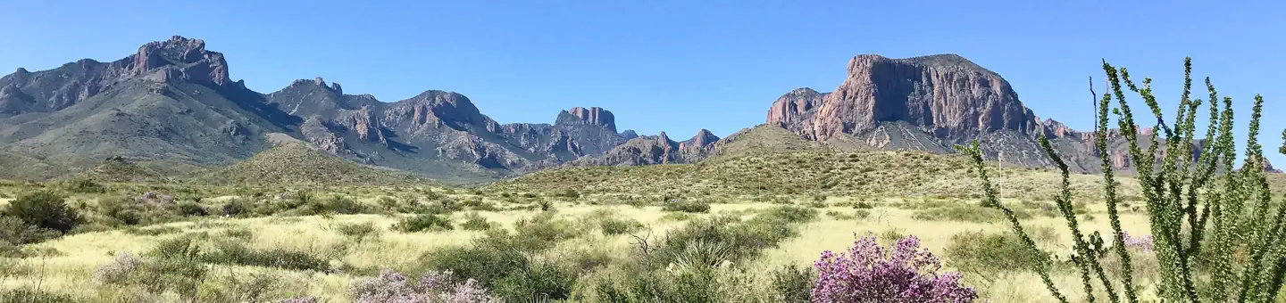
Big Bend's vast undeveloped areas provide excellent opportunities for backcountry experiences if you seek solitude, wilderness, and adventure! The backcountry sites listed here are primitive backcountry road campsites and primitive backpacking sites in the Chisos Mountains. All are designated sites located in remote locations. Campers must be self-sufficient. Visit the park's Backcountry Use web page to learn about proper planning and trip preparation for this remote area.
Backcountry Regulations are strictly enforced.
- These are primitive sites and do not offer water, electricity, toilet access, or any amenities.
- Primitive Chisos campsites are BACKPACK-ONLY campsites with NO vehicle access. Campsites are from 1-6 miles (1.6 to 10 km) from the trailhead. Maximum group size is 15 people. Overnight backpackers may park in the large amphitheater lot adjacent to the Chisos Basin Campground.
- Most primitive roadside campsites require a high clearance vehicle. The park highly recommends a four wheel drive vehicle. Road conditions can change quickly. High clearance vehicles are defined as an SUV or truck with at least 15 inch (38 cm) tire rims AND at least 8 inches (20 cm) of ground clearance from the lowest point of the frame, body, or suspension.
Recreation
Splendid Isolation! Big Bend National Park is beloved as one of the few large public land areas in Texas. Major activities include camping, backpacking, hiking, birdwatching, river trips, enjoying the spring bloom, and adventuring along backcountry roads. The spring months of March and April are the busiest, as well as the Thanksgiving and New Year’s holidays, although the park is open and visited year round.
Facilities
These are primitive campsites, and require extra trip planning. Please take the time to plan and carefully prepare your itinerary.
- Backpacking in Big Bend offers primitive designated backpacking campsites located along the extensive Chisos Mountains Trails system .
- Primitive Roadside Campsites: offer camping with your vehicle in designated campsites along rugged backcountry dirt roads .
- Roadside campsites are intended for high clearance vehicles only. Trailers and passenger vehicles will not be able to access most of these campsites. High clearance vehicles are defined as an SUV or truck, with at least 15 inch (38 cm) tire rims AND at least 8 inches (20 cm) of ground clearance, as measured from the lowest point of the vehicle (frame, suspension, body, differential).
Natural Features
From an elevation of less than 1,800 feet (550 m) along the Rio Grande to nearly 8,000 feet (2438 m) in the Chisos Mountains, Big Bend includes massive canyons, vast desert expanses, forested mountains, and an ever-changing river. Here you can explore one of the last remaining wild corners of the United States
Nearby Attractions
Charges & Cancellations
Changes/Modifications
- Changes may be made prior to the day the reservation begins.
- If a customer wants to switch dates that are entirely outside of the original reservation dates, there is a $10 change fee.
- There is no change fee if a customer extends or shortens a reservation, as long as the change includes dates from the original reservation.
- If a reservation is made that includes dates beyond the maximum booking window, that reservation cannot be changed until 18 days have passed from the original booking date.
Cancellations
- Customers may cancel their reservation prior to day of arrival both on-line and through the call center. A $10 cancellation fee will be withheld from any refund due back the customer. Depending on when you cancel in relation to your arrival day, it may be considered a late cancellation (see below).
Late Cancellations or Cancellations within the Cut-off Window
- A customer who cancels a reservation the day before or on the day of arrival will have a $10.00 cancellation fee withheld from their refund AND will forfeit the first night's use fee (not to exceed the total paid for the original reservation). Cancellations for a one-night reservation will forfeit the entire amount paid and will not be subject to an additional service fee.
The facts
- 49 bookable sites
- 112 sites in total, including non-bookable
- Vehicles up to 30 ft
- Up to 20 people per site
- Loops: Backpacking Site
Site types
- 63 Management
- 29 Hike To
- 20 Standard Nonelectric
Amenities
- Shade
- Pets allowed
- Water hookups — not available
- Campfires allowed — not available
Not recorded upstream: electric hookups, sewer hookups, fire pits, picnic tables, grills.
112 campsites at Big Bend Backcountry Camping
| Site | Loop | Type | Entry | Surface | Access | Max rig | People | |
|---|---|---|---|---|---|---|---|---|
| Black Dike | — | Management | — | Gravel | Drive In | — | 10 | 🐾 |
| Buenos Aires | — | Management | — | Gravel | Drive In | — | 10 | 🐾 |
| Camp de Leon | — | Management | Back In | Gravel | Drive In | 25 ft | 6 | 🐾 |
| Candelilla | — | Management | Pull Through | Gravel | Drive In | 25 ft | 8 | 🐾 |
| Chilicotal | — | Management | — | Gravel | Drive In | — | 6 | 🐾 |
| Croton Spring 1 | — | Standard Nonelectric | — | Gravel | Drive In | — | 12 | 🐾 |
| Desert Vista 1 (DV-1) | — | Management | — | Gravel | Drive In | 25 ft | 8 | 🐾 |
| Desert Vista 2 (DV-2) | — | Management | — | Gravel | Drive In | 25 ft | 8 | 🐾 |
| Dominguez Trailhead | — | Management | — | Gravel | Drive In | — | 8 | 🐾 |
| Elephant Tusk | — | Management | — | Gravel | Drive In | — | 6 | 🐾 |
| Ernst Basin | — | Management | Pull Through | Gravel | Drive In | 25 ft | 10 | 🐾 |
| Ernst Tinaja | — | Management | Pull Through | Gravel | Drive In | 25 ft | 10 | 🐾 |
| Fresno | — | Management | — | Gravel | Drive In | — | 8 | 🐾 |
| Gauging Station | — | Management | — | Gravel | Drive In | — | 6 | 🐾 |
| Glenn Spring 1 | — | Management | Pull Through | Gravel | Drive In | — | 8 | 🐾 |
| Glenn Spring 2 | — | Management | Pull Through | Gravel | Drive In | — | 8 | 🐾 |
| Grand View 1 (GV-1) | — | Management | — | Gravel | Drive In | 25 ft | 8 | 🐾 |
| Grand View 2 (GV-2) | — | Management | — | Gravel | Drive In | 25 ft | 8 | 🐾 |
| Grand View 3 (GV-3) | — | Management | — | Gravel | Drive In | 25 ft | 8 | 🐾 |
| Grapevine Hills 1 | — | Standard Nonelectric | — | Gravel | Drive In | — | 20 | 🐾 |
| Grapevine Hills 2 | — | Standard Nonelectric | — | Gravel | Drive In | 25 ft | 12 | 🐾 |
| Grapevine Hills 3 | — | Standard Nonelectric | — | Gravel | Drive In | 25 ft | 6 | 🐾 |
| Grapevine Hills 4 | — | Standard Nonelectric | — | Gravel | Drive In | 25 ft | 6 | 🐾 |
| Gravel Pit 1 | — | Management | — | Gravel | Drive In | — | 10 | 🐾 |
| Gravel Pit 2 | — | Management | — | Gravel | Drive In | — | 10 | 🐾 |
| Gravel Pit 3 | — | Management | — | Gravel | Drive In | — | 12 | 🐾 |
| Hannold Draw | — | Standard Nonelectric | — | Gravel | Drive In | — | 20 | 🐾 |
| Johnson Ranch 1 | — | Management | — | Gravel | Drive In | — | 10 | 🐾 |
| Johnson Ranch 2 | — | Management | — | Gravel | Drive In | — | 8 | 🐾 |
| K-Bar 1 | — | Standard Nonelectric | — | Gravel | Drive In | 25 ft | 6 | 🐾 |
| K-Bar 2 | — | Standard Nonelectric | — | Gravel | Drive In | 30 ft | 6 | 🐾 |
| La Clocha 1 | — | Management | — | Gravel | Drive In | — | 12 | 🐾 |
| La Clocha 2 | — | Management | — | Gravel | Drive In | — | 8 | 🐾 |
| La Noria 1 | — | Management | Back In | Gravel | Drive In | 25 ft | 6 | 🐾 |
| La Noria 2 | — | Management | Pull Through | Gravel | Drive In | 25 ft | 6 | 🐾 |
| Loop Camp 1 | — | Management | — | Gravel | Drive In | — | 12 | 🐾 |
| Loop Camp 2 | — | Management | — | Gravel | Drive In | — | 8 | 🐾 |
| Maverick Camp 1 (MC-1) | — | Management | — | Gravel | Drive In | 25 ft | 8 | 🐾 |
| McKinney Spring | — | Management | Back In | Gravel | Drive In | 25 ft | 6 | 🐾 |
| Nine Point Draw | — | Standard Nonelectric | — | Gravel | Drive In | 30 ft | 8 | 🐾 |
| Nugent Mountain | — | Standard Nonelectric | — | Gravel | Drive In | 30 ft | 20 | 🐾 |
| Ocotillo Grove | — | Management | Back In | Gravel | Drive In | — | 8 | 🐾 |
| Paint Gap 1 | — | Standard Nonelectric | — | Gravel | Drive In | 25 ft | 4 | 🐾 |
| Paint Gap 2 | — | Standard Nonelectric | — | Gravel | Drive In | 25 ft | 6 | 🐾 |
| Paint Gap 3 | — | Standard Nonelectric | Back In | Gravel | Drive In | 25 ft | 6 | 🐾 |
| Pine Canyon 1 | — | Standard Nonelectric | — | Gravel | Drive In | 25 ft | 6 | 🐾 |
| Pine Canyon 2 | — | Standard Nonelectric | — | Gravel | Drive In | 25 ft | 6 | 🐾 |
| Pine Canyon 3 | — | Standard Nonelectric | — | Gravel | Drive In | 25 ft | 4 | 🐾 |
| Pine Canyon 4 | — | Standard Nonelectric | — | Gravel | Drive In | 25 ft | 6 | 🐾 |
| Pine Canyon 5 | — | Standard Nonelectric | — | Gravel | Drive In | 25 ft | 6 | 🐾 |
| Rattlesnake Mountain 1 (RM-1) | — | Management | — | Gravel | Drive In | 25 ft | 8 | 🐾 |
| Rattlesnake Mountain 2 (RM-s) | — | Management | Back In | Gravel | Drive In | 25 ft | 6 | 🐾 |
| Rice Tank | — | Management | Back In | Gravel | Drive In | — | 6 | 🐾 |
| Robbers Roost | — | Standard Nonelectric | — | Gravel | Drive In | 25 ft | 8 | 🐾 |
| Roys Peak | — | Management | Pull Through | Gravel | Drive In | 25 ft | 6 | 🐾 |
| Solis 1 | — | Management | — | Gravel | Drive In | — | 12 | 🐾 |
| Solis 2 | — | Management | — | Gravel | Drive In | — | 15 | 🐾 |
| Talley 1 | — | Management | — | Gravel | Drive In | — | 8 | 🐾 |
| Talley 2 | — | Management | — | Gravel | Drive In | — | 8 | 🐾 |
| Talley 3 | — | Management | — | Gravel | Drive In | — | 6 | 🐾 |
| Talley 4 | — | Management | — | Gravel | Drive In | — | 8 | 🐾 |
| Telephone Canyon 1 | — | Management | Back In | Gravel | Drive In | 25 ft | 6 | 🐾 |
| Telephone Canyon 2 | — | Management | Pull Through | Gravel | Drive In | 25 ft | 12 | 🐾 |
| Terlingua Abajo 1 | — | Management | — | Gravel | Drive In | 25 ft | 12 | 🐾 |
| Twisted Shoe | — | Standard Nonelectric | — | Gravel | Drive In | 25 ft | 4 | 🐾 |
| Willow Tank | — | Management | Back In | Gravel | Drive In | 25 ft | 6 | 🐾 |
| ZCroton Spring 2 | — | Management | — | Gravel | Drive In | 30 ft | 6 | 🐾 |
| ZGrapevine Hills 3 | — | Management | Pull Through | Gravel | Drive In | 30 ft | 6 | 🐾 |
| ZPaint Gap 3 | — | Management | — | Gravel | Drive In | 25 ft | 4 | 🐾 |
| ZTerlingua Abajo 2 | — | Management | Back In | Gravel | Drive In | — | 8 | 🐾 |
| ZTerlingua Abajo 3 | — | Management | Back In | Gravel | Drive In | — | 8 | 🐾 |
| Blue Creek 1 | Backpacking Site | Hike To | — | — | Hike In | — | 4 | |
| Blue Creek 2 | Backpacking Site | Hike To | — | — | Hike In | — | 4 | |
| Boot Canyon 1 | Backpacking Site | Hike To | — | — | Hike In | — | 6 | |
| Boot Canyon 2 | Backpacking Site | Hike To | — | — | Hike In | — | 12 | |
| Boot Canyon 3 | Backpacking Site | Hike To | — | — | Hike In | — | 4 | |
| Boot Canyon 4 | Backpacking Site | Hike To | — | — | Hike In | — | 6 | |
| Boulder Mdw 1 | Backpacking Site | Management | — | — | Hike In | — | 4 | |
| Boulder Mdw 2 | Backpacking Site | Management | — | — | Hike In | — | 4 | |
| Boulder Mdw 3 | Backpacking Site | Management | — | — | Hike In | — | 4 | |
| Boulder Mdw 4 | Backpacking Site | Management | — | — | Hike In | — | 4 | |
| Boulder Mdw 5 | Backpacking Site | Management | — | — | Hike In | — | 6 | |
| Colima 1 | Backpacking Site | Hike To | — | — | Hike In | — | 15 | |
| Colima 2 | Backpacking Site | Hike To | — | — | Hike In | — | 3 | |
| Colima 3 | Backpacking Site | Management | — | — | Hike In | — | 4 | |
| East Rim 1 | Backpacking Site | Hike To | — | — | Hike In | — | 5 | |
| East Rim 2 | Backpacking Site | Hike To | — | — | Hike In | — | 6 | |
| East Rim 3 | Backpacking Site | Hike To | — | — | Hike In | — | 6 | |
| East Rim 4 | Backpacking Site | Hike To | — | — | Hike In | — | 10 | |
| East Rim 5 | Backpacking Site | Hike To | — | — | Hike In | — | 6 | |
| East Rim 6 | Backpacking Site | Hike To | — | — | Hike In | — | 6 | |
| East Rim 7 | Backpacking Site | Hike To | — | — | Hike In | — | 10 | |
| East Rim 8 | Backpacking Site | Hike To | — | — | Hike In | — | 6 | |
| East Rim 9 | Backpacking Site | Hike To | — | — | Hike In | — | 6 | |
| Juniper Can. 1 | Backpacking Site | Management | — | — | Hike In | — | 6 | |
| Juniper Flat 1 | Backpacking Site | Management | — | — | Hike In | — | 4 | |
| Juniper Flat 2 | Backpacking Site | Management | — | — | Hike In | — | 6 | |
| Juniper Flat 3 | Backpacking Site | Management | — | — | Hike In | — | 6 | |
| Laguna Mdw 1 | Backpacking Site | Hike To | — | — | Hike In | — | 6 | |
| Laguna Mdw 2 | Backpacking Site | Hike To | — | — | Hike In | — | 10 | |
| Laguna Mdw 3 | Backpacking Site | Management | — | — | Hike In | — | 6 | |
| Laguna Mdw 4 | Backpacking Site | Hike To | — | — | Hike In | — | 6 | |
| Laguna West 1 | Backpacking Site | Management | — | — | Hike In | — | 4 | |
| Laguna West 2 | Backpacking Site | Hike To | — | — | Hike In | — | 4 | |
| Laguna West 3 | Backpacking Site | Hike To | — | — | Hike In | — | 4 | |
| Pinnacles 1 | Backpacking Site | Hike To | — | — | Hike In | — | 4 | |
| Pinnacles 2 | Backpacking Site | Hike To | — | — | Hike In | — | 6 | |
| Pinnacles 3 | Backpacking Site | Hike To | — | — | Hike In | — | 10 | |
| South Rim 2 | Backpacking Site | Hike To | — | — | Hike In | — | 3 | |
| South Rim 3 | Backpacking Site | Hike To | — | — | Hike In | — | 10 | |
| South Rim 4 | Backpacking Site | Hike To | — | — | Hike In | — | 4 | |
| Toll Mountain | Backpacking Site | Hike To | — | — | Hike In | — | 4 |
Getting there
Big Bend National Park is located in West Texas, a considerable distance from cities and transportation hubs. While the isolation of Big Bend is a draw for many visitors, it also means you must be well prepared for and carefully plan your trip. There is no public transportation to or within Big Bend National Park.
Several highways lead to Big Bend National Park: TX 118 from Alpine to Study Butte or FM 170 from Presidio to Study Butte (then 26 miles (42 km) east to park headquarters) or US 90 or US 385 to Marathon (then 70 miles/113 km) south to park headquarters). Visit the park's Directions & Transportation web page for details.
Distances between towns and services are considerable. Be sure you have plenty of gas, oil, food, and water for your trip. The park has four camp stores, but supply and selection can be limited. There are also small stores in the communities outside the park. The last major shopping areas (grocery and hardware stores) are Alpine, Fort Stockton, and Del Rio.
- Each backcountry campsite is in a remote area of the park. Check the site listing for your reservation for detailed directions on how to get to that specific site.
- If you are staying in a backpacking site, park in the Chisos Basin amphitheater parking area, located near the Chisos Basin campground.
29.32781, -103.20596 · 29°19'40.1"N 103°12'21.4"W
Typical weather
Typically 94°F in Jun, down to 61°F in Jan.
| Jan | Feb | Mar | Apr | May | Jun | Jul | Aug | Sep | Oct | Nov | Dec | |
|---|---|---|---|---|---|---|---|---|---|---|---|---|
| High °F | 61 | 66 | 74 | 82 | 89 | 94 | 92 | 91 | 86 | 80 | 69 | 62 |
| Low °F | 37 | 41 | 47 | 54 | 62 | 68 | 70 | 69 | 63 | 55 | 45 | 38 |
| Precip in | 0.5 | 0.4 | 0.4 | 0.5 | 1.3 | 1.7 | 2.3 | 1.9 | 1.7 | 1.2 | 0.7 | 0.5 |
1991–2020 averages from the nearest NOAA station, 0 mi away — not measured at the facility itself, and elevation can make a real difference over that distance.
Map
Fees and stay limits
Camping Use Fee: $10 per night
From Recreation.gov, which is not always current. The operator's own page is the authority on what you will be charged.
More photos

Member photos
Common questions about Big Bend Backcountry Camping
- Can you reserve a site at Big Bend Backcountry Camping?
- Yes, Big Bend Backcountry Camping is reservable through Recreation.gov.
- How many campsites does Big Bend Backcountry Camping have?
- 112 sites in total, of which 49 can be booked.
- What is the maximum RV length at Big Bend Backcountry Camping?
- 30 ft. That is the longest vehicle the sites here are recorded as taking; individual sites may be shorter.
- Are pets allowed at Big Bend Backcountry Camping?
- Yes, pets are allowed at Big Bend Backcountry Camping.
- Does Big Bend Backcountry Camping have hookups?
- No hookups are recorded here.
- Are campfires allowed at Big Bend Backcountry Camping?
- Campfires are not allowed at Big Bend Backcountry Camping.
Camping near Big Bend Backcountry Camping
- Chisos Basin Group Campground (Big Bend, TX) 7 mi · Campground · we watch it
- Chisos Basin Campground (Big Bend, TX) 7 mi · Campground · we watch it
- Rio Grande Village (Big Bend, TX) 18.1 mi · Campground · we watch it
- Rio Grande Village Group Campground (Big Bend, TX) 18.1 mi · Campground · we watch it
- Cottonwood (Big Bend, TX) 23.2 mi · Campground · we watch it
- Panther Junction Visitor Center less than 0.1 mi · Facility
- Chisos Basin Visitor Center 6.9 mi · Facility
- Rio Grande Village Visitor Center 17.7 mi · Visitor Center
- Rio Grande Village Visitor Center 17.7 mi · Visitor Center
- Rio Grande Village RV 17.7 mi · Facility
- Castolon Visitor Center 22.9 mi · Facility
- Persimmon Gap Visitor Center 23 mi · Facility
Contact
- Phone 432-477-1158
- Book Recreation.gov
Recreation.gov last updated this record on 2026-05-13.
Facility information and photographs from Recreation.gov (RIDB). SpotOpened is not affiliated with Recreation.gov or any federal agency.
Comments