Rayburn
Campground · Texas · 25 bookable sites ·
Managed by the US Army Corps of Engineers
Sam Rayburn Recreation Area (Recreation Area) · Open Access
- 25
- Bookable sites
- 99 ft
- Max rig length
- up to 20
- People per site
- 181 ft
- Elevation
Overview
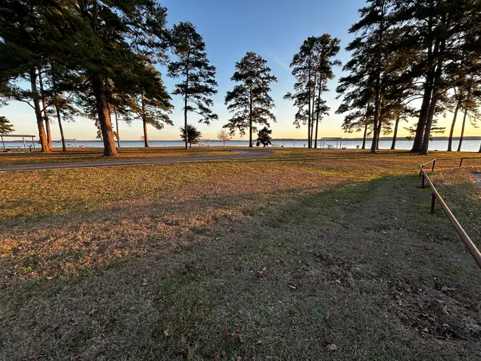
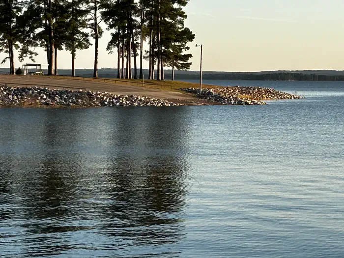
Rayburn Park lies on the north shore of Sam Rayburn Reservoir, a popular family destination with boating and fishing and access to hunting less than a mile away. Sam Rayburn Reservoir and the surrounding Angelina National Forest provide a wintering habitat for the bald eagle. During the winter months, forest visitors may see the bald eagle soaring over the lake, perched on a flooded snag or in a tall pine along the shoreline.Recreation
Sam Rayburn Reservoir is well-known for its largemouth bass, with numerous tournaments hosted here each year. Among the most impressive catches ever recorded is a 74-pound Flathead catfish.The lake is also popular for jet skiing, water skiing, swimming and birding. It's used as a feeding and resting grounds for migratory birds on their path to the Gulf Coast. A resident population of wood ducks remains in the forest year-round.
Facilities
Rayburn park is open year-round and features 16 campsites with water and 50 amp electric hookups. The park also offers 9 non-electric sites, one of which is a group site. Two boat ramps, a swim beach, and a playground are also available within the campground.
Natural Features
At 114,000 surface acres, Sam Rayburn is the largest man-made lake that is completely within the boundaries of Texas. The reservoir is fed by the Angelina River, a major tributary of the Neches River.The piney woods region boasts native flora like orchids, insect-eating plants and scores of animal species.
Nearby Attractions
From the eastern edge of the lake, hikers can embark on a 28-mile trail that heads east to the Toledo Bend Reservoir.The facts
- 25 bookable sites
- 27 sites in total, including non-bookable
- Vehicles up to 99 ft
- Up to 20 people per site
- Loops: LOOB, LOOC
Site types
- 16 Standard Electric
- 5 Tent Only Nonelectric
- 3 Standard Nonelectric
- 2 Management
- 1 Group Standard Nonelectric
Amenities
- Electric hookups
- Water hookups
- Campfires allowed
- Fire pits
- Picnic tables
- Shade
- Pets allowed
Not recorded upstream: sewer hookups, grills.
27 campsites at Rayburn
Check-in 3:00 PM · Check-out 2:00 PM
| Site | Loop | Type | Entry | Surface | Max rig | People | |
|---|---|---|---|---|---|---|---|
| 33 | LOOB | Standard Electric | Back In | Paved | 65 ft | 10 | 🐾 |
| 34 | LOOB | Standard Electric | Back In | Paved | 65 ft | 10 | 🐾 |
| 35 | LOOB | Standard Electric | Back In | Paved | 70 ft | 10 | 🐾 |
| 36 | LOOB | Standard Electric | Back In | Paved | 70 ft | 10 | 🐾 |
| 37 | LOOB | Standard Electric | Back In | Paved | 70 ft | 10 | 🐾 |
| 38 | LOOB | Standard Electric | Back In | Paved | 70 ft | 10 | 🐾 |
| 39 | LOOB | Standard Electric | Back In | Paved | 70 ft | 10 | 🐾 |
| 40 | LOOB | Standard Electric | Back In | Paved | 70 ft | 10 | 🐾 |
| 41 | LOOB | Standard Electric | Back In | Paved | 70 ft | 10 | 🐾 |
| 43 | LOOB | Standard Electric | Back In | Paved | 70 ft | 10 | 🐾 |
| 44 | LOOB | Standard Electric | Back In | Paved | 70 ft | 10 | 🐾 |
| 45 | LOOB | Standard Electric | Back In | Paved | 70 ft | 10 | 🐾 |
| 46 | LOOB | Standard Electric | Back In | Paved | 70 ft | 10 | 🐾 |
| 47 | LOOB | Standard Electric | Back In | Paved | 70 ft | 10 | 🐾 |
| 48 | LOOB | Standard Electric | Back In | Paved | 70 ft | 10 | 🐾 |
| 49 | LOOB | Standard Electric | Back In | Paved | 99 ft | 10 | 🐾 |
| 55 | LOOC | Management | — | — | 20 ft | 10 | 🐾 |
| 56 | LOOC | Management | — | Paved | 36 ft | 10 | 🐾 |
| 57 | LOOC | Standard Nonelectric | Back In | Paved | 38 ft | 10 | 🐾 |
| 58 | LOOC | Standard Nonelectric | Back In | Paved | 36 ft | 10 | 🐾 |
| 59 | LOOC | Standard Nonelectric | Back In | Paved | 33 ft | 10 | 🐾 |
| 60 | LOOC | Group Standard Nonelectric | Back In | Paved | 39 ft | 20 | 🐾 |
| 61 | LOOC | Tent Only Nonelectric | — | — | 25 ft | 10 | 🐾 |
| 62 | LOOC | Tent Only Nonelectric | — | — | 15 ft | 10 | 🐾 |
| 63 | LOOC | Tent Only Nonelectric | — | — | 20 ft | 10 | 🐾 |
| 64 | LOOC | Tent Only Nonelectric | — | — | 20 ft | 10 | 🐾 |
| 65 | LOOC | Tent Only Nonelectric | — | — | 15 ft | 10 | 🐾 |
Getting there
31.10667, -94.10722 · 31°6'24.0"N 94°6'26.0"W
Typical weather
Typically 95°F in Aug, down to 60°F in Jan.
| Jan | Feb | Mar | Apr | May | Jun | Jul | Aug | Sep | Oct | Nov | Dec | |
|---|---|---|---|---|---|---|---|---|---|---|---|---|
| High °F | 60 | 64 | 71 | 78 | 85 | 91 | 94 | 95 | 89 | 81 | 70 | 62 |
| Low °F | 41 | 45 | 51 | 58 | 66 | 73 | 75 | 74 | 70 | 59 | 50 | 43 |
| Precip in | 5.6 | 4.8 | 5.4 | 4.6 | 4.5 | 5.5 | 3.5 | 5.0 | 4.4 | 5.2 | 5.3 | 6.1 |
1991–2020 averages from the nearest NOAA station, 3.1 mi away — not measured at the facility itself, and elevation can make a real difference over that distance.
Map
More photos
Member photos
Common questions about Rayburn
- Can you reserve a site at Rayburn?
- Yes, Rayburn is reservable through Recreation.gov.
- How many campsites does Rayburn have?
- 27 sites in total, of which 25 can be booked.
- What is the maximum RV length at Rayburn?
- 99 ft. That is the longest vehicle the sites here are recorded as taking; individual sites may be shorter.
- Are pets allowed at Rayburn?
- Yes, pets are allowed at Rayburn.
- Does Rayburn have hookups?
- Electric, Water.
- Are campfires allowed at Rayburn?
- Campfires are allowed at Rayburn. Check for a current fire restriction before you go.
Camping near Rayburn
- Ebenezer Park 2.7 mi · Campground · we watch it
- Twin Dikes 3.7 mi · Campground · we watch it
- San Augustine 6.6 mi · Campground · we watch it
- Mill Creek (Texas) 6.7 mi · Campground · we watch it
- Caney Creek 9.1 mi · Campground · we watch it
- Boykin Springs Pavilion 10.2 mi · Campground · we watch it
- Boykin Springs Camping 10.6 mi · Campground · we watch it
- Magnolia Ridge 18.3 mi · Campground · we watch it
- Sandy Creek 20.8 mi · Campground · we watch it
- National Forests and Grasslands in Texas Day Use 10.4 mi · Activity pass
- Boykin Springs: (936) 897-1068 10.6 mi · Campground
- ANGELINA (Sam Rayburn Reservoir Area) 936-897-1068 13 mi · Facility
Contact
- Phone 409-384-5716
- Book Recreation.gov
Recreation.gov last updated this record on 2026-02-25.
Facility information and photographs from Recreation.gov (RIDB). SpotOpened is not affiliated with Recreation.gov or any federal agency.
Comments