Longhorn
Campground · Texas · 1 bookable site ·
Managed by the US Army Corps of Engineers
Benbrook Recreation Area (REC) · Open Access
- 1
- Bookable site
- up to 100
- People per site
- 758 ft
- Elevation
Overview
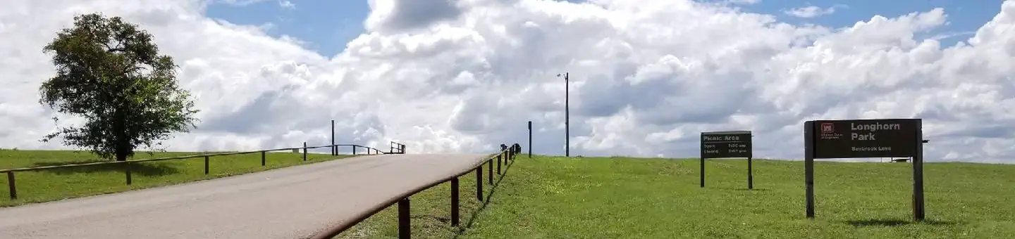
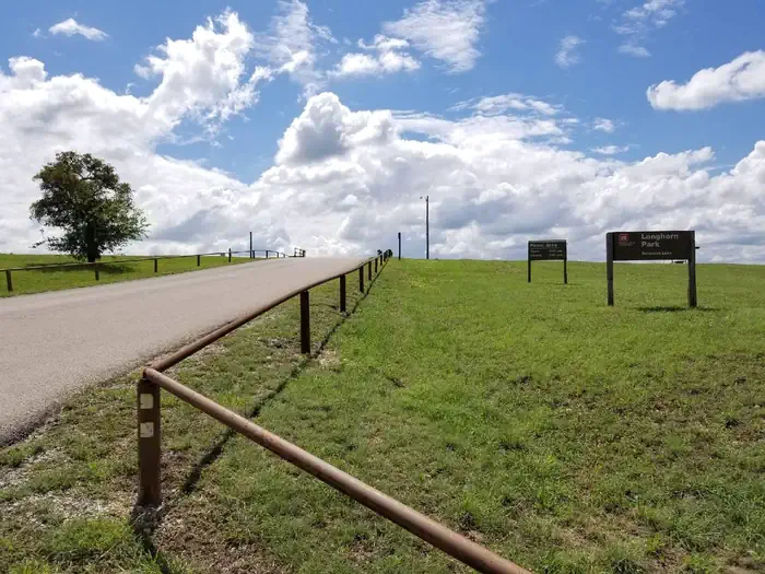
Longhorn Park Picnic Area overlooks Benbrook Lake & Dam in north-central Texas, easiley accessible from the Chisholm Trail Parkway and southwest Fort Worth. Along with a scenic overlook, a large group pavilion is available as well as picnicking, fishing and boat launching.Recreation
The large group pavilion is popular for family and group activitries. Individual picnic sites and boat launching is also available in the park. The nearby spillway cut for the dam is a popular fossil-hunting locaiotn where visitors can search rof Cretaceous clams and coral remnants form 85 million yeats ago.Facilities
The large picnic shelter can accommodate up to 100 guests, with restrooms, available parking, access to trails and lake shoreline. There is no electricity on site.
Natural Features
Longhorn Park is on the high rocky bluffs of the Clear Fork, overlooking the southeast end of the dam.Nearby Attractions
City lease areas on the lake's north end offer golf courses, ball fields, tennis & volleyball courts, children's play areas, trail access and other facilities. Fort Worth's renowned Cultural & Museum District, Stockyards National Historic District, Botanical Gardens, Zoo, Bass Performance Hall, and downtown Sundance Square, are all only a short drive.The facts
- 1 bookable site
- 1 site for day use only
- Up to 100 people per site
- Loops: LONGHORN GROUP SHELT
Site types
- 1 Group Shelter Electric
Amenities
- Electric hookups
- Water hookups
- Campfires allowed
- Picnic tables
- Shade
- Pets allowed
Not recorded upstream: sewer hookups, fire pits, grills.
1 campsite at Longhorn
Check-in 7:30 AM · Check-out 9:00 PM
| Site | Loop | Type | Entry | Surface | Max rig | People | |
|---|---|---|---|---|---|---|---|
| 1 | LONGHORN GROUP SHELT | Group Shelter Electric | — | Paved | — | 100 | 🐾 |
Getting there
32.65037, -97.44639 · 32°39'1.3"N 97°26'47.0"W
Typical weather
Typically 98°F in Aug, down to 59°F in Jan.
| Jan | Feb | Mar | Apr | May | Jun | Jul | Aug | Sep | Oct | Nov | Dec | |
|---|---|---|---|---|---|---|---|---|---|---|---|---|
| High °F | 59 | 63 | 70 | 78 | 85 | 93 | 97 | 98 | 90 | 81 | 69 | 60 |
| Low °F | 33 | 37 | 45 | 52 | 62 | 70 | 73 | 73 | 65 | 54 | 44 | 36 |
| Precip in | 2.1 | 2.4 | 3.2 | 3.2 | 4.5 | 3.5 | 1.9 | 2.5 | 3.4 | 4.3 | 2.7 | 2.4 |
1991–2020 averages from the nearest NOAA station, 0.2 mi away — not measured at the facility itself, and elevation can make a real difference over that distance.
Map
More photos
Member photos
Common questions about Longhorn
- Can you reserve a site at Longhorn?
- Yes, Longhorn is reservable through Recreation.gov.
- How many campsites does Longhorn have?
- 1 site.
- Are pets allowed at Longhorn?
- Yes, pets are allowed at Longhorn.
- Does Longhorn have hookups?
- Electric, Water.
- Are campfires allowed at Longhorn?
- Campfires are allowed at Longhorn. Check for a current fire restriction before you go.
Camping near Longhorn
- North Holiday Park 1.6 mi · Campground · we watch it
- Rocky Creek Park (Benbrook Lake) 3.1 mi · Campground · we watch it
- Holiday (Texas) 3.7 mi · Campground · we watch it
- Mustang 4.4 mi · Campground · we watch it
- Bear Creek 4.7 mi · Campground · we watch it
- Murrell Park 31.7 mi · Campground · we watch it
- Kimball Bend Park 36.5 mi · Campground · we watch it
- Hickory Creek (TX) 39.1 mi · Campground · we watch it
- Plowman Creek 40.2 mi · Campground · we watch it
- The Ashton Hotel 9.8 mi · Facility
- Hilton Fort Worth 10.1 mi · Facility
- Bureau of Engraving and Printing: Fort Worth 18.2 mi · Federal
Contact
- Phone 817-292-2400
- Book Recreation.gov
Recreation.gov last updated this record on 2026-05-21.
Facility information and photographs from Recreation.gov (RIDB). SpotOpened is not affiliated with Recreation.gov or any federal agency.
Comments