Shenango Lake Mahaney Spruce Cove Trails End Rolling Meadows Skyline Picnic Shelters
Campground · Pennsylvania · 4 bookable sites ·
Managed by the US Army Corps of Engineers
- 4
- Bookable sites
- up to 64
- People per site
- 967 ft
- Elevation
Overview
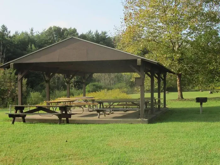
Situated within the suburban Shenango Valley, Shenango Lake provides an attractive setting where visitors can spend the day picnicking, camping, fishing, boating, or enjoying nature's beauty at one of the lake's many recreation areas. The Mahaney Rec Area Day Use is located off of Kelly Road in Hermitage, PA, adjacent to the Shenango Dam, and provides four covered group picnic shelters (Trails End, Spruce Cove, Skyline and Rolling Meadows Shelters) with electric as well as a disc golf course and access to the lake to go boating and fishing.Recreation
Come explore and enjoy the outdoors! The lake provides a variety of recreational opportunities, including, but not limited to, picnicking, camping, fishing, boating, swimming, hiking, viewing wildlife and hunting. Picnickers can rent, for a fee, one of our seven picnic pavilions located within four different recreation areas. Boating is a popular activity where areas are provided on the lake for unlimited horsepower operation, as well as restricted horsepower and minimum wake operation. Many fishing enthusiasts are attracted to the waters of Shenango for the crappie, bass, walleye, catfish and muskellunge that inhabit the river, lake and tailwaters. Campers visiting the lake will enjoy spacious facilities at our 330-site campground.Facilities
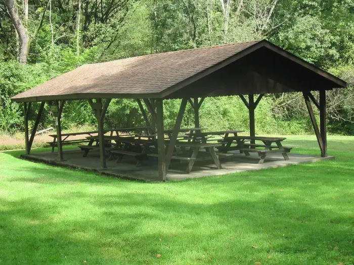
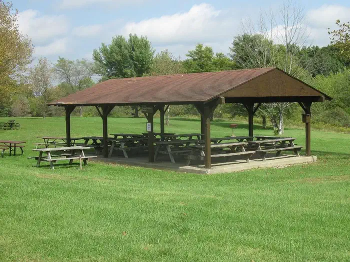
The Mahaney Rec Area Day Use offers four group picnic shelters (Trails End, Spruce Cove, Skyline and Rolling Meadows Shelters) that can each accommodate between 42-56 people, depending upon the use of 6-8 people per table. Electric is available at the shelters with a paid reservation only, grills are available on site, and flush toilets and drinking water are provided at the restrooms adjacent to the shelters (seasonal). A children's playground is located next to the Spruce Cove shelter, and the interpretive Seth Myers hiking trail is located near the Trails End shelter. Swing sets and a large soccer field are located on site near Skyline and Rolling Meadows Shelters. This area boasts an 18-hole disc golf course. The Mahaney Outflow Rec Area is just a short distance away featuring the Shenango Dam and Outflow, a concrete gravity dam as well as great fishing at the outflow and river.Natural Features
Shenango Lake stretches 11 miles up its namesake river, covering over 11,000 acres. The shore is lined with a northern hardwood forest of shady and colorful trees such as black cherry, beech, maple, and hemlock. Deer, turkey and other small game animals are plentiful, with excellent opportunities to observe osprey and eagles in the area.
Nearby Attractions
The Shenango Water Trail provides 7.5 miles of scenic river corridor for paddlers, with three access points between Kidds Mill Park and Big Bend. Life jackets must be worn on all canoes and kayaks. The historic Kidds Mill Covered Bridge features the unique "Smith-Truss" design from the 1800s. Remnants of the Erie Extension Canal can be found nearby in Sharpsville below the Shenango Dam. The Shenango and Mahaney Recreations Areas feature restoration chestnut tree orchards that are managed through a partnership with the American Chestnut Foundation for research and education, with the goal of developing blight resistant American chestnut trees.
The facts
- 4 bookable sites
- 4 sites for day use only
- Up to 64 people per site
- Loops: Shenango Lake Mahaney Spruce Cove Trails End Rolling Meadows Skyline Picnic Shelters
Site types
- 4 Group Shelter Electric
Amenities
- Electric hookups
- Picnic tables
Not recorded upstream: water hookups, sewer hookups, campfires allowed, fire pits, grills, shade, pets allowed.
4 campsites at Shenango Lake Mahaney Spruce Cove Trails End Rolling Meadows Skyline Picnic Shelters
Check-in 8:00 AM · Check-out 9:00 PM
| Site | Loop | Type | Entry | Surface | Max rig | People | |
|---|---|---|---|---|---|---|---|
| Rolling Meadows Shelter | Shenango Lake Mahaney Spruce Cove Trails End Rolling Meadows Skyline Picnic Shelters | Group Shelter Electric | — | — | — | 64 | |
| Skyline Shelter | Shenango Lake Mahaney Spruce Cove Trails End Rolling Meadows Skyline Picnic Shelters | Group Shelter Electric | — | — | — | 64 | |
| Spruce Cove Shelter | Shenango Lake Mahaney Spruce Cove Trails End Rolling Meadows Skyline Picnic Shelters | Group Shelter Electric | — | — | — | 64 | |
| Trails End Shelter | Shenango Lake Mahaney Spruce Cove Trails End Rolling Meadows Skyline Picnic Shelters | Group Shelter Electric | — | — | — | 64 |
Getting there
Take Exit 4B off of I-80 and follow Route 18 north for approximately 5 miles. Make a left at the stoplight onto Lamor Road (the intersection with Dollar General and D'Onofrio's Food Center at the corners). Stay straight on that road for 2 miles; Lamor Road will eventually turn into South Walnut Street. Make a right onto East High Street. Continue on this road where you will cross a one-lane steel bridge. Just up the hill from that, you will come to a "y" in the road. Stay straight at this intersection and this will bring you to the Mahaney Rec Area. Veer to the left upon entering the area and the Trails End & Spruce Cove picnic shelters and parking lots will be about a mile down on the right. After passing those shelters, you will come to a stop sign. At this stop sign, make a left and follow that road to the "Upper" Mahaney Rec Area where you will find the Skyline & Rolling Meadows picnic shelters. Each shelter is labeled. If you would have gone straight at that stop sign, that will bring you down to the boat launch and lake.
41.26639, -80.46361 · 41°15'59.0"N 80°27'49.0"W
Typical weather
Typically 83°F in Jul, down to 34°F in Jan.
| Jan | Feb | Mar | Apr | May | Jun | Jul | Aug | Sep | Oct | Nov | Dec | |
|---|---|---|---|---|---|---|---|---|---|---|---|---|
| High °F | 34 | 37 | 47 | 60 | 71 | 79 | 83 | 81 | 74 | 62 | 50 | 39 |
| Low °F | 19 | 21 | 28 | 38 | 48 | 56 | 60 | 59 | 52 | 42 | 33 | 26 |
| Precip in | 3.0 | 2.5 | 3.2 | 3.8 | 3.7 | 3.9 | 4.3 | 3.5 | 3.8 | 3.3 | 3.0 | 3.2 |
1991–2020 averages from the nearest NOAA station, 11 mi away — not measured at the facility itself, and elevation can make a real difference over that distance.
Map
More photos
Member photos
Common questions about Shenango Lake Mahaney Spruce Cove Trails End Rolling Meadows Skyline Picnic Shelters
- Can you reserve a site at Shenango Lake Mahaney Spruce Cove Trails End Rolling Meadows Skyline Picnic Shelters?
- Yes, Shenango Lake Mahaney Spruce Cove Trails End Rolling Meadows Skyline Picnic Shelters is reservable through Recreation.gov.
- How many campsites does Shenango Lake Mahaney Spruce Cove Trails End Rolling Meadows Skyline Picnic Shelters have?
- 4 sites.
- Does Shenango Lake Mahaney Spruce Cove Trails End Rolling Meadows Skyline Picnic Shelters have hookups?
- Electric.
Camping near Shenango Lake Mahaney Spruce Cove Trails End Rolling Meadows Skyline Picnic Shelters
- Shenango River Lake Dam Tours 0.1 mi · Tickets · we watch it
- Shenango Lake Mahaney Outflow Riverview Picnic Shelter 0.2 mi · Campground · we watch it
- Shenango Rec Area Campground 2 mi · Campground · we watch it
- Shenango Lake Clark Picnic Shelter 2.3 mi · Campground · we watch it
- Shenango Lake Shenango Lakeside Picnic Shelter 2.5 mi · Campground · we watch it
- Berlin Lake Dam Tours 31.9 mi · Tickets · we watch it
- Mill Creek Day Use 32.9 mi · Campground · we watch it
- Mill Creek Camping (Berlin Lake) 33.1 mi · Campground · we watch it
- Woodcock Lake Park 35.2 mi · Campground · we watch it
- Overlook Recreation Area 35.7 mi · Campground · we watch it
- Tionesta Rec. Area Campground 54.7 mi · Campground · we watch it
- James A. Garfield National Historic Site Visitor Center 53.6 mi · Visitor Center
Contact
- Phone 724-646-1124
- Email christina.r.barker@usace.army.mil
- Book Recreation.gov
Recreation.gov last updated this record on 2026-02-25.
Facility information and photographs from Recreation.gov (RIDB). SpotOpened is not affiliated with Recreation.gov or any federal agency.
Comments