Berlin Lake Dam Tours
Tickets · Ohio ·
Managed by the US Army Corps of Engineers
Berlin Lake Wildlife Area (Wildlife Area) · Open Access
- 966 ft
- Elevation
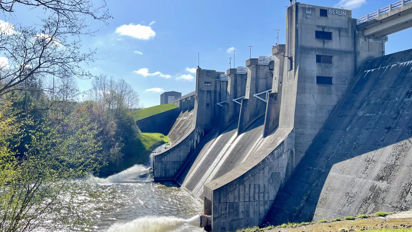
The Berlin Lake project is situated on the Mahoning River, where it covers 3,590 acres and offers 70 miles of shoreline. The lake is in Portage, Mahoning, and Stark counties. The Berlin Dam is a partially controlled concrete gravity type with a center spillway flanked by rolled earth filled abutments. The Dam is 96’ above the original streambed, stretches 5750’ in length, and was completed in 1943.
Getting there
From I-76, take Exit 54 and go south 5.5 miles on State Route 534 to U.S. Route 224 in Berlin Center. Turn right (west) onto U.S. Route 224 and go about 3 miles to Bonner Road. Turn right (north) on Bonner Road and go about 1 mile. The entrance of the Dam Day Use area is located on the right side of Bonner Road.
41.04630, -81.00265 · 41°2'46.7"N 81°0'9.5"W
Typical weather
| Jan | Feb | Mar | Apr | May | Jun | Jul | Aug | Sep | Oct | Nov | Dec | |
|---|---|---|---|---|---|---|---|---|---|---|---|---|
| High °F | — | — | — | — | — | — | — | — | — | — | — | — |
| Low °F | — | — | — | — | — | — | — | — | — | — | — | — |
| Precip in | 2.7 | 2.2 | 2.9 | 3.9 | 4.1 | 4.1 | 4.3 | 3.5 | 3.7 | 3.4 | 3.0 | 3.1 |
1991–2020 averages from the nearest NOAA station, 4.9 mi away — not measured at the facility itself, and elevation can make a real difference over that distance.
Map
More photos
Member photos
Common questions about Berlin Lake Dam Tours
- Can you reserve a site at Berlin Lake Dam Tours?
- Yes, Berlin Lake Dam Tours is reservable through Recreation.gov.
Camping near Berlin Lake Dam Tours
- Mill Creek Day Use 2.5 mi · Campground · we watch it
- Mill Creek Camping (Berlin Lake) 2.7 mi · Campground · we watch it
- Cuyahoga Valley National Park Picnic Shelters 29.3 mi · Campground · we watch it
- Shenango Lake Mahaney Outflow Riverview Picnic Shelter 31.8 mi · Campground · we watch it
- Shenango Lake Mahaney Spruce Cove Trails End Rolling Meadows Skyline Picnic Shelters 31.9 mi · Campground · we watch it
- Shenango River Lake Dam Tours 31.9 mi · Tickets · we watch it
- Shenango Rec Area Campground 33.8 mi · Campground · we watch it
- Shenango Lake Clark Picnic Shelter 34.2 mi · Campground · we watch it
- Visitor Center 26 mi · Visitor Center
- Archives of the History of American Psychology 27.1 mi · Facility
- Hunt House 31.5 mi · Facility
- Boston Mill Visitor Center 32.6 mi · Facility
Contact
- Phone 330-547-3781
- Book Recreation.gov
Recreation.gov last updated this record on 2026-02-25.
Facility information and photographs from Recreation.gov (RIDB). SpotOpened is not affiliated with Recreation.gov or any federal agency.
Comments