Rujada Day Use Picnic Area
Campground · Oregon · 2 bookable sites ·
Managed by the USDA Forest Service
Umpqua National Forest (NF) · Open Access
- 2
- Bookable sites
- up to 30
- People per site
- 1,212 ft
- Elevation
Overview
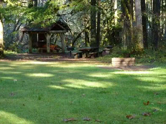
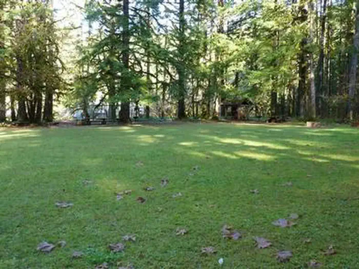
Rujada Day Use Picnic Area is set along the banks of Layng Creek, with a large, open grassy area amidst a scattering of Douglas fir. Rujada is a perfect setting for family reunions, parties or group getaways.Recreation
In addition to being a prime location for hiking and biking in summer and early fall. The large grassy field is perfect for group activities or sports, and a playground and horseshoe pit are also provided on-site.Hikers will enjoy a moderately challenging hike on Swordfern Trail, leaving from the historic Civilian Conservation Corps Campground Register booth, located in the Rujada Picnic Area. The trail parallels the south side of Layng Creek, traveling through a stand of second growth Douglas fir and lush swordfern understory, then climbs to an abandoned logging road. Eventually it loops back to the Rujada Picnic area, or continues on the logging road and back into the camping loop.
In autumn, visitors will be treated to the brilliant fall colors of the hardwood trees along Layng Creek.
Facilities
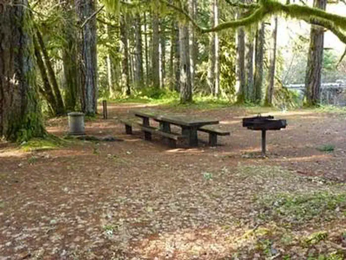
This day use area has two reservable picnic sites. Each site can accommodate up to 30 people, and groups of up to 60 may reserve both sites. The sites are equipped with picnic tables and grills. Flush toilets and drinking water are provided.Natural Features
Visitors to Umpqua National Forest are often taken aback by the unique landscapes of southwestern Oregon. Explosive geologic events have shaped the distinctive landscape on the nearly 1 million-acre forest, and provide spectacular scenery as well as an abundance of natural and cultural resources. The translation of the word, "Umpqua," meaning "thundering waters," defines the area. High mountain lakes, heart-stopping rapids, peaceful ponds and thundering waterfalls, including the 272-foot Watson Falls on the North Umpqua Highway, provide plenty of pastimes for visitors. Diverse ecosystems support a wide range of habitat for wildlife common to the area. From eagles and owls, to salamanders and salmon, these species, along with many others, depend on surrounding undeveloped wilderness, clean streams and diverse forests to live.Nearby Attractions
Nearby are three spectacular waterfall trails. Spirit Falls is a short 0.4-mile, more difficult hike to a 60’ waterfall. Moon Falls is an easy, 0.5-mile hike to a 125’ cascading waterfall. Pinard Falls is a 0.6-mile, more difficult hike to a 105’ waterfall. All three hikes are within 10 miles of the campground and can be done within a single day. Visitors enjoy taking a picnic lunch and eating at the base of Moon Falls at a picnic table made and installed by a modern day Conservation Corps crew.Contact Info
For facility specific information, please call (760) 932-7092.Charges & Cancellations
Reservation sites will be held until check out time (11am) the day following your arrival date. Sites must be occupied by the checkout time of that following day to hold a reservation or the site will be forfeited and released to other guests. Once your reservation start date has begun, neither the Recreation.gov Contact Center nor the Campground Manager will be able to modify your reservation.
The facts
- 2 bookable sites
- 2 sites for day use only
- Up to 30 people per site
- Loops: RUJADA DAY USE PICNIC AREA
Site types
- 2 Group Standard Area Nonelectric
Amenities
- Fire pits
- Picnic tables
- Grills
- Shade
- Pets allowed
Not recorded upstream: electric hookups, water hookups, sewer hookups, campfires allowed.
2 campsites at Rujada Day Use Picnic Area
Check-in 8:00 AM · Check-out 9:00 PM
| Site | Loop | Type | Entry | Surface | Water | Max rig | People | |
|---|---|---|---|---|---|---|---|---|
| Area 1 | RUJADA DAY USE PICNIC AREA | Group Standard Area Nonelectric | Back In | Gravel | Riverfront | — | 30 | 🐾 |
| Area 2 | RUJADA DAY USE PICNIC AREA | Group Standard Area Nonelectric | Back In | Gravel | Riverfront | — | 30 | 🐾 |
Getting there
43.70658, -122.74255 · 43°42'23.7"N 122°44'33.2"W
Typical weather
| Jan | Feb | Mar | Apr | May | Jun | Jul | Aug | Sep | Oct | Nov | Dec | |
|---|---|---|---|---|---|---|---|---|---|---|---|---|
| High °F | — | — | — | — | — | — | — | — | — | — | — | — |
| Low °F | — | — | — | — | — | — | — | — | — | — | — | — |
| Precip in | 10.0 | 7.8 | 9.0 | 7.7 | 5.5 | 3.3 | 0.9 | 0.9 | 2.7 | 6.2 | 10.9 | 12.3 |
1991–2020 averages from the nearest NOAA station, 9 mi away — not measured at the facility itself, and elevation can make a real difference over that distance.
Map
More photos
Member photos
Common questions about Rujada Day Use Picnic Area
- Can you reserve a site at Rujada Day Use Picnic Area?
- Yes, Rujada Day Use Picnic Area is reservable through Recreation.gov.
- How many campsites does Rujada Day Use Picnic Area have?
- 2 sites.
- Are pets allowed at Rujada Day Use Picnic Area?
- Yes, pets are allowed at Rujada Day Use Picnic Area.
Camping near Rujada Day Use Picnic Area
- Rujada Campground less than 0.1 mi · Campground · we watch it
- Sharps Creek Recreation Site 4.3 mi · Campground · we watch it
- Lund Park Campground 5 mi · Campground · we watch it
- Black Canyon Campground (Willamette National Forest, OR) 10 mi · Campground · we watch it
- Musick Guard Station 10 mi · Campground · we watch it
- Cedar Creek Campground 3 mi · Campground
- Hobo Camp Campground 5.5 mi · Campground
- Mineral Camp Campground 8.6 mi · Campground
- Fairview Peak Lookout 9.4 mi · Campground
- Middle Fork Ranger District (Hwy 58) 11 mi · Facility
- Black Canyon Campground 11.2 mi · Campground
- Eugene to Crest Trailhead #1 11.8 mi · Facility
Contact
- Phone 541-767-5000
- Email joy@westrecllc.com
- Book Recreation.gov
Recreation.gov last updated this record on 2026-03-09.
Facility information and photographs from Recreation.gov (RIDB). SpotOpened is not affiliated with Recreation.gov or any federal agency.
Comments