Castle Rock Campground
Campground · Oregon ·
Managed by the Bureau of Land Management
Prineville Deschutes Field Office (Bureau of Land Management OR) · Open Access
- 2,981 ft
- Elevation
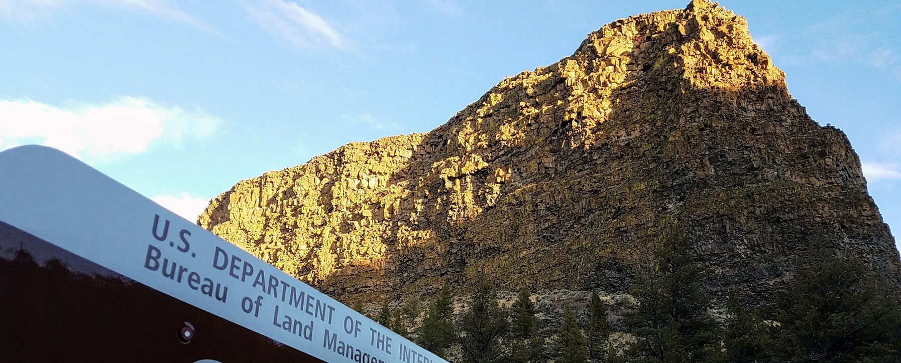
Located south of Prineville, Oregon, this six-site campground offers year-round camping and Crooked River access along the Lower Crooked Back Country Byway. Castle Rock looms above its namesake campground on the Chimney Rock section of the Crooked Wild and Scenic River. An ADA-accessible vault toilet is onsite.
Know Before You Go
- Open year-round on a first-come, first-served basis; no potable water available.
- Cell phone service is not available in the campground.
- Watch for bicyclists: the section of State Highway 27 between Prineville and Bowman dam is a state scenic bikeway
Point of Interest
Castle Rock Campground is the first in a series of twelve Bureau of Land Management recreation sites along the Crooked Wild and Scenic River, south of Prineville, Oregon. Eight additional campgrounds, two day-use areas and a trailhead offer ample access to camping, fishing, hiking and photography.
Getting there
From Prineville, Oregon: Drive 12.4 miles south on State Highway 27; the campground will be on your right.
44.15814, -120.83395 · 44°9'29.3"N 120°50'2.2"W
Typical weather
Typically 87°F in Jul, down to 42°F in Dec.
| Jan | Feb | Mar | Apr | May | Jun | Jul | Aug | Sep | Oct | Nov | Dec | |
|---|---|---|---|---|---|---|---|---|---|---|---|---|
| High °F | 43 | 48 | 55 | 60 | 69 | 76 | 87 | 86 | 79 | 65 | 51 | 42 |
| Low °F | 25 | 26 | 29 | 33 | 40 | 45 | 49 | 48 | 42 | 34 | 29 | 24 |
| Precip in | 1.1 | 0.8 | 0.9 | 0.8 | 1.4 | 0.8 | 0.4 | 0.4 | 0.3 | 0.9 | 1.2 | 1.3 |
1991–2020 averages from the nearest NOAA station, 9.8 mi away — not measured at the facility itself, and elevation can make a real difference over that distance.
Map
Fees and stay limits
$8 per night; $2 per extra vehicle (tow vehicles excluded) with a maximum of two vehicles allowed per site.
Stay limit: 14 Days
From Recreation.gov, which is not always current. The operator's own page is the authority on what you will be charged.
Member photos
Common questions about Castle Rock Campground
- Can you reserve a site at Castle Rock Campground?
- No. Castle Rock Campground is not reservable through Recreation.gov, so sites are first-come, first-served or booked elsewhere.
- How long can you stay at Castle Rock Campground?
- 14 Days
Camping near Castle Rock Campground
- Stillwater Campground 0.9 mi · Campground
- Greenwood Day-Use Area 1.6 mi · Facility
- Chimney Rock Campground 1.9 mi · Campground
- Chimney Rock Trail 1.9 mi · Facility
- Palisades Campground 1.9 mi · Facility
- Lone Pine Campground 1.9 mi · Facility
- Upper Lone Pine Day-Use Area 2 mi · Facility
- Cobble Rock Campground 2.4 mi · Facility
- Post Pile Campground 2.6 mi · Facility
- Poison Butte Campground 3.1 mi · Facility
- Big Bend Campground (Crooked River) 3.7 mi · Facility
- Reservoir Road Off Highway Vehicle Play Area 5.3 mi · Facility
Contact
- Phone 541-416-6700
- Email BLM_OR_PR_Mail@blm.gov
- Info Recreation.gov
Recreation.gov last updated this record on 2026-04-09.
Facility information and photographs from Recreation.gov (RIDB). SpotOpened is not affiliated with Recreation.gov or any federal agency.
Comments