Fire Island National Seashore Permits
Permit · New York ·
Managed by the National Park Service
Fire Island National Seashore (National Seashore) · Open Access
- 7 ft
- Elevation
Overview:
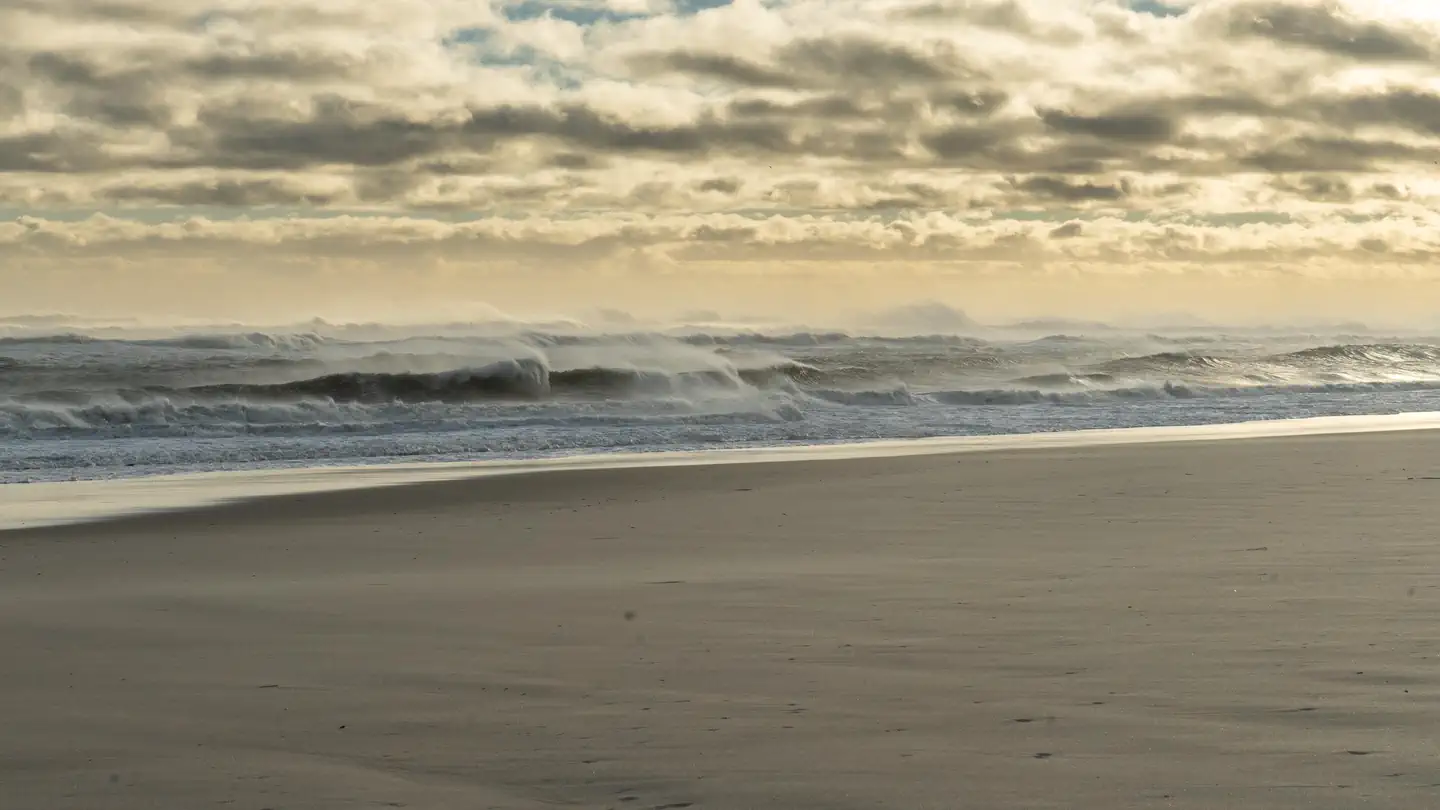
- Under the stars, near the sound of the surf, waking to a chorus of song birds, camping on Fire Island within the Otis Pike Fire Island High Dune Wilderness can be a memorable experience. This wilderness camping experience is available by permit only.
Two backcountry camping zones are available within the Otis Pike Fire Island High Dune Wilderness, the eastern and western zones.
From March 15 to Labor Day (when seasonal driving restrictions are implemented), backcountry campsites may be selected on the beach in front of the eastern zone or western zone, in areas where there are no restrictions or closures (e.g., for the protection of nesting shorebirds or other protected species, or where beach conditions are not suitable). When seasonal driving restrictions are not in place, from early September through mid-March, campers must select campsites behind the dunes in wilderness within either the eastern or western zone.
At least one member of each camping party must be 21 years of age or older in order to obtain a backcountry camping permit. There is a 3-night limit of stay for wilderness camping.
Access to wilderness/backcountry camping is through the western gateway to wilderness, Watch Hill.
Eastern Zone: Maximum number of permitted campers is 12 per night with a maximum number of four campers allowed in each site. Access to the Eastern Zone is on foot from Watch Hill, a 4 to 5.5 miles walk.
Western Zone: Maximum number of permitted campers is 24 per night with a maximum number of eight campers allowed in each site.
Getting there
For Western Zone: Off of the exit 52 from Sunrise Highway (SR27) travel south on Waverly Ave. Bear left at the traffic circle to head east and cross Main Street.
The Ferry termianl is 1/8 mile after crossing trains. A ferry to Watch Hill is required to access. Ferrys are seasonal.
40.69972, -72.96287 · 40°41'59.0"N 72°57'46.3"W
Typical weather
Typically 80°F in Aug, down to 39°F in Jan.
| Jan | Feb | Mar | Apr | May | Jun | Jul | Aug | Sep | Oct | Nov | Dec | |
|---|---|---|---|---|---|---|---|---|---|---|---|---|
| High °F | 39 | 40 | 46 | 56 | 64 | 74 | 80 | 80 | 73 | 63 | 53 | 44 |
| Low °F | 26 | 27 | 33 | 43 | 52 | 63 | 70 | 69 | 61 | 50 | 40 | 32 |
| Precip in | 3.5 | 4.6 | 4.4 | 3.8 | 3.5 | 3.7 | 4.7 | 5.8 | 4.3 | 3.6 | 3.0 | 4.9 |
1991–2020 averages from the nearest NOAA station, 6.9 mi away — not measured at the facility itself, and elevation can make a real difference over that distance.
Map
Ways in
Showing 3 of 3.
- Eastern Zone — Entry Point · New York
- Watch Hill — Entry Point · New York
- Western Zone — Entry Point · New York
More photos
Member photos
Common questions about Fire Island National Seashore Permits
- Can you reserve a site at Fire Island National Seashore Permits?
- Yes, Fire Island National Seashore Permits is reservable through Recreation.gov.
Camping near Fire Island National Seashore Permits
- Watch Hill Bayview House 1.6 mi · Campground · we watch it
- The Bayberry Dunes House 1.6 mi · Campground · we watch it
- The Cottage at Sailors Haven 7.8 mi · Campground · we watch it
- Sagamore Hill National Historic Site Tours 30.8 mi · Tickets · we watch it
- Jacob Riis Park Daily Beach Parking 38.4 mi · Timed entry · we watch it
- Watch Hill Campground 1.4 mi · Campground
- Watch Hill Visitor Center 1.5 mi · Facility
- Wilderness Visitor Center 5.5 mi · Facility
- Sailors Haven Visitor Center 8 mi · Facility
- William Floyd Estate 8.6 mi · Facility
- Fire Island Lighthouse 14.2 mi · Facility
- Oheka Castle 26.7 mi · Facility
Contact
- Phone 631-687-4750
- Email FIIS_Information@nps.gov
- Book Recreation.gov
Recreation.gov last updated this record on 2026-02-25.
Facility information and photographs from Recreation.gov (RIDB). SpotOpened is not affiliated with Recreation.gov or any federal agency.
Comments