Coal Mine
Campground · New Mexico · 15 bookable sites ·
Managed by the USDA Forest Service
Cibola National Forest (NF) · Open Access
- 15
- Bookable sites
- 45 ft
- Max rig length
- up to 10
- People per site
- 7,456 ft
- Elevation
Overview
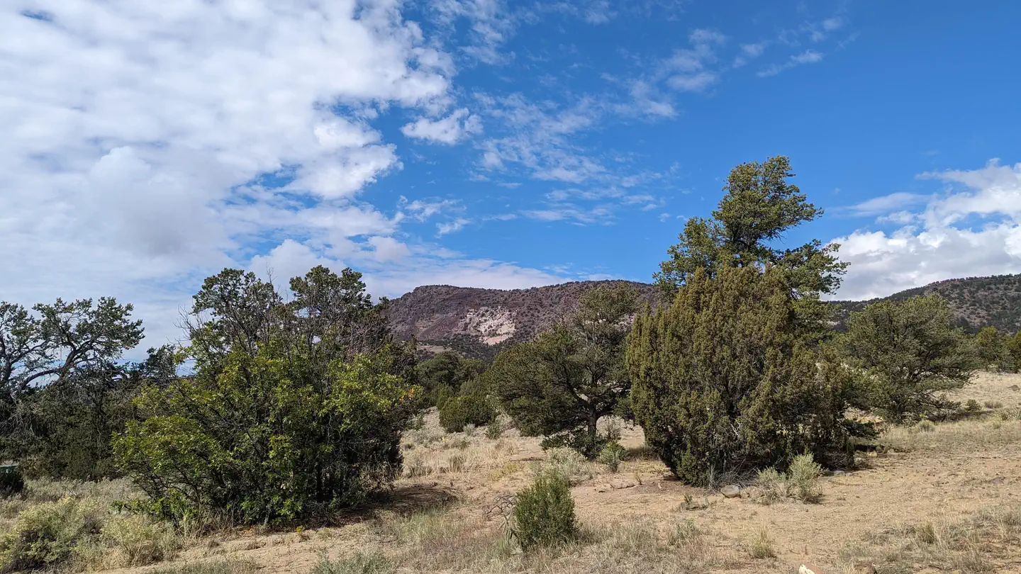
Coal Mine Campground is situated in the upper portion of the Cibola National Forest in west-central New Mexico. Visitors can enjoy hiking the Lobo Canyon Trail, as well as picnicking and scenic driving. This campground is located near the Continental Divide Trail as well as Mt. Taylor.
Recreation
The Lobo Canyon Trail begins in the campground and leads hikers access a network of trails in the area. Some trails are still under constuction.
Visitors also enjoy picnicking in the surrounding area.
Facilities
The campground offers more than a dozen sites for tent or RV camping. Each site can accommodate up to 10 people. Utility hookups are not available. Parking spurs are paved.
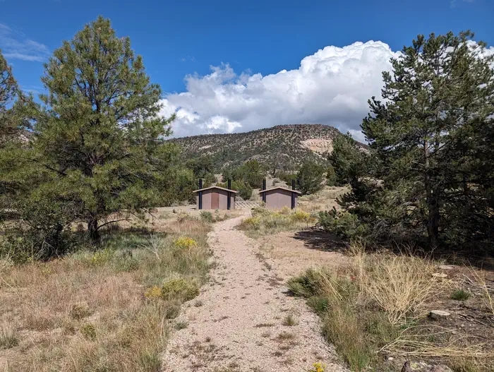
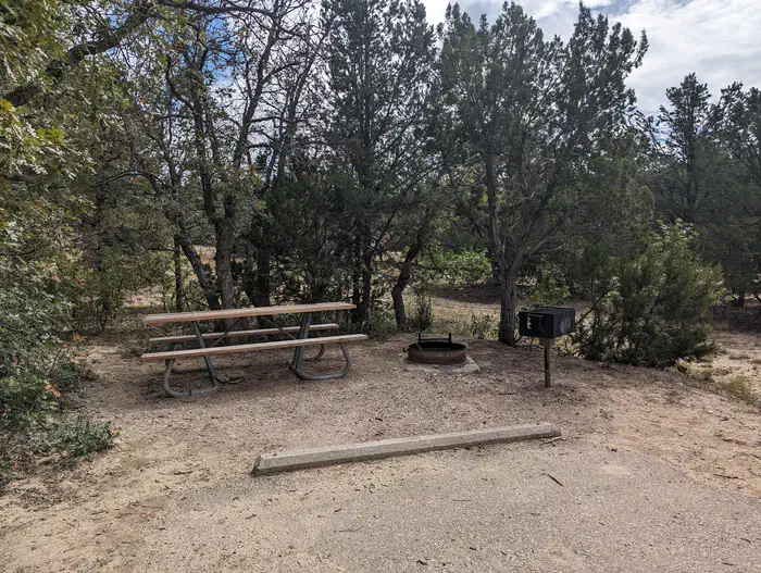
Each site is equipped with a table and campfire ring with grill. Accessible vault toilets are provided. Drinking water is not available in the campground; visitors must bring their own supply.
Natural Features
The campground is located northeast of the town of Grants at an elevation of 7,400 feet. It lies on the top of a hill, with campsites situated on gently sloping ground. A forest of mature pine, juniper and oak trees surrounds the campground.Nearby Attractions
The El Malpais National Monument and Conservation Area can be accessed from various points within a short drive of the campground. Its extensive, ancient lava flow landscape and other scenic features draw tourists year-round.
Points of interest within the monument and conservation area include the Northwest New Mexico Visitor Center, Sandstone Bluffs Overlook and La Ventana Natural Arch. A portion of the Continental Divide National Scenic Trail parallels the Zuni-Acoma Trail as it passes through the monument.
The city of Grants is about 12 miles from the campground, offering dining and lodging options. The city also boasts a mining museum with gem and mineral displays and a self-guided tour into an underground world.
Charges & Cancellations
A $10.00 service charge will apply if you change or cancel your reservation. Late cancellations are subject to additional fees. For full details see NRRS Reservation Policy.The facts
- Season: May 15 – October 15 — USDA Forest Service, Aug 24, 2026
- 15 bookable sites
- Vehicles up to 45 ft
- Up to 10 people per site
- Loops: COAL
Site types
- 15 RV Nonelectric
15 campsites at Coal Mine
Check-in 2:00 PM · Check-out 1:00 PM
| Site | Loop | Type | Entry | Surface | Max rig | People | |
|---|---|---|---|---|---|---|---|
| 001 | COAL | Rv Nonelectric | Back In | Gravel | 20 ft | 10 | |
| 002 | COAL | Rv Nonelectric | Back In | Gravel | 35 ft | 10 | |
| 003 | COAL | Rv Nonelectric | Back In | Gravel | 20 ft | 10 | |
| 004 | COAL | Rv Nonelectric | Back In | Gravel | 35 ft | 10 | |
| 005 | COAL | Rv Nonelectric | Back In | Gravel | 35 ft | 10 | |
| 006 | COAL | Rv Nonelectric | Pull Through | Gravel | 35 ft | 10 | |
| 007 | COAL | Rv Nonelectric | Pull Through | Gravel | 35 ft | 10 | |
| 008 | COAL | Rv Nonelectric | Pull Through | Gravel | 25 ft | 10 | |
| 009 | COAL | Rv Nonelectric | Back In | Gravel | 20 ft | 10 | |
| 010 | COAL | Rv Nonelectric | Back In | Gravel | 20 ft | 10 | |
| 011 | COAL | Rv Nonelectric | Back In | Gravel | 20 ft | 10 | |
| 012 | COAL | Rv Nonelectric | Back In | Gravel | 20 ft | 10 | |
| 013 | COAL | Rv Nonelectric | Pull Through | Gravel | 45 ft | 10 | |
| 014 | COAL | Rv Nonelectric | Back In | Gravel | 20 ft | 10 | |
| 015 | COAL | Rv Nonelectric | Pull Through | Gravel | 20 ft | 10 |
Getting there
35.23417, -107.70139 · 35°14'3.0"N 107°42'5.0"W
Typical weather
| Jan | Feb | Mar | Apr | May | Jun | Jul | Aug | Sep | Oct | Nov | Dec | |
|---|---|---|---|---|---|---|---|---|---|---|---|---|
| High °F | — | — | — | — | — | — | — | — | — | — | — | — |
| Low °F | — | — | — | — | — | — | — | — | — | — | — | — |
| Precip in | 0.5 | 0.6 | 0.6 | 0.9 | 0.6 | 0.5 | 1.6 | 2.5 | 1.3 | 1.0 | 0.6 | 0.7 |
1991–2020 averages from the nearest NOAA station, 10.3 mi away — not measured at the facility itself, and elevation can make a real difference over that distance.
Map
Fees and stay limits
Payment in full will be charged to you credit card upon completion of the reservation. A $10.00 non-refundable on line reservation fee may be charged for some facilities.
From Recreation.gov, which is not always current. The operator's own page is the authority on what you will be charged.
More photos
Member photos
Common questions about Coal Mine
- Can you reserve a site at Coal Mine?
- Yes, Coal Mine is reservable through Recreation.gov.
- How many campsites does Coal Mine have?
- 15 sites.
- What is the maximum RV length at Coal Mine?
- 45 ft. That is the longest vehicle the sites here are recorded as taking; individual sites may be shorter.
Also listed by
Coal Mine also appears in other federal recreation data. Facts below are matched by name and location, not confirmed by Coal Mine's operator.
USDA Forest Service — data as of Aug 24, 2026
- $10.00/site for overnight camping; $5.00/vehicle for day use (picnic/parking).
Restrictions:
- There is a 14-day stay limit for this campground; Trailers limited to less than 22 feet in length.
Camping near Coal Mine
- Gallo Campground 56.7 mi · Campground · we watch it
- Lobo Canyon Picnic ground 2.2 mi · Campground
- El Malpais Visitor Center 10.7 mi · Facility
- Joe Skeen Campground 21.4 mi · Campground
- Ojo Redondo Campground 23.6 mi · Facility
- El Morro Campground 38.4 mi · Campground
- El Morro Visitor Center 39 mi · Facility
- McGaffey Campground 47.3 mi · Campground
- Quaking Aspen Campground 48.8 mi · Campground
- Chaco Culture National Historical Park Visitor Center 56.2 mi · Facility
- Petroglyph Information Center 56.3 mi · Facility
Contact
- Phone 505-287-8833
- Book Recreation.gov
Recreation.gov last updated this record on 2026-02-25.
Facility information and photographs from Recreation.gov (RIDB). SpotOpened is not affiliated with Recreation.gov or any federal agency.
Comments