Amole Canyon Group Shelter
Campground · New Mexico · 1 bookable site ·
Managed by the USDA Forest Service
Carson National Forest (NF) · Open Access
- 1
- Bookable site
- 30 ft
- Max rig length
- up to 100
- People per site
- 1
- Accessible site
- 8,301 ft
- Elevation
Overview
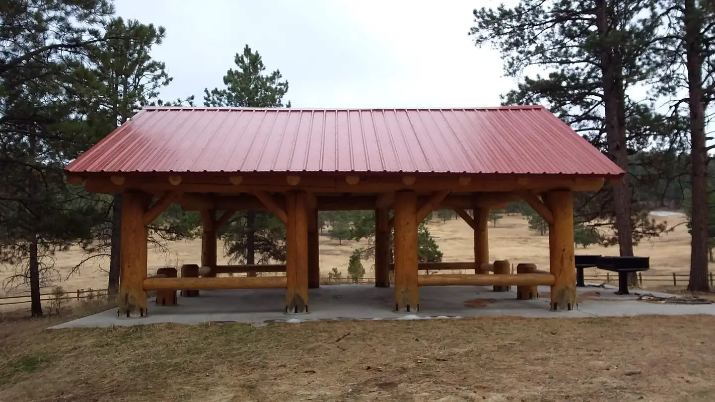
The Amole Group Shelter is located immediately adjacent to the popular wooded Amole Canyon Day Use Area at 8,400 feet in elevation. The group shelter accommodates up to 100 people with plenty of solitude since this is the only group facility in this location.
Recreation
There are approximately 11 miles of non-motorized trails located in the Amole Canyon Day Use Area. Here, visitors can enjoy sections of the nearby South Loop Trail, with views of the Rio Pueblo Valley, and nearby Bear Mountain and Penasco Mountain. Along the Upper Cutoff Trail, views of Picuris Mountain are readily available. The trails are popular for hiking, mountain biking, snowshoeing and cross-country skiing and are rated easy to more difficult. The Amole Canyon Trailhead also provides access to the Forest's Motorized Trail System via Trail 182, the Tio Maes Trail.
Facilities
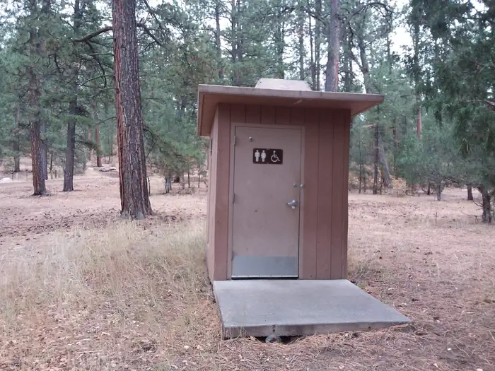
This location provides gated access, twin barbecue grills, picnic tables and a group-sized fire ring. In addition, accessible twin vault toilets with a paved path to the shelter are provided. There is no water at this facility and no trash service. Please bring all the water you will need for your stay and pack out your trash.
There is group camping for up to 100 people with 4 paved single vehicle parking spots, and gravel spots for passenger vehicles or camper trailers/RVs. All designated parking is surfaced with gravel or pavement. The pull-thrus can either be used for passenger vehicles or RVs and camp trailers. All parking, regardless of vehicle type, must be on surfaced parking areas.
Natural Features
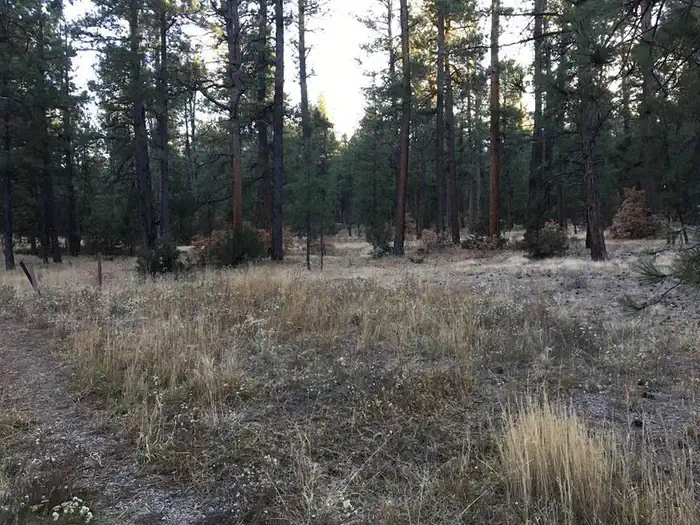
The group camping area has been constructed within a stand of tall ponderosa pine trees. The shelter has been constructed on a small hill overlooking a pristine meadow.Contact Info
This location is unstaffed. To speak with our main office for general information, please call: (575) 587-2255.Nearby Attractions
Amole Canyon Group Shelter is located approximately seven miles away from the unincorporated community of Penasco with art galleries, some restaurants, fuel and automotive services, and a small hardware store; seven miles from Sipapu Ski and Summer Resort with a resturant and a nationally ranked disc golf course; eight miles from the Taos Campus of Southern Methodist University and the Pot Creek Cultural Site; 11 miles from Picuris Pueblo; 15 miles from Taos which has a hospital and most services; 15 miles from access to the Pecos Wilderness and world class fly fishing at the Santa Barbara Trailhead; 20 miles from the Serpent Lake Trailhead which accesses the Pecos Wilderness and Jicarita Peak (12,800 feet); 20 miles to Taos Pueblo with events and pueblo tours; and 30 miles from the Rio Grande del Norte National Monument with word class rafting, kayaking and flying fishing.
The facts
- 1 bookable site
- 1 accessible site
- Vehicles up to 30 ft
- Up to 100 people per site
- Loops: A
Site types
- 1 Group Standard Area Nonelectric
Amenities
- Campfires allowed
- Fire pits
- Picnic tables
- Grills
- Shade
- Pets allowed
Not recorded upstream: electric hookups, water hookups, sewer hookups.
1 campsite at Amole Canyon Group Shelter
Check-in 2:00 PM · Check-out 11:00 AM
| Site | Loop | Type | Entry | Surface | Grade | Max rig | People | |
|---|---|---|---|---|---|---|---|---|
| 1 | A | Group Standard Area Nonelectric | Pull Through | Gravel | Slight | 30 ft | 100 | ♿ 🐾 |
Getting there
From State Road 68 in Ranchos de Taos, go south on 518 14.2 miles to the junction with National Forest System Road 703, go southeast on FSR703 approximately 0.4 mile to a gate locked with a coded padlock. The code will be provided to you in an email. Unlock the gate and proceed south into the group shelter parking area.
36.18795, -105.60734 · 36°11'16.6"N 105°36'26.4"W
Typical weather
| Jan | Feb | Mar | Apr | May | Jun | Jul | Aug | Sep | Oct | Nov | Dec | |
|---|---|---|---|---|---|---|---|---|---|---|---|---|
| High °F | — | — | — | — | — | — | — | — | — | — | — | — |
| Low °F | — | — | — | — | — | — | — | — | — | — | — | — |
| Precip in | 2.2 | 2.2 | 2.3 | 2.0 | 1.6 | 0.7 | 3.0 | 3.1 | 2.0 | 2.0 | 2.1 | 2.5 |
1991–2020 averages from the nearest NOAA station, 2.6 mi away — not measured at the facility itself, and elevation can make a real difference over that distance.
Map
More photos
Member photos
Common questions about Amole Canyon Group Shelter
- Can you reserve a site at Amole Canyon Group Shelter?
- Yes, Amole Canyon Group Shelter is reservable through Recreation.gov.
- How many campsites does Amole Canyon Group Shelter have?
- 1 site.
- What is the maximum RV length at Amole Canyon Group Shelter?
- 30 ft. That is the longest vehicle the sites here are recorded as taking; individual sites may be shorter.
- Are pets allowed at Amole Canyon Group Shelter?
- Yes, pets are allowed at Amole Canyon Group Shelter.
- Are campfires allowed at Amole Canyon Group Shelter?
- Campfires are allowed at Amole Canyon Group Shelter. Check for a current fire restriction before you go.
Camping near Amole Canyon Group Shelter
- Agua Piedra Campground 5.7 mi · Campground · we watch it
- Santa Barbara Campground 6.8 mi · Campground · we watch it
- Comales Campground 2.2 mi · Campground
- Camino Real RD 4.3 mi · Facility
- La Junta Canyon 7.7 mi · Campground
- Duran Canyon Campground 8.2 mi · Campground
- Arroyo Hondo Campground 11.9 mi · Campground
- Lone Juniper Campground 12 mi · Campground
- Pilar Campground 12 mi · Campground
- Rio Bravo Campground 12.1 mi · Campground
- Petaca Campground 12.1 mi · Campground
- Rio Pueblo Campground 12.4 mi · Campground
Contact
- Phone 575-587-2255
- Email ricardo.leon@usda.gov
- Book Recreation.gov
Recreation.gov last updated this record on 2026-05-13.
Facility information and photographs from Recreation.gov (RIDB). SpotOpened is not affiliated with Recreation.gov or any federal agency.
Comments