Nebraska Tailwaters
Campground · Nebraska · 37 bookable sites ·
Managed by the US Army Corps of Engineers
Lewis And Clark Recreation Area (Recreation Area) · Open Access
- 37
- Bookable sites
- 84 ft
- Max rig length
- up to 25
- People per site
- 2
- Accessible sites
- 1,193 ft
- Elevation
Overview
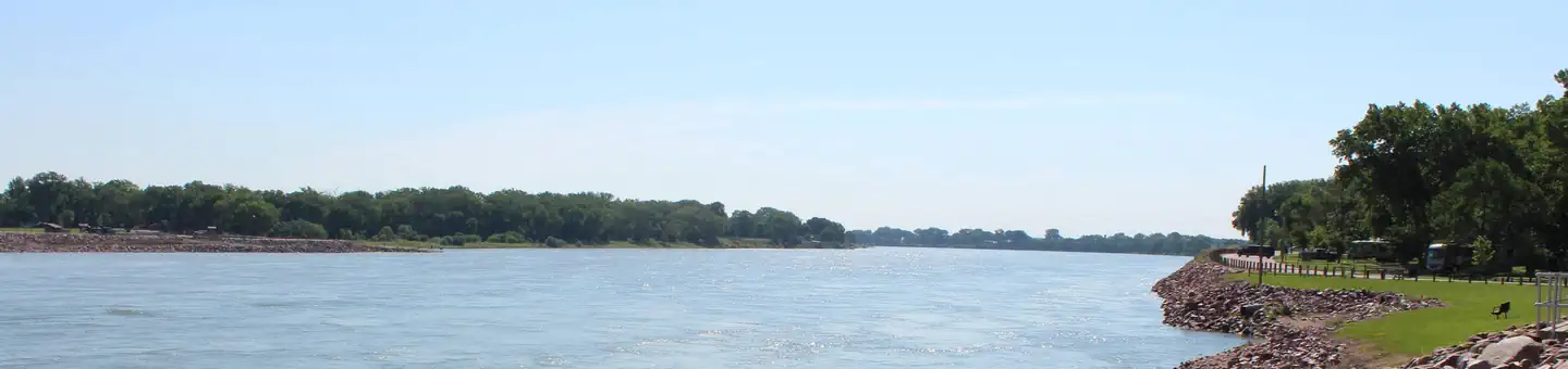
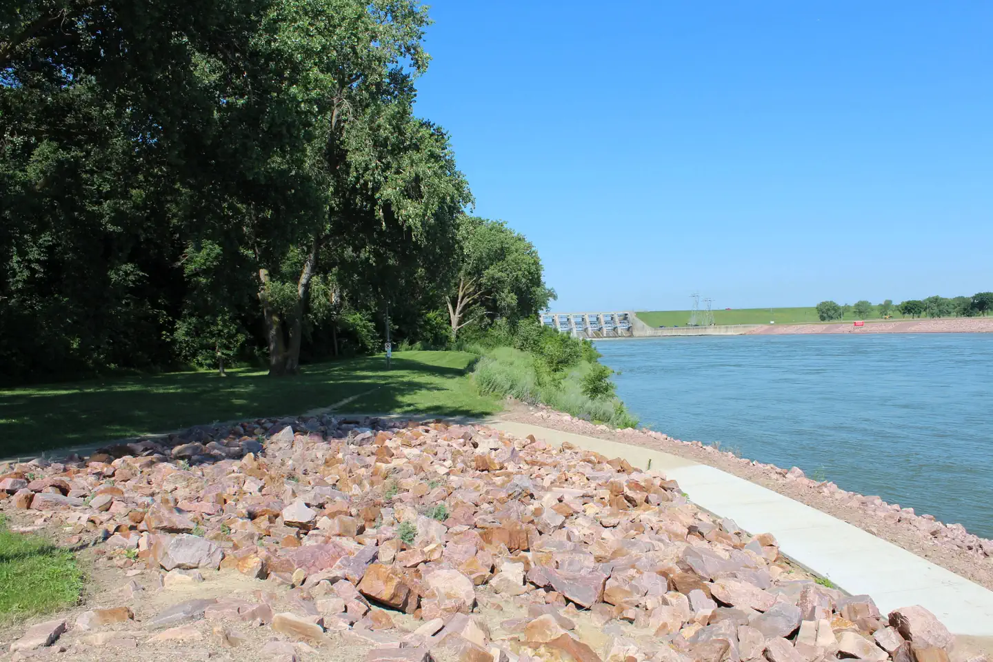
Nebraska Tailwaters Campground is nestled along the Nebraska bank of the Missouri River, is a fun-filled camping destination just downstream of Gavins Point Dam and Lewis & Clark Lake. The 31,400-acre Lewis & Clark Lake and Gavins Point Dam are nestled in the golden, chalkstone-lined valley of the Missouri River growing into one of the most popular recreation destinations in the Great Plains.
For more information, please visit the Gavins Point Project Website.
Recreation
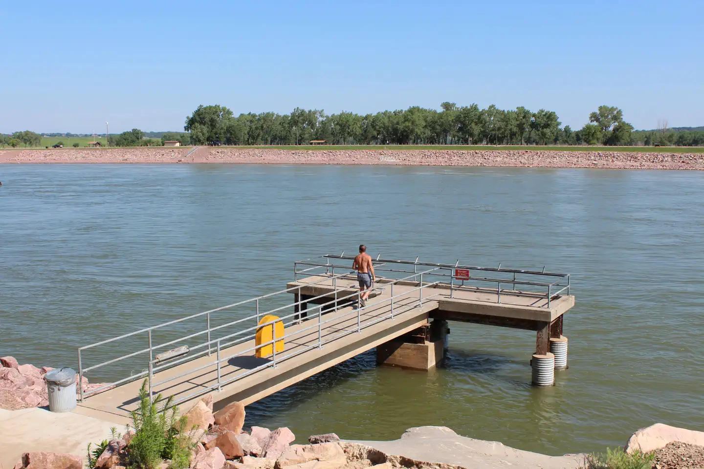
Located just below Gavins Point Dam in the dam "Tailwaters" provides exceptional access to the Missouri River. A large 2-lane boat ramp, large parking area is available, along with an accessible fishing pier and many areas for bank fishing. The Lewis and Clark Lake area attracts more than 2 million visitors each year to its shores. Recreation opportunities around the lake include camping, fishing, hunting, hiking, boating, sailing, swimming, bird-watching, and photography.
For the biking and hiking enthusiasts, three trails are available in the area. They include a paved trail that runs from Yankton to the Gavins Point area, a multi-use trail in the Gavins Point area and the Calumet Bluff hiking trail located near the visitor center. Wintertime activities include ice fishing, cross-country skiing, snowmobiling and sledding.
Developed public parks and recreation areas surround the lake above and below Gavins Point Dam. Camping facilities provided by the Corps and the States of South Dakota and Nebraska include boat ramps, picnic areas, campsites with electricity, modern restrooms, playground equipment and trailer dump stations.
Facilities
Nebraska Tailwaters offers 36 campsites, 34 of these campsites have electric hookups and 2 of the campsites are non-electric and are for tent camping only. Amenities include modern shower facilities with flush toilets, river access with shore fishing, handicap accessible fishing pier, boat ramp, fish cleaning station and RV dump station. There is also a Group Camping Area with electric hookups, picnic shelter, fire pit, grill, and vault toilet.
Natural Features
The campground sits on the south bank of the Missouri River, along the tailwaters of Gavins Point Dam. Surrounding the area is the golden, chalkstone-lined Missouri River Valley. Nebraska Tailwaters is known for its exceptional Bald Eagle viewing year-round, along with many other birds of prey.
Contact Info
For facility specific information, please call (402) 667-2546.Nearby Attractions
The Lewis and Clark Visitor Center , exhibits on Missouri River and area history including the Lewis and Clark Expedition with stunning views of Lewis and Clark Lake along with the Missouri River. Please contact the Lewis and Clark Visitor Center at (402) 667-2546 for more information.
Visit nearby Yankton, South Dakota - the historic capitol of the Dakota Territory.
Charges & Cancellations
Reservation changes and cancellations can be made on Recreation.gov or by calling 1-877-444-6777.
For more information on rules and policies regarding reservation cancellations and changes, please visit: https://www.recreation.gov/rules-reservation-policies.
The facts
- 37 bookable sites
- 2 accessible sites
- Vehicles up to 84 ft
- Up to 25 people per site
- Loops: NEBRASKA TAILWATERS, NTAI
Site types
- 34 Standard Electric
- 2 Tent Only Nonelectric
- 1 Group Standard Area Electric
Amenities
- Electric hookups
- Water hookups
- Campfires allowed
- Fire pits
- Picnic tables
- Grills
- Shade
- Pets allowed
- Sewer hookups — not available
37 campsites at Nebraska Tailwaters
Check-in 4:00 PM · Check-out 2:00 PM
| Site | Loop | Type | Entry | Surface | Grade | Water | Max rig | People | |
|---|---|---|---|---|---|---|---|---|---|
| Group Camp | NEBRASKA TAILWATERS | Group Standard Area Electric | Back In | Paved | Moderate | — | 25 ft | 25 | 🐾 |
| 01 | NTAI | Standard Electric | Pull Through | Paved | Slight | Riverfront | — | 8 | 🐾 |
| 02 | NTAI | Standard Electric | Pull Through | Paved | Slight | Riverfront | — | 8 | 🐾 |
| 03 | NTAI | Standard Electric | — | — | — | Riverfront | — | 8 | 🐾 |
| 04 | NTAI | Standard Electric | Back In | Paved | Slight | Riverfront | 68 ft | 8 | 🐾 |
| 05 | NTAI | Standard Electric | Back In | Paved | Slight | Riverfront | 65 ft | 8 | 🐾 |
| 06 | NTAI | Standard Electric | Back In | Paved | — | Riverfront | 67 ft | 8 | 🐾 |
| 07 | NTAI | Standard Electric | Back In | Paved | Slight | Riverfront | 70 ft | 8 | 🐾 |
| 08 | NTAI | Standard Electric | Back In | Paved | Slight | Riverfront | 71 ft | 8 | 🐾 |
| 09 | NTAI | Standard Electric | Back In | Paved | Slight | Riverfront | 66 ft | 8 | 🐾 |
| 10 | NTAI | Standard Electric | Back In | Paved | Slight | Riverfront | 74 ft | 8 | 🐾 |
| 11 | NTAI | Standard Electric | Back In | Paved | Slight | Riverfront | 69 ft | 8 | 🐾 |
| 12 | NTAI | Standard Electric | Back In | Paved | Slight | Riverfront | 65 ft | 8 | 🐾 |
| 13 | NTAI | Standard Electric | Back In | Paved | Slight | Riverfront | 67 ft | 8 | 🐾 |
| 14 | NTAI | Standard Electric | Back In | Paved | Slight | Riverfront | 69 ft | 8 | 🐾 |
| 15 | NTAI | Standard Electric | Back In | Paved | Slight | Riverfront | 72 ft | 8 | ♿ 🐾 |
| 16 | NTAI | Standard Electric | Back In | Paved | Slight | Riverfront | 78 ft | 8 | 🐾 |
| 17 | NTAI | Standard Electric | Back In | Paved | Slight | Riverfront | 78 ft | 8 | ♿ 🐾 |
| 18 | NTAI | Standard Electric | Back In | Paved | Slight | Riverfront | 83 ft | 8 | 🐾 |
| 19 | NTAI | Standard Electric | Back In | Paved | Slight | Riverfront | 82 ft | 8 | 🐾 |
| 20 | NTAI | Standard Electric | Back In | Paved | Slight | Riverfront | 79 ft | 8 | 🐾 |
| 21 | NTAI | Standard Electric | Back In | Paved | Slight | Riverfront | 78 ft | 8 | 🐾 |
| 22 | NTAI | Standard Electric | Back In | Paved | Slight | Riverfront | 78 ft | 8 | 🐾 |
| 23 | NTAI | Standard Electric | Back In | Paved | Slight | Riverfront | 80 ft | 8 | 🐾 |
| 24 | NTAI | Standard Electric | Back In | Paved | Slight | Riverfront | 78 ft | 8 | 🐾 |
| 25 | NTAI | Standard Electric | Back In | Paved | Slight | Riverfront | 77 ft | 8 | 🐾 |
| 26 | NTAI | Standard Electric | Back In | Paved | Slight | Riverfront | 79 ft | 8 | 🐾 |
| 27 | NTAI | Standard Electric | Back In | Paved | Slight | Riverfront | 77 ft | 8 | 🐾 |
| 28 | NTAI | Standard Electric | Back In | Paved | Slight | Riverfront | 77 ft | 8 | 🐾 |
| 29 | NTAI | Standard Electric | Back In | Paved | Slight | Riverfront | 61 ft | 8 | 🐾 |
| 30 | NTAI | Standard Electric | Back In | Paved | Slight | Riverfront | 67 ft | 8 | 🐾 |
| 31 | NTAI | Standard Electric | Back In | Paved | Slight | Riverfront | 62 ft | 8 | 🐾 |
| 32 | NTAI | Standard Electric | Back In | Paved | Slight | Riverfront | 84 ft | 8 | 🐾 |
| 33 | NTAI | Standard Electric | Back In | Paved | Slight | Riverfront | 62 ft | 8 | 🐾 |
| 34 | NTAI | Standard Electric | Back In | Paved | Slight | Riverfront | 63 ft | 8 | 🐾 |
| 35 | NTAI | Tent Only Nonelectric | — | — | — | Riverfront | — | 8 | 🐾 |
| 36 | NTAI | Tent Only Nonelectric | — | — | — | Riverfront | — | 8 | 🐾 |
Getting there
From Yankton, South Dakota, go south on U.S. Highway 81 for 2 miles, then west on Nebraska Highway 121 for 4 miles, campground entrance will be on your right.
42.84889, -97.47028 · 42°50'56.0"N 97°28'13.0"W
Typical weather
Typically 87°F in Jul, down to 30°F in Jan.
| Jan | Feb | Mar | Apr | May | Jun | Jul | Aug | Sep | Oct | Nov | Dec | |
|---|---|---|---|---|---|---|---|---|---|---|---|---|
| High °F | 30 | 35 | 47 | 60 | 72 | 82 | 87 | 85 | 78 | 63 | 47 | 34 |
| Low °F | 10 | 14 | 25 | 35 | 48 | 59 | 64 | 62 | 52 | 39 | 25 | 15 |
| Precip in | 0.7 | 0.9 | 1.6 | 3.4 | 3.7 | 4.0 | 3.5 | 3.3 | 2.9 | 2.6 | 1.3 | 1.0 |
1991–2020 averages from the nearest NOAA station, 5.8 mi away — not measured at the facility itself, and elevation can make a real difference over that distance.
Map
Fees and stay limits
Camping reservations can be made at Recreation.gov or by calling 1-877-444-6777.
From Recreation.gov, which is not always current. The operator's own page is the authority on what you will be charged.
More photos
Member photos
Common questions about Nebraska Tailwaters
- Can you reserve a site at Nebraska Tailwaters?
- Yes, Nebraska Tailwaters is reservable through Recreation.gov.
- How many campsites does Nebraska Tailwaters have?
- 37 sites.
- What is the maximum RV length at Nebraska Tailwaters?
- 84 ft. That is the longest vehicle the sites here are recorded as taking; individual sites may be shorter.
- Are pets allowed at Nebraska Tailwaters?
- Yes, pets are allowed at Nebraska Tailwaters.
- Does Nebraska Tailwaters have hookups?
- Electric, Water.
- Are campfires allowed at Nebraska Tailwaters?
- Campfires are allowed at Nebraska Tailwaters. Check for a current fire restriction before you go.
Camping near Nebraska Tailwaters
- Gavins Point Overlook Day Use Shelter 0.4 mi · Campground · we watch it
- Cottonwood (Ne) 0.9 mi · Campground · we watch it
- Cottonwood (NE) Day Use Shelter 1.2 mi · Campground · we watch it
- Gavins Point National Fish Hatchery 1.9 mi · Facility
- Green Island Primitive Camping 3.5 mi · Campground
- Missouri National Recreational River Headquarters 4.6 mi · Visitor Center
- Bow Creek Primitive Camping 17.1 mi · Campground
- Goat Island Primitive Camping 21.2 mi · Campground
Contact
Recreation.gov last updated this record on 2026-03-11.
Facility information and photographs from Recreation.gov (RIDB). SpotOpened is not affiliated with Recreation.gov or any federal agency.
Comments