Cascade Campground
Campground · Montana · 2 bookable sites ·
Managed by the USDA Forest Service
Lolo National Forest (NF) · Open Access
- 2
- Bookable sites
- 30 ft
- Max rig length
- up to 16
- People per site
- 1
- Accessible site
- 2,532 ft
- Elevation
Overview
Scenic Byway
Clark Fork River
Iron Mountain Trailhead
Cascade Falls
Wildlife
Douglas-fir, ponderosa pine, and western larch trees
Recreation
Camping
Hiking
Fishing
Rafting
Boating
Facilities
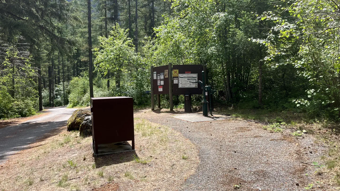
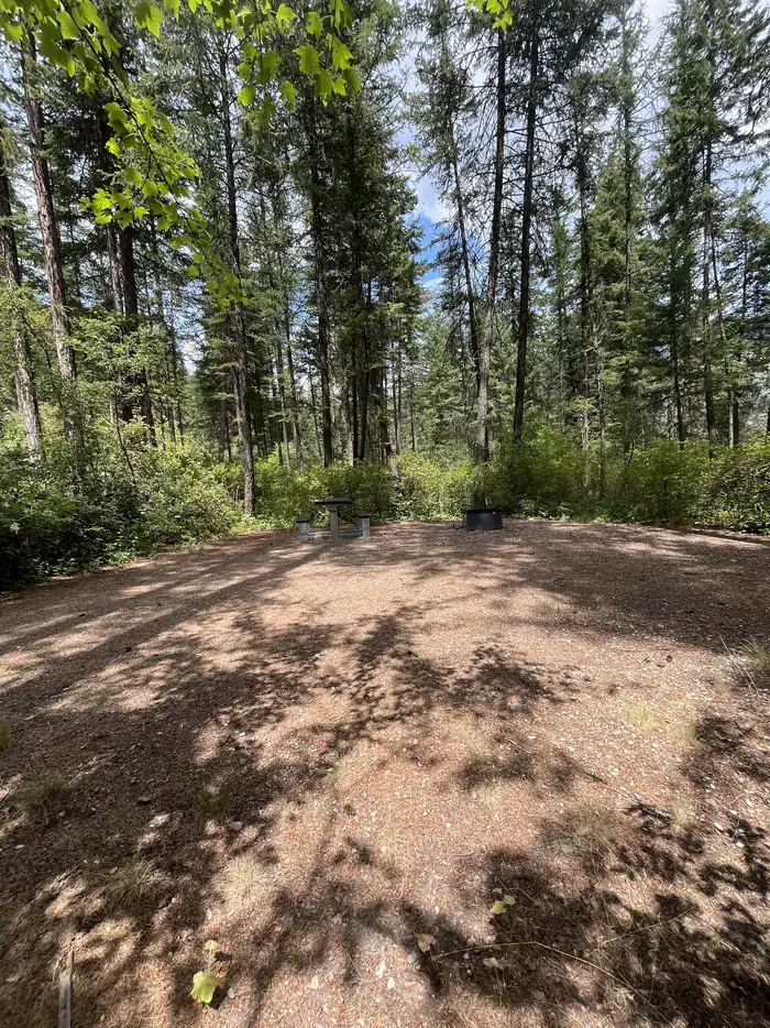
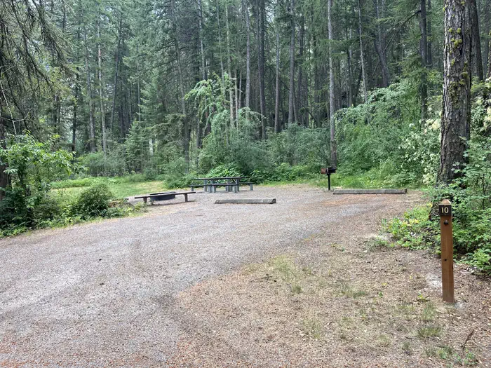
Cascade Campground has 11 sites plus 1 group site that are back in only and can accommodate RV's 27' to 35' in length depending on the site. All sites have a picnic table and a fire ring. A primitive boat ramp is available on Clark Fork River across the highway from the campground. Potable water, vault toilets and garbage service are available. This is a first come first served campground with a self-serve fee station with no host on site. It is 13 miles to groceries in Plains, Montana from this location
Natural Features
This campground is located in the canyon bottom along the Clark Fork River. The site is adjacent to the highway and across the road from the river, and forested with Douglas-fir, ponderosa pine and western larch providing abundant shade. Fishing opportunities are available at the river. The Iron Mountain Trailhead #242 also known as the historic Wagon Road Trail are located near the campground. The Cascade Falls overlook trail is also accessible from the Cascade Campground.
Nearby Attractions
Clark Fork River
Quinns natural hot springs.
The Iron Mountain Trail #242, historic wagon road.
Cascade Falls
Contact Info
For facility specific information, please call (406) 210-5287.The facts
- Season: May 7 — USDA Forest Service, Aug 24, 2026
- 2 bookable sites
- 1 accessible site
- Vehicles up to 30 ft
- Up to 16 people per site
- Loops: Cascade
Site types
- 1 Group RV Area Nonelectric
- 1 Standard Nonelectric
Amenities
- Campfires allowed
- Shade
- Pets allowed
- Water hookups — not available
- Sewer hookups — not available
Not recorded upstream: electric hookups, fire pits, picnic tables, grills.
2 campsites at Cascade Campground
Check-in 2: PM · Check-out 11:00 AM
| Site | Loop | Type | Entry | Surface | Grade | Max rig | People | |
|---|---|---|---|---|---|---|---|---|
| Group | Cascade | Group Rv Area Nonelectric | Back In | Paved | Slight | 30 ft | 16 | ♿ 🐾 |
| Standard | Cascade | Standard Nonelectric | — | — | — | — | — |
Getting there
Off I-90 take Exit 33 at St. Regis, Montana and travel 18 miles northeast on state Highway 135. Campground entrance is on your right.
From Plains Montana, take highway 200 east to Highway 135. Travel 13 miles southwest. Cascade Campground entrance is on your left.
47.30537, -114.82450 · 47°18'19.3"N 114°49'28.2"W
Typical weather
Typically 89°F in Jul, down to 34°F in Dec.
| Jan | Feb | Mar | Apr | May | Jun | Jul | Aug | Sep | Oct | Nov | Dec | |
|---|---|---|---|---|---|---|---|---|---|---|---|---|
| High °F | 36 | 42 | 53 | 61 | 71 | 78 | 89 | 88 | 77 | 61 | 43 | 34 |
| Low °F | 22 | 22 | 27 | 32 | 40 | 46 | 51 | 49 | 42 | 34 | 27 | 22 |
| Precip in | 1.2 | 1.3 | 1.1 | 1.4 | 1.8 | 2.0 | 0.9 | 1.1 | 1.0 | 1.3 | 1.9 | 1.4 |
1991–2020 averages from the nearest NOAA station, 8.4 mi away — not measured at the facility itself, and elevation can make a real difference over that distance.
Map
Fees and stay limits
$15.00 per night. Extra vehicle not in tow $5.00. Group site $20.00 per night. Extra vehicle not in tow $5.00.
From Recreation.gov, which is not always current. The operator's own page is the authority on what you will be charged.
More photos
Member photos
Common questions about Cascade Campground
- Can you reserve a site at Cascade Campground?
- Yes, Cascade Campground is reservable through Recreation.gov.
- How many campsites does Cascade Campground have?
- 2 sites.
- What is the maximum RV length at Cascade Campground?
- 30 ft. That is the longest vehicle the sites here are recorded as taking; individual sites may be shorter.
- Are pets allowed at Cascade Campground?
- Yes, pets are allowed at Cascade Campground.
- Does Cascade Campground have hookups?
- No hookups are recorded here.
- Are campfires allowed at Cascade Campground?
- Campfires are allowed at Cascade Campground. Check for a current fire restriction before you go.
Also listed by
Cascade Campground also appears in other federal recreation data. Facts below are matched by name and location, not confirmed by Cascade Campground's operator.
USDA Forest Service — data as of Aug 24, 2026
- $15 per night. $5 fee for each additional vehicle after two vehicles. The group site fee is $20 and filled on a first-come, first-served basis.
Restrictions:
- Bear Safety and Food Storage Requirements Information
Camping near Cascade Campground
- Thompson Peak Lookout Tower 9.6 mi · Campground · we watch it
- Sloway Campground (MT) 10.7 mi · Campground · we watch it
- Trout Creek Campground (MT) 13.3 mi · Campground · we watch it
- Quartz Flat Campground (MT) 16 mi · Campground · we watch it
- Cabin City Campground (MT) 21.1 mi · Campground · we watch it
- Big Hole Lookout (MT) 23.6 mi · Campground · we watch it
- Up Up Lookout 24.4 mi · Campground · we watch it
- Muchwater Dispersed Campground and Recreation Area 1.2 mi · Campground
- Peninsula Dispersed Campground and Recreation Area 4.1 mi · Campground
- Little Joe Campground - Lolo NF 14.8 mi · Facility
- Kreis Pond Campground 23.5 mi · Campground
- Up Up 40-Foot Lookout Tower 24.4 mi · Campground
Contact
- Email heather.berman@usda.gov
- Book Recreation.gov
Recreation.gov last updated this record on 2026-03-11.
Facility information and photographs from Recreation.gov (RIDB). SpotOpened is not affiliated with Recreation.gov or any federal agency.
Comments