Noblett Lake
Campground · Missouri · 1 bookable site ·
Managed by the USDA Forest Service
Mark Twain National Forest (NF) · Open Access
- 1
- Bookable site
- up to 75
- People per site
- 879 ft
- Elevation

Overview
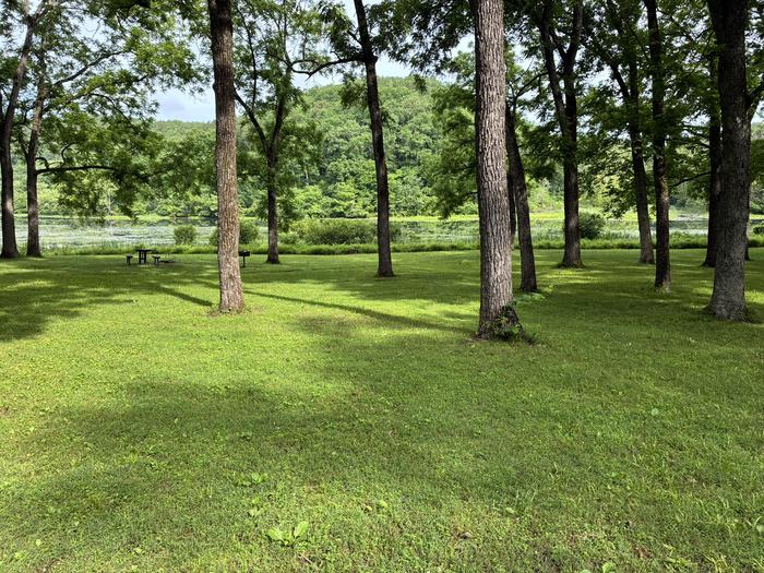
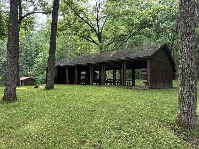
Noblett Lake Picnic Pavilion provides a sheltered place among forests, streams and wildlife, for groups to picnic near Noblett Lake. It is a great location for birding, canoeing and boating.Recreation
Noblett Lake is a popular location for boating, canoeing and fishing. Only electric trolling motors or non-motorized boats are allowed on the lake.Visitors enjoy the day-use picnic area and the Ridge Runner Trail, a 22-mile remote path that loops hikers through the scenic Ozark Mountains.
Facilities
The pavilion offers seating for up to 75 people. If over 75 people, a special use permit is required; please contact Tray Hall at 417-967-4194. It is equipped with electricity, tables and grills. There is a vault toilet. Trash collection services are provided. There is no water available; visitors must bring their own. There is no overnight camping allowed in the day use area. Dispersed camping (no amenities provided) is allowed in area across from Noblett Trailhead (old Oak Hill camping area) and below dam (old Sycamore Loop camping area). A parking area for the pavilion and the adjacent trail is available.
Natural Features
The pavilion is set in a forest of oak and pine trees, on the Salem Plateau. It is near Noblett Lake and south of the town of Willow Springs.Nearby Attractions
West Plains, Willow Springs, Cabool and Mountain Grove are the closest towns.The facts
- 1 bookable site
- 1 site for day use only
- Up to 75 people per site
- Loops: CLEARWATER PICNIC PAVILION
Site types
- 1 Group Shelter Electric
Amenities
- Shade
- Pets allowed
Not recorded upstream: electric hookups, water hookups, sewer hookups, campfires allowed, fire pits, picnic tables, grills.
1 campsite at Noblett Lake
Check-in 10:00 AM · Check-out 9:00 PM
| Site | Loop | Type | Entry | Surface | Water | Max rig | People | |
|---|---|---|---|---|---|---|---|---|
| PS1 | CLEARWATER PICNIC PAVILION | Group Shelter Electric | — | Paved | Lakefront | — | 75 | 🐾 |
Getting there
36.90848, -92.09668 · 36°54'30.5"N 92°5'48.1"W
Typical weather
| Jan | Feb | Mar | Apr | May | Jun | Jul | Aug | Sep | Oct | Nov | Dec | |
|---|---|---|---|---|---|---|---|---|---|---|---|---|
| High °F | — | — | — | — | — | — | — | — | — | — | — | — |
| Low °F | — | — | — | — | — | — | — | — | — | — | — | — |
| Precip in | 3.1 | 3.0 | 4.7 | 5.6 | 5.0 | 3.8 | 3.3 | 3.6 | 4.1 | 3.7 | 3.6 | 3.3 |
1991–2020 averages from the nearest NOAA station, 7.2 mi away — not measured at the facility itself, and elevation can make a real difference over that distance.
Map
More photos
Member photos
Common questions about Noblett Lake
- Can you reserve a site at Noblett Lake?
- Yes, Noblett Lake is reservable through Recreation.gov.
- How many campsites does Noblett Lake have?
- 1 site.
- Are pets allowed at Noblett Lake?
- Yes, pets are allowed at Noblett Lake.
Camping near Noblett Lake
- Udall Park 27.2 mi · Campground · we watch it
- Gamaliel 34.4 mi · Campground · we watch it
- Bidwell Point Park 36.9 mi · Campground · we watch it
- Cranfield Park 37 mi · Campground · we watch it
- Henderson Park 37.5 mi · Campground · we watch it
- Panther Bay Park 38.1 mi · Campground · we watch it
- Theodosia Park 38.6 mi · Campground · we watch it
- Robinson Point 39.2 mi · Campground · we watch it
- Alley Spring 39.3 mi · Campground · we watch it
- North Fork Recreation Area 10.8 mi · Campground
- Ava/Cassville/Willow Springs Ranger District 31.3 mi · Facility
- Alley General Store 39.8 mi · Visitor Center
Contact
- Book Recreation.gov
Recreation.gov last updated this record on 2026-05-22.
Facility information and photographs from Recreation.gov (RIDB). SpotOpened is not affiliated with Recreation.gov or any federal agency.
Comments