Pictured Rocks National Lakeshore Backcountry Camping Permit
Campground · Michigan · 72 bookable sites ·
Managed by the National Park Service
Beaver Basin Wilderness Area (Wilderness Area) · Restricted Access
- 72
- Bookable sites
- up to 20
- People per site
- 703 ft
- Elevation

Overview
Pictured Rocks National Lakeshore hugs the Lake Superior shoreline for more than 40 miles along Michigan's northern coast. Lake Superior is the largest, deepest, coldest, and most pristine of all the Great Lakes. In addition to boating and kayaking on the lake, the park's backcountry offers nearly 100 miles of walking and hiking trails and opportunities for solitude, inspiration, physical challenge, renewal, and camping. Access to Pictured Rocks' backcountry is primarily along the 'Lakeshore Trail', a part of the 42-mile long North Country National Scenic Trail where you can experience forests, dunes, beaches, waterfalls and wonderful panoramic views.
Please download the Backcountry Camping Planner form the park website for complete details. The backcountry campgrounds are accessed by hiking or kayaking only. A backcountry camping permit is required year-round for all overnight trips into the Pictured Rocks National Lakeshore backcountry. Permits are not required for day hiking. To assist in planning an overnight backcountry trip into Pictured Rocks National Lakeshore, take time to carefully plan and prepare for your adventure. Pictured Rocks offers fourteen backcountry campgrounds, that are located at 2 to 5 mile intervals along the Lakeshore Trail. Private shuttle services are available.
The permit holder must print and retain one copy of the permit when hiking to the campground; permit must be visibly secured to tent at campsite. You will be assigned a campsite number at every backcountry campground. Permit holder may have only one permit reserved at one time. Camp only in designated sites and follow permit itinerary. You must camp within 15 feet (4.5 m) of the numbered post at your chosen campsite. Individual campsites are available for groups of 1-6 people, and 3 tents or hammocks maximum (or a combination thereof). Group sites are available for groups of 7-20 people, and 10 tents or hammocks maximum (or a combination thereof). Group campsite reservations must camp in designated group sites. Each campground has a specific capacity; campsites within each backcountry campground are identified by a numbered post.
Recreation
Pictured Rocks National Lakeshore offers 100 miles (161 km) of hiking trails leading to waterfalls, beaches, forest wilderness, cultural sites, and breathtaking cliff-top views of Lake Superior. Whether you have only a few minutes, hours, or days to see a portion of the lakeshore, one of these hikes may be for you.
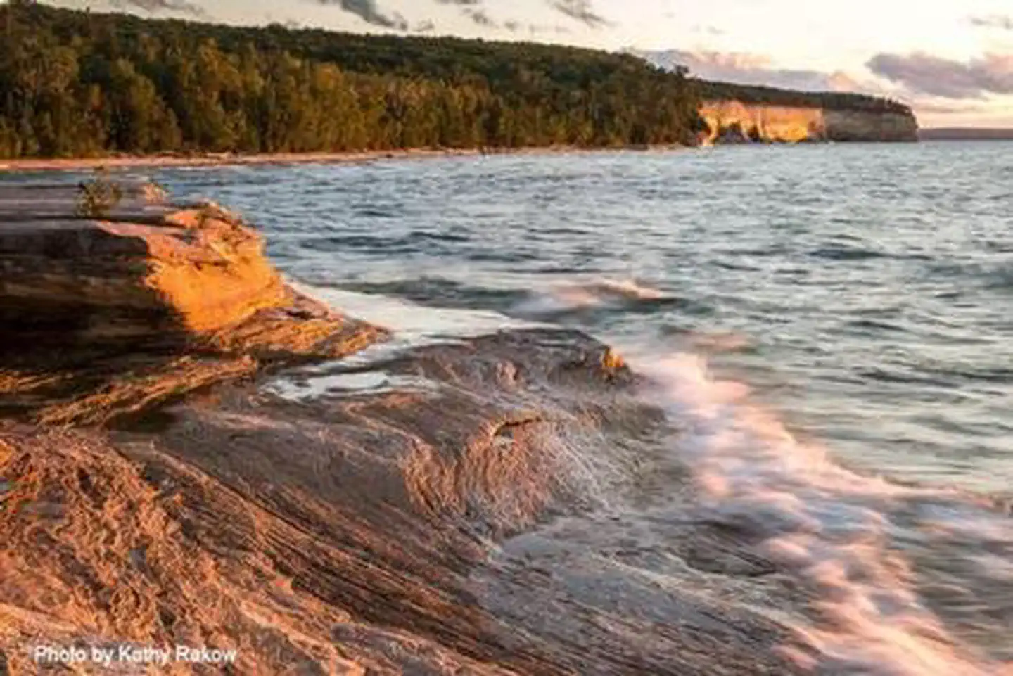
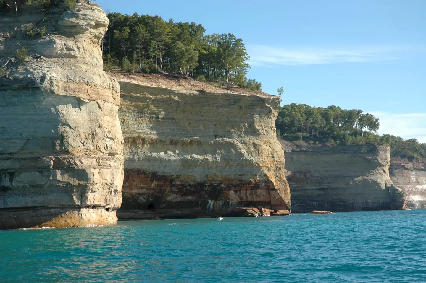
Lake Superior's rugged shoreline invites individuals to explore the beautiful Pictured Rocks National Lakeshore with its miles of colorful sandstone cliffs and long stretches of sandy beaches. Watch the weather carefully while on the lake. The weather can change suddenly and unexpectedly. Just because it's calm in Munising Bay or Grand Marais Harbor does not mean it is calm along the more distant shores. The Pictured Rocks cliffs rise 50 to 200 feet (15 to 61 m) directly from the lake, offering precious few protected places if the wind and waves increase.
Facilities
- Backcountry camping is spread across the National Lakeshore. Facilities are entirely primitive and located in the most remote regions of our park.
- There are 72 available backcountry campsites. 7 of these campsites are group campsites. Only one of these sites are a designated "boat-in" campsite.
- All campsites have food storage boxes on-site. Please store all food in these containers to protect from wildlife.
- All campsites are located along the North Country Trail, spanning only a small portion of the entire trail length.
- Pack in, pack out. There are no designated trash disposal areas at these campsites.
- There is no electricy or hookups located along the North Country Trail and backcountry campsites.
- There is no potable water located along the North Country Trail. A reminder to bring items to sanitize any lake or stream water for safe consumption.
- Certain parts of the North Country Trail are located along frontcountry camping. These campgrounds will have vault toilets for public use.
Natural Features
Sandstone cliffs, beaches, sand dunes, waterfalls, inland lakes, deep forest, and wild shoreline beckon you to visit Pictured Rocks National Lakeshore. The power of Lake Superior shapes the park's coastal features and affects every ecosystem, creating a unique landscape to explore. Hiking, camping, sightseeing, and four-season outdoor opportunities abound!
Charges & Cancellations
Cancellation Policy:
Prior to printing your permit, you may cancel any time before your reservation date and receive a 50% refund of all backcountry camping permit fees ($5 per person, per night). The $15 reservation fee is non-refundable. If you have printed your permit, there are no refunds.
Change Policy:
Prior to printing your permit, you may make changes to your permit before your reservation date. Changes may be made to the group size, campground, and the duration of your trip. An additional $15 non-refundable fee will be charged for changes.
Changes may be made to the group size through your Recreation.gov account or through the Call Center and may incur additional backcountry camping permit fees or be refunded these fees depending on whether you increase or decrease your group size. If decreasing your numbers, you will receive a full refund of the backcountry camping permit fees for the numbers you are decreasing only.
A change to the duration of the trip or campground may only be made through the Call Center. For changes to the duration of the trip, you may incur additional backcountry camping permit fees or be refunded these fees depending on whether you increase or decrease your number of nights. If decreasing your numbers, you will receive a full refund of the backcountry camping permit fees for the numbers you are decreasing only.
To change your entry date, you must cancel your permit and reserve a new permit. All fees apply.
No Show Policy:
If you do not print your permit by 11:59 p.m. on the first day of your scheduled trip, your entire backcountry camping permit will be canceled. No refunds. Please cancel your reservation if you are unable to use it to open space for others.
The facts
- 72 bookable sites
- Up to 20 people per site
- Loops: AuSable East, Beaver Creek, Benchmark, Chapel Beach, Cliffs, Coves, Grand Sable Lake, Lowney Creek, Masse Homestead, Mosquito River, Pine Bluff, Potato Patch, Sevenmile Creek, Trappers Lake
Site types
- 64 Hike To
- 7 Group Hike To
- 1 Boat In
Amenities
- Campfires allowed
- Shade
Not recorded upstream: electric hookups, water hookups, sewer hookups, fire pits, picnic tables, grills, pets allowed.
72 campsites at Pictured Rocks National Lakeshore Backcountry Camping Permit
Check-in 1:00 PM · Check-out 12:00 PM
| Site | Loop | Type | Entry | Surface | Water | Max rig | People | |
|---|---|---|---|---|---|---|---|---|
| AuSable East 1 | AuSable East | Hike To | — | — | Lakefront | — | 6 | |
| AuSable East 2 | AuSable East | Hike To | — | — | Lakefront | — | 6 | |
| AuSable East 3 | AuSable East | Hike To | — | — | Lakefront | — | 6 | |
| AuSable East 4 | AuSable East | Hike To | — | — | Lakefront | — | 6 | |
| AuSable East 5 | AuSable East | Hike To | — | — | Lakefront | — | 6 | |
| AuSable East 6 | AuSable East | Hike To | — | — | Lakefront | — | 6 | |
| AuSable East Group | AuSable East | Group Hike To | — | — | Lakefront | — | 20 | |
| Beaver Creek 1 | Beaver Creek | Hike To | — | — | Lakefront | — | 6 | |
| Beaver Creek 2 | Beaver Creek | Hike To | — | — | Lakefront | — | 6 | |
| Beaver Creek 3 | Beaver Creek | Hike To | — | — | Lakefront | — | 6 | |
| Beaver Creek 4 | Beaver Creek | Hike To | — | — | Lakefront | — | 6 | |
| Beaver Creek 5 | Beaver Creek | Hike To | — | — | Lakefront | — | 6 | |
| Beaver Creek 6 | Beaver Creek | Hike To | — | — | Lakefront | — | 6 | |
| Benchmark 1 | Benchmark | Hike To | — | — | Lakefront | — | 6 | |
| Benchmark 2 | Benchmark | Hike To | — | — | Lakefront | — | 6 | |
| Benchmark 3 | Benchmark | Hike To | — | — | Lakefront | — | 6 | |
| Benchmark 4 | Benchmark | Hike To | — | — | Lakefront | — | 6 | |
| Benchmark 5 | Benchmark | Hike To | — | — | Lakefront | — | 6 | |
| Benchmark 6 | Benchmark | Hike To | — | — | Lakefront | — | 6 | |
| Chapel Beach 1 | Chapel Beach | Hike To | — | — | Lakefront | — | 6 | |
| Chapel Beach 2 | Chapel Beach | Hike To | — | — | Lakefront | — | 6 | |
| Chapel Beach 3 | Chapel Beach | Hike To | — | — | Lakefront | — | 6 | |
| Chapel Beach 4 | Chapel Beach | Hike To | — | — | Lakefront | — | 6 | |
| Chapel Beach 5 | Chapel Beach | Hike To | — | — | Lakefront | — | 6 | |
| Chapel Beach 6 | Chapel Beach | Hike To | — | — | Lakefront | — | 6 | |
| Cliffs 1 | Cliffs | Hike To | — | — | — | — | 6 | |
| Cliffs 2 | Cliffs | Hike To | — | — | — | — | 6 | |
| Cliffs 3 | Cliffs | Hike To | — | — | — | — | 6 | |
| Cliffs Group | Cliffs | Group Hike To | — | — | — | — | 20 | |
| Coves 1 | Coves | Hike To | — | — | Lakefront | — | 6 | |
| Coves 2 | Coves | Hike To | — | — | Lakefront | — | 6 | |
| Coves 3 | Coves | Hike To | — | — | Lakefront | — | 6 | |
| Coves 4 | Coves | Hike To | — | — | Lakefront | — | 6 | |
| Coves 5 | Coves | Hike To | — | — | Lakefront | — | 6 | |
| Coves Group | Coves | Group Hike To | — | — | — | — | 20 | |
| Boat In | Grand Sable Lake | Boat In | — | — | Lakefront | — | 6 | |
| Lowney Creek 1 | Lowney Creek | Hike To | — | — | Lakefront | — | 6 | |
| Lowney Creek 2 | Lowney Creek | Hike To | — | — | Lakefront | — | 6 | |
| Lowney Creek 3 | Lowney Creek | Hike To | — | — | Lakefront | — | 6 | |
| Lowney Creek 4 | Lowney Creek | Hike To | — | — | Lakefront | — | 6 | |
| Lowney Creek Group | Lowney Creek | Group Hike To | — | — | Lakefront | — | 20 | |
| Masse Homestead 1 | Masse Homestead | Hike To | — | — | — | — | 6 | |
| Masse Homestead 2 | Masse Homestead | Hike To | — | — | — | — | 6 | |
| Masse Homestead 3 | Masse Homestead | Hike To | — | — | — | — | 6 | |
| Masse Homestead Group | Masse Homestead | Group Hike To | — | — | — | — | 20 | |
| Mosquito River 1 | Mosquito River | Hike To | — | — | Lakefront | — | 6 | |
| Mosquito River 2 | Mosquito River | Hike To | — | — | Lakefront | — | 6 | |
| Mosquito River 3 | Mosquito River | Hike To | — | — | Lakefront | — | 6 | |
| Mosquito River 4 | Mosquito River | Hike To | — | — | Lakefront | — | 6 | |
| Mosquito River 5 | Mosquito River | Hike To | — | — | Lakefront | — | 6 | |
| Mosquito River 6 | Mosquito River | Hike To | — | — | Lakefront | — | 6 | |
| Mosquito River Group | Mosquito River | Group Hike To | — | — | Lakefront | — | 20 | |
| Pine Bluff 1 | Pine Bluff | Hike To | — | — | Lakefront | — | 6 | |
| Pine Bluff 2 | Pine Bluff | Hike To | — | — | Lakefront | — | 6 | |
| Pine Bluff 3 | Pine Bluff | Hike To | — | — | Lakefront | — | 6 | |
| Pine Bluff 4 | Pine Bluff | Hike To | — | — | Lakefront | — | 6 | |
| Pine Bluff 5 | Pine Bluff | Hike To | — | — | Lakefront | — | 6 | |
| Potato Patch 1 | Potato Patch | Hike To | — | — | — | — | 6 | |
| Potato Patch 2 | Potato Patch | Hike To | — | — | — | — | 6 | |
| Potato Patch 3 | Potato Patch | Hike To | — | — | — | — | 6 | |
| Sevenmile Creek 1 | Sevenmile Creek | Hike To | — | — | Lakefront | — | 6 | |
| Sevenmile Creek 2 | Sevenmile Creek | Hike To | — | — | Lakefront | — | 6 | |
| Sevenmile Creek 3 | Sevenmile Creek | Hike To | — | — | Lakefront | — | 6 | |
| Sevenmile Creek 4 | Sevenmile Creek | Hike To | — | — | Lakefront | — | 6 | |
| Sevenmile Creek 5 | Sevenmile Creek | Hike To | — | — | Lakefront | — | 6 | |
| Sevenmile Creek Group | Sevenmile Creek | Group Hike To | — | — | Lakefront | — | 20 | |
| Trappers Lake 1 | Trappers Lake | Hike To | — | — | Lakefront | — | 6 | |
| Trappers Lake 2 | Trappers Lake | Hike To | — | — | Lakefront | — | 6 | |
| Trappers Lake 3 | Trappers Lake | Hike To | — | — | Lakefront | — | 6 | |
| Trappers Lake 4 | Trappers Lake | Hike To | — | — | Lakefront | — | 6 | |
| Trappers Lake 5 | Trappers Lake | Hike To | — | — | Lakefront | — | 6 | |
| Trappers Lake Group | Trappers Lake | Hike To | — | — | Lakefront | — | 20 |
Getting there
46.56222, -86.30513 · 46°33'44.0"N 86°18'18.5"W
Typical weather
Typically 75°F in Aug, down to 24°F in Jan.
| Jan | Feb | Mar | Apr | May | Jun | Jul | Aug | Sep | Oct | Nov | Dec | |
|---|---|---|---|---|---|---|---|---|---|---|---|---|
| High °F | 24 | 27 | 37 | 48 | 61 | 70 | 75 | 75 | 68 | 55 | 41 | 31 |
| Low °F | 14 | 13 | 20 | 28 | 40 | 48 | 55 | 56 | 50 | 39 | 29 | 20 |
| Precip in | — | — | — | — | — | — | — | — | — | — | — | — |
1991–2020 averages from the nearest NOAA station, 18.3 mi away — not measured at the facility itself, and elevation can make a real difference over that distance.
Map
Fees and stay limits
Reservation Fee: $15 non-refundable reservation fee is required for each permit reserved. Backcountry Camping Permit Fee: $5 per person/per night. Children 5 and under are free. Entrance Fee: Pictured Rocks National Lakeshore charges an entrance fee separate from reservation and camping permit fees. You may pay the fee if you stop at the visitor center or purchase in advance. The park also honors Federal interagency passes (e.g., annual, senior, access, 4th grade, Golden Age pass etc.).
From Recreation.gov, which is not always current. The operator's own page is the authority on what you will be charged.
Ways in
Showing 22 of 22.
- Au Sable East Group — Group Site
- AuSable East — Individual Campsite
- Beaver Creek — Individual Campsite
- Benchmark — Individual Campsite
- Chapel Beach — Individual Campsite
- Cliffs — Individual Campsite
- Cliffs Group — Group Site
- Coves — Individual Campsite
- Coves Group — Group Site
- Grand Sable Lake Campground, Boat-In Only — Individual Campsite
- Lowney Creek — Individual Campsite
- Lowney Creek Group — Group Site
- Masse Homestead — Individual Campsite
- Masse Homestead Group — Group Site
- Mosquito River — Individual Campsite
- Mosquito River Group — Group Site
- Pine Bluff — Individual Campsite
- Potato Patch — Individual Campsite
- Sevenmile Creek — Individual Campsite
- Sevenmile Creek Group — Group Site
- Trappers Lake — Individual Campsite
- Trappers Lake Group — Group Site
More photos
Member photos
Common questions about Pictured Rocks National Lakeshore Backcountry Camping Permit
- Can you reserve a site at Pictured Rocks National Lakeshore Backcountry Camping Permit?
- Yes, Pictured Rocks National Lakeshore Backcountry Camping Permit is reservable through Recreation.gov.
- How many campsites does Pictured Rocks National Lakeshore Backcountry Camping Permit have?
- 72 sites.
- Are campfires allowed at Pictured Rocks National Lakeshore Backcountry Camping Permit?
- Campfires are allowed at Pictured Rocks National Lakeshore Backcountry Camping Permit. Check for a current fire restriction before you go.
Camping near Pictured Rocks National Lakeshore Backcountry Camping Permit
- Little Beaver Campground 2.7 mi · Campground · we watch it
- Twelvemile Beach Campground and Cabin 6.7 mi · Campground · we watch it
- Hurricane River Campground 9.6 mi · Campground · we watch it
- Au Sable Light Station 11 mi · Tickets · we watch it
- Little Dune 1 Campsite on Grand Island 16.6 mi · Campground
- Little Duck Campsite on Grand Island 17.1 mi · Facility
- Bermuda Campsite on Grand Island 17.4 mi · Campground
- Duck Lake Campsite on Grand Island 17.5 mi · Campground
- Loon Call Campsite on Grand Island 17.6 mi · Campground
- Murray Bay Group Campsite on Grand Island 17.8 mi · Campground
- Hemlock Campsite on Grand Island 18.5 mi · Campground
- Hardwood Campsite on Grand Island 18.6 mi · Campground
Contact
- Phone 906 387 3700 MUNISING FALLS VISITOR CENTER EMAIL: INFORMATION_PIRO@NPS.GOV
- Email piro_information@nps.gov
- Book Recreation.gov
Recreation.gov last updated this record on 2026-06-04.
Facility information and photographs from Recreation.gov (RIDB). SpotOpened is not affiliated with Recreation.gov or any federal agency.
Comments