Gabions Campground
Campground · Michigan · 8 bookable sites ·
Managed by the USDA Forest Service
Huron National Forest (NF) · Open Access
- 8
- Bookable sites
- 99 ft
- Max rig length
- up to 8
- People per site
- 851 ft
- Elevation
Overview
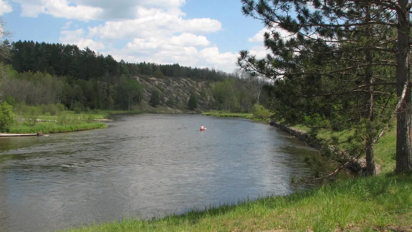
Gabions Campground offers camping on the National Scenic stretch of the Au Sable River. Natural springs are common on this section of the river, including a small one at the river's edge near the gabions. Gabions are rock-filled wire baskets that are placed along the riverbank to help reduce erosion.
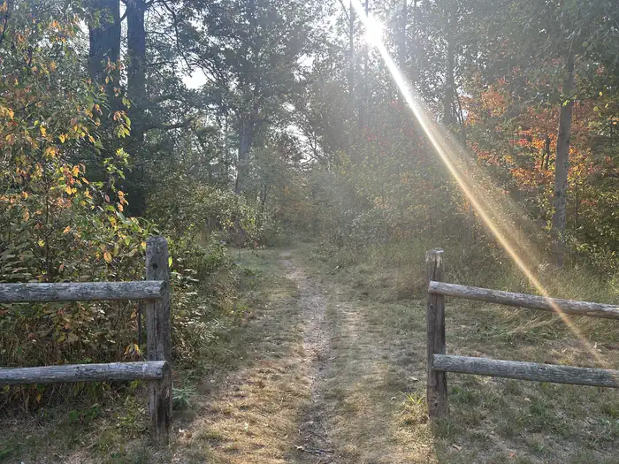
The Shore-to-Shore Trail passes near the campground; however, Gabions is not a designated horse camp and horse camping is not permitted. Wildlife and waterfowl viewing opportunities exist; please respect wildlife and observe from a distance.
Recreation
- Water Activites: Anglers can boat, wade, and fish from shore. Fish species found in the Au Sable River include bass, pike, brown trout, walleye, perch, sunfish, steelhead, and salmon. The water flows at a speed of 2 mph. The Au Sable River provides opportunities for non-motorized boating using watercraft such as canoes, kayaks, and rafts. 4001 Canoe Access is a short drive and provides developed access to the Au Sable river. Alcona Canoe Rental in nearby Glennie and Hinchman's Acres Resort in Mio provide watercraft rentals for canoes, kayaks, and tubes.
- Hiking: Visitors can walk the Shore-to-Shore Horse Trail which passes through the campground. This trail is open to hiking and horseback riding. Hikers should be aware this is not a loop trail. Additionally, hikers can drive southwest on Au Sable River road to reach the Ruffed Grouse trail head for a short leasurely 0.6 mile loop through the forest.
- OHV Riding: An OHV trail utilizes Au Sable River road at the mouth of the campground road. Taking the trail to the east will connect riders to the Alcona ATV Trail and taking the trail to the west will connect riders to to the Mack Lake Motorized Trail System and the Bull Gap Hill Climb Area . Additionally, a large majority of Forest Service roads are open to OHV use. Please refer to the motor vehicle use map (MVUM) to understand which roads are open to OHV use.
Facilities
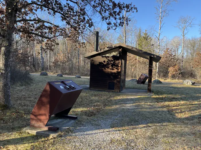
Amenities available include a vault toilet and trash collection. There is no water provided in the campground. Campsites are equipped with picnic tables, campfire rings, and lantern posts.
Natural Features
The Au Sable River is a short walk from the campground where visitors can experience world class fishing and floating opportunities.
Each site is shaded by a mixed forest of hardwoods, red pines, and jack pine.
Contact Info
This location is unstaffed. To speak with our main office for general information, please call: (989) 826-3252.The facts
- Season: May 1 – November 30 — USDA Forest Service, Aug 24, 2026
- 8 bookable sites
- Vehicles up to 99 ft
- Up to 8 people per site
- Loops: Gabions
Site types
- 7 Standard Nonelectric
- 1 Tent Only Nonelectric
Amenities
- Campfires allowed
- Pets allowed
- Water hookups — not available
Not recorded upstream: electric hookups, sewer hookups, fire pits, picnic tables, grills, shade.
8 campsites at Gabions Campground
| Site | Loop | Type | Entry | Surface | Max rig | People | |
|---|---|---|---|---|---|---|---|
| 1 | Gabions | Standard Nonelectric | Back In | Gravel | 99 ft | 8 | 🐾 |
| 2 | Gabions | Standard Nonelectric | Back In | Gravel | 45 ft | 8 | 🐾 |
| 3 | Gabions | Standard Nonelectric | Back In | Gravel | 45 ft | 8 | 🐾 |
| 4 | Gabions | Standard Nonelectric | Back In | Gravel | 75 ft | 8 | 🐾 |
| 5 | Gabions | Standard Nonelectric | Back In | Gravel | 40 ft | 8 | 🐾 |
| 6 | Gabions | Standard Nonelectric | Parallel | Gravel | 30 ft | 8 | 🐾 |
| 7 | Gabions | Standard Nonelectric | Back In | Gravel | 99 ft | 8 | 🐾 |
| 8 | Gabions | Tent Only Nonelectric | — | — | — | 8 | 🐾 |
Getting there
From the South on M33:
- Turn East onto Curtisville Road and stay on it for approximately 15.5 miles. (Note the name of the road will change to: Au Sable Valley River Rd and then Au Sable River Rd.)
- Turn Left (north) onto Brodie Road. Follow the signs to the campground.
From Mio via McKinley Road:
- Follow McKinley Road/Au Sable Road approximately 20 miles.
- Turn right on 4001/Au Sable River Road and drive 3/4 mile.
- Turn Right (north) onto Brodie Road.
44.62105, -83.84706 · 44°37'15.8"N 83°50'49.4"W
Typical weather
Typically 79°F in Jul, down to 27°F in Jan.
| Jan | Feb | Mar | Apr | May | Jun | Jul | Aug | Sep | Oct | Nov | Dec | |
|---|---|---|---|---|---|---|---|---|---|---|---|---|
| High °F | 27 | 30 | 39 | 53 | 66 | 75 | 79 | 77 | 70 | 57 | 43 | 33 |
| Low °F | 9 | 8 | 17 | 28 | 41 | 50 | 54 | 53 | 46 | 35 | 25 | 17 |
| Precip in | 1.7 | 1.3 | 1.9 | 2.9 | 3.1 | 3.3 | 3.7 | 3.1 | 2.8 | 3.6 | 2.1 | 2.3 |
1991–2020 averages from the nearest NOAA station, 9.2 mi away — not measured at the facility itself, and elevation can make a real difference over that distance.
Map
More photos
Member photos
Common questions about Gabions Campground
- Can you reserve a site at Gabions Campground?
- Yes, Gabions Campground is reservable through Recreation.gov.
- How many campsites does Gabions Campground have?
- 8 sites.
- What is the maximum RV length at Gabions Campground?
- 99 ft. That is the longest vehicle the sites here are recorded as taking; individual sites may be shorter.
- Are pets allowed at Gabions Campground?
- Yes, pets are allowed at Gabions Campground.
- Does Gabions Campground have hookups?
- No hookups are recorded here.
- Are campfires allowed at Gabions Campground?
- Campfires are allowed at Gabions Campground. Check for a current fire restriction before you go.
Also listed by
Gabions Campground also appears in other federal recreation data. Facts below are matched by name and location, not confirmed by Gabions Campground's operator.
USDA Forest Service — data as of Aug 24, 2026
- Day: $5.00
- Week: $15.00
- Per Night: $10.00
Restrictions:
- Au Sable National Scenic River Corridor; R904-14-18
- Motorized Vehicle Use of Roads, Trails and Off-road Areas; R904-14-02
- Occupancy and Use; R904-14-03
Accessibility:
- Restroom facilities are accessible.
- One site has a tent pad.
- Path to river is narrow, hard-packed earth.
Camping near Gabions Campground
- South Branch Trail Camp Group Site 9.6 mi · Campground · we watch it
- Mack Lake ORV Campground 11.1 mi · Campground · we watch it
- Rollways Campground 11.7 mi · Campground · we watch it
- Au Sable Loop Campground 12.6 mi · Campground · we watch it
- Ausable River Camping 12.6 mi · Campground · we watch it
- Bear Island Campground 2.5 mi · Campground
- Buttercup Campground 3.6 mi · Campground
- Horseshoe Lake Campground and Boat Launch 4.3 mi · Campground
- Au Sable Area 5.2 mi · Facility
- Cathedral Pines Campground 8.1 mi · Campground
- Meadow Springs Campground 11.4 mi · Campground
- River Dune Campground 12.5 mi · Campground
Contact
- Phone 989-826-3252
- Email sm.fs.hmnf@usda.gov
- Book Recreation.gov
Recreation.gov last updated this record on 2026-06-30.
Facility information and photographs from Recreation.gov (RIDB). SpotOpened is not affiliated with Recreation.gov or any federal agency.
Comments