Au Sable Loop Campground
Campground · Michigan · 5 bookable sites ·
Managed by the USDA Forest Service
Au Sable, Michigan Wild and Scenic River (Scenic) · Open Access
- 5
- Bookable sites
- 99 ft
- Max rig length
- up to 8
- People per site
- 934 ft
- Elevation
Overview
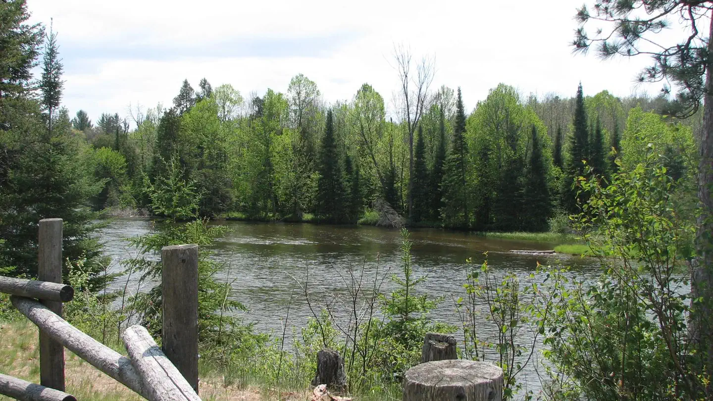
As visitors exit McKinley Road to enter the Au Sable Loop Scenic Overlook, they will first see a panoramic vista of the National Scenic portion of the Au Sable River. From the Au Sable Loop Scenic Overlook follow the unpaved road to reach the campground. The small five site campground is set amidst a mixed hardwood forest. The campground and day use areas are ideal for scenery viewing, wildlife viewing, and picnicking.
Recreation
- Water Activities: The Au Sable Loop Campground provides forest visitors with a variety of water activities. Access to the Au Sable River is afforded by a short path from the campground. Anglers can boat, wade, and fish from shore. Fish species found in the Au Sable River include bass, pike, brown trout, walleye, perch, sunfish, steelhead, and salmon. The water flows at a speed of 2 mph. The Au Sable River provides opportunities for non-motorized boating using watercraft such as canoes, kayaks, and rafts. Watercraft can be rented in Mio at Hinchman’s Acres Resort or at Alcona Canoe Rental in Glennie.
- Hiking: Along the north side of the river is the 0.5 mile Mio Nature Trail with a trailhead located in the Mio Ranger Station parking lot. Along the south side of the river is the 4.5 mile Wolf Creek Trail . The trailhead for Wolf Creek is on the lefthand side 1 mile west of Mio down South River road. Both trails provide views of the Au Sable River and are appropriate for a variety of skill levels.
Facilities
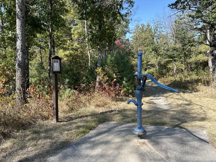
The Au Sable Loop Campground provides a handpump well for drinking water, a vault toilet, and trash collection services. Campsites provide users with picnic tables, campfire rings, and lantern posts.
Natural Features
Located near the banks of the National Scenic Au Sable River, this campground is a haven for water based recreation. An exemplary setting for wildlife viewing, visitors and campers will see a melding of habitats as the river turns to forest and then to field. The area is inhabited by bald eagles, deer, bear, bobcat, porcupine, various songbirds, and waterfowl. Please respect wildlife and observe from a distance.
Contact Info
This location is unstaffed. To speak with our main office for general information, please call: (989) 826-3252.Charges & Cancellations
All reservation changes, cancellations, and refunds are managed through Recreation.gov.
The facts
- Season: May 1 – November 30 — USDA Forest Service, Aug 24, 2026
- 5 bookable sites
- Vehicles up to 99 ft
- Up to 8 people per site
- Loops: Au Sable Loop
Site types
- 5 Standard Nonelectric
Amenities
- Campfires allowed
- Pets allowed
- Water hookups — not available
Not recorded upstream: electric hookups, sewer hookups, fire pits, picnic tables, grills, shade.
5 campsites at Au Sable Loop Campground
| Site | Loop | Type | Entry | Surface | Max rig | People | |
|---|---|---|---|---|---|---|---|
| 1 | Au Sable Loop | Standard Nonelectric | Back In | Gravel | 90 ft | 8 | 🐾 |
| 2 | Au Sable Loop | Standard Nonelectric | Pull Through | Gravel | 75 ft | 8 | 🐾 |
| 3 | Au Sable Loop | Standard Nonelectric | Back In | Gravel | 45 ft | 8 | 🐾 |
| 4 | Au Sable Loop | Standard Nonelectric | Back In | Gravel | 38 ft | 8 | 🐾 |
| 5 | Au Sable Loop | Standard Nonelectric | Pull Through | Gravel | 99 ft | 8 | 🐾 |
Getting there
From Grayling:
- Travel east on M-72 for 30 miles.
- Turn left and go north on M-72/M-33 for .5 miles.
- Turn right and go east on McKinley Rd. for 3 miles.
- Turn right and follow the signs to the site.
44.65111, -84.09944 · 44°39'4.0"N 84°5'58.0"W
Typical weather
Typically 81°F in Jul, down to 28°F in Jan.
| Jan | Feb | Mar | Apr | May | Jun | Jul | Aug | Sep | Oct | Nov | Dec | |
|---|---|---|---|---|---|---|---|---|---|---|---|---|
| High °F | 28 | 32 | 42 | 54 | 68 | 77 | 81 | 79 | 72 | 58 | 44 | 33 |
| Low °F | 11 | 10 | 18 | 30 | 41 | 51 | 56 | 54 | 47 | 36 | 28 | 18 |
| Precip in | 1.9 | 1.4 | 1.7 | 3.2 | 3.5 | 3.6 | 2.9 | 3.8 | 2.9 | 3.1 | 2.3 | 1.7 |
1991–2020 averages from the nearest NOAA station, 0.9 mi away — not measured at the facility itself, and elevation can make a real difference over that distance.
Map
More photos

Member photos
Common questions about Au Sable Loop Campground
- Can you reserve a site at Au Sable Loop Campground?
- Yes, Au Sable Loop Campground is reservable through Recreation.gov.
- How many campsites does Au Sable Loop Campground have?
- 5 sites.
- What is the maximum RV length at Au Sable Loop Campground?
- 99 ft. That is the longest vehicle the sites here are recorded as taking; individual sites may be shorter.
- Are pets allowed at Au Sable Loop Campground?
- Yes, pets are allowed at Au Sable Loop Campground.
- Does Au Sable Loop Campground have hookups?
- No hookups are recorded here.
- Are campfires allowed at Au Sable Loop Campground?
- Campfires are allowed at Au Sable Loop Campground. Check for a current fire restriction before you go.
Also listed by
Au Sable Loop Campground also appears in other federal recreation data. Facts below are matched by name and location, not confirmed by Au Sable Loop Campground's operator.
USDA Forest Service — data as of Aug 24, 2026
- Day: $5.00
- Week: $15.00
- Per Night: $10.00
Restrictions:
- Au Sable National Scenic River Corridor; R904-14-18
- Motorized Vehicle Use of Roads, Trails and Off-road Areas; R904-14-02
- Occupancy and Use; R904-14-03
Accessibility:
- Restroom facilities are accessible.
- Campsites are hard-packed earth.
Camping near Au Sable Loop Campground
- Ausable River Camping less than 0.1 mi · Campground · we watch it
- Mack Lake ORV Campground 5.3 mi · Campground · we watch it
- Wagner Lake (MI) 7.1 mi · Campground · we watch it
- Chimney Loop Campground 7.4 mi · Campground · we watch it
- Island lake (MI) 10 mi · Campground · we watch it
- Meadows ORV Campground 12.1 mi · Campground · we watch it
- River Dune Campground 0.1 mi · Campground
- Meadow Springs Campground 1.3 mi · Campground
- Cathedral Pines Campground 4.7 mi · Campground
- Buttercup Campground 9.2 mi · Campground
- Loon Lake Day Use Area 9.6 mi · Facility
- Bear Island Campground 10.2 mi · Campground
Contact
- Phone 989-826-3252
- Email sm.fs.hmnf@usda.gov
- Book Recreation.gov
Recreation.gov last updated this record on 2026-06-30.
Facility information and photographs from Recreation.gov (RIDB). SpotOpened is not affiliated with Recreation.gov or any federal agency.
Comments