Alum Ford Campground
Campground · Kentucky · 6 bookable sites ·
Managed by the National Park Service
Big South Fork National River and Recreation Area (National River) · Open Access
- 6
- Bookable sites
- up to 6
- People per site
- 1
- Accessible site
- 709 ft
- Elevation
Overview
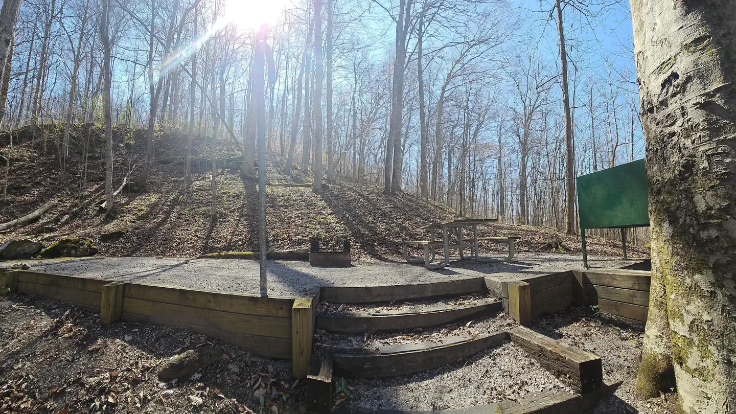
Alum Ford Campground is located in the Kentucky portion of Big South Fork seven miles west of Whitley City, Kentucky at the end of Highway 700. The campground consists of six campsites each with picnic table and fire ring.
Recreation
The campground is located adjacent to the Alum Ford Boat Launch, providing access for motorized and non-motorized watercraft to this remote section of the Big South Fork River where it becomes Lake Cumberland. The Sheltowee Trace National Recreational Trail also passes through the campground. The Sheltowee Trace is a 260-mile back country trail through Daniel Boone National Forest, Big South Fork NRRA, and Natural Bridge, Cumberland Falls, & Pickett State Parks in Kentucky and Tennessee.
Facilities
Alum Ford Campground has six sites with tent pads, picnic tables, fire rings with grills, bear-proof garbage cans, and food storage lockers. A vault toilet facility is also available.
Natural Features
This small campground sits above the Alum Ford Boat Ramp which provides access to the Big South Fork River.
Nearby Attractions
The Big South Fork Scenic Railway Depot is located about 9 miles away in the town of Stearns, which offers train rides and other educational opportunities for campers. More information can be found online at https://bsfsry.com.
Just a few miles from Stearns is Blue Heron Mine, also known as Mine 18, a historic abandoned mining town that has been rebuilt as an outdoor museum. Visitors can hear audio presentations from actual people who lived in the community in the 1950s.
Additional attractions include the Daniel Boone National Forest and Cumberland Falls State Resort Park, offering additional recreation opportunities.
The facts
- 6 bookable sites
- 1 accessible site
- Up to 6 people per site
- Loops: NA
Site types
- 6 Standard Nonelectric
Amenities
- Campfires allowed
- Fire pits
- Picnic tables
- Shade
- Pets allowed
- Water hookups — not available
Not recorded upstream: electric hookups, sewer hookups, grills.
6 campsites at Alum Ford Campground
Check-in 12:00 PM · Check-out 12:00 PM
| Site | Loop | Type | Entry | Surface | Grade | Water | Max rig | People | |
|---|---|---|---|---|---|---|---|---|---|
| Campsite 1 | NA | Standard Nonelectric | Back In | Gravel | Slight | Riverfront | — | 6 | 🐾 |
| Campsite 2 | NA | Standard Nonelectric | Back In | Gravel | Slight | Riverfront | — | 6 | 🐾 |
| Campsite 3 | NA | Standard Nonelectric | Back In | Gravel | Slight | Riverfront | — | 6 | 🐾 |
| Campsite 4 | NA | Standard Nonelectric | Back In | Gravel | Slight | Riverfront | — | 6 | 🐾 |
| Campsite 5 | NA | Standard Nonelectric | Back In | Gravel | Slight | Riverfront | — | 6 | ♿ 🐾 |
| Campsite 6 | NA | Standard Nonelectric | Back In | Gravel | Slight | Riverfront | — | 6 | 🐾 |
Getting there
36.76517, -84.54722 · 36°45'54.6"N 84°32'50.0"W
Typical weather
Typically 85°F in Jul, down to 45°F in Jan.
| Jan | Feb | Mar | Apr | May | Jun | Jul | Aug | Sep | Oct | Nov | Dec | |
|---|---|---|---|---|---|---|---|---|---|---|---|---|
| High °F | 45 | 49 | 59 | 69 | 77 | 82 | 85 | 85 | 80 | 69 | 58 | 48 |
| Low °F | 24 | 26 | 33 | 41 | 51 | 59 | 63 | 62 | 54 | 42 | 32 | 27 |
| Precip in | 4.8 | 4.5 | 5.2 | 4.7 | 5.5 | 5.3 | 6.1 | 3.7 | 3.6 | 3.3 | 3.8 | 5.8 |
1991–2020 averages from the nearest NOAA station, 7.4 mi away — not measured at the facility itself, and elevation can make a real difference over that distance.
Map
More photos
Member photos
Common questions about Alum Ford Campground
- Can you reserve a site at Alum Ford Campground?
- Yes, Alum Ford Campground is reservable through Recreation.gov.
- How many campsites does Alum Ford Campground have?
- 6 sites.
- Are pets allowed at Alum Ford Campground?
- Yes, pets are allowed at Alum Ford Campground.
- Does Alum Ford Campground have hookups?
- No hookups are recorded here.
- Are campfires allowed at Alum Ford Campground?
- Campfires are allowed at Alum Ford Campground. Check for a current fire restriction before you go.
Camping near Alum Ford Campground
- Blue Heron Campground 6.2 mi · Campground · we watch it
- Bear Creek Campground - KY 8.7 mi · Campground · we watch it
- Station Camp Campground 15.9 mi · Campground · we watch it
- Waitsboro Campground 17 mi · Campground · we watch it
- Mill Springs Mill Shelter 17.3 mi · Campground · we watch it
- Natural Arch Scenic Area 5.5 mi · Activity pass
- Blue Heron Interpretive Center 6.5 mi · Facility
- Keno Shooting Range 9.1 mi · Facility
- Bell Farm Horse Camp 9.4 mi · Facility
- Beaver Creek Wilderness 11.1 mi · Facility
- Lake Cumberland - Stearns 13.5 mi · Facility
- Great Meadows Campground 13.7 mi · Campground
Contact
- Phone (423) 569-9778
- Email biso_information@nps.gov
- Book Recreation.gov
Recreation.gov last updated this record on 2026-03-11.
Facility information and photographs from Recreation.gov (RIDB). SpotOpened is not affiliated with Recreation.gov or any federal agency.
Comments