Tower Rock Campground
Campground · Idaho · 12 bookable sites ·
Managed by the Bureau of Land Management
Salmon Field Office (Bureau of Land Management ID) · Open Access
- 12
- Bookable sites
- 3,769 ft
- Elevation
Overview
The Lewis & Clark Expedition camped at the Tower Rock site, along the main Salmon River. Today, the site offers prime river access for floaters and steelhead and trout anglers. Camping and picnic sites are also available, and the area makes a great stopping point for scenic drivers.
Recreation
The area surrounding the campground offers a multitude of recreation opportunities including motorized and non-motorized trails, hunting, fishing, and wildlife viewing. Rafters and anglers often use the boat ramp to access the Salmon River.
Facilities
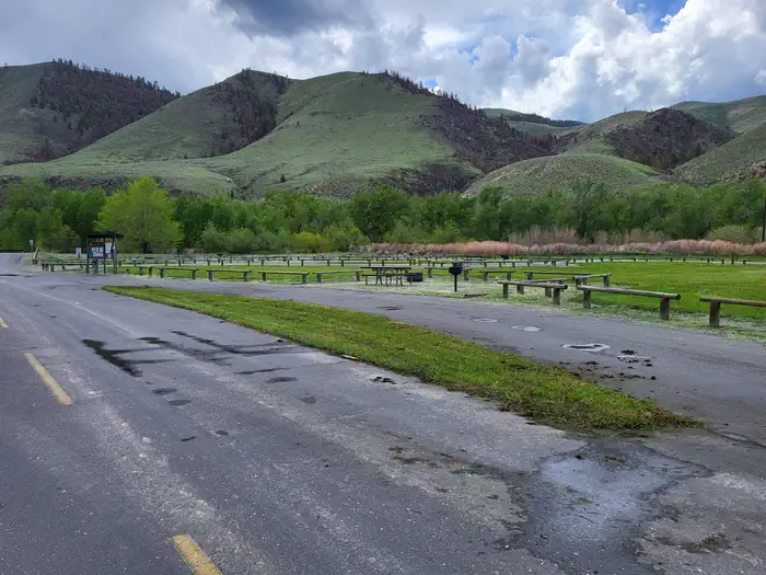
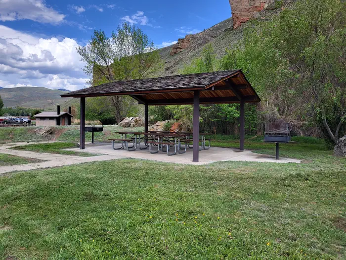
The campground offers single-family campsites for both RV and designated tent-only camping. Each site is equipped with accessible picnic tables and campfire rings with grills. Vault toilets, fishing platforms, picnic shelter, and boat ramp with access to the Salmon River are provided. No hookups are available at this location.
Natural Features
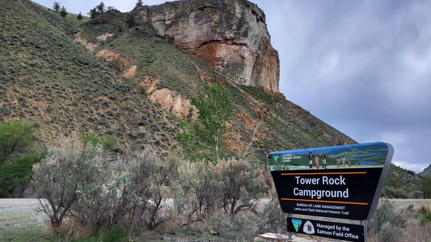
William Clark described the rock formation above the campground, known today as Tower Rock, as a “Clift of dark brown flint”. The Precambrian quartzite is some of the oldest rock in Idaho and can be found in the outcrops between the campground and North Fork, ID. At the nearby Tower Pirimids Day Use Area "hoodoo" type sandstone, gravel, and capstone formation can be seen near another Corps of Discovery campsite.
Contact Info
This location is unstaffed. To speak with our main office for general information, please call: (208) 756-5400.Nearby Attractions
- Salmon River
- Tower Pirimids Day Use Area
- Morgan Bar Campground
Charges & Cancellations
No changes/cancellations/refunds are allowed as all fees are paid either on-site or through the Recreation.gov Scan & Pay App.
The facts
- 12 bookable sites
Site types
- 6 Parking
- 4 Standard Nonelectric
- 2 Tent Only Nonelectric
12 campsites at Tower Rock Campground
| Site | Loop | Type | Entry | Surface | Max rig | People | |
|---|---|---|---|---|---|---|---|
| Site #1 | — | Standard Nonelectric | — | — | — | — | |
| Site #1 Extra Vehicle | — | Parking | — | — | — | — | |
| Site #2 | — | Standard Nonelectric | — | — | — | — | |
| Site #2 Extra Vehicle | — | Parking | — | — | — | — | |
| Site #3 | — | Standard Nonelectric | — | — | — | — | |
| Site #3 Extra Vehicle | — | Parking | — | — | — | — | |
| Site #4 | — | Standard Nonelectric | — | — | — | — | |
| Site #4 Extra Vehicle | — | Parking | — | — | — | — | |
| Site #5 Extra Vehicle | — | Parking | — | — | — | — | |
| Site #6 Extra Vehicle | — | Parking | — | — | — | — | |
| Tent Site #5 | — | Tent Only Nonelectric | — | — | — | — | |
| Tent Site #6 | — | Tent Only Nonelectric | — | — | — | — |
Getting there
Take Highway 93 North of Salmon, ID for 10 miles. Campground will be on the left between the highway and the Salmon River.
45.31209, -113.90625 · 45°18'43.5"N 113°54'22.5"W
Typical weather
Typically 86°F in Jul, down to 28°F in Jan.
| Jan | Feb | Mar | Apr | May | Jun | Jul | Aug | Sep | Oct | Nov | Dec | |
|---|---|---|---|---|---|---|---|---|---|---|---|---|
| High °F | 28 | 36 | 50 | 59 | 68 | 76 | 86 | 85 | 74 | 58 | 41 | 29 |
| Low °F | 11 | 16 | 26 | 32 | 40 | 46 | 52 | 49 | 41 | 31 | 22 | 13 |
| Precip in | 0.6 | 0.4 | 0.5 | 0.8 | 1.3 | 1.6 | 0.8 | 0.6 | 0.8 | 0.8 | 0.7 | 0.7 |
1991–2020 averages from the nearest NOAA station, 9.7 mi away — not measured at the facility itself, and elevation can make a real difference over that distance.
Map
Fees and stay limits
Campsite nightly rates are $5/site and $2 per additional vehicle. Limit of one additional vehicle per campsite. Fees may be paid on-site using fee envelopes or with the Recreation.gov Scan & Pay App.
From Recreation.gov, which is not always current. The operator's own page is the authority on what you will be charged.
More photos
Member photos
Common questions about Tower Rock Campground
- Can you reserve a site at Tower Rock Campground?
- Yes, Tower Rock Campground is reservable through Recreation.gov.
- How many campsites does Tower Rock Campground have?
- 12 sites.
Camping near Tower Rock Campground
- Morgan Bar Campground 4.1 mi · Campground · we watch it
- Twin Lakes Cabin (MT) 12.6 mi · Campground · we watch it
- Shoup Bridge Campground 14.8 mi · Campground · we watch it
- Williams Lake Campground 20.1 mi · Campground · we watch it
- Tower Creek Pyramids Day Use Area 2.2 mi · Facility
- Wallace Lake Campground 6.6 mi · Campground
- Shoup Bridge Recreation Site 14.8 mi · Facility
- Miner Lake Campground 15.7 mi · Campground
- Cougar Point Campground 17.4 mi · Campground
- Spring Creek Campground 17.8 mi · Campground
- Deep Creek Campground 19.9 mi · Campground
- Williams Lake Campground 20.1 mi · Campground
Contact
- Book Recreation.gov
Recreation.gov last updated this record on 2026-02-25.
Facility information and photographs from Recreation.gov (RIDB). SpotOpened is not affiliated with Recreation.gov or any federal agency.
Comments