Thompson Flat
Campground · Idaho · 11 bookable sites ·
Managed by the USDA Forest Service
Sawtooth National Forest (NF) · Open Access
- 11
- Bookable sites
- 60 ft
- Max rig length
- up to 64
- People per site
- 13
- Accessible sites
- 8,036 ft
- Elevation
Overview
Thompson Flat Campground is located high in the Albion Mountain Range of southern Idaho, near the towns of Declo and Albion. Visitors enjoy the area for its abundant trails, alpine lakes and scenic beauty.Recreation
The Twin Lakes Campground area is located just outside the campground and across the road. It offers picnic areas, horse corrals and access to a variety of trails.Lake Cleveland is a two-mile drive from the campground, offering fishing, canoeing and trail opportunities. Several additional hiking, mountain biking, horse and off-road vehicle trails are on the mountain.
Facilities
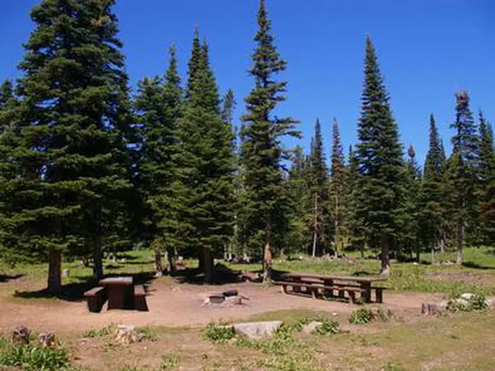
The campground contains three group sites, which can accommodate from 40 to 64 people, respectively. All sites are equipped with large picnic tables and campfire rings with grills. There are four reservable single units and four double unit campsites as well as 17 additional single-family campsites that are available on a first-come, first-served basis, but the group sites must be reserved.Accessible vault toilets are provided. A campground host is located on-site. Roads and parking spurs within the campground are gravel.
Natural Features
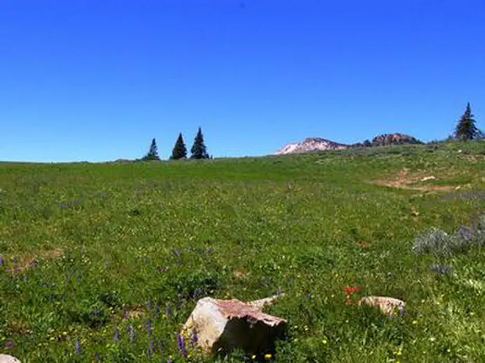
The campground is situated in a beautiful wildflower-filled meadow lined with tall pine and fir trees, on the eastern slope of Mount Harrison. It sits at an elevation of 8,400 feet.Nearby Attractions
A visit up the road to the Mount Harrison Lookout offers interesting area information and breathtaking panoramic views of the valleys below.Pomerelle Ski Area, just below Thompson Flat, offers lift-served hiking and mountain biking, scenic chairlift rides and a few dining options, generally on weekends.
The facts
- Season: July — USDA Forest Service, Aug 24, 2026
- 11 bookable sites
- 13 sites in total, including non-bookable
- 13 accessible sites
- Vehicles up to 60 ft
- Up to 64 people per site
- Loops: LOOP A, LOOP B, LOOP C, S&P, THOMPSON FLAT
Site types
- 8 Standard Nonelectric
- 3 Group Standard Nonelectric
- 2 Management
Amenities
- Campfires allowed
- Fire pits
- Picnic tables
- Grills
- Shade
- Pets allowed
Not recorded upstream: electric hookups, water hookups, sewer hookups.
13 campsites at Thompson Flat
Check-in 2:00 PM · Check-out 12:00 PM
| Site | Loop | Type | Entry | Surface | Max rig | People | |
|---|---|---|---|---|---|---|---|
| A1 -A5 | LOOP A | Group Standard Nonelectric | Back In | Gravel | 60 ft | 40 | ♿ 🐾 |
| B1 -B8 | LOOP B | Group Standard Nonelectric | Back In | Gravel | 60 ft | 64 | ♿ 🐾 |
| C1-C4 | LOOP C | Group Standard Nonelectric | Back In | Gravel | 60 ft | 56 | ♿ 🐾 |
| Double S&P | S&P | Management | Back In | Gravel | 50 ft | 16 | ♿ 🐾 |
| Double S&P | S&P | Management | Back In | Gravel | 48 ft | 8 | ♿ 🐾 |
| 02 | THOMPSON FLAT | Standard Nonelectric | Back In | Gravel | 50 ft | 16 | ♿ 🐾 |
| 06 | THOMPSON FLAT | Standard Nonelectric | Back In | Gravel | 48 ft | 8 | ♿ 🐾 |
| 10 | THOMPSON FLAT | Standard Nonelectric | Back In | Gravel | 60 ft | 16 | ♿ 🐾 |
| 11 | THOMPSON FLAT | Standard Nonelectric | Back In | Gravel | 56 ft | 8 | ♿ 🐾 |
| 12 | THOMPSON FLAT | Standard Nonelectric | Back In | Gravel | 60 ft | 16 | ♿ 🐾 |
| 17 | THOMPSON FLAT | Standard Nonelectric | Back In | Gravel | 60 ft | 8 | ♿ 🐾 |
| 19 | THOMPSON FLAT | Standard Nonelectric | Back In | Gravel | 52 ft | 16 | ♿ 🐾 |
| 20 | THOMPSON FLAT | Standard Nonelectric | Back In | Gravel | 53 ft | 8 | ♿ 🐾 |
Getting there
42.32472, -113.62361 · 42°19'29.0"N 113°37'25.0"W
Typical weather
| Jan | Feb | Mar | Apr | May | Jun | Jul | Aug | Sep | Oct | Nov | Dec | |
|---|---|---|---|---|---|---|---|---|---|---|---|---|
| High °F | — | — | — | — | — | — | — | — | — | — | — | — |
| Low °F | — | — | — | — | — | — | — | — | — | — | — | — |
| Precip in | 5.9 | 4.4 | 4.2 | 4.2 | 3.6 | 1.9 | 0.8 | 1.3 | 1.5 | 2.5 | 4.1 | 6.0 |
1991–2020 averages from the nearest NOAA station, 0.4 mi away — not measured at the facility itself, and elevation can make a real difference over that distance.
Map
More photos

Member photos
Common questions about Thompson Flat
- Can you reserve a site at Thompson Flat?
- Yes, Thompson Flat is reservable through Recreation.gov.
- How many campsites does Thompson Flat have?
- 13 sites in total, of which 11 can be booked.
- What is the maximum RV length at Thompson Flat?
- 60 ft. That is the longest vehicle the sites here are recorded as taking; individual sites may be shorter.
- Are pets allowed at Thompson Flat?
- Yes, pets are allowed at Thompson Flat.
- Are campfires allowed at Thompson Flat?
- Campfires are allowed at Thompson Flat. Check for a current fire restriction before you go.
Also listed by
Thompson Flat also appears in other federal recreation data. Facts below are matched by name and location, not confirmed by Thompson Flat's operator.
USDA Forest Service — data as of Aug 24, 2026
- Single Unit/$8 night; Group Unit/$50 night Camping fees at Thompson Flat remain the same at $8.00 per site; this includes the sites within the new group areas as well.
Restrictions:
- Occupancy : The following act is prohibited within the Minidoka Ranger District: Pursuant to 36 CFR 262.58 (a), camping in any area including a developed recreation site or an undeveloped/dispersed recreation site for more than 14 (fourteen) days in a 28 (twenty-eight) day period. A camper or a grou
Camping near Thompson Flat
- Twin Lakes Campground (Sawtooth) 0.5 mi · Campground · we watch it
- Lake Cleveland - East Side 1.2 mi · Campground · we watch it
- Lake Cleveland Campground - West Side 1.3 mi · Campground · we watch it
- Twin Lakes Campground (Albion Division) 0.5 mi · Campground
- Bennett Springs Campground 1.1 mi · Campground
- Lake Cleveland 1.3 mi · Facility
- Lake Cleveland Campground - West Side 1.5 mi · Campground
- Mt. Harrison Lookout 2.1 mi · Facility
- Independence Lakes Campground 7.8 mi · Campground
- City of Rocks Visitor Center 16.1 mi · Facility
- Smoky Mountain Campground 17.3 mi · Campground
- City of Rocks Campground 18.2 mi · Campground
Contact
- Phone 208-678-0430
- Book Recreation.gov
Recreation.gov last updated this record on 2026-02-25.
Facility information and photographs from Recreation.gov (RIDB). SpotOpened is not affiliated with Recreation.gov or any federal agency.
Comments