Peace Valley Campground
Campground · Idaho · 1 bookable site ·
Managed by the USDA Forest Service
Boise National Forest (NF) · Open Access
- 1
- Bookable site
- 30 ft
- Max rig length
- up to 50
- People per site
- 1
- Accessible site
- 4,603 ft
- Elevation

Overview
Peace Valley Campground sits just 27 miles north of Garden Valley, Idaho, at an elevation of 4591 feet. The beautiful Peace Valley offers excellent hiking, motorcycle riding, fishing, and hunting opportunities.Recreation
Peace Valley offers several trails for hiking, mountain biking, horseback riding, and OHV use. Peace Creek Trail and Bitter Creek Trail (both motorcycle trails) begin nearby. The Rattlesnake Trail and 465 ATV Trail are in the vicinity of the campground.
Peace Creek and nearby Silver Creek offer excellent fishing most of the year. Anglers cast for whitefish and rainbow trout.
In-season big game hunting for deer, elk, and bear is a popular activity in the surrounding mountains.
Facilities
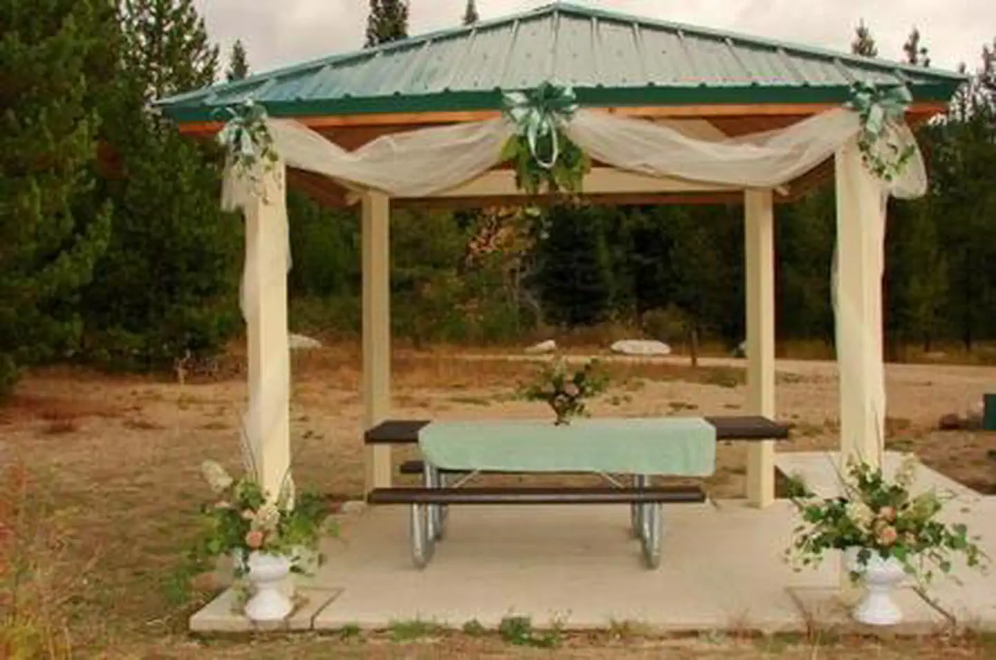
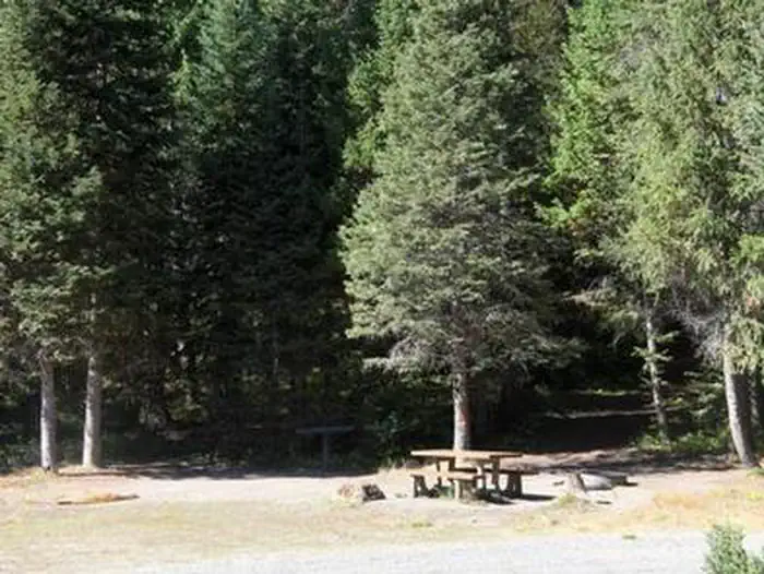
This fully-accessible campground is a small facility with just five campsites that make up one group site that can accommodate up to 50 people. Picnic tables, grills, a small picnic shelter, and campfire rings are provided. Parking spurs can accommodate small to medium RVs up to 30 feet in length. Vault toilets and drinking water are available.Natural Features
The surrounding area consists of high, forested mountains, and steep valleys. The campground lies close to an experimental forest and a fire lookout.
A variety of wildlife makes its home in and around Peace Valley, including deer, elk, bald eagles, and red-tailed hawks.
Nearby Attractions
Silver Creek Plunge, a privately-developed hot springs resort, is 2.5 miles away with a hot springs pool, general store, concessions, a playground, horseshoe pits, and both volleyball and basketball courts.The facts
- Season: End of May – End of September — USDA Forest Service, Aug 24, 2026
- 1 bookable site
- 1 accessible site
- Vehicles up to 30 ft
- Up to 50 people per site
- Loops: PEACE VALLEY CAMPGROUND
Site types
- 1 Group Standard Nonelectric
Amenities
- Campfires allowed
- Fire pits
- Picnic tables
- Shade
- Pets allowed
Not recorded upstream: electric hookups, water hookups, sewer hookups, grills.
1 campsite at Peace Valley Campground
Check-in 2:00 PM · Check-out 12:00 PM
| Site | Loop | Type | Entry | Surface | Max rig | People | |
|---|---|---|---|---|---|---|---|
| GS1 | PEACE VALLEY CAMPGROUND | Group Standard Nonelectric | Back In | Gravel | 30 ft | 50 | ♿ 🐾 |
Getting there
44.35389, -115.78278 · 44°21'14.0"N 115°46'58.0"W
Typical weather
| Jan | Feb | Mar | Apr | May | Jun | Jul | Aug | Sep | Oct | Nov | Dec | |
|---|---|---|---|---|---|---|---|---|---|---|---|---|
| High °F | — | — | — | — | — | — | — | — | — | — | — | — |
| Low °F | — | — | — | — | — | — | — | — | — | — | — | — |
| Precip in | 4.7 | 3.7 | 3.8 | 2.7 | 2.2 | 1.5 | 0.5 | 0.5 | 1.0 | 2.1 | 3.9 | 5.8 |
1991–2020 averages from the nearest NOAA station, 7.5 mi away — not measured at the facility itself, and elevation can make a real difference over that distance.
Map
More photos
Member photos
Common questions about Peace Valley Campground
- Can you reserve a site at Peace Valley Campground?
- Yes, Peace Valley Campground is reservable through Recreation.gov.
- How many campsites does Peace Valley Campground have?
- 1 site.
- What is the maximum RV length at Peace Valley Campground?
- 30 ft. That is the longest vehicle the sites here are recorded as taking; individual sites may be shorter.
- Are pets allowed at Peace Valley Campground?
- Yes, pets are allowed at Peace Valley Campground.
- Are campfires allowed at Peace Valley Campground?
- Campfires are allowed at Peace Valley Campground. Check for a current fire restriction before you go.
Camping near Peace Valley Campground
- Silver Creek Campground 1.9 mi · Campground · we watch it
- Boiling Springs Cabin 3.7 mi · Campground · we watch it
- River Side (Id - Boise) 5.9 mi · Campground · we watch it
- Barneys Campground (Boise National Forest, ID) 6.7 mi · Campground · we watch it
- Howers 7 mi · Campground · we watch it
- Rattlesnake 7.7 mi · Campground · we watch it
- Cozy Cove 7.8 mi · Campground · we watch it
- Silver Creek Summit Trailhead 2.2 mi · Facility
- Middle Fork Payette River / Wet Foot Trailhead 3.9 mi · Facility
- Riverside Campground (Lowman) 6.2 mi · Campground
- Barney's Campground 6.9 mi · Campground
- Hardscrabble Campground 9.8 mi · Campground
Contact
- Phone 541-351-1182
- Book Recreation.gov
Recreation.gov last updated this record on 2026-02-25.
Facility information and photographs from Recreation.gov (RIDB). SpotOpened is not affiliated with Recreation.gov or any federal agency.
Comments