Bumblebee Campground
Campground · Idaho · 13 bookable sites ·
Managed by the USDA Forest Service
Coeur d'Alene National Forest (NF) · Open Access
- 13
- Bookable sites
- 80 ft
- Max rig length
- up to 100
- People per site
- 2,240 ft
- Elevation
Overview
Bumblebee Campground is located in a beautiful meadow with no standing trees, near the Little North Fork Coeur D'Alene River. It makes a perfect fishing and seasonal hunting base camp. Swimming and floating the river are popular activities as well.
Recreation
Bumblebee's creekside location creates easy access for floating, swimming and wading. Trout fishing is available about a half-mile from the campground in the Little North Fork of Coeur d'Alene River. Rainbow and cutthroat trout are the most common catches.About 15 miles from the campground is the 803 Motorized Trail System, which provides dedicated off-road trails and open roads in the Steamboat Creek area.
Facilities
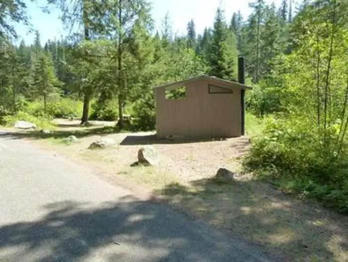
Bumblebee is comprised of two loops, each with vault toilets. One hand-pump for drinking water is available at the group site (both single-site campers and group campers share this spigot). Roads are paved and campsite parking spurs are sealed gravel.
Several single-family campsites are available. A group site can accommodate up to 100 people.
Natural Features
The campground sits next to Bumblebee Creek near the Little North Fork Coeur D'Alene River at an elevation of 2,200 feet.Coeur d'Alene National Forest spans 726,819 acres and is one of three forests comprising the Idaho Panhandle National Forests. The majority of Idaho's waters are located in this northern region.
Nearby Attractions
The town of Coeur d'Alene is a delightful place to explore. Visitors can go paddle boating or parasailing on Lake Coeur d'Alene, or even take a trip around the lake on a seaplane. A variety of shops and restaurants are available.Charges & Cancellations
A $10.00 service fee will apply if you change or cancel your reservation. Late cancellations are subject to additional fees. For full details see NRRS Reservation Policy.The facts
- Season: Mid May – Late September — USDA Forest Service, Aug 24, 2026
- 13 bookable sites
- 24 sites in total, including non-bookable
- Vehicles up to 80 ft
- Up to 100 people per site
- Loops: NORT, SOUTH LOOP
Site types
- 12 Standard Nonelectric
- 11 Management
- 1 Group Standard Area Nonelectric
Amenities
- Campfires allowed
- Fire pits
- Picnic tables
- Pets allowed
- Shade — not available
Not recorded upstream: electric hookups, water hookups, sewer hookups, grills.
24 campsites at Bumblebee Campground
| Site | Loop | Type | Entry | Surface | Grade | Max rig | People | |
|---|---|---|---|---|---|---|---|---|
| 002 | NORT | Management | — | Paved | — | — | — | 🐾 |
| 003 | NORT | Management | — | Paved | — | — | — | 🐾 |
| 004 | NORT | Management | — | Paved | — | — | — | 🐾 |
| 005 | NORT | Management | — | Paved | — | — | — | 🐾 |
| 006 | NORT | Management | — | Paved | — | — | — | 🐾 |
| 007 | NORT | Management | — | Paved | — | — | — | 🐾 |
| 008 | NORT | Management | — | Paved | — | — | — | 🐾 |
| 009 | NORT | Management | — | Paved | — | — | — | 🐾 |
| 010 | NORT | Management | — | Paved | — | — | — | 🐾 |
| 011 | NORT | Management | — | Paved | — | — | — | 🐾 |
| GS001 | NORT | Group Standard Area Nonelectric | Back In | Paved | — | 35 ft | 100 | 🐾 |
| 013 | SOUTH LOOP | Standard Nonelectric | Pull Through | Paved | — | 80 ft | 8 | 🐾 |
| 014 | SOUTH LOOP | Standard Nonelectric | Back In | Paved | — | 52 ft | 8 | 🐾 |
| 015 | SOUTH LOOP | Management | — | Paved | — | — | — | 🐾 |
| 016 | SOUTH LOOP | Standard Nonelectric | Back In | Paved | — | 45 ft | 8 | 🐾 |
| 017 | SOUTH LOOP | Standard Nonelectric | — | Paved | — | — | 8 | 🐾 |
| 018 | SOUTH LOOP | Standard Nonelectric | — | Paved | — | — | 16 | 🐾 |
| 019 | SOUTH LOOP | Standard Nonelectric | Back In | Paved | — | 45 ft | 8 | 🐾 |
| 020 | SOUTH LOOP | Standard Nonelectric | Back In | Paved | Slight | 10 ft | 8 | 🐾 |
| 021 | SOUTH LOOP | Standard Nonelectric | — | Paved | — | — | 16 | 🐾 |
| 022 | SOUTH LOOP | Standard Nonelectric | — | Paved | — | — | — | 🐾 |
| 023 | SOUTH LOOP | Standard Nonelectric | Back In | Paved | — | 40 ft | 16 | 🐾 |
| 024 | SOUTH LOOP | Standard Nonelectric | — | Paved | — | — | — | 🐾 |
| 025 | SOUTH LOOP | Standard Nonelectric | Back In | Paved | — | 40 ft | 8 | 🐾 |
Getting there
47.63333, -116.27944 · 47°37'60.0"N 116°16'46.0"W
Typical weather
| Jan | Feb | Mar | Apr | May | Jun | Jul | Aug | Sep | Oct | Nov | Dec | |
|---|---|---|---|---|---|---|---|---|---|---|---|---|
| High °F | — | — | — | — | — | — | — | — | — | — | — | — |
| Low °F | — | — | — | — | — | — | — | — | — | — | — | — |
| Precip in | 4.5 | 3.0 | 3.6 | 2.3 | 2.8 | 2.9 | 1.0 | 1.1 | 1.5 | 2.8 | 4.2 | 4.0 |
1991–2020 averages from the nearest NOAA station, 9.7 mi away — not measured at the facility itself, and elevation can make a real difference over that distance.
Map
More photos
Member photos
Common questions about Bumblebee Campground
- Can you reserve a site at Bumblebee Campground?
- Yes, Bumblebee Campground is reservable through Recreation.gov.
- How many campsites does Bumblebee Campground have?
- 24 sites in total, of which 13 can be booked.
- What is the maximum RV length at Bumblebee Campground?
- 80 ft. That is the longest vehicle the sites here are recorded as taking; individual sites may be shorter.
- Are pets allowed at Bumblebee Campground?
- Yes, pets are allowed at Bumblebee Campground.
- Are campfires allowed at Bumblebee Campground?
- Campfires are allowed at Bumblebee Campground. Check for a current fire restriction before you go.
Also listed by
Bumblebee Campground also appears in other federal recreation data. Facts below are matched by name and location, not confirmed by Bumblebee Campground's operator.
USDA Forest Service — data as of Aug 24, 2026
- See Recreation.gov for fee information.
Camping near Bumblebee Campground
- Magee Rangers Cabin 14.6 mi · Campground · we watch it
- Kit Price 14.7 mi · Campground · we watch it
- Spyglass Ground House 14.9 mi · Campground · we watch it
- Devils Elbow 15.3 mi · Campground · we watch it
- Berlin Flats 15.3 mi · Campground · we watch it
- Big Hank 15.6 mi · Campground · we watch it
- Avery Creek Cabin 16.8 mi · Campground · we watch it
- Little Guard Lookout 17.2 mi · Campground · we watch it
- Coeur d'Alene River Area 6.2 mi · Facility
- Honeysuckle Campground 11.7 mi · Campground
- Kit Price Campground 11.7 mi · Campground
- Devil's Elbow Campground 14.9 mi · Campground
Contact
- Phone 435-245-6521
- Book Recreation.gov
Recreation.gov last updated this record on 2026-02-25.
Facility information and photographs from Recreation.gov (RIDB). SpotOpened is not affiliated with Recreation.gov or any federal agency.
Comments