Baumgartner Campground
Campground · Idaho · 31 bookable sites ·
Managed by the USDA Forest Service
Sawtooth National Forest (NF) · Open Access
- 31
- Bookable sites
- 76 ft
- Max rig length
- up to 100
- People per site
- 30
- Accessible sites
- 5,784 ft
- Elevation
Overview
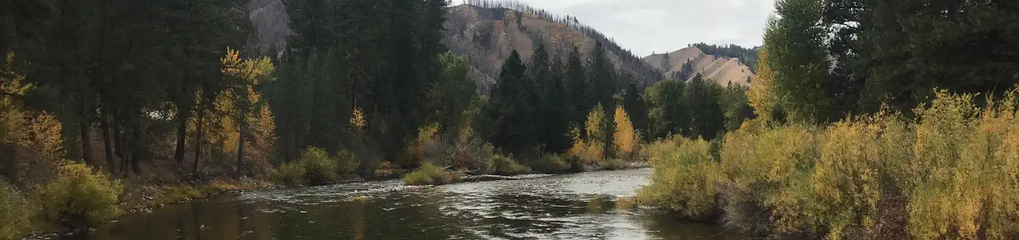
Baumgartner Campground is situated alongside the South Fork Boise River, 11 miles from Featherville, Idaho. The area offers excellent fishing, hiking and off-road vehicle riding opportunities. Baumgartner Hot Springs is located within the campground, where visitors can enjoy soaking in the pool while admiring the scenic, natural setting.Recreation
The campground's main draw is Baumgartner Hot Springs. The 101-degree water is piped into a large concrete soaking pool. The pool is open during daylight hours and is drained and refilled daily. The pool is pressure washed Tuesday mornings and will not open until around noon.
The South Fork Boise River provides great fishing for wild and stocked rainbow trout. Younger campers love splashing in the cool mountain waters. An accessible path leads to a bench overlooking the swimming/fishing hole on thenorth end of the campground.
The John Baumgartner Gravesite is a short walk from the hot springs. A 1/4-mile interpretive nature trail begins at the hot springs and meanders up the hill through the forest.
Kelley Creek/Iron Mountain, Virginia Gulch, Willow Creek, Van Gulch and Big Water Trails all begin in the area. Ponderosa Trail Learner's Loop is located approximately 1 mile to the west of the campground and offers beginner level trails for young ATV and off-road motorcycle riders.
ATVs, UTVs and off-road motorcycles cannot be ridden within the campground. You may trailer them in and out of the campground but the trailer must fit within your camping spur.
Facilities
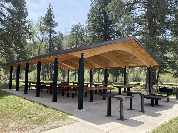
The campground offers single and double-family sites, as well as one quad site and one large group site (Site 100), all with picnic tables, fire rings and utility tables. Vault toilets and drinking water are provided. Roads and parking spurs within the main campground are paved. Site 100 is not paved.
Natural Features
The campground is nestled beneath towering ponderosa pines at an elevation of 5,200 feet. The gentle South Fork Boise River runs along the site, offering beautiful scenery and recreation. A variety of wildlife is commonly seen in and around the campground, including deer and moose.Nearby Attractions
Numerous hiking, biking, horseback and off-road vehicle trails crisscross the surrounding area. Kelley Creek Flats Recreation Area is adjacent with additional designated dispersed site camping and livestock corrals near Kelley Creek. The historic Iron Mountain Lookout is located to the south of the campground. It is approximately a 12 mile one-way trip along the Kelley Creek trail which is open to vehicles 50" or less in width.The facts
- 31 bookable sites
- 30 accessible sites
- Vehicles up to 76 ft
- Up to 100 people per site
- Loops: BAUMGARTNER CAMPGROUND, Loop A, Loop B, Main Access
Site types
- 29 Standard Nonelectric
- 1 Group RV Area Nonelectric
- 1 Group Standard Nonelectric
Amenities
- Campfires allowed
- Fire pits
- Picnic tables
- Grills
- Shade
- Pets allowed
Not recorded upstream: electric hookups, water hookups, sewer hookups.
31 campsites at Baumgartner Campground
Check-in 2:00 PM · Check-out 12:00 PM
| Site | Loop | Type | Entry | Surface | Grade | Water | Max rig | People | |
|---|---|---|---|---|---|---|---|---|---|
| 100 | BAUMGARTNER CAMPGROUND | Group Rv Area Nonelectric | — | — | — | — | — | 100 | 🐾 |
| 001 | Loop A | Standard Nonelectric | Back In | Paved | Slight | Riverfront | 40 ft | 8 | ♿ 🐾 |
| 002 | Loop A | Standard Nonelectric | Back In | Paved | Slight | Riverfront | 48 ft | 8 | ♿ 🐾 |
| 003 | Loop A | Standard Nonelectric | Back In | Paved | Slight | Riverfront | — | 8 | ♿ 🐾 |
| 004 | Loop A | Standard Nonelectric | Back In | Paved | Slight | Riverfront | 48 ft | 8 | ♿ 🐾 |
| 005 | Loop A | Standard Nonelectric | Back In | Paved | Slight | Riverfront | 65 ft | 8 | ♿ 🐾 |
| 006 | Loop A | Standard Nonelectric | Back In | Paved | Slight | Riverfront | 56 ft | 8 | ♿ 🐾 |
| 007 | Loop A | Standard Nonelectric | Back In | Paved | Slight | Riverfront | 58 ft | 8 | ♿ 🐾 |
| 008 | Loop A | Standard Nonelectric | Pull Through | Paved | Slight | Riverfront | — | 8 | ♿ 🐾 |
| 009 | Loop A | Standard Nonelectric | Back In | Paved | Slight | Riverfront | 48 ft | 8 | ♿ 🐾 |
| 010 | Loop A | Standard Nonelectric | Back In | Paved | Slight | Riverfront | 35 ft | 8 | ♿ 🐾 |
| 011 | Loop A | Standard Nonelectric | Back In | Paved | Slight | Riverfront | 45 ft | 8 | ♿ 🐾 |
| 012 | Loop A | Standard Nonelectric | Back In | Paved | Slight | Riverfront | 44 ft | 8 | ♿ 🐾 |
| 013 | Loop A | Standard Nonelectric | Back In | Paved | Slight | Riverfront | 39 ft | 8 | ♿ 🐾 |
| 014-015 | Loop B | Standard Nonelectric | Back In | Paved | Slight | Springs | 60 ft | 16 | ♿ 🐾 |
| 016-017 | Loop B | Standard Nonelectric | Back In | Paved | Slight | Springs | 47 ft | 16 | ♿ 🐾 |
| 018-019 | Loop B | Standard Nonelectric | Back In | Paved | Slight | Springs | 46 ft | 16 | ♿ 🐾 |
| 020-021 | Loop B | Standard Nonelectric | Back In | Paved | Slight | Springs | 38 ft | 16 | ♿ 🐾 |
| 022-025 | Loop B | Group Standard Nonelectric | Back In | Paved | Slight | Riverfront | 34 ft | 32 | ♿ 🐾 |
| 026 | Main Access | Standard Nonelectric | Back In | Paved | Slight | Riverfront | 40 ft | 8 | ♿ 🐾 |
| 027 | Main Access | Standard Nonelectric | Back In | Paved | Slight | Riverfront | 36 ft | 8 | ♿ 🐾 |
| 028 | Main Access | Standard Nonelectric | Back In | Paved | Slight | Riverfront | 46 ft | 8 | ♿ 🐾 |
| 029 | Main Access | Standard Nonelectric | Back In | Paved | Slight | Riverfront | 36 ft | 8 | ♿ 🐾 |
| 030 | Main Access | Standard Nonelectric | Back In | Paved | Slight | Riverfront | 40 ft | 8 | ♿ 🐾 |
| 031 | Main Access | Standard Nonelectric | Back In | Paved | Slight | Riverfront | 38 ft | 8 | ♿ 🐾 |
| 032-033 | Main Access | Standard Nonelectric | Back In | Paved | Slight | Riverfront | 76 ft | 16 | ♿ 🐾 |
| 034 | Main Access | Standard Nonelectric | Back In | Paved | Slight | Riverfront | 36 ft | 8 | ♿ 🐾 |
| 035 | Main Access | Standard Nonelectric | Back In | Paved | Slight | Riverfront | 36 ft | 8 | ♿ 🐾 |
| 036 | Main Access | Standard Nonelectric | Back In | Paved | Slight | Riverfront | 46 ft | 8 | ♿ 🐾 |
| 037 | Main Access | Standard Nonelectric | Back In | Paved | Slight | Riverfront | 24 ft | 8 | ♿ 🐾 |
| 038-039 | Main Access | Standard Nonelectric | Back In | Paved | Slight | Riverfront | 24 ft | 16 | ♿ 🐾 |
Getting there
43.61250, -115.08028 · 43°36'45.0"N 115°4'49.0"W
Typical weather
| Jan | Feb | Mar | Apr | May | Jun | Jul | Aug | Sep | Oct | Nov | Dec | |
|---|---|---|---|---|---|---|---|---|---|---|---|---|
| High °F | — | — | — | — | — | — | — | — | — | — | — | — |
| Low °F | — | — | — | — | — | — | — | — | — | — | — | — |
| Precip in | 6.5 | 5.3 | 5.4 | 3.7 | 3.1 | 1.9 | 0.7 | 0.6 | 1.1 | 2.8 | 4.9 | 7.7 |
1991–2020 averages from the nearest NOAA station, 12.9 mi away — not measured at the facility itself, and elevation can make a real difference over that distance.
Map
More photos

Member photos
Common questions about Baumgartner Campground
- Can you reserve a site at Baumgartner Campground?
- Yes, Baumgartner Campground is reservable through Recreation.gov.
- How many campsites does Baumgartner Campground have?
- 31 sites.
- What is the maximum RV length at Baumgartner Campground?
- 76 ft. That is the longest vehicle the sites here are recorded as taking; individual sites may be shorter.
- Are pets allowed at Baumgartner Campground?
- Yes, pets are allowed at Baumgartner Campground.
- Are campfires allowed at Baumgartner Campground?
- Campfires are allowed at Baumgartner Campground. Check for a current fire restriction before you go.
Camping near Baumgartner Campground
- Elks Flat Campground 11.9 mi · Campground · we watch it
- Dog Creek (Id) 12.6 mi · Campground · we watch it
- Baumgartner Campground 0.5 mi · Campground
- Willow Creek Transfer Camp 2.9 mi · Campground
- Willow Creek Campground 3.2 mi · Campground
- Bird Creek Campground 4.8 mi · Campground
- Chaparral Campground 6.1 mi · Campground
- Big Hole 6.5 mi · Campground
- Abbott Campground 6.9 mi · Campground
- Bowns Campground 9.9 mi · Campground
- Canyon Transfer Camp 11.1 mi · Campground
- Bear Creek Transfer Camp 12 mi · Campground
Contact
- Phone 208-764-3202
- Book Recreation.gov
Recreation.gov last updated this record on 2026-02-25.
Facility information and photographs from Recreation.gov (RIDB). SpotOpened is not affiliated with Recreation.gov or any federal agency.
Comments