Teal Lake Group Campsite
Campground · Colorado · 18 bookable sites ·
Managed by the USDA Forest Service
Routt National Forest (NF) · Open Access
- 18
- Bookable sites
- up to 30
- People per site
- 8,829 ft
- Elevation
Overview
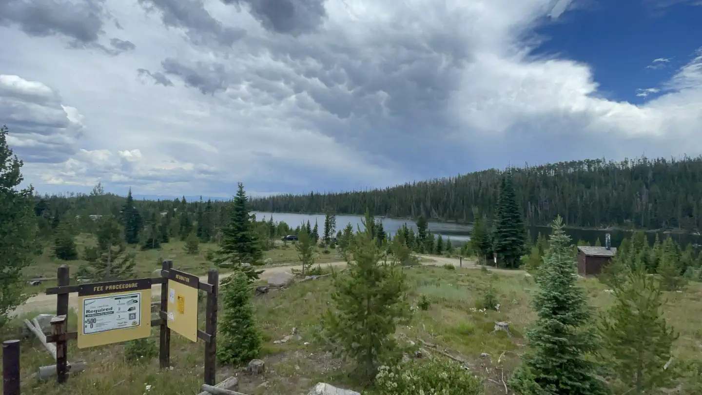
Teal Lake Group Site and Campground is set along a small yet scenic lake in north central Colorado in the heart of the Rocky Mountains. Located in the Routt National Forest at an elevation of 9,000-ft., the lake is popular for trout fishing and lies close to a wilderness area with a variety of hiking and off-highway vehicle trails.
Recreation
Trout fishing and boating are popular activities in the clear, calm waters of Teal Lake. Only electric boats and non-motorized boats are permitted. Off-road vehicle enthusiasts have easy access to the Grizzly-Helena Trail nearby.Hiking is great in the nearby Mount Zirkel wilderness, though hikers must drive to the trailheads.
Facilities
Teal Lake provides 17 individual campsites and one group site for up to 30 people. Campsites are private and have ample space. The group site has four picnic tables and two campfire rings for groups to gather.Natural Features
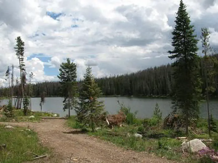
Teal Lake is a 50-acre lake surrounded by a rocky shoreline and pine-fir forest. Some previously forested areas of the campground have been thinned due to pests and thus have more sun than others.Black bear, bobcat, coyote, elk, mule deer and moose are just some of the many animals that inhabit the Medicine Bow-Routt National Forests and Thunder Basin National Grassland.
The area is generally snow-free from Memorial Day to Labor Day, but visitors should come prepared for anything, including freezing temperatures and snow during summer.
Nearby Attractions
The closest town is Walden, Colorado. Many more outdoor opportunities exist in the nearly 3 million acres of surrounding national forests and grasslands, including hiking, biking, camping, horseback riding, OHV riding, fishing, hunting, sightseeing and winter sports.The facts
- Season: Early June (weather dependent) – Mid to Late October (weather dependent) — USDA Forest Service, Aug 24, 2026
- 18 bookable sites
- 36 sites in total, including non-bookable
- Up to 30 people per site
- Loops: A, MANAGEMENT, TEAL
Site types
- 18 Management
- 17 Standard Nonelectric
- 1 Group Standard Area Nonelectric
Amenities
- Campfires allowed
- Pets allowed
- Water hookups — not available
Not recorded upstream: electric hookups, sewer hookups, fire pits, picnic tables, grills, shade.
36 campsites at Teal Lake Group Campsite
| Site | Loop | Type | Entry | Surface | Max rig | People | |
|---|---|---|---|---|---|---|---|
| 01 | A | Standard Nonelectric | — | Gravel | — | 10 | 🐾 |
| 02 | A | Standard Nonelectric | — | Gravel | — | 10 | 🐾 |
| 03 | A | Standard Nonelectric | — | Gravel | — | 10 | 🐾 |
| 04 | A | Standard Nonelectric | — | Gravel | — | 10 | 🐾 |
| 05 | A | Standard Nonelectric | — | Gravel | — | 10 | 🐾 |
| 06 | A | Standard Nonelectric | — | Gravel | — | 10 | 🐾 |
| 07 | A | Standard Nonelectric | — | Gravel | — | 10 | 🐾 |
| 08 | A | Standard Nonelectric | — | Gravel | — | 10 | 🐾 |
| 09 | A | Standard Nonelectric | — | Gravel | — | 10 | 🐾 |
| 10 | A | Standard Nonelectric | — | Gravel | — | 10 | 🐾 |
| 11 | A | Standard Nonelectric | — | Gravel | — | 10 | 🐾 |
| 12 | A | Standard Nonelectric | — | Gravel | — | 10 | 🐾 |
| 13 | A | Standard Nonelectric | — | Gravel | — | 10 | 🐾 |
| 14 | A | Standard Nonelectric | — | Gravel | — | 10 | 🐾 |
| 15 | A | Standard Nonelectric | — | Gravel | — | 10 | 🐾 |
| 16 | A | Standard Nonelectric | — | Gravel | — | 10 | 🐾 |
| 17 | A | Standard Nonelectric | — | Gravel | — | 10 | 🐾 |
| XXX | MANAGEMENT | Management | — | Gravel | — | 10 | |
| XXX1 | MANAGEMENT | Management | — | — | — | — | |
| XXX10 | MANAGEMENT | Management | — | — | — | — | |
| XXX11 | MANAGEMENT | Management | — | — | — | — | |
| XXX12 | MANAGEMENT | Management | — | — | — | — | |
| XXX13 | MANAGEMENT | Management | — | — | — | — | |
| XXX14 | MANAGEMENT | Management | — | — | — | — | |
| XXX15 | MANAGEMENT | Management | — | — | — | — | |
| XXX16 | MANAGEMENT | Management | — | — | — | — | |
| XXX17 | MANAGEMENT | Management | — | — | — | — | |
| XXX2 | MANAGEMENT | Management | — | — | — | — | |
| XXX3 | MANAGEMENT | Management | — | — | — | — | |
| XXX4 | MANAGEMENT | Management | — | — | — | — | |
| XXX5 | MANAGEMENT | Management | — | — | — | — | |
| XXX6 | MANAGEMENT | Management | — | — | — | — | |
| XXX7 | MANAGEMENT | Management | — | — | — | — | |
| XXX8 | MANAGEMENT | Management | — | — | — | — | |
| XXX9 | MANAGEMENT | Management | — | — | — | — | |
| 001 | TEAL | Group Standard Area Nonelectric | — | Gravel | — | 30 |
Getting there
40.58472, -106.60556 · 40°35'5.0"N 106°36'20.0"W
Typical weather
| Jan | Feb | Mar | Apr | May | Jun | Jul | Aug | Sep | Oct | Nov | Dec | |
|---|---|---|---|---|---|---|---|---|---|---|---|---|
| High °F | — | — | — | — | — | — | — | — | — | — | — | — |
| Low °F | — | — | — | — | — | — | — | — | — | — | — | — |
| Precip in | 8.0 | 7.2 | 6.2 | 6.9 | 4.8 | 2.5 | 1.7 | 1.6 | 3.1 | 4.5 | 6.4 | 6.9 |
1991–2020 averages from the nearest NOAA station, 5 mi away — not measured at the facility itself, and elevation can make a real difference over that distance.
Map
More photos
Member photos
Common questions about Teal Lake Group Campsite
- Can you reserve a site at Teal Lake Group Campsite?
- Yes, Teal Lake Group Campsite is reservable through Recreation.gov.
- How many campsites does Teal Lake Group Campsite have?
- 36 sites in total, of which 18 can be booked.
- Are pets allowed at Teal Lake Group Campsite?
- Yes, pets are allowed at Teal Lake Group Campsite.
- Does Teal Lake Group Campsite have hookups?
- No hookups are recorded here.
- Are campfires allowed at Teal Lake Group Campsite?
- Campfires are allowed at Teal Lake Group Campsite. Check for a current fire restriction before you go.
Also listed by
Teal Lake Group Campsite also appears in other federal recreation data. Facts below are matched by name and location, not confirmed by Teal Lake Group Campsite's operator.
USDA Forest Service — data as of Aug 24, 2026
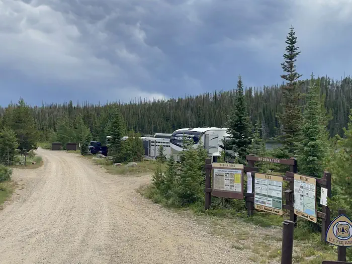
- $20/single site. Group Site : $40.00/night. 21 person maximum capacity. NO CREDIT CARDS accepted. Exact cash or check only as there is no option for change back if paying cash. Payment instructions are found on the kiosk.
Restrictions:
- Dogs must be on leash in campground at all times.
Camping near Teal Lake Group Campsite
- Grizzly Creek Guard Station 2.1 mi · Campground · we watch it
- Dry Lake Campground (CO) 9.9 mi · Campground · we watch it
- Dumont Campground 12.5 mi · Campground · we watch it
- Seedhouse Group Site - Medicine-Bow Routt NF (CO) 14.7 mi · Campground · we watch it
- Seedhouse Campground 15.6 mi · Campground · we watch it
- Meadows Campground (CO) 15.7 mi · Campground · we watch it
- Seedhouse Guard Station 15.8 mi · Campground · we watch it
- Grizzly Guard Station Interpretive Site 2 mi · Facility
- Summit Lake Campground 4.9 mi · Campground
- Hidden Lakes Campground 5.4 mi · Campground
- Granite Campground 7.6 mi · Campground
- Rawah Wilderness: Arapaho & Roosevelt 15 mi · Facility
Contact
- Phone 970-723-2700
- Book Recreation.gov
Recreation.gov last updated this record on 2026-07-03.
Facility information and photographs from Recreation.gov (RIDB). SpotOpened is not affiliated with Recreation.gov or any federal agency.
Comments